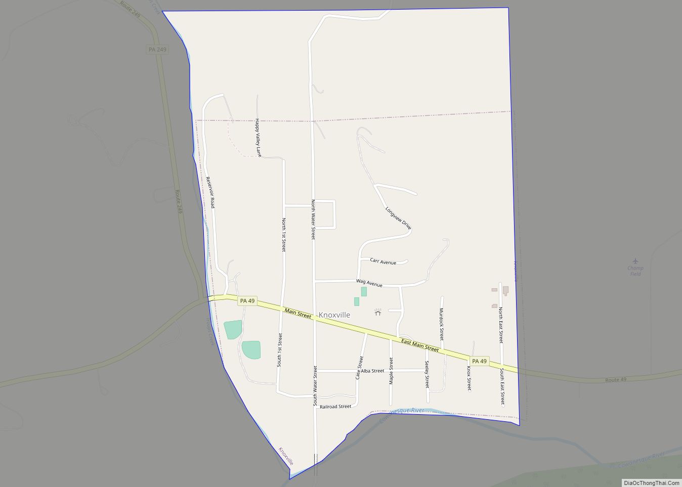
Knoxville is a borough in northwestern Tioga County, Pennsylvania, United States. The population was 682 at the time of the 2020 census.
| Name: | Knoxville borough |
|---|---|
| LSAD Code: | 21 |
| LSAD Description: | borough (suffix) |
| State: | Pennsylvania |
| County: | Tioga County |
| Elevation: | 1,240 ft (380 m) |
| Total Area: | 0.62 sq mi (1.61 km²) |
| Land Area: | 0.62 sq mi (1.61 km²) |
| Water Area: | 0.00 sq mi (0.00 km²) |
| Total Population: | 680 |
| Population Density: | 1,096.77/sq mi (423.26/km²) |
| ZIP code: | 16928 |
| Area code: | 814 |
| FIPS code: | 4240360 |
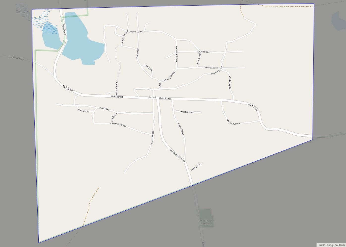
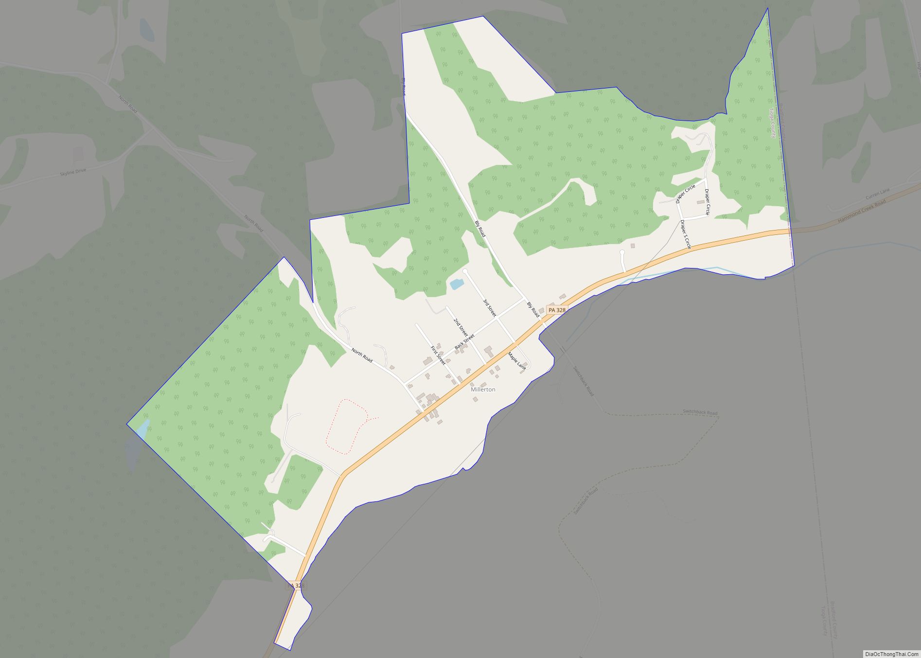
Online Interactive Map
Click on ![]() to view map in "full screen" mode.
to view map in "full screen" mode.
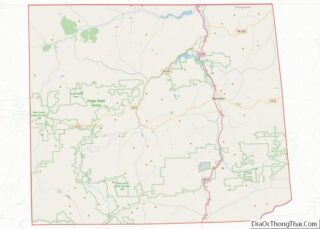
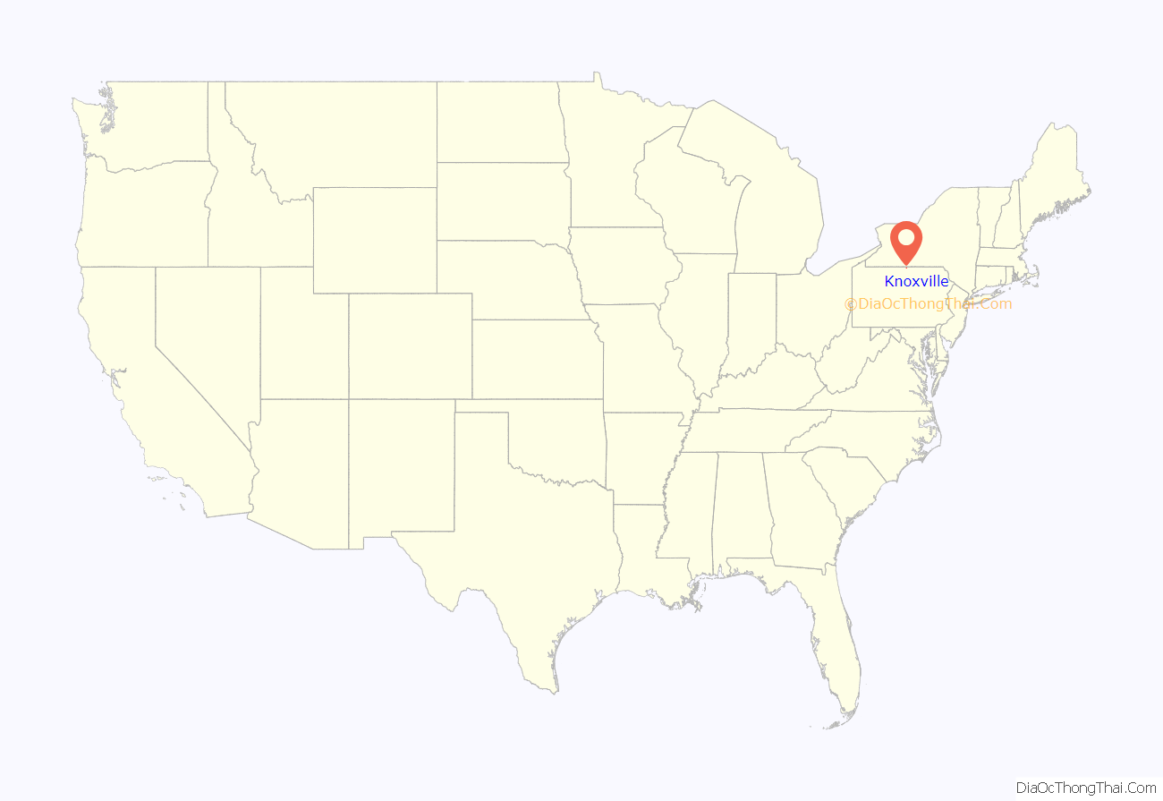
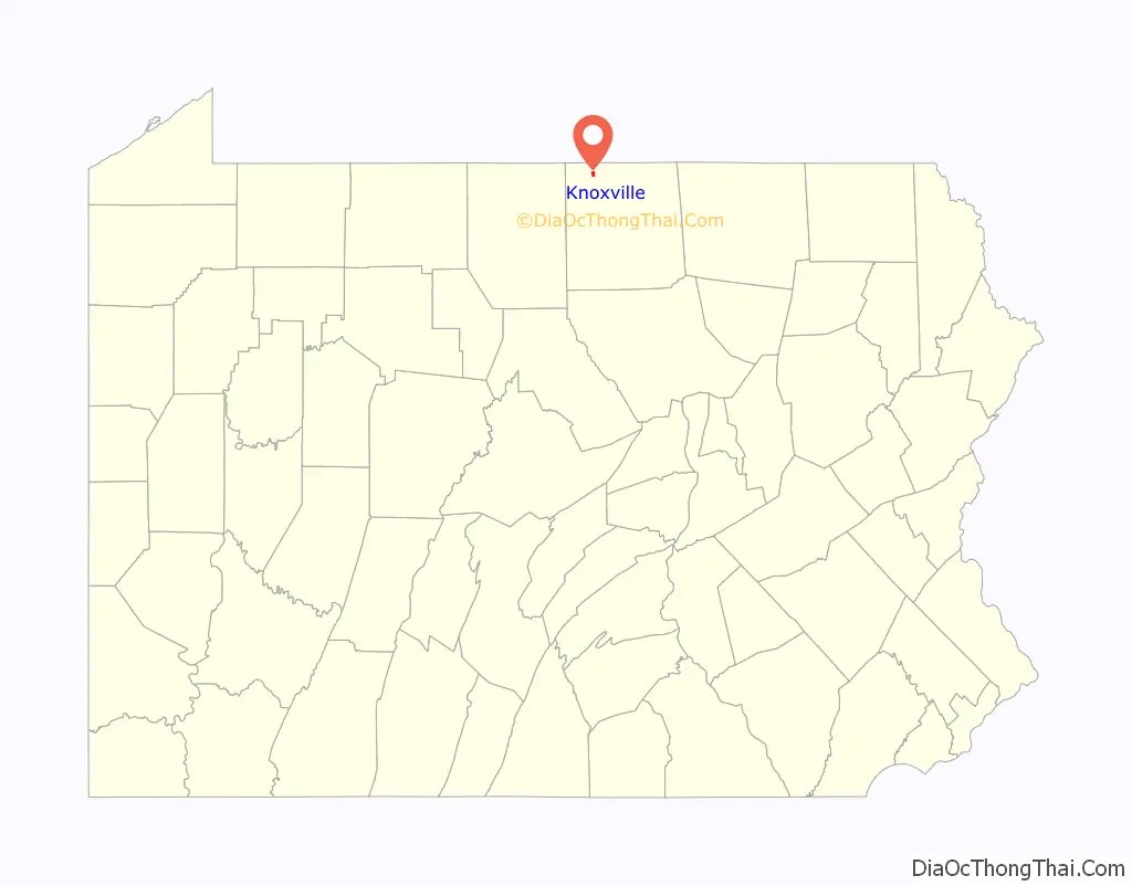
Knoxville location map. Where is Knoxville borough?
History
The land on which the town of Knoxville, Pennsylvania would be created was situated in Deerfield Township, Tioga County, Pennsylvania. The town was laid out and settled in 1835, and was officially incorporated as a borough in May 1851.
In 1899, the borough had four churches: Deerfield Baptist, First Methodist, Union Church, and a Presbyterian church. Among the businesses operating that year were bakeries, barbershops, a bicycle store, multiple blacksmith operations, a book and stationary store, bootmakers and shoemakers, a brick, lime and cement manufacturer, a bridge builder, a building mover, multiple independent carpenters, a carpet weaver and carpet sellers, two carriage, sleigh and wagonmakers, a clothing store, two coal dealers, a confectioner, two crockery stores, nine dressmakers, one drug store, two dry goods stores, two express agents, three furniture stores, two general merchandise stores, one grain dealer, one grist mill, three grocers, two hardware stores, two harnessmakers, three hotels, three insurance agents, two jewelers, a laundry, two lawyers, one livestock breeder and one poultry retailer, one livery, sale and horse boarding stable, one marble and granite plant, one mason, one music teacher, one newspaper, one nickel plating operation, one optician, four painters and paper hangers, two paint and oil artists, four physicians, two plumbers, one printer, two produce dealers, two railroad agents, one restaurant, one roofer, one sash door and blind retailer, one sawmill, two sewing machine retailers, one stove and tinware retailer, one surveyor, one telegraph agent, eight tobacco growers, two undertakers, and one wallpaper hanger.
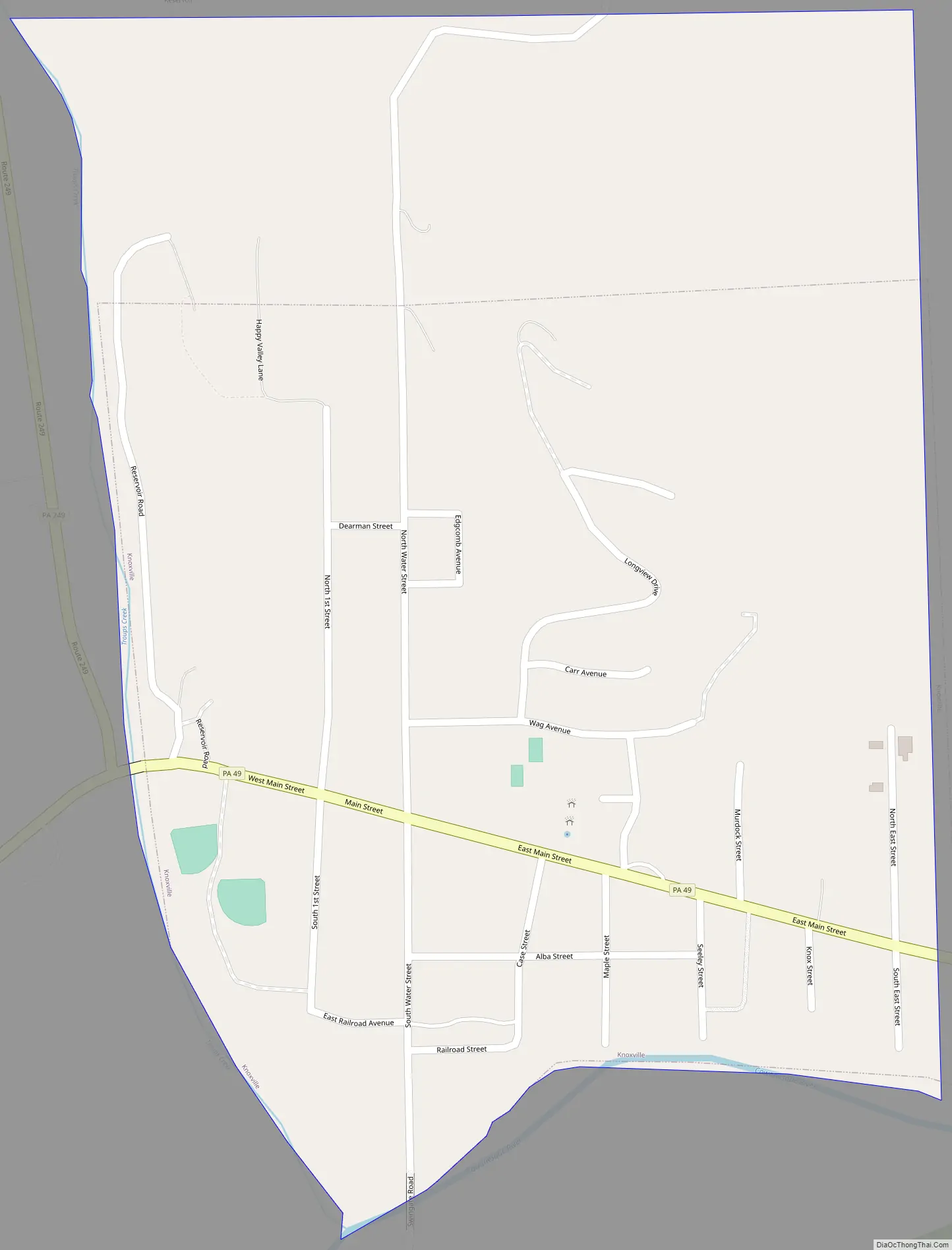
Knoxville Road Map
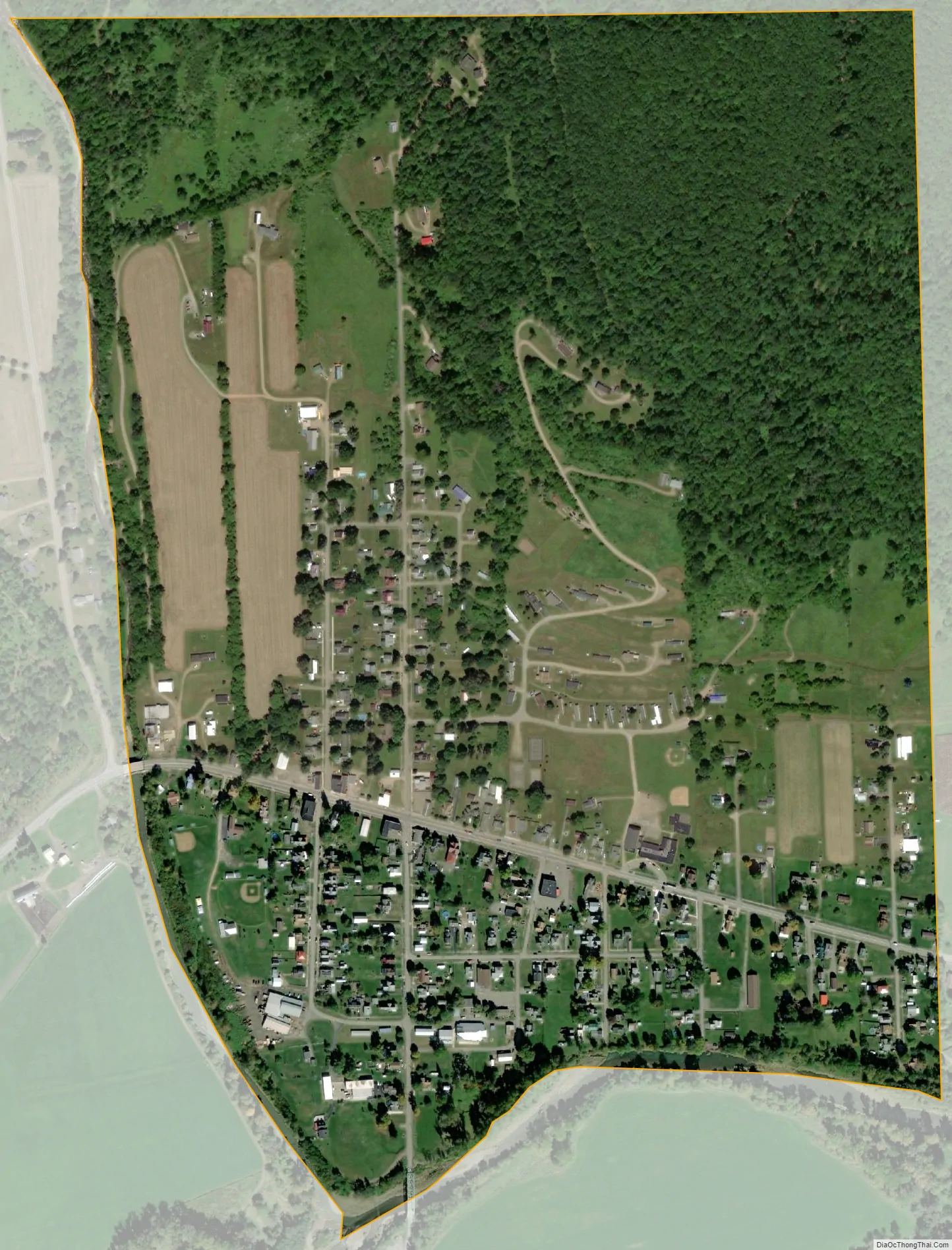
Knoxville city Satellite Map
Geography
Knoxville is located at 41°57′26″N 77°26′19″W / 41.95722°N 77.43861°W / 41.95722; -77.43861 (41.957247, -77.438498).
According to the United States Census Bureau, the borough has a total area of 0.5 square miles (1.3 km), all of it land.
See also
Map of Pennsylvania State and its subdivision:- Adams
- Allegheny
- Armstrong
- Beaver
- Bedford
- Berks
- Blair
- Bradford
- Bucks
- Butler
- Cambria
- Cameron
- Carbon
- Centre
- Chester
- Clarion
- Clearfield
- Clinton
- Columbia
- Crawford
- Cumberland
- Dauphin
- Delaware
- Elk
- Erie
- Fayette
- Forest
- Franklin
- Fulton
- Greene
- Huntingdon
- Indiana
- Jefferson
- Juniata
- Lackawanna
- Lancaster
- Lawrence
- Lebanon
- Lehigh
- Luzerne
- Lycoming
- Mc Kean
- Mercer
- Mifflin
- Monroe
- Montgomery
- Montour
- Northampton
- Northumberland
- Perry
- Philadelphia
- Pike
- Potter
- Schuylkill
- Snyder
- Somerset
- Sullivan
- Susquehanna
- Tioga
- Union
- Venango
- Warren
- Washington
- Wayne
- Westmoreland
- Wyoming
- York
- Alabama
- Alaska
- Arizona
- Arkansas
- California
- Colorado
- Connecticut
- Delaware
- District of Columbia
- Florida
- Georgia
- Hawaii
- Idaho
- Illinois
- Indiana
- Iowa
- Kansas
- Kentucky
- Louisiana
- Maine
- Maryland
- Massachusetts
- Michigan
- Minnesota
- Mississippi
- Missouri
- Montana
- Nebraska
- Nevada
- New Hampshire
- New Jersey
- New Mexico
- New York
- North Carolina
- North Dakota
- Ohio
- Oklahoma
- Oregon
- Pennsylvania
- Rhode Island
- South Carolina
- South Dakota
- Tennessee
- Texas
- Utah
- Vermont
- Virginia
- Washington
- West Virginia
- Wisconsin
- Wyoming