Lake Meade is an unincorporated census-designated place in Latimore and Reading townships, Adams County, Pennsylvania, United States. The population was 2,539 at the 2020 census.
| Name: | Lake Meade CDP |
|---|---|
| LSAD Code: | 57 |
| LSAD Description: | CDP (suffix) |
| State: | Pennsylvania |
| County: | Adams County |
| Elevation: | 499 ft (152 m) |
| Total Area: | 1.74 sq mi (4.51 km²) |
| Land Area: | 1.32 sq mi (3.42 km²) |
| Water Area: | 0.42 sq mi (1.09 km²) |
| Total Population: | 2,539 |
| Population Density: | 1,924.94/sq mi (743.17/km²) |
| FIPS code: | 4240988 |
| GNISfeature ID: | 2390019 |
| Website: | www.lakemeade.org |
Online Interactive Map
Click on ![]() to view map in "full screen" mode.
to view map in "full screen" mode.
Lake Meade location map. Where is Lake Meade CDP?
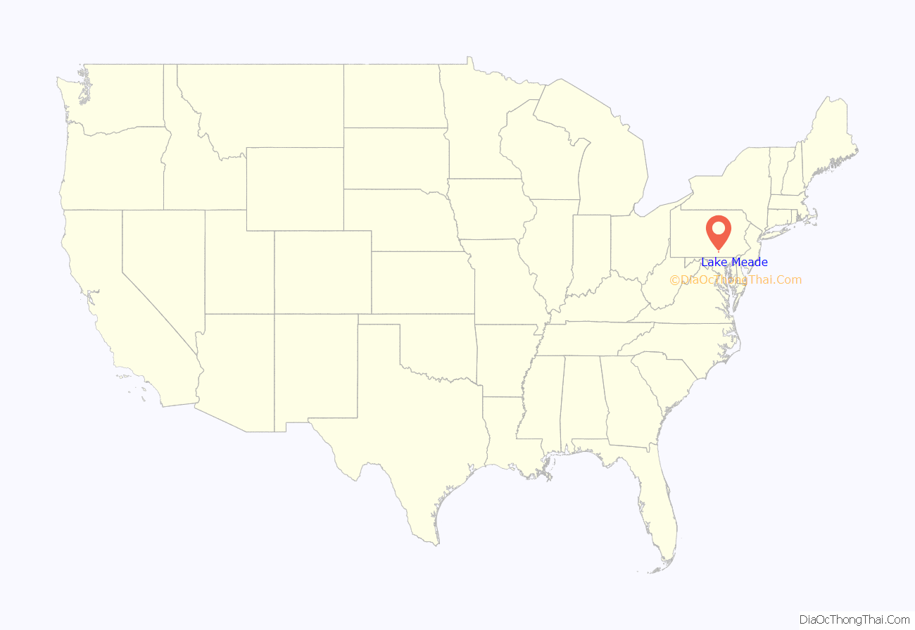
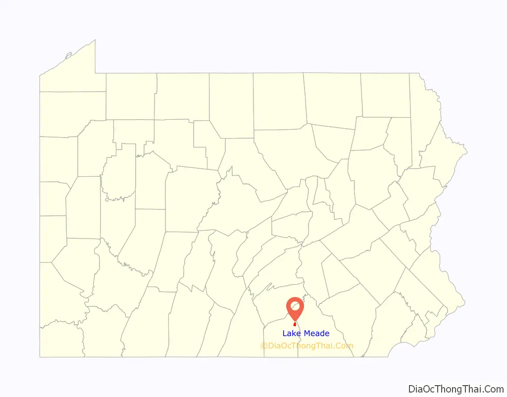
Lake Meade Road Map
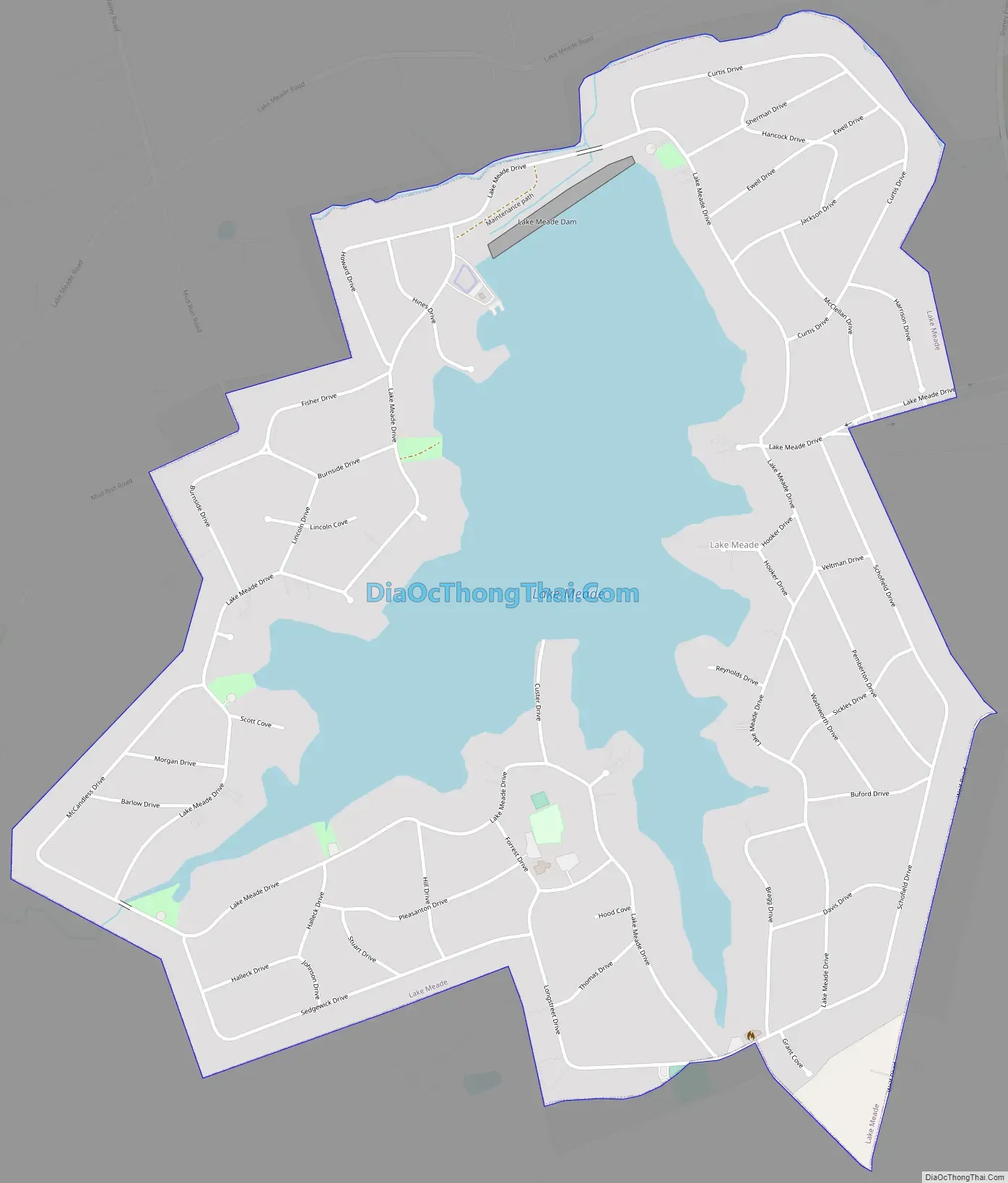
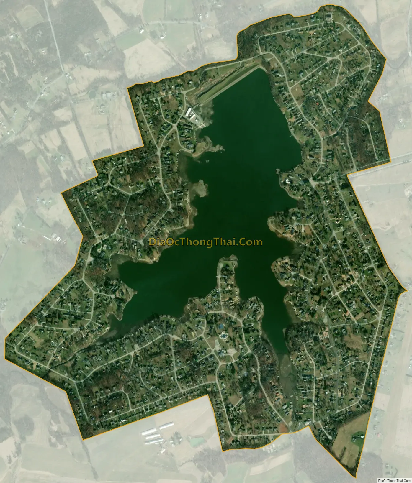
Lake Meade city Satellite Map
Geography
The community of Lake Meade is located around an artificial lake of the same name at 39°59′6″N 77°2′48″W / 39.98500°N 77.04667°W / 39.98500; -77.04667 (39.984958, -77.046734). The lake is an impoundment of Mud Run, a tributary of Bermudian Creek, the water of which flows via Conewago Creek to the Susquehanna River and eventually Chesapeake Bay.
According to the United States Census Bureau, the community has a total area of 1.7 square miles (4.5 km), of which 1.3 square miles (3.4 km) is land and 0.42 square miles (1.1 km), or 24.28%, is water.
See also
Map of Pennsylvania State and its subdivision:- Adams
- Allegheny
- Armstrong
- Beaver
- Bedford
- Berks
- Blair
- Bradford
- Bucks
- Butler
- Cambria
- Cameron
- Carbon
- Centre
- Chester
- Clarion
- Clearfield
- Clinton
- Columbia
- Crawford
- Cumberland
- Dauphin
- Delaware
- Elk
- Erie
- Fayette
- Forest
- Franklin
- Fulton
- Greene
- Huntingdon
- Indiana
- Jefferson
- Juniata
- Lackawanna
- Lancaster
- Lawrence
- Lebanon
- Lehigh
- Luzerne
- Lycoming
- Mc Kean
- Mercer
- Mifflin
- Monroe
- Montgomery
- Montour
- Northampton
- Northumberland
- Perry
- Philadelphia
- Pike
- Potter
- Schuylkill
- Snyder
- Somerset
- Sullivan
- Susquehanna
- Tioga
- Union
- Venango
- Warren
- Washington
- Wayne
- Westmoreland
- Wyoming
- York
- Alabama
- Alaska
- Arizona
- Arkansas
- California
- Colorado
- Connecticut
- Delaware
- District of Columbia
- Florida
- Georgia
- Hawaii
- Idaho
- Illinois
- Indiana
- Iowa
- Kansas
- Kentucky
- Louisiana
- Maine
- Maryland
- Massachusetts
- Michigan
- Minnesota
- Mississippi
- Missouri
- Montana
- Nebraska
- Nevada
- New Hampshire
- New Jersey
- New Mexico
- New York
- North Carolina
- North Dakota
- Ohio
- Oklahoma
- Oregon
- Pennsylvania
- Rhode Island
- South Carolina
- South Dakota
- Tennessee
- Texas
- Utah
- Vermont
- Virginia
- Washington
- West Virginia
- Wisconsin
- Wyoming