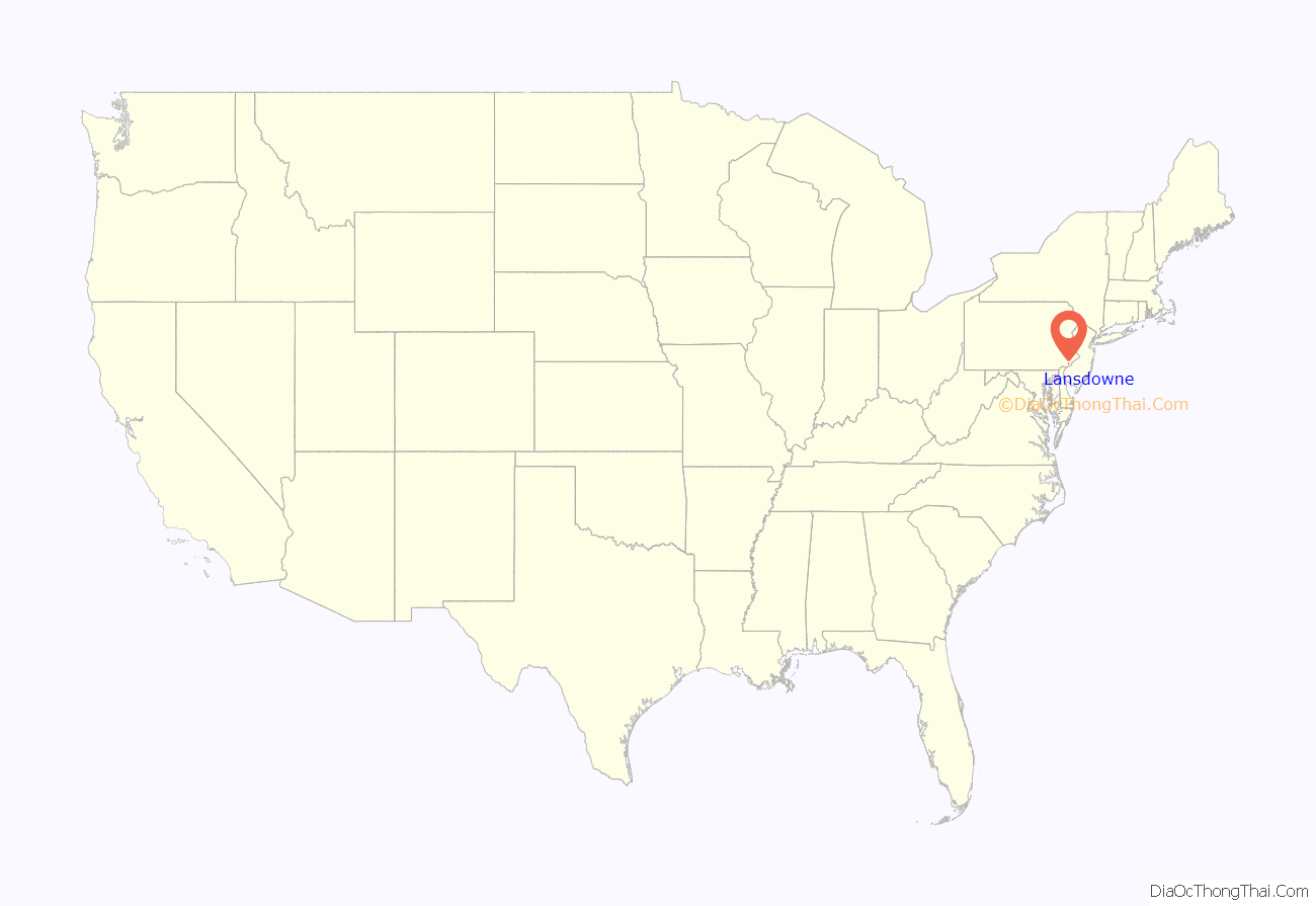
Lansdowne is a borough in Delaware County, Pennsylvania, United States, located 6 miles (10 km) southwest of Center City Philadelphia. It was named for the Marquess of Lansdowne. As of the 2010 census, the borough had a population of 10,620.
Lansdowne grew quickly in the early part of the twentieth century, when a railroad stop was established near the intersection of Lansdowne Avenue and Baltimore Pike. The borough is primarily residential, with a commercial center near the original railroad stop. The borough also contained some light industrial buildings, which have been in decline in recent decades.
The borough is sometimes erroneously spelled “Landsdowne” or confused with Lansdale, in nearby Montgomery County.
| Name: | Lansdowne borough |
|---|---|
| LSAD Code: | 21 |
| LSAD Description: | borough (suffix) |
| State: | Pennsylvania |
| County: | Delaware County |
| Elevation: | 108 ft (33 m) |
| Total Area: | 1.18 sq mi (3.06 km²) |
| Land Area: | 1.18 sq mi (3.06 km²) |
| Water Area: | 0.00 sq mi (0.00 km²) |
| Total Population: | 11,107 |
| Population Density: | 9,404.74/sq mi (3,629.96/km²) |
| ZIP code: | 19050 |
| FIPS code: | 4241440 |
| GNISfeature ID: | 1178879 |
| Website: | www.lansdowneborough.com |
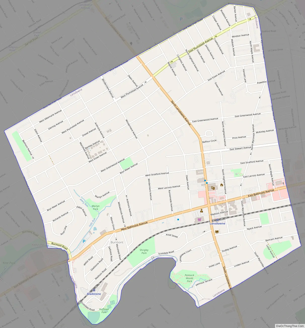
Online Interactive Map
Click on ![]() to view map in "full screen" mode.
to view map in "full screen" mode.
Lansdowne location map. Where is Lansdowne borough?
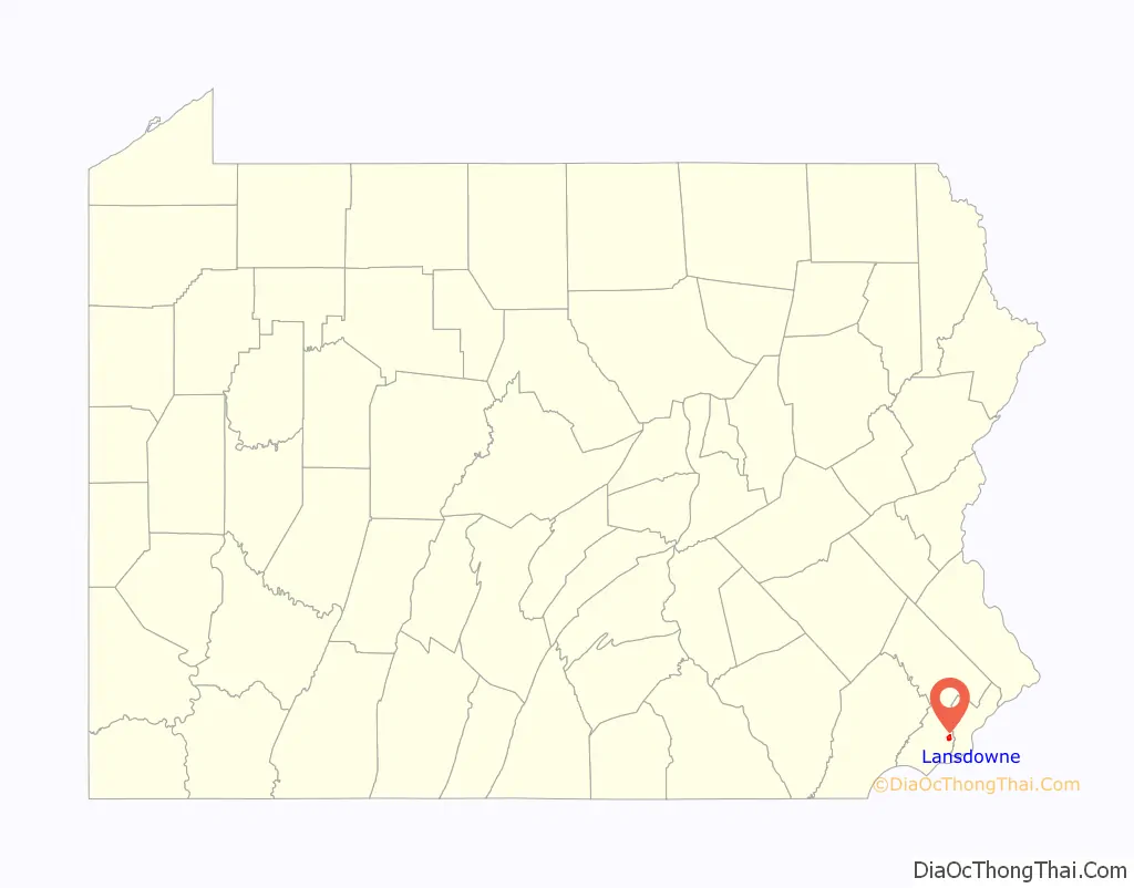
Lansdowne Road Map
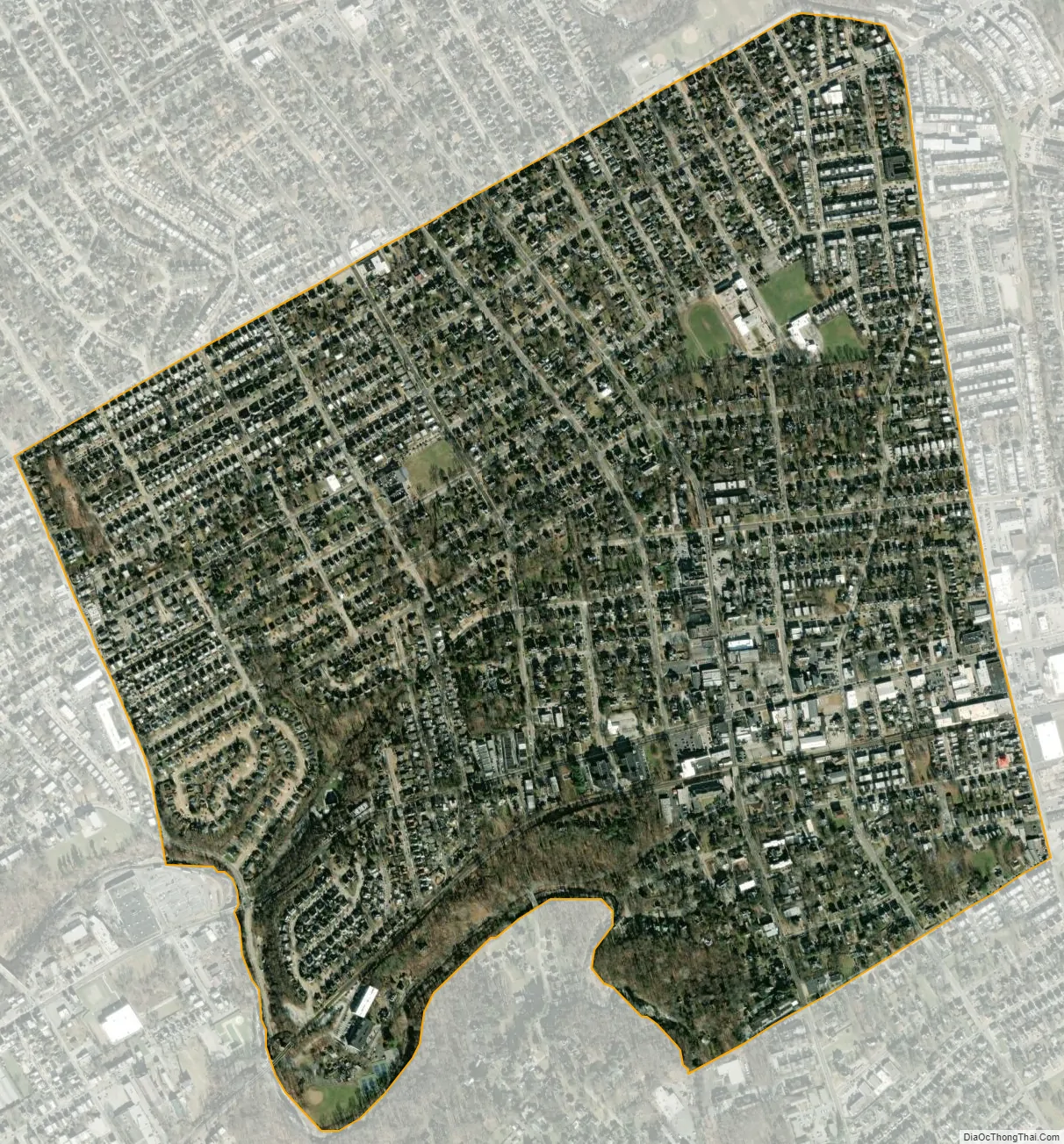
Lansdowne city Satellite Map
Geography
Lansdowne is located in eastern Delaware County at 39°56′29″N 75°16′31″W / 39.94139°N 75.27528°W / 39.94139; -75.27528 (39.941345, -75.275343). It is bordered to the southeast by Yeadon, to the southwest by Clifton Heights, and to the north, east, west, and south by Upper Darby Township. Drexel Hill, a part of Upper Darby Township, borders Lansdowne to the northwest, and the borough of East Lansdowne is just 0.1 miles (0.16 km) east of the Lansdowne border.
According to the United States Census Bureau, the borough has a total area of 1.2 square miles (3.1 km), all land. Darby Creek, a tributary of the Delaware River, forms the southwestern and southern borders of the borough.
See also
Map of Pennsylvania State and its subdivision:- Adams
- Allegheny
- Armstrong
- Beaver
- Bedford
- Berks
- Blair
- Bradford
- Bucks
- Butler
- Cambria
- Cameron
- Carbon
- Centre
- Chester
- Clarion
- Clearfield
- Clinton
- Columbia
- Crawford
- Cumberland
- Dauphin
- Delaware
- Elk
- Erie
- Fayette
- Forest
- Franklin
- Fulton
- Greene
- Huntingdon
- Indiana
- Jefferson
- Juniata
- Lackawanna
- Lancaster
- Lawrence
- Lebanon
- Lehigh
- Luzerne
- Lycoming
- Mc Kean
- Mercer
- Mifflin
- Monroe
- Montgomery
- Montour
- Northampton
- Northumberland
- Perry
- Philadelphia
- Pike
- Potter
- Schuylkill
- Snyder
- Somerset
- Sullivan
- Susquehanna
- Tioga
- Union
- Venango
- Warren
- Washington
- Wayne
- Westmoreland
- Wyoming
- York
- Alabama
- Alaska
- Arizona
- Arkansas
- California
- Colorado
- Connecticut
- Delaware
- District of Columbia
- Florida
- Georgia
- Hawaii
- Idaho
- Illinois
- Indiana
- Iowa
- Kansas
- Kentucky
- Louisiana
- Maine
- Maryland
- Massachusetts
- Michigan
- Minnesota
- Mississippi
- Missouri
- Montana
- Nebraska
- Nevada
- New Hampshire
- New Jersey
- New Mexico
- New York
- North Carolina
- North Dakota
- Ohio
- Oklahoma
- Oregon
- Pennsylvania
- Rhode Island
- South Carolina
- South Dakota
- Tennessee
- Texas
- Utah
- Vermont
- Virginia
- Washington
- West Virginia
- Wisconsin
- Wyoming


