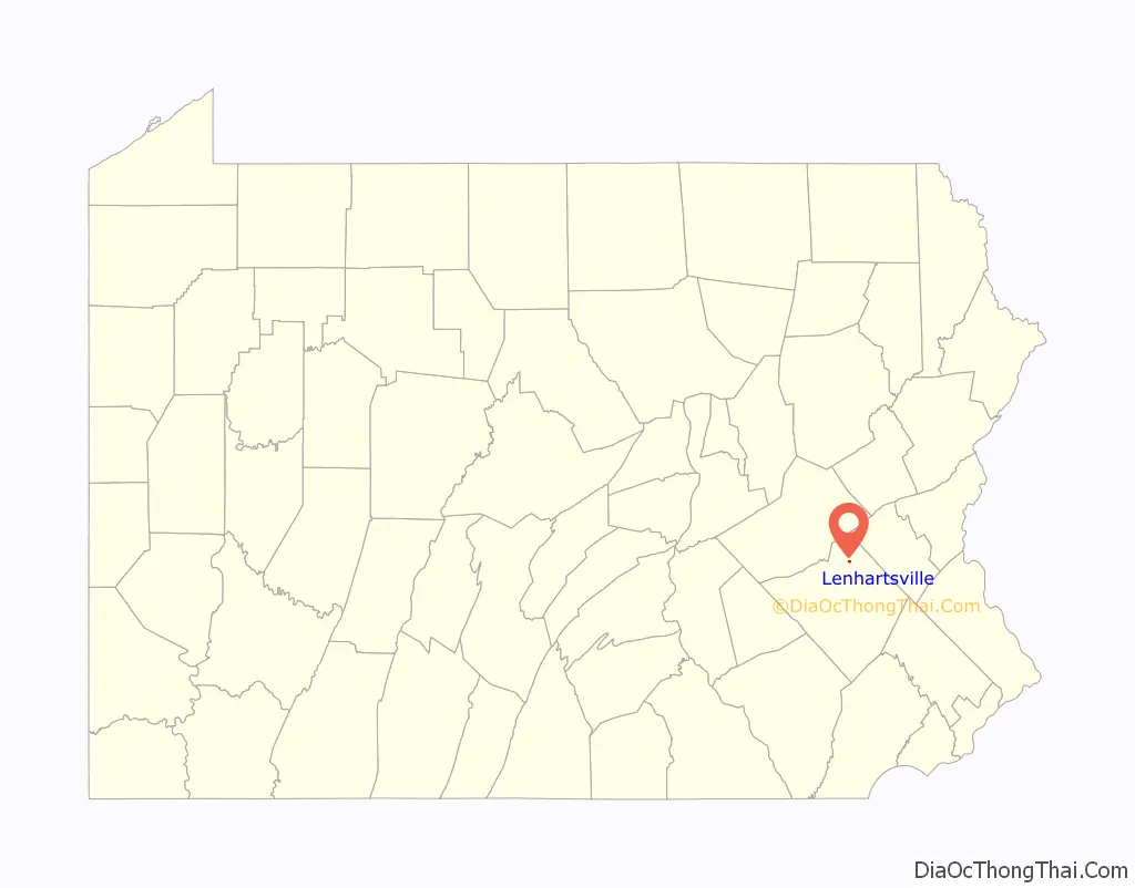
Lenhartsville is a borough in Berks County, Pennsylvania. The population was 165 at the 2010 census.
| Name: | Lenhartsville borough |
|---|---|
| LSAD Code: | 21 |
| LSAD Description: | borough (suffix) |
| State: | Pennsylvania |
| County: | Berks County |
| Elevation: | 381 ft (116 m) |
| Total Area: | 0.19 sq mi (0.49 km²) |
| Land Area: | 0.18 sq mi (0.48 km²) |
| Water Area: | 0.01 sq mi (0.01 km²) |
| Total Population: | 180 |
| Population Density: | 972.97/sq mi (375.79/km²) |
| ZIP code: | 19534 |
| Area code: | 610 |
| FIPS code: | 4242688 |
Online Interactive Map
Click on ![]() to view map in "full screen" mode.
to view map in "full screen" mode.
Lenhartsville location map. Where is Lenhartsville borough?

History
Heinrich (Henry) Lenhart, 1773–1837, son of Jacob Lenhart, is considered the founder of Lenhartsville, on land once owned by his grandfather Johan Peter Lenhart.
The Lenhart Farm was listed on the National Register of Historic Places in 1978.
Borough Hall
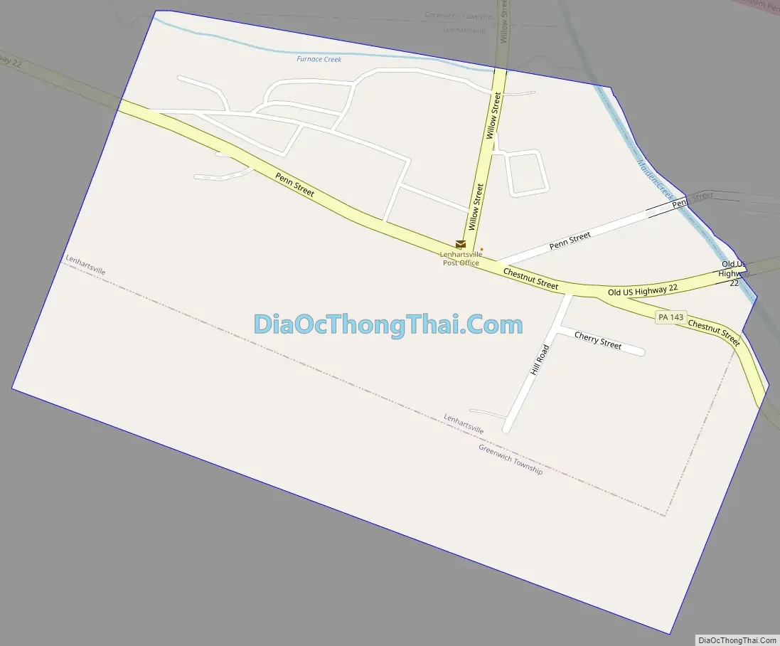
Lenhartsville Road Map
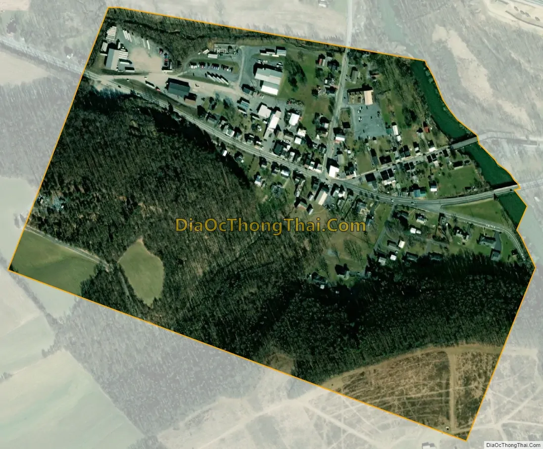
Lenhartsville city Satellite Map
Geography
Lenhartsville is located in northern Berks County at 40°34′24″N 75°53′12″W / 40.57333°N 75.88667°W / 40.57333; -75.88667 (40.573438, -75.886717), in the valley of Maiden Creek. It is surrounded by Greenwich Township but is separate from it. According to the U.S. Census Bureau, Lenhartsville has a total area of 0.14 square miles (0.35 km), of which 0.004 square miles (0.01 km), or 2.75%, is water.
See also
Map of Pennsylvania State and its subdivision:- Adams
- Allegheny
- Armstrong
- Beaver
- Bedford
- Berks
- Blair
- Bradford
- Bucks
- Butler
- Cambria
- Cameron
- Carbon
- Centre
- Chester
- Clarion
- Clearfield
- Clinton
- Columbia
- Crawford
- Cumberland
- Dauphin
- Delaware
- Elk
- Erie
- Fayette
- Forest
- Franklin
- Fulton
- Greene
- Huntingdon
- Indiana
- Jefferson
- Juniata
- Lackawanna
- Lancaster
- Lawrence
- Lebanon
- Lehigh
- Luzerne
- Lycoming
- Mc Kean
- Mercer
- Mifflin
- Monroe
- Montgomery
- Montour
- Northampton
- Northumberland
- Perry
- Philadelphia
- Pike
- Potter
- Schuylkill
- Snyder
- Somerset
- Sullivan
- Susquehanna
- Tioga
- Union
- Venango
- Warren
- Washington
- Wayne
- Westmoreland
- Wyoming
- York
- Alabama
- Alaska
- Arizona
- Arkansas
- California
- Colorado
- Connecticut
- Delaware
- District of Columbia
- Florida
- Georgia
- Hawaii
- Idaho
- Illinois
- Indiana
- Iowa
- Kansas
- Kentucky
- Louisiana
- Maine
- Maryland
- Massachusetts
- Michigan
- Minnesota
- Mississippi
- Missouri
- Montana
- Nebraska
- Nevada
- New Hampshire
- New Jersey
- New Mexico
- New York
- North Carolina
- North Dakota
- Ohio
- Oklahoma
- Oregon
- Pennsylvania
- Rhode Island
- South Carolina
- South Dakota
- Tennessee
- Texas
- Utah
- Vermont
- Virginia
- Washington
- West Virginia
- Wisconsin
- Wyoming


