Linglestown is a census-designated place (CDP) in Lower Paxton Township, Dauphin County, Pennsylvania, United States. It was founded and laid out in 1765 by Thomas Lingle.
The population was 6,539 at the 2020 census. It is part of the Harrisburg–Carlisle Metropolitan Statistical Area.
| Name: | Linglestown CDP |
|---|---|
| LSAD Code: | 57 |
| LSAD Description: | CDP (suffix) |
| State: | Pennsylvania |
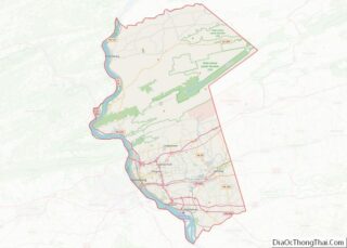
| County: | Dauphin County |
| Elevation: | 540 ft (160 m) |
| Total Area: | 3.83 sq mi (9.91 km²) |
| Land Area: | 3.83 sq mi (9.91 km²) |
| Water Area: | 0.00 sq mi (0.00 km²) |
| Total Population: | 6,539 |
| Population Density: | 1,708.65/sq mi (659.77/km²) |
| ZIP code: | 17112 |
| FIPS code: | 4243672 |
| GNISfeature ID: | 1179431 |
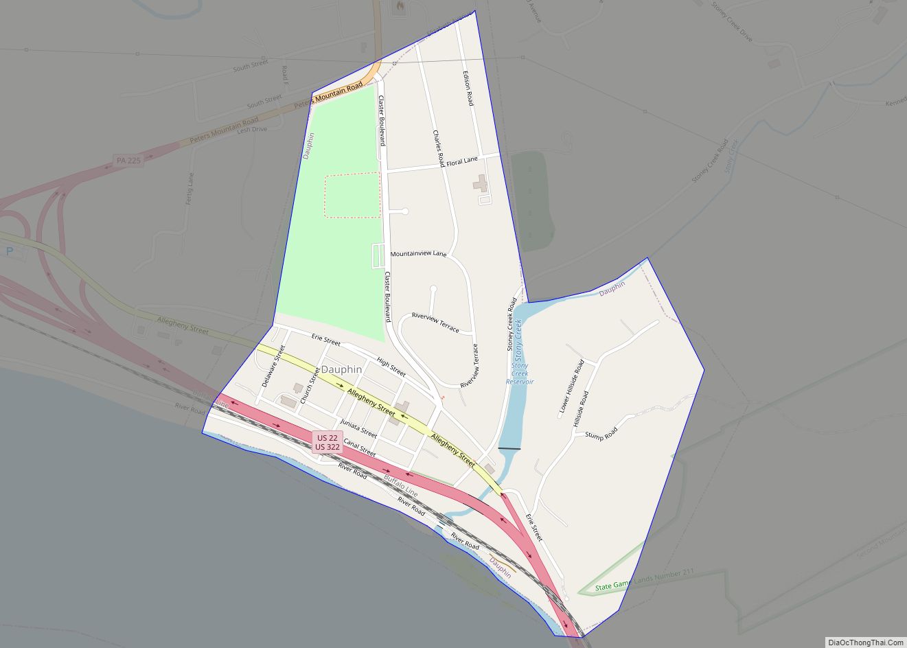
Online Interactive Map
Click on ![]() to view map in "full screen" mode.
to view map in "full screen" mode.
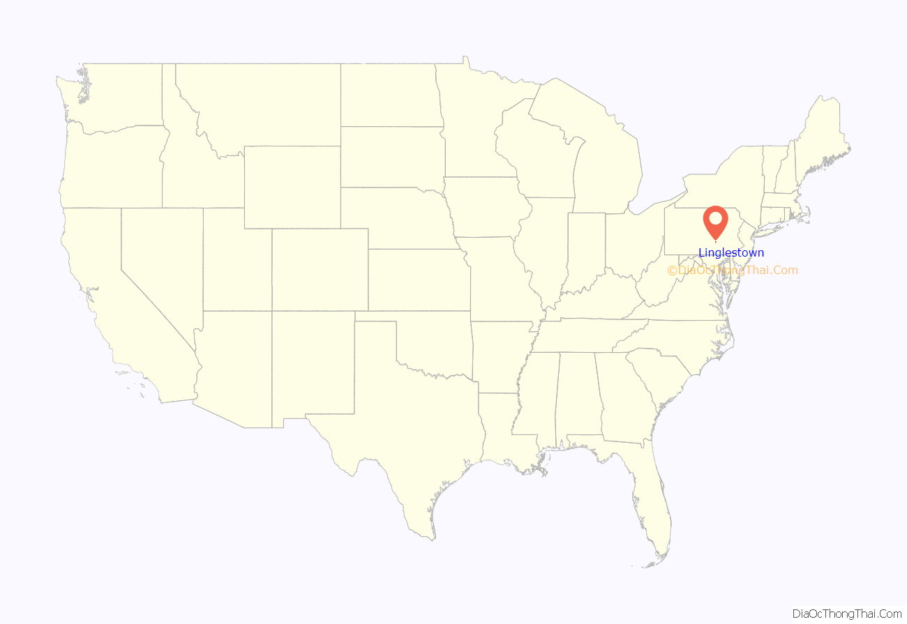
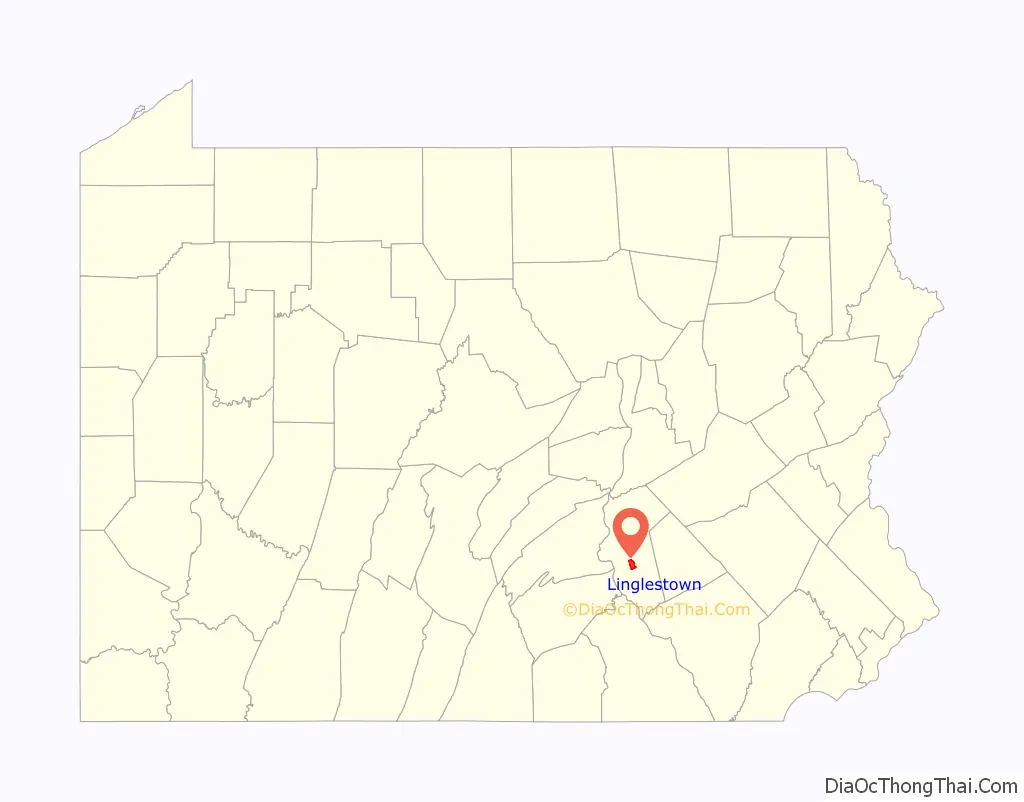
Linglestown location map. Where is Linglestown CDP?
History
In 1765, Thomas Lingle purchased a parcel of land in what was then Paxton Township, so as to develop a 90-plot living, working, and studying community for newly-arriving European settlers. He called his new settlement “The Town of St. Thomas”, after the Christian apostle, his namesake. The sheepskin document on which Lingle drew the plan for his village still exists, showing in great detail the village’s name, each of the plots, their plot numbers, and all street and alley names. The county deed recorder’s seal and record information are visible on the bottom left corner of the document.
In 1811, Lingle died and was buried in the Wenrich’s Church cemetery (now St. Thomas United Church of Christ), at the east end of the village. Soon thereafter, village and area residents began calling his village “Lingle’s town”, and the name soon took on its current form.
As a busy crossroads community located at the base of the mountain, the village soon became the area center for commerce, civic, religious, and educational activities, much of which still exists today.
St. Thomas UCC is the village’s oldest denomination. The Church of God denomination had its world beginning and first structure and cemetery in Linglestown.
Linglestown Square renovation
Since 1996, the village has been considering making improvements to the village square. At the center of the square is a flag pole located in the middle of the road. The initial plan was to move the flag pole and insert a traffic light. After long debate, that idea was shot down. It was replaced by the “Linglestown Plan”, proposed on March 31, 2000. Nearly seven years later, on February 20, 2007, Lower Paxton Township approved a modified version of the Linglestown Action Plan, which involves the addition of roundabouts, other approaches to slowing down traffic through the square, and general community improvement. On September 11, 2009, PennDOT awarded a construction bid for the project to E. Wintermyer Co. of Etters.
While the road construction was intended not only to relieve traffic but also promote an aesthetic aspect in order to draw in business for Linglestown merchants, many of those merchants faced the brink of closing. The plan intended to address the issues with congestion and rush hour traffic, as well as safety concerns. In June 2010, the project entered its final phase. The roadways in the roundabouts were opened to two-way traffic, with the remainder of the road closed to two-way traffic until November 2010.
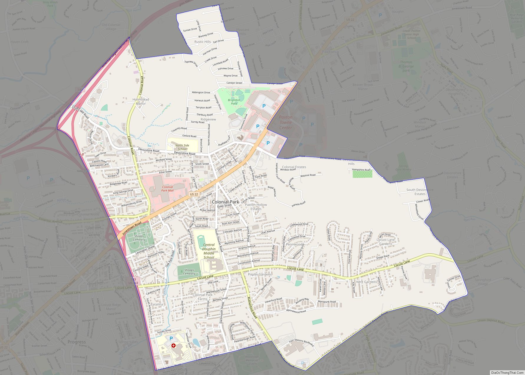
Linglestown Road Map
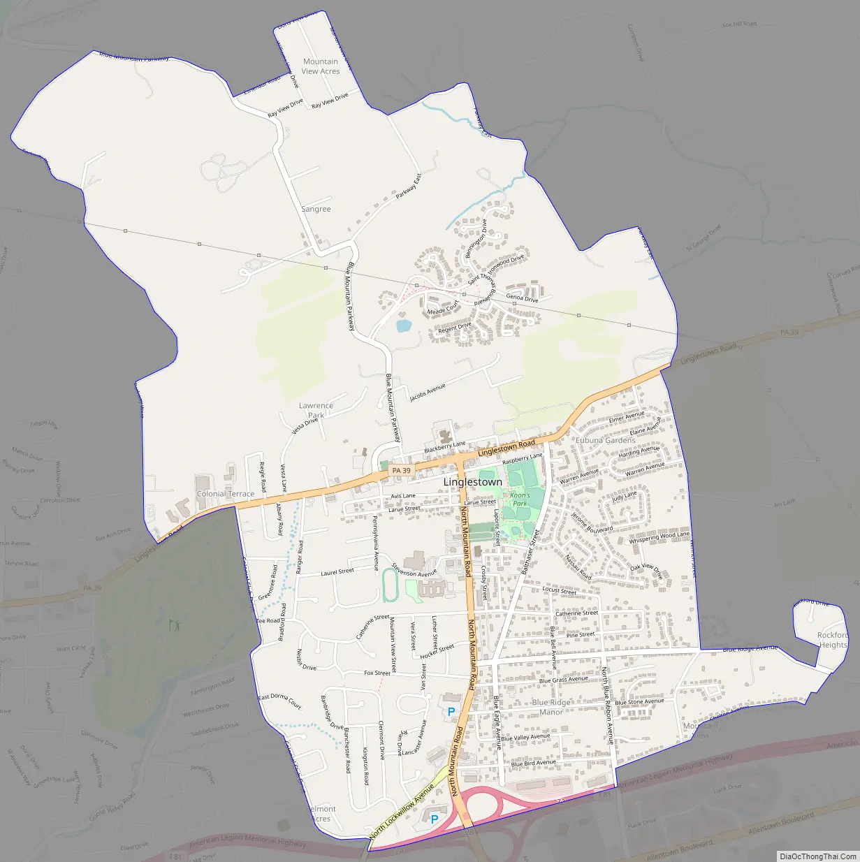
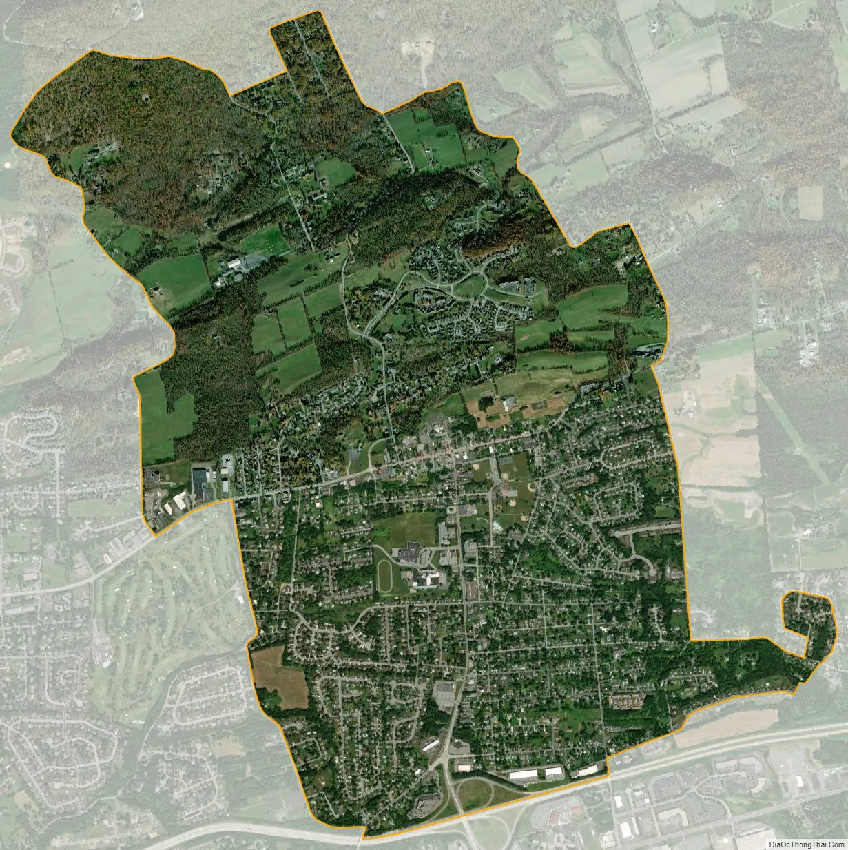
Linglestown city Satellite Map
Geography
Linglestown is located in northern Lower Paxton Township at 40°20′13″N 76°47′27″W / 40.33694°N 76.79083°W / 40.33694; -76.79083 (40.336888, -76.790764). It is bordered to the south by the community of Paxtonia, with the border between them formed by Interstate 81 and with access from Exit 72 (Mountain Road).
According to the United States Census Bureau, the CDP has a total area of 3.8 square miles (9.9 km), all land (except a few streams and ponds).
The highest elevation is 995 feet (303 m) on the south slope of Blue Mountain, along Blue Mountain Parkway north of the center of town. Pennsylvania Route 39 (Linglestown Road) passes east-to-west through the village, leading east 3.5 miles (5.6 km) to Exit 77 on Interstate 81 and west 5 miles (8 km) to Highway 22-322 at the north end of Harrisburg.
See also
Map of Pennsylvania State and its subdivision:- Adams
- Allegheny
- Armstrong
- Beaver
- Bedford
- Berks
- Blair
- Bradford
- Bucks
- Butler
- Cambria
- Cameron
- Carbon
- Centre
- Chester
- Clarion
- Clearfield
- Clinton
- Columbia
- Crawford
- Cumberland
- Dauphin
- Delaware
- Elk
- Erie
- Fayette
- Forest
- Franklin
- Fulton
- Greene
- Huntingdon
- Indiana
- Jefferson
- Juniata
- Lackawanna
- Lancaster
- Lawrence
- Lebanon
- Lehigh
- Luzerne
- Lycoming
- Mc Kean
- Mercer
- Mifflin
- Monroe
- Montgomery
- Montour
- Northampton
- Northumberland
- Perry
- Philadelphia
- Pike
- Potter
- Schuylkill
- Snyder
- Somerset
- Sullivan
- Susquehanna
- Tioga
- Union
- Venango
- Warren
- Washington
- Wayne
- Westmoreland
- Wyoming
- York
- Alabama
- Alaska
- Arizona
- Arkansas
- California
- Colorado
- Connecticut
- Delaware
- District of Columbia
- Florida
- Georgia
- Hawaii
- Idaho
- Illinois
- Indiana
- Iowa
- Kansas
- Kentucky
- Louisiana
- Maine
- Maryland
- Massachusetts
- Michigan
- Minnesota
- Mississippi
- Missouri
- Montana
- Nebraska
- Nevada
- New Hampshire
- New Jersey
- New Mexico
- New York
- North Carolina
- North Dakota
- Ohio
- Oklahoma
- Oregon
- Pennsylvania
- Rhode Island
- South Carolina
- South Dakota
- Tennessee
- Texas
- Utah
- Vermont
- Virginia
- Washington
- West Virginia
- Wisconsin
- Wyoming