Marienville is an unincorporated community and census-designated place (CDP) in Jenks Township, Forest County, Pennsylvania, United States. Its altitude is 1,735 feet (529 m), and it is located at 41°28′12″N 79°7′29″W / 41.47000°N 79.12472°W / 41.47000; -79.12472 (41.4702014, -79.1247623). Other names for the community have included “Marion” and “Marionville”. Marienville is a major point on a well-known ATV trail. According to the 2010 census the population of Marienville was 3,137.
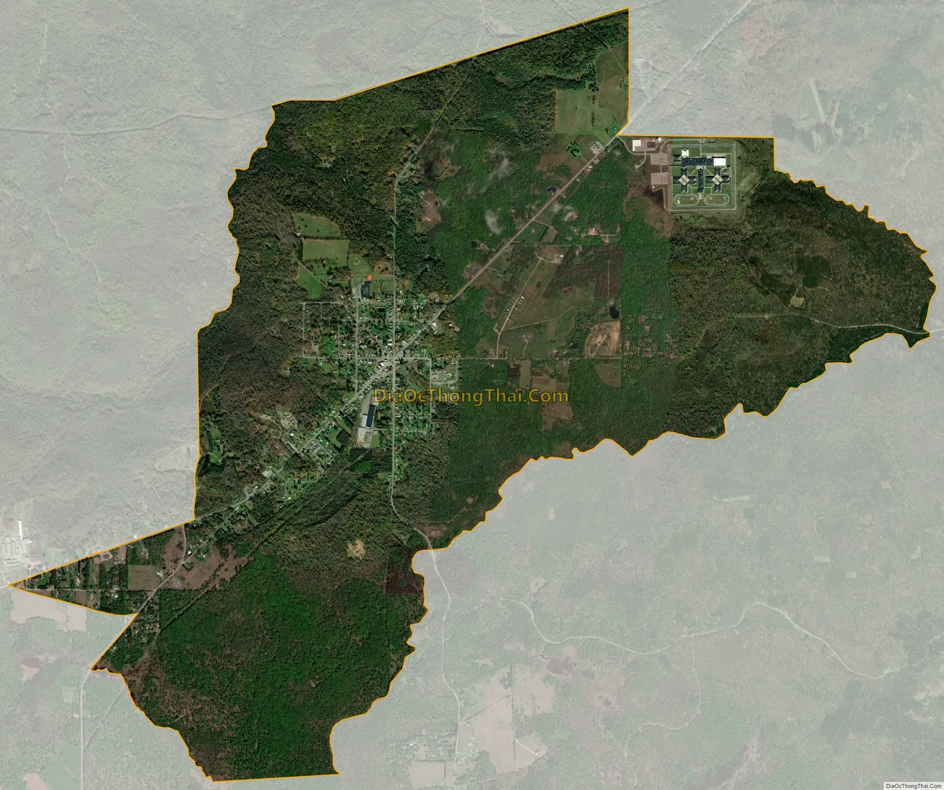
Marienville is the location of the SCI Forest state penitentiary.
| Name: | Marienville CDP |
|---|---|
| LSAD Code: | 57 |
| LSAD Description: | CDP (suffix) |
| State: | Pennsylvania |
| County: | Forest County |
| Elevation: | 1,735 ft (529 m) |
| Total Area: | 6.06 sq mi (15.69 km²) |
| Land Area: | 6.06 sq mi (15.69 km²) |
| Water Area: | 0.00 sq mi (0.00 km²) |
| Total Population: | 3,362 |
| Population Density: | 554.88/sq mi (214.23/km²) |
| ZIP code: | 16239 |
| FIPS code: | 4247416 |
| GNISfeature ID: | 1213633 |
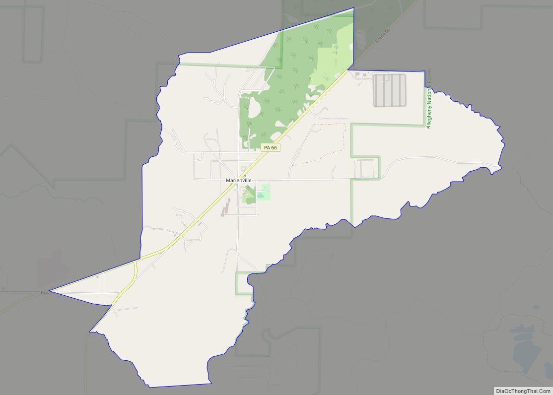
Online Interactive Map
Click on ![]() to view map in "full screen" mode.
to view map in "full screen" mode.
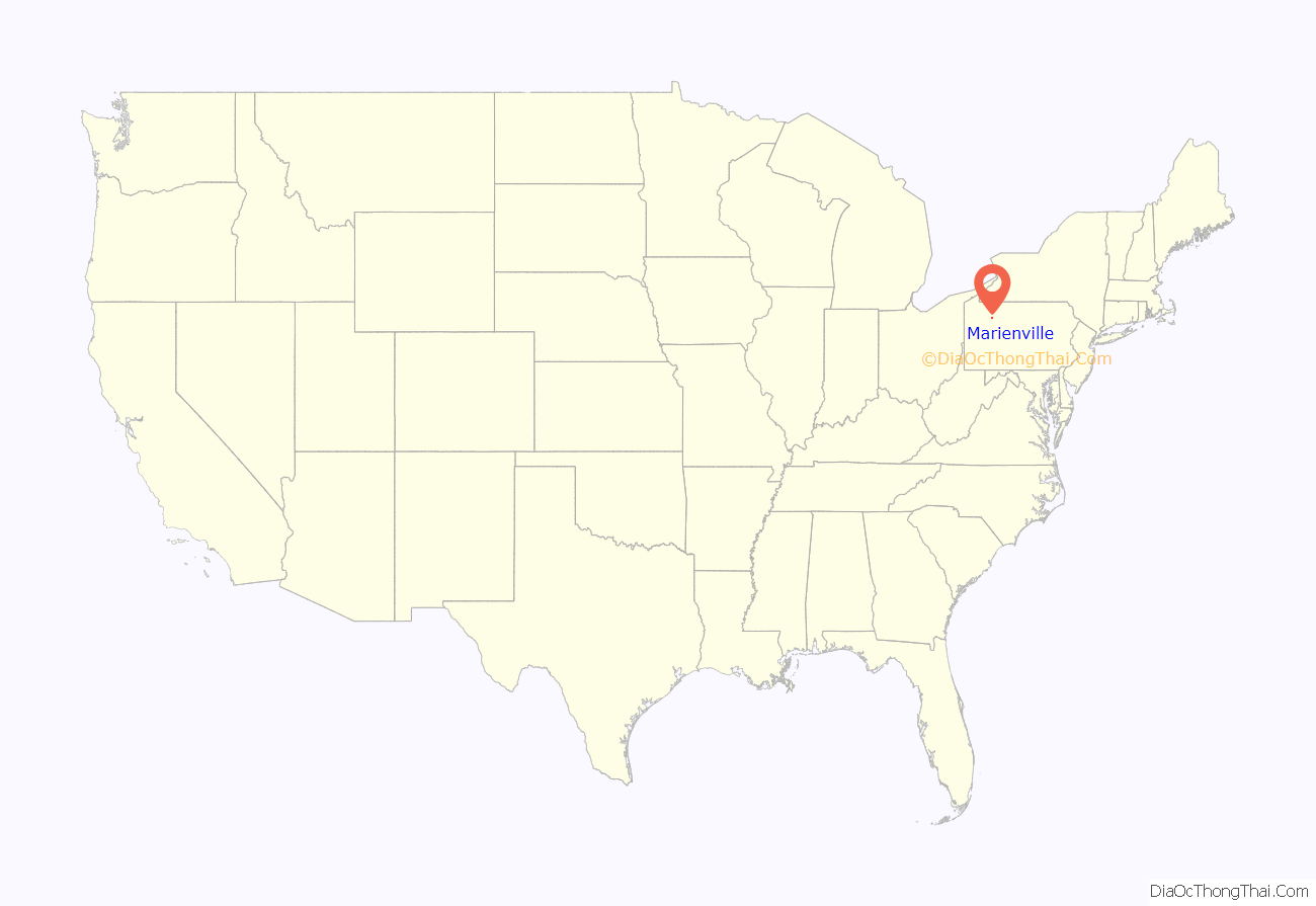
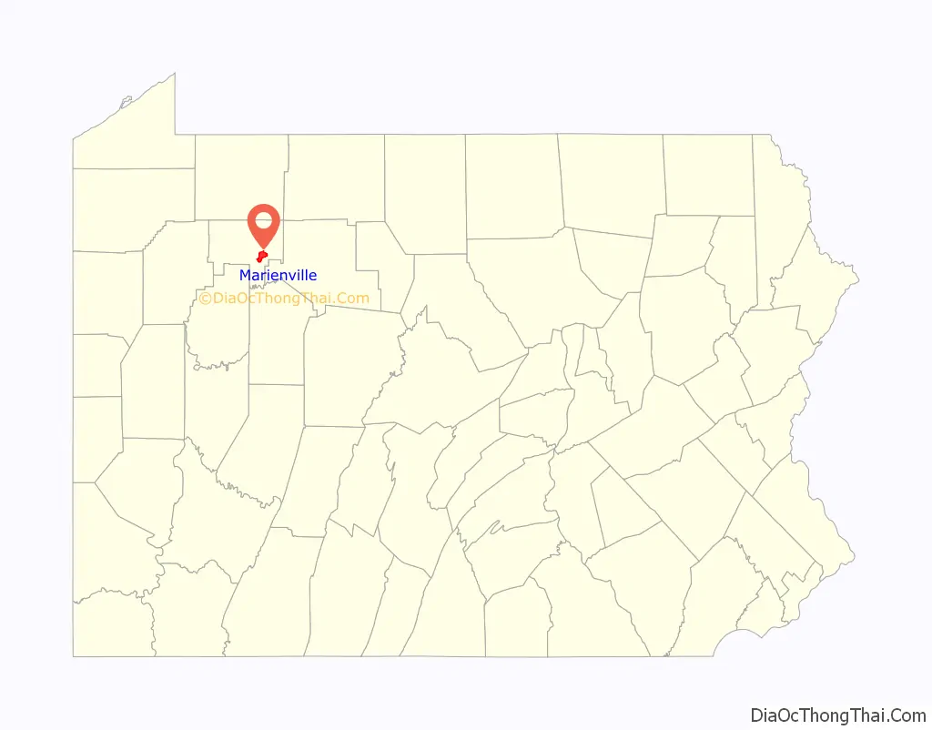
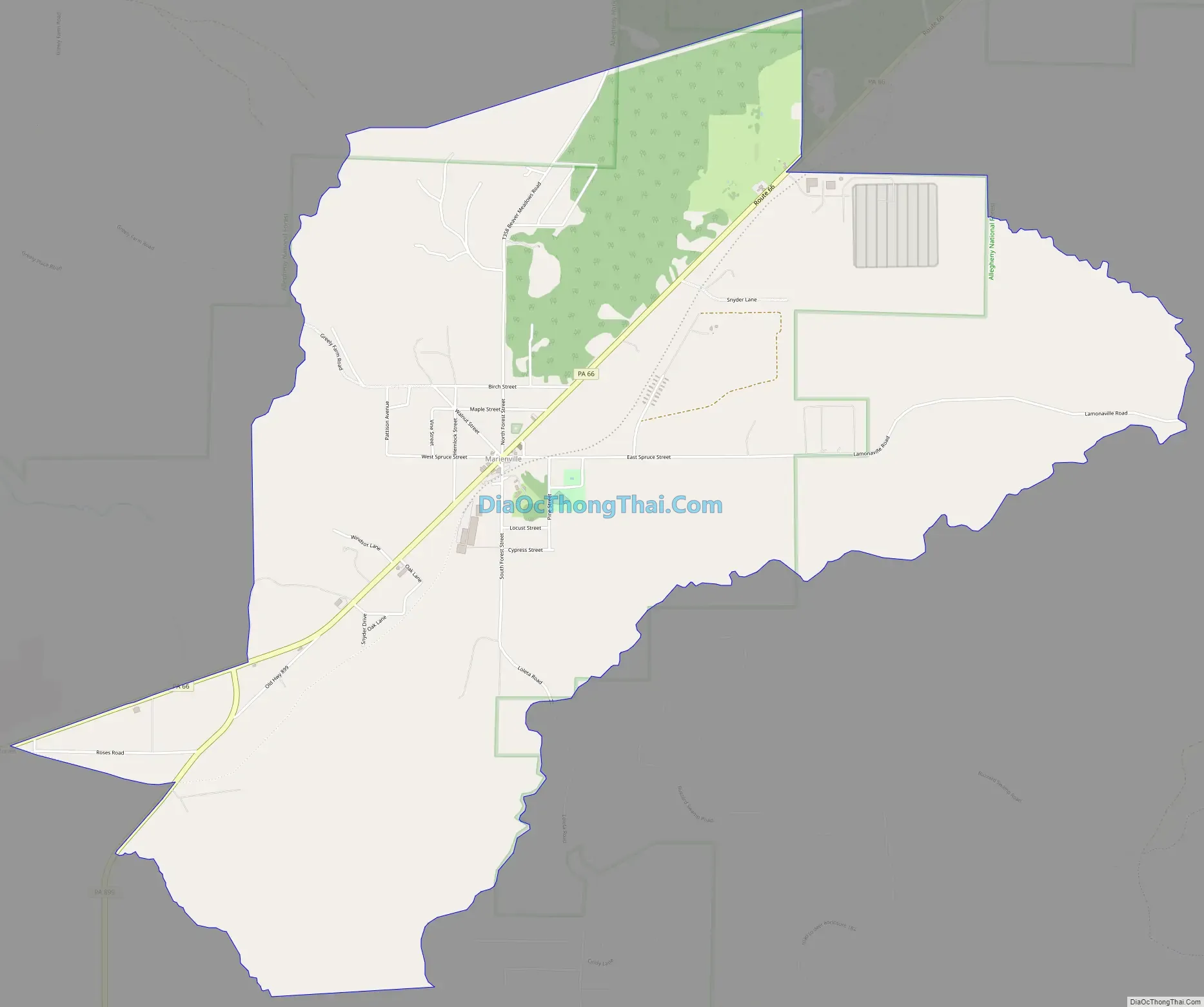
Marienville location map. Where is Marienville CDP?
Marienville Road Map
Marienville city Satellite Map
Geography
The community is in southeastern Forest County near the center of Jenks Township. Pennsylvania Route 66 is the main street, leading northeast 24 miles (39 km) to U.S. Route 6 at Kane and southwest 27 miles (43 km) to Interstate 80 near Clarion. Pennsylvania Route 899 leads south from Marienville 10 miles (16 km) to Clarington.
According to the U.S. Census Bureau, the Marienville CDP has a total area of 6.1 square miles (15.7 km), all land.
Marienville Presbyterian Church
See also
Map of Pennsylvania State and its subdivision:- Adams
- Allegheny
- Armstrong
- Beaver
- Bedford
- Berks
- Blair
- Bradford
- Bucks
- Butler
- Cambria
- Cameron
- Carbon
- Centre
- Chester
- Clarion
- Clearfield
- Clinton
- Columbia
- Crawford
- Cumberland
- Dauphin
- Delaware
- Elk
- Erie
- Fayette
- Forest
- Franklin
- Fulton
- Greene
- Huntingdon
- Indiana
- Jefferson
- Juniata
- Lackawanna
- Lancaster
- Lawrence
- Lebanon
- Lehigh
- Luzerne
- Lycoming
- Mc Kean
- Mercer
- Mifflin
- Monroe
- Montgomery
- Montour
- Northampton
- Northumberland
- Perry
- Philadelphia
- Pike
- Potter
- Schuylkill
- Snyder
- Somerset
- Sullivan
- Susquehanna
- Tioga
- Union
- Venango
- Warren
- Washington
- Wayne
- Westmoreland
- Wyoming
- York
- Alabama
- Alaska
- Arizona
- Arkansas
- California
- Colorado
- Connecticut
- Delaware
- District of Columbia
- Florida
- Georgia
- Hawaii
- Idaho
- Illinois
- Indiana
- Iowa
- Kansas
- Kentucky
- Louisiana
- Maine
- Maryland
- Massachusetts
- Michigan
- Minnesota
- Mississippi
- Missouri
- Montana
- Nebraska
- Nevada
- New Hampshire
- New Jersey
- New Mexico
- New York
- North Carolina
- North Dakota
- Ohio
- Oklahoma
- Oregon
- Pennsylvania
- Rhode Island
- South Carolina
- South Dakota
- Tennessee
- Texas
- Utah
- Vermont
- Virginia
- Washington
- West Virginia
- Wisconsin
- Wyoming