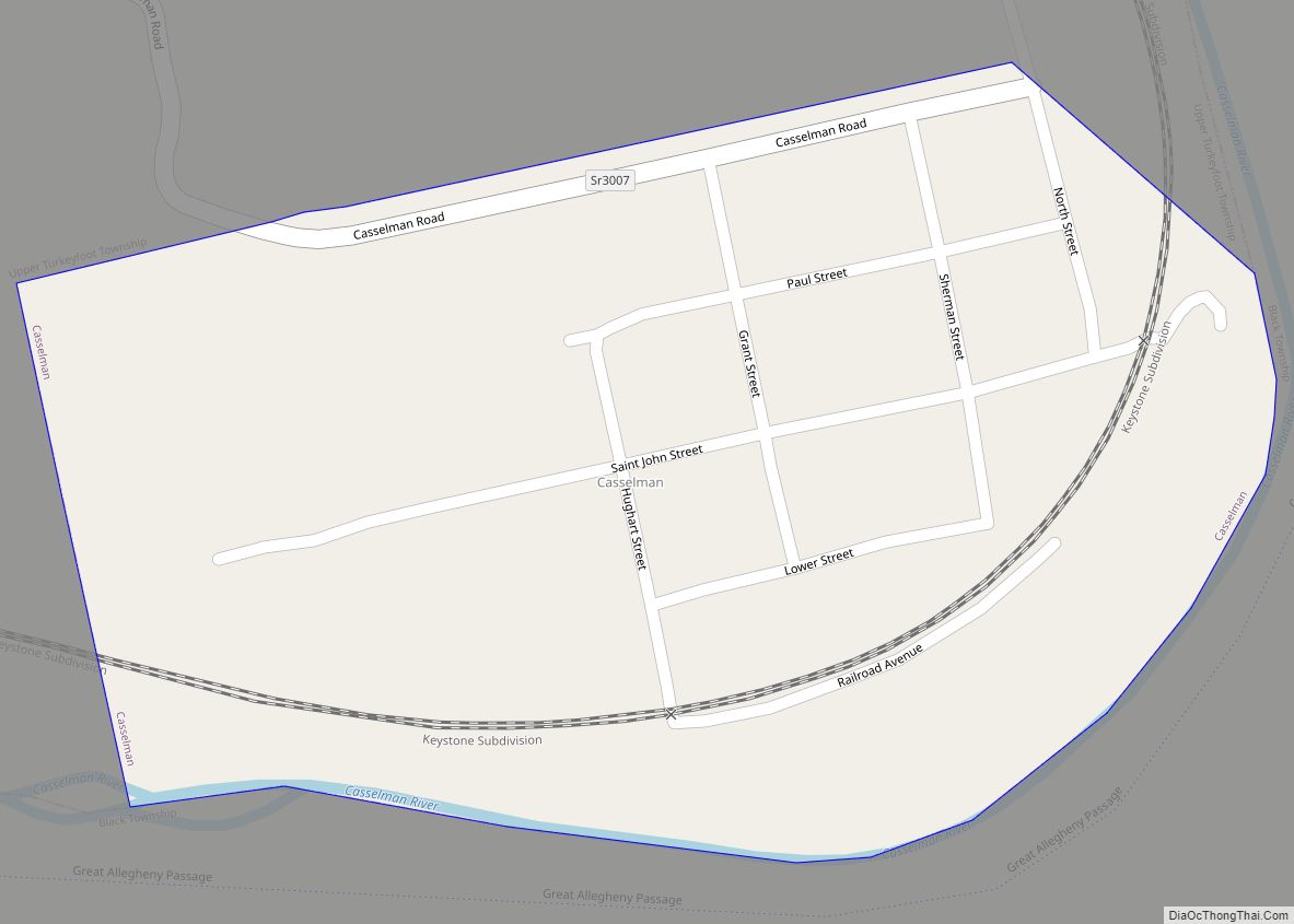
Meyersdale is a borough in Somerset County, Pennsylvania, United States, situated on the Casselman River, 73 miles (117 km) southeast of Pittsburgh. It is part of the Johnstown, Pennsylvania, Metropolitan Statistical Area.
In the past, Meyersdale’s chief industry was the mining of coal.
Meyersdale is located along the Great Allegheny Passage, a multi-use recreational rail trail.
The Pennsylvania Maple Festival has taken place each spring in Meyersdale since 1948.
| Name: | Meyersdale borough |
|---|---|
| LSAD Code: | 21 |
| LSAD Description: | borough (suffix) |
| State: | Pennsylvania |
| County: | Somerset County |
| Incorporated: | 1871 |
| Total Area: | 0.82 sq mi (2.11 km²) |
| Land Area: | 0.82 sq mi (2.11 km²) |
| Water Area: | 0.00 sq mi (0.00 km²) |
| Total Population: | 2,070 |
| Population Density: | 2,536.76/sq mi (979.13/km²) |
| Area code: | 814 |
| FIPS code: | 4248912 |
Online Interactive Map
Click on ![]() to view map in "full screen" mode.
to view map in "full screen" mode.
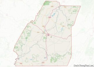
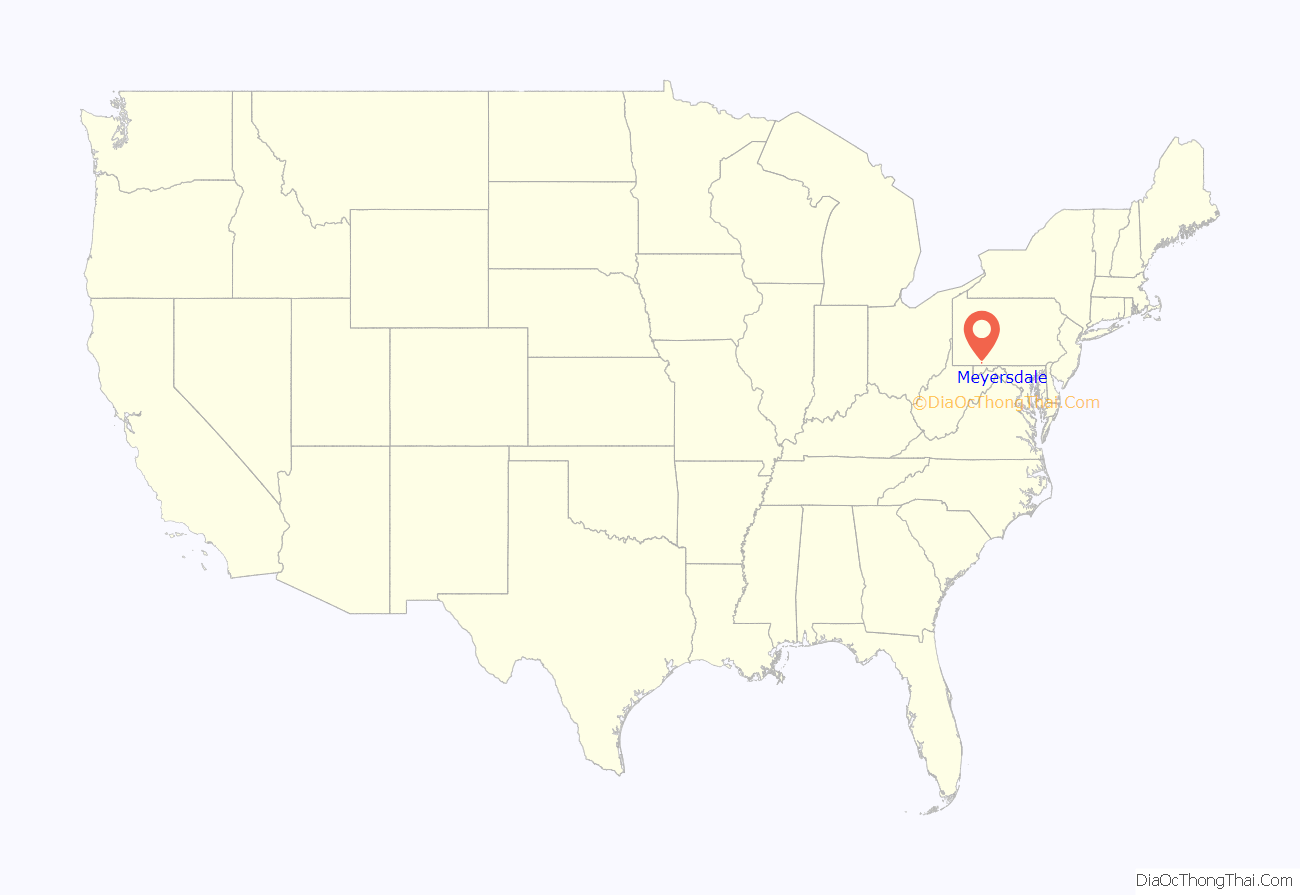
Meyersdale location map. Where is Meyersdale borough?

History
Meyersdale was first settled as early as 1776, but the growth of the town dates from the advent of the first railroad in 1871. Coal mining began in the next year.
The borough was named for an early settler: Peter Meyers, a local farmer who was integral to the beginning of the town. Early names for Meyersdale included Meyers Mills and Dale City. Jacob Olinger had 30 lots laid out on his land in 1844 with Alexander Philson of Berlin serving as the surveyor. Additional lots were laid out in 1852, with M.D. Miller acting as the surveyor, and in 1869, with Kenneth McCloud as surveyor. Around the same time, Peter Meyers had lots laid out on his land and the Beachley family had lots laid out on their land. The Olinger and Beachley lots were organized together in 1872 and named Dale City. The Meyers lots were added in 1874, and the name was changed to Meyersdale. The Amity Reformed Church was organized about 1851, and the Zion Evangelical Lutheran Church in 1852, and both congregations shared a union churchhouse from 1854 until 1875.
In 1981–82, Meyersdale received an All-America City Award from the National Civic League. The Meyersdale Wind Farm began commercial operations in 2003.
The New Colonial Hotel and Second National Bank of Meyersdale are listed on the National Register of Historic Places.
Meyersdale Road Map
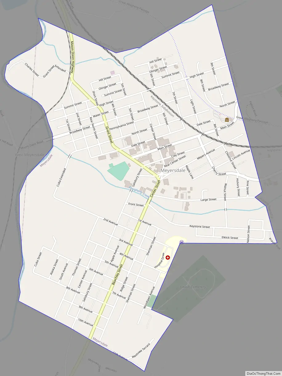
Meyersdale city Satellite Map

Geography
According to the United States Census Bureau, the borough has a total area of 0.8 square miles (2.1 km), all land. Meyersdale is surrounded by Summit Township.
See also
Map of Pennsylvania State and its subdivision:- Adams
- Allegheny
- Armstrong
- Beaver
- Bedford
- Berks
- Blair
- Bradford
- Bucks
- Butler
- Cambria
- Cameron
- Carbon
- Centre
- Chester
- Clarion
- Clearfield
- Clinton
- Columbia
- Crawford
- Cumberland
- Dauphin
- Delaware
- Elk
- Erie
- Fayette
- Forest
- Franklin
- Fulton
- Greene
- Huntingdon
- Indiana
- Jefferson
- Juniata
- Lackawanna
- Lancaster
- Lawrence
- Lebanon
- Lehigh
- Luzerne
- Lycoming
- Mc Kean
- Mercer
- Mifflin
- Monroe
- Montgomery
- Montour
- Northampton
- Northumberland
- Perry
- Philadelphia
- Pike
- Potter
- Schuylkill
- Snyder
- Somerset
- Sullivan
- Susquehanna
- Tioga
- Union
- Venango
- Warren
- Washington
- Wayne
- Westmoreland
- Wyoming
- York
- Alabama
- Alaska
- Arizona
- Arkansas
- California
- Colorado
- Connecticut
- Delaware
- District of Columbia
- Florida
- Georgia
- Hawaii
- Idaho
- Illinois
- Indiana
- Iowa
- Kansas
- Kentucky
- Louisiana
- Maine
- Maryland
- Massachusetts
- Michigan
- Minnesota
- Mississippi
- Missouri
- Montana
- Nebraska
- Nevada
- New Hampshire
- New Jersey
- New Mexico
- New York
- North Carolina
- North Dakota
- Ohio
- Oklahoma
- Oregon
- Pennsylvania
- Rhode Island
- South Carolina
- South Dakota
- Tennessee
- Texas
- Utah
- Vermont
- Virginia
- Washington
- West Virginia
- Wisconsin
- Wyoming