Narberth is a borough in Montgomery County, Pennsylvania, United States. It is one of many neighborhoods on the historic Philadelphia Main Line. The population was 4,282 at the 2010 census.
| Name: | Narberth borough |
|---|---|
| LSAD Code: | 21 |
| LSAD Description: | borough (suffix) |
| State: | Pennsylvania |
| County: | Montgomery County |
| Elevation: | 308 ft (94 m) |
| Total Area: | 0.50 sq mi (1.30 km²) |
| Land Area: | 0.50 sq mi (1.30 km²) |
| Water Area: | 0.00 sq mi (0.00 km²) |
| Total Population: | 4,492 |
| Population Density: | 8,930.42/sq mi (3,449.00/km²) |
| ZIP code: | 19072 |
| FIPS code: | 4252664 |
| Website: | www.narberthborough.com |
Online Interactive Map
Click on ![]() to view map in "full screen" mode.
to view map in "full screen" mode.
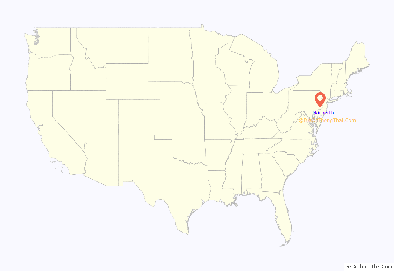
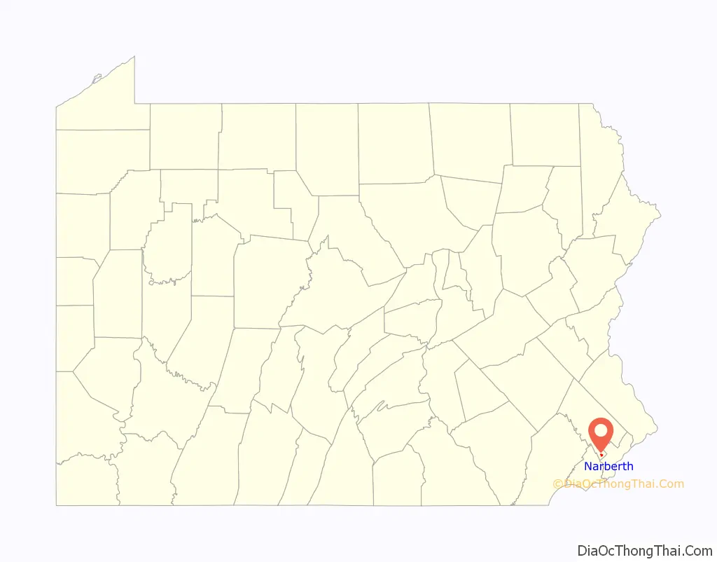
Narberth location map. Where is Narberth borough?
History
Narberth is located on a parcel of land originally deeded to Edward Rees (which later became “Prees” and eventually “Price”), who arrived from Wales in 1682. A portion of this original tract became the 100-acre (0.40 km) farm of Edward R. Price, who founded Elm as a Quaker-friendly town in 1881. The town name changed to Narberth in 1893, and Narberth was incorporated in 1895. In 1995, the borough celebrated its 100th birthday with a year-long celebration.
The Narbrook Park Historic District was listed on the National Register of Historic Places in 2003.
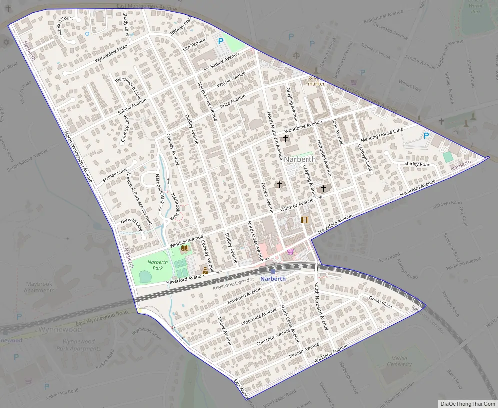
Narberth Road Map
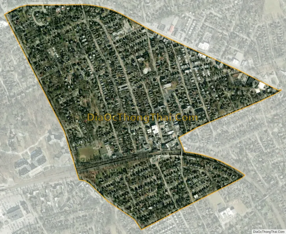
Narberth city Satellite Map
Geography
According to the U.S. Census Bureau, the borough has a total area of 0.5 square miles (1.3 km), all land.
Narberth is an enclave surrounded by Lower Merion Township, close to the western edge of the city of Philadelphia. It is part of the Philadelphia Main Line, a string of leafy, picturesque suburbs with quaint Welsh names extending west from Philadelphia along the old Pennsylvania Railroad’s “main line” from Merion through Ardmore, Bryn Mawr, Villanova, Devon and Wayne among other towns and municipalities. Narberth is unique among those locations in that it is fairly enclosed; no major thoroughfares run through the town, but Montgomery Avenue runs northwest–southeast along the borough’s northern border.
Because of its small size, many of Narberth’s shopping and recreational facilities are within walking distance of residents’ houses. SEPTA’s “Main Line” railroad tracks separate North Side from South Side. Narberth is mostly a residential community, with a central business district along Haverford, Narberth, Forrest, and Essex Avenues. The borough is bordered by the towns of Wynnewood, Pennsylvania, Merion, and Penn Valley, Pennsylvania.
See also
Map of Pennsylvania State and its subdivision:- Adams
- Allegheny
- Armstrong
- Beaver
- Bedford
- Berks
- Blair
- Bradford
- Bucks
- Butler
- Cambria
- Cameron
- Carbon
- Centre
- Chester
- Clarion
- Clearfield
- Clinton
- Columbia
- Crawford
- Cumberland
- Dauphin
- Delaware
- Elk
- Erie
- Fayette
- Forest
- Franklin
- Fulton
- Greene
- Huntingdon
- Indiana
- Jefferson
- Juniata
- Lackawanna
- Lancaster
- Lawrence
- Lebanon
- Lehigh
- Luzerne
- Lycoming
- Mc Kean
- Mercer
- Mifflin
- Monroe
- Montgomery
- Montour
- Northampton
- Northumberland
- Perry
- Philadelphia
- Pike
- Potter
- Schuylkill
- Snyder
- Somerset
- Sullivan
- Susquehanna
- Tioga
- Union
- Venango
- Warren
- Washington
- Wayne
- Westmoreland
- Wyoming
- York
- Alabama
- Alaska
- Arizona
- Arkansas
- California
- Colorado
- Connecticut
- Delaware
- District of Columbia
- Florida
- Georgia
- Hawaii
- Idaho
- Illinois
- Indiana
- Iowa
- Kansas
- Kentucky
- Louisiana
- Maine
- Maryland
- Massachusetts
- Michigan
- Minnesota
- Mississippi
- Missouri
- Montana
- Nebraska
- Nevada
- New Hampshire
- New Jersey
- New Mexico
- New York
- North Carolina
- North Dakota
- Ohio
- Oklahoma
- Oregon
- Pennsylvania
- Rhode Island
- South Carolina
- South Dakota
- Tennessee
- Texas
- Utah
- Vermont
- Virginia
- Washington
- West Virginia
- Wisconsin
- Wyoming


