Olyphant is a borough in Lackawanna County, Pennsylvania, United States. It is six miles (10 km) northeast of downtown Scranton, on the Lackawanna River in the heart of the anthracite region of the state. Its main source of employment was the mining and shipping of coal. It was the headquarters of the Lackawanna Coal Company. Other industries of the past were the manufacturing of blasting powder, iron and steel goods, cigars, and silks. Olyphant experienced a severe downturn in the 1950s. There was once a thriving garment industry with numerous dress factories in the downtown area. There was also a slaughterhouse. Until 2018, the biggest industry was Cinram the manufacture of compact discs (CD) and digital video discs (DVD). The population was 5,395 at the 2020 census.
| Name: | Olyphant borough |
|---|---|
| LSAD Code: | 21 |
| LSAD Description: | borough (suffix) |
| State: | Pennsylvania |
| County: | Lackawanna County |
| Elevation: | 843 ft (257 m) |
| Total Area: | 5.50 sq mi (14.25 km²) |
| Land Area: | 5.44 sq mi (14.08 km²) |
| Water Area: | 0.06 sq mi (0.17 km²) |
| Total Population: | 5,383 |
| Population Density: | 990.07/sq mi (382.27/km²) |
| ZIP code: | 18447-18448 |
| Area code: | 570 |
| FIPS code: | 4256792 |
| Website: | olyphantborough.com |
Online Interactive Map
Click on ![]() to view map in "full screen" mode.
to view map in "full screen" mode.
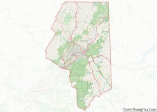
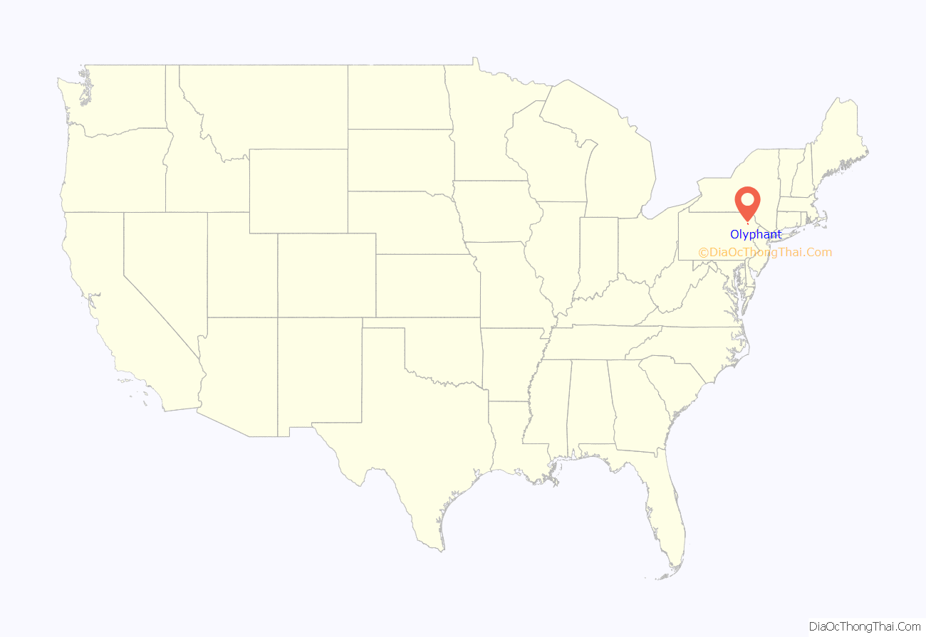
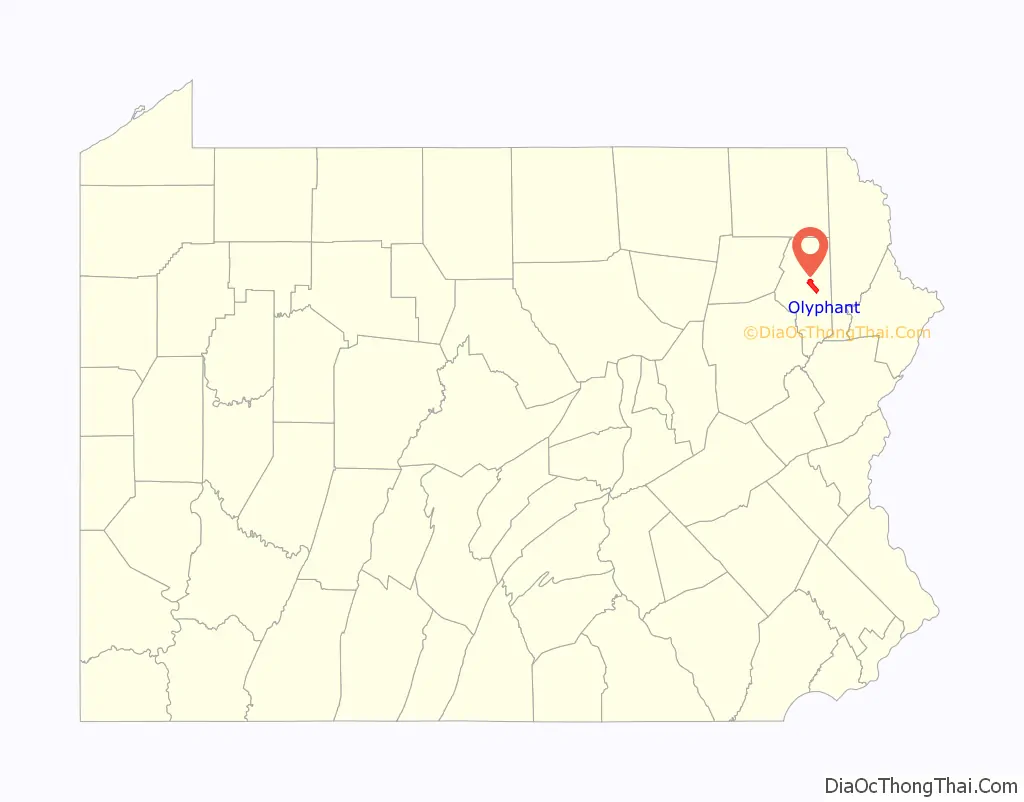
Olyphant location map. Where is Olyphant borough?
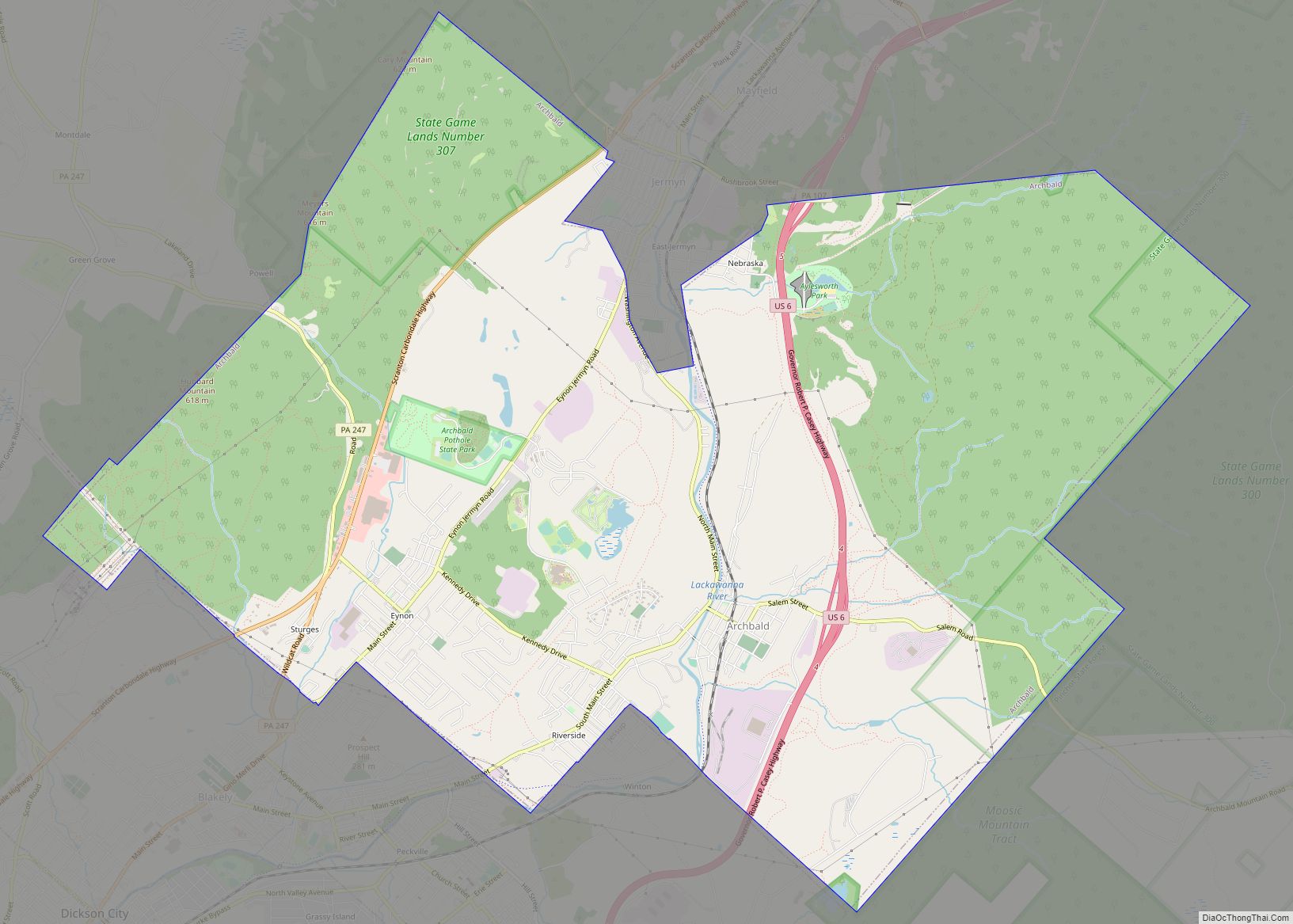
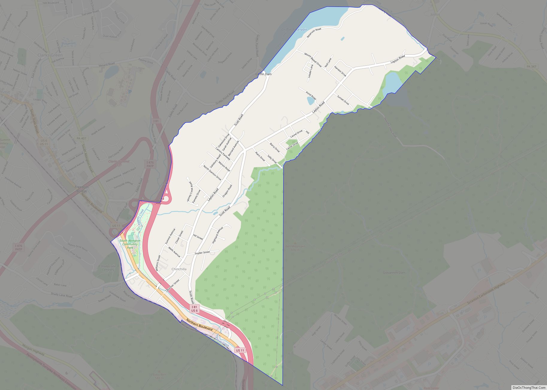
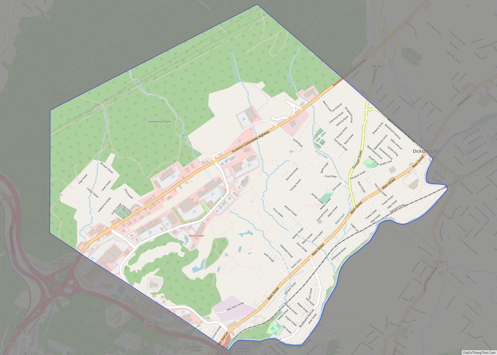
Olyphant Road Map
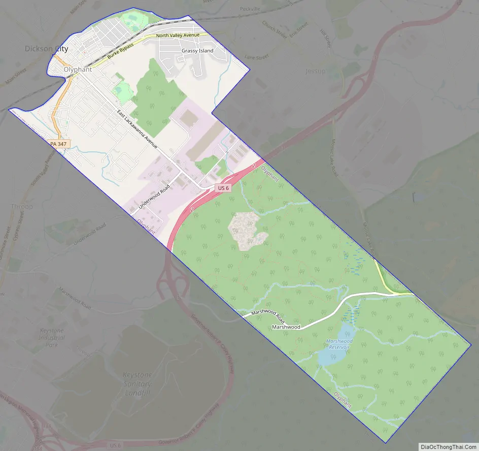
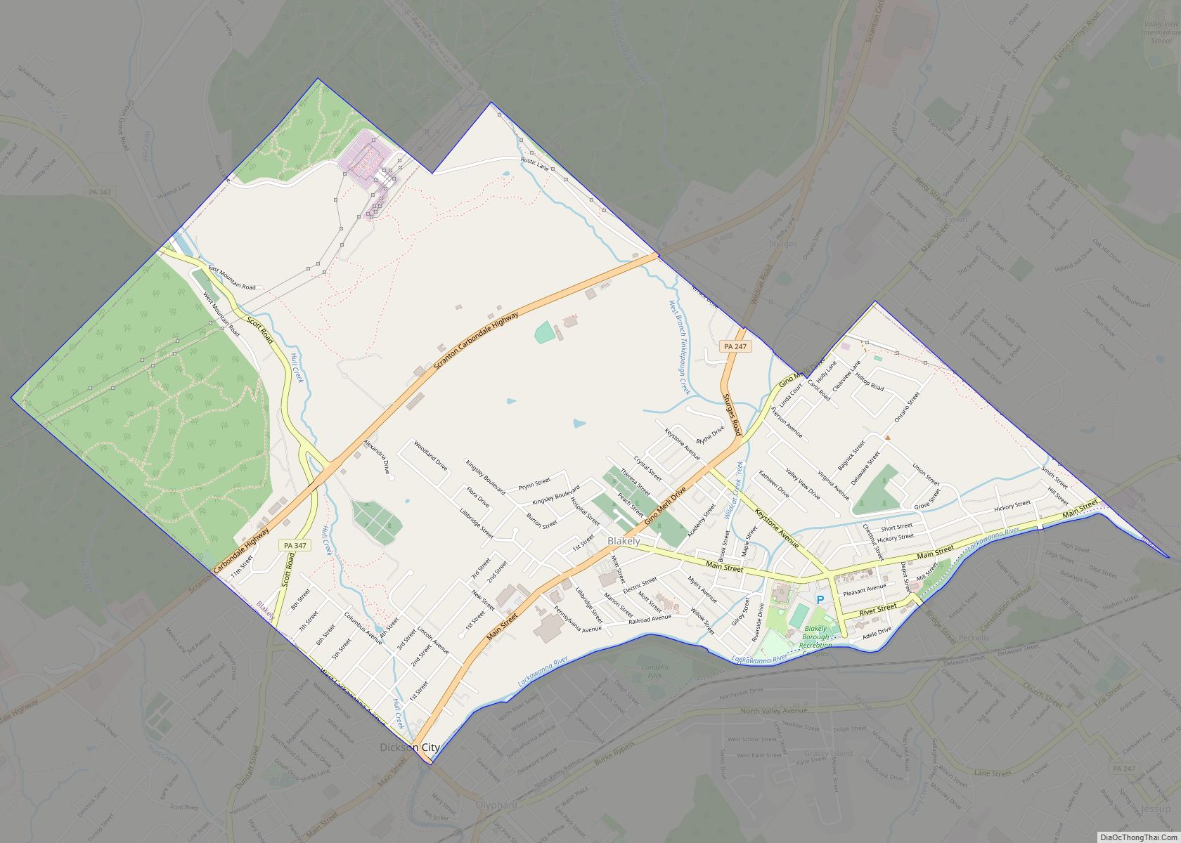
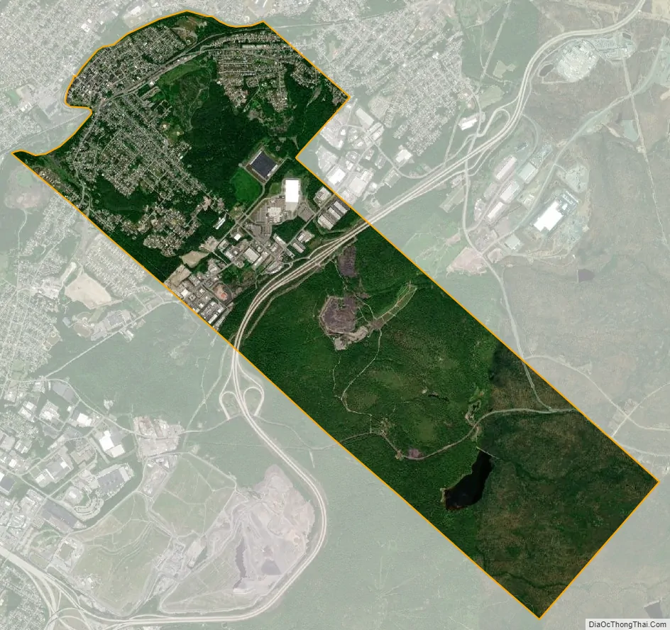
Olyphant city Satellite Map
Geography
Olyphant is located at 41°27′45″N 75°35′44″W / 41.46250°N 75.59556°W / 41.46250; -75.59556 (41.462630, -75.595617).
According to the United States Census Bureau, the borough has a total area of 5.5 square miles (14 km), of which 5.4 square miles (14 km) is land and 0.1 square miles (0.26 km) (1.82%) is water.
See also
Map of Pennsylvania State and its subdivision:- Adams
- Allegheny
- Armstrong
- Beaver
- Bedford
- Berks
- Blair
- Bradford
- Bucks
- Butler
- Cambria
- Cameron
- Carbon
- Centre
- Chester
- Clarion
- Clearfield
- Clinton
- Columbia
- Crawford
- Cumberland
- Dauphin
- Delaware
- Elk
- Erie
- Fayette
- Forest
- Franklin
- Fulton
- Greene
- Huntingdon
- Indiana
- Jefferson
- Juniata
- Lackawanna
- Lancaster
- Lawrence
- Lebanon
- Lehigh
- Luzerne
- Lycoming
- Mc Kean
- Mercer
- Mifflin
- Monroe
- Montgomery
- Montour
- Northampton
- Northumberland
- Perry
- Philadelphia
- Pike
- Potter
- Schuylkill
- Snyder
- Somerset
- Sullivan
- Susquehanna
- Tioga
- Union
- Venango
- Warren
- Washington
- Wayne
- Westmoreland
- Wyoming
- York
- Alabama
- Alaska
- Arizona
- Arkansas
- California
- Colorado
- Connecticut
- Delaware
- District of Columbia
- Florida
- Georgia
- Hawaii
- Idaho
- Illinois
- Indiana
- Iowa
- Kansas
- Kentucky
- Louisiana
- Maine
- Maryland
- Massachusetts
- Michigan
- Minnesota
- Mississippi
- Missouri
- Montana
- Nebraska
- Nevada
- New Hampshire
- New Jersey
- New Mexico
- New York
- North Carolina
- North Dakota
- Ohio
- Oklahoma
- Oregon
- Pennsylvania
- Rhode Island
- South Carolina
- South Dakota
- Tennessee
- Texas
- Utah
- Vermont
- Virginia
- Washington
- West Virginia
- Wisconsin
- Wyoming