Oswayo is a borough in Potter County, Pennsylvania, United States. The population was 133 at the 2020 census.
Oswayo is a Native American name purported to mean “the pine forest.
| Name: | Oswayo borough |
|---|---|
| LSAD Code: | 21 |
| LSAD Description: | borough (suffix) |
| State: | Pennsylvania |
| County: | Potter County |
| Total Area: | 1.08 sq mi (2.80 km²) |
| Land Area: | 1.08 sq mi (2.80 km²) |
| Water Area: | 0.00 sq mi (0.00 km²) |
| Total Population: | 134 |
| Population Density: | 123.96/sq mi (47.84/km²) |
| Area code: | 814 |
| FIPS code: | 4257280 |
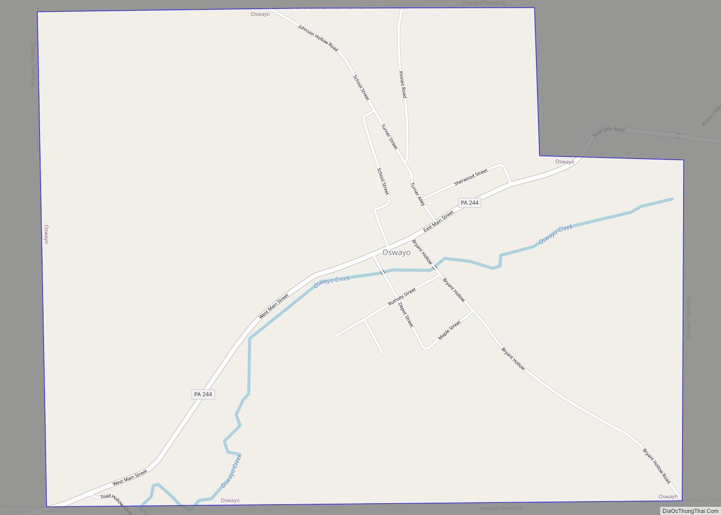
Online Interactive Map
Click on ![]() to view map in "full screen" mode.
to view map in "full screen" mode.
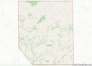
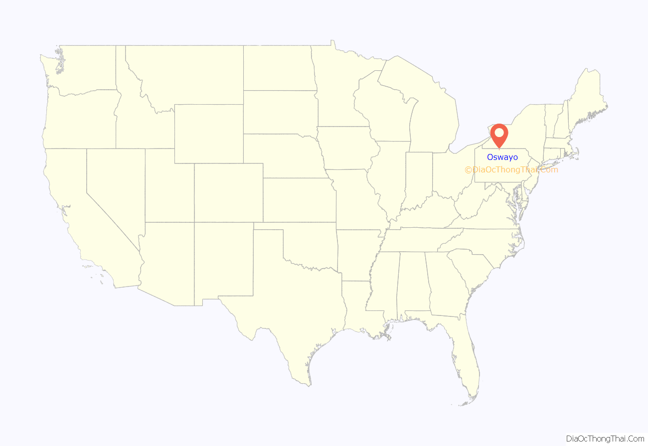
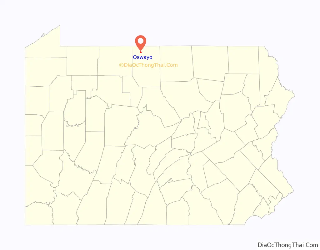
Oswayo location map. Where is Oswayo borough?
History
Oswayo was incorporated on January 8, 1901 and named for the Township. The Oswayo Valley had one of the best white pine stands in Pennsylvania. The name is the English derivative of the Seneca word “O-sa-ayeh”, meaning pine forest. The whole of the valley was a vast pine forest of trees standing so close that it was impossible for underbrush to grow. Some of the trees reached heights of between 100 and 150 feet with the lowest branches 50 to 75 feet above the ground. The nucleus of the town had been well established in the days before the Civil War. Early settlers earned their living harvesting white pine. Many of the logs were splashed out on the high waters in the spring of the year. The cities along the Ohio often specified “Oswayo White Pine” because of its quality.
The village was first called Brindleville, but the name was changed when the post office was established in the 1840s. During early years, the village contained two sawmills and shingle mills and several small shops which catered to local business. Several doctors and attorneys were also located here. The first large tannery to begin operation in the county began tanning here in 1877. It was sold to P.H.. Costello Company in 1879. The tannery was destroyed by fire on June 20, 1903. At that time, it was owned by the Penn Tanning Company. From 1894 to the 1930s, the town was served by the New York & Pennsylvania Railroad. The borough probably peaked in population at the time of incorporation with about 1000 people. By 1910, the Census showed only 382 residents. The loss of the tannery and several other lumber related business had rapidly taken its toll. By 1920, the Census showed only 209 residents. Today agriculture remains important and there are a few loggers in the region. A state Fish Cultural Station, located above the village, raises trout for stocking in streams throughout the State.
Oswayo Road Map
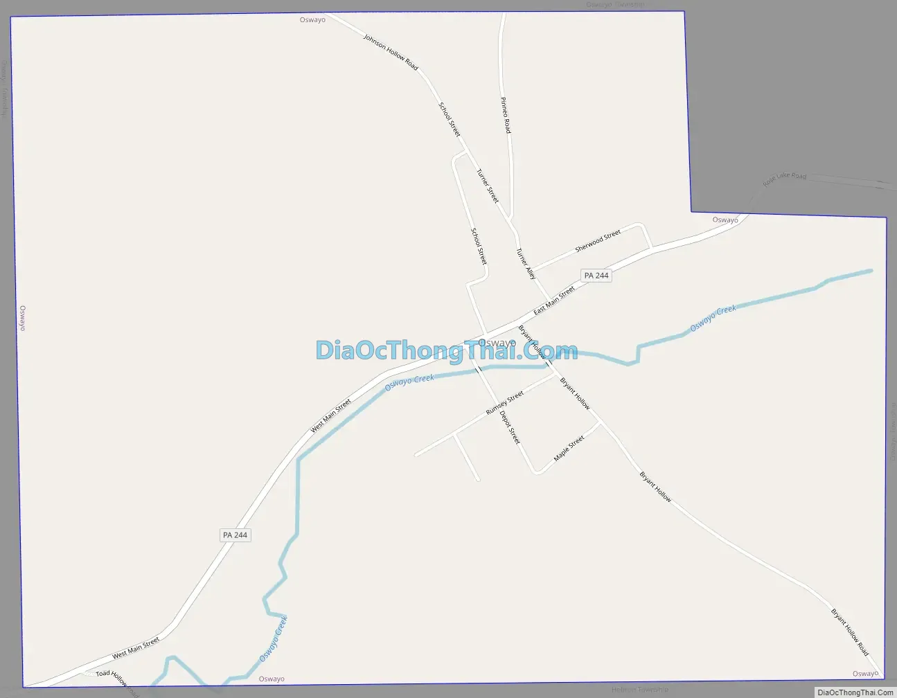
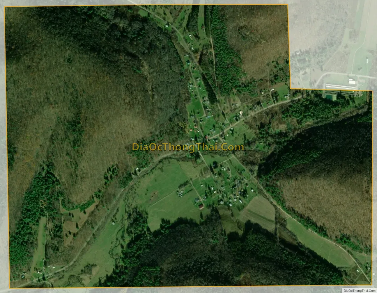
Oswayo city Satellite Map
Geography
Oswayo is located at 41°55′16″N 78°1′5″W / 41.92111°N 78.01806°W / 41.92111; -78.01806 (41.921171, -78.018160).
According to the United States Census Bureau, the borough has a total area of 1.1 square miles (2.8 km), all land.
See also
Map of Pennsylvania State and its subdivision:- Adams
- Allegheny
- Armstrong
- Beaver
- Bedford
- Berks
- Blair
- Bradford
- Bucks
- Butler
- Cambria
- Cameron
- Carbon
- Centre
- Chester
- Clarion
- Clearfield
- Clinton
- Columbia
- Crawford
- Cumberland
- Dauphin
- Delaware
- Elk
- Erie
- Fayette
- Forest
- Franklin
- Fulton
- Greene
- Huntingdon
- Indiana
- Jefferson
- Juniata
- Lackawanna
- Lancaster
- Lawrence
- Lebanon
- Lehigh
- Luzerne
- Lycoming
- Mc Kean
- Mercer
- Mifflin
- Monroe
- Montgomery
- Montour
- Northampton
- Northumberland
- Perry
- Philadelphia
- Pike
- Potter
- Schuylkill
- Snyder
- Somerset
- Sullivan
- Susquehanna
- Tioga
- Union
- Venango
- Warren
- Washington
- Wayne
- Westmoreland
- Wyoming
- York
- Alabama
- Alaska
- Arizona
- Arkansas
- California
- Colorado
- Connecticut
- Delaware
- District of Columbia
- Florida
- Georgia
- Hawaii
- Idaho
- Illinois
- Indiana
- Iowa
- Kansas
- Kentucky
- Louisiana
- Maine
- Maryland
- Massachusetts
- Michigan
- Minnesota
- Mississippi
- Missouri
- Montana
- Nebraska
- Nevada
- New Hampshire
- New Jersey
- New Mexico
- New York
- North Carolina
- North Dakota
- Ohio
- Oklahoma
- Oregon
- Pennsylvania
- Rhode Island
- South Carolina
- South Dakota
- Tennessee
- Texas
- Utah
- Vermont
- Virginia
- Washington
- West Virginia
- Wisconsin
- Wyoming