Patton is a borough in Cambria County, Pennsylvania, United States. It is 19 miles (31 km) northwest of Altoona, in an agricultural region. It is part of the Johnstown, Pennsylvania Metropolitan Statistical Area. In 1900, 2,651 people lived here, and in 1910, 3,907 people inhabited Patton. The population was 1,769 at the 2010 census.
Patton is perhaps best known for an important local manufacturer, the Patton Clay Works. The Clay Works were one of the largest clay and brick concerns in the world in the first half of the 1900s. The company manufactured terra cotta products (pipe and tiles), building bricks, and pavers (known as “Patton Pavers”) from 1893 until it closed in 1968. Bricks made there were used in the construction of the Panama Canal, and the pavers were used around the Eiffel Tower in France. The products were made from clay excavated from the area.
Due to the loss of the Clay Works, Patton’s population has had a major decline. In 1960 it had a population of 2,880, to an estimated 1,626 in 2018.
| Name: | Patton borough |
|---|---|
| LSAD Code: | 21 |
| LSAD Description: | borough (suffix) |
| State: | Pennsylvania |
| County: | Cambria County |
| Incorporated: | 1893 |
| Elevation: | 1,736 ft (529 m) |
| Total Area: | 0.89 sq mi (2.31 km²) |
| Land Area: | 0.89 sq mi (2.31 km²) |
| Water Area: | 0.00 sq mi (0.00 km²) |
| Total Population: | 1,728 |
| Population Density: | 1,939.39/sq mi (748.77/km²) |
| ZIP code: | 16668 |
| Area code: | 814 |
| FIPS code: | 4258432 |
| GNISfeature ID: | 1215031 |
| Website: | www.pattonboro.com |
Online Interactive Map
Click on ![]() to view map in "full screen" mode.
to view map in "full screen" mode.
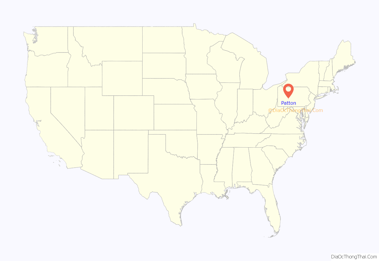
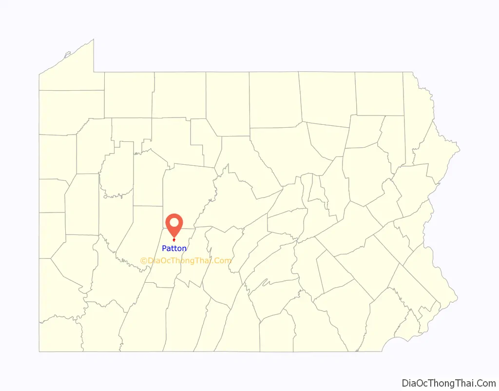
Patton location map. Where is Patton borough?
History
The Patton Historic District was listed on the National Register of Historic Places in 1996.
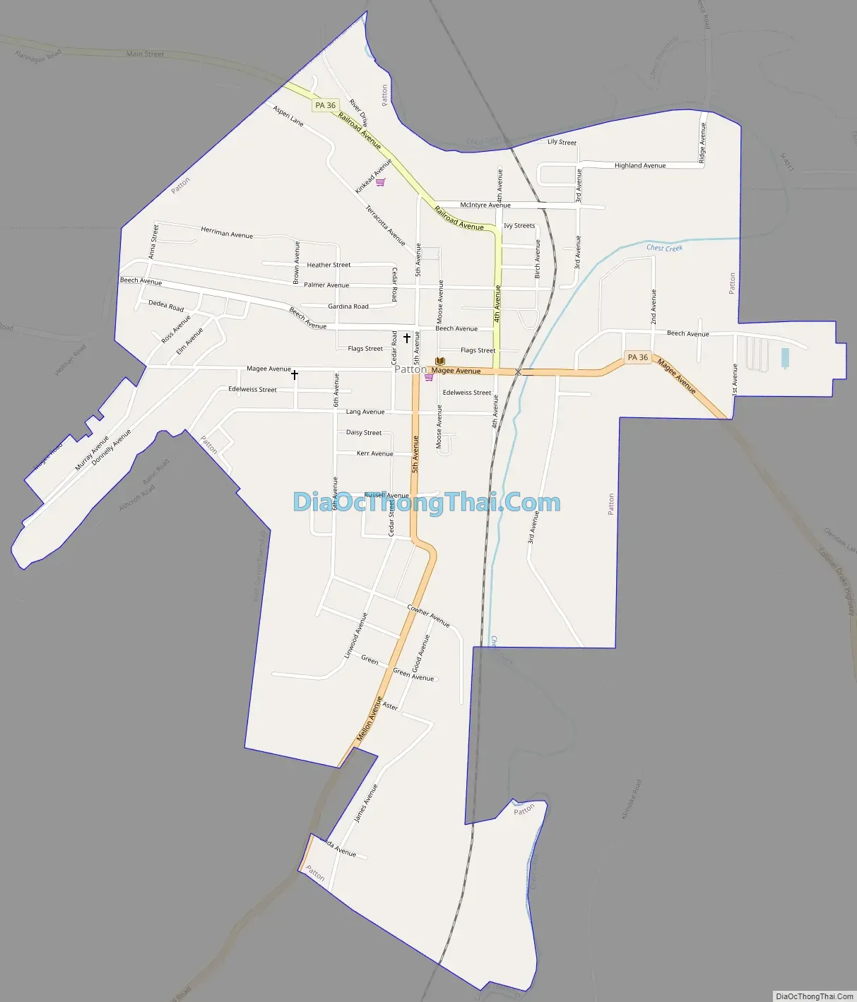
Patton Road Map
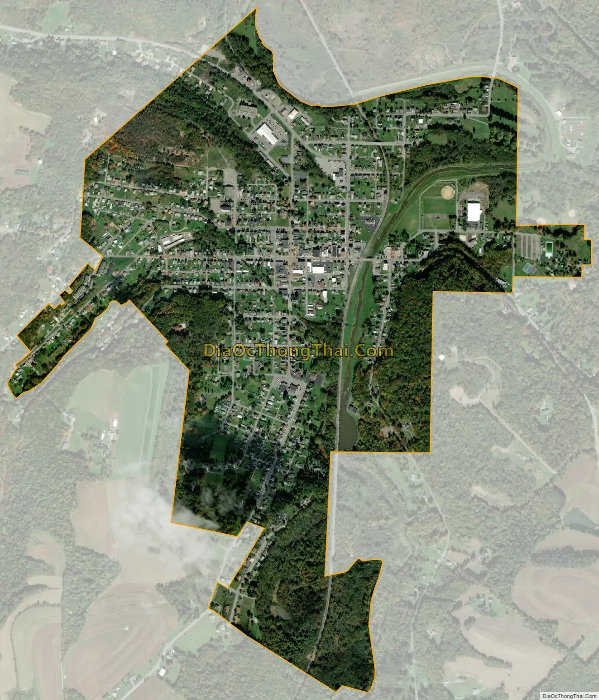
Patton city Satellite Map
Geography
Patton is located in northern Cambria County at 40°38′4″N 78°39′3″W / 40.63444°N 78.65083°W / 40.63444; -78.65083 (40.634466, -78.650812), in the valley of Chest Creek, a northward-flowing tributary of the West Branch of the Susquehanna River. Ebensburg, the county seat, is 13 miles (21 km) to the south.
According to the United States Census Bureau, the borough of Patton has a total area of 0.89 square miles (2.3 km), all land.
See also
Map of Pennsylvania State and its subdivision:- Adams
- Allegheny
- Armstrong
- Beaver
- Bedford
- Berks
- Blair
- Bradford
- Bucks
- Butler
- Cambria
- Cameron
- Carbon
- Centre
- Chester
- Clarion
- Clearfield
- Clinton
- Columbia
- Crawford
- Cumberland
- Dauphin
- Delaware
- Elk
- Erie
- Fayette
- Forest
- Franklin
- Fulton
- Greene
- Huntingdon
- Indiana
- Jefferson
- Juniata
- Lackawanna
- Lancaster
- Lawrence
- Lebanon
- Lehigh
- Luzerne
- Lycoming
- Mc Kean
- Mercer
- Mifflin
- Monroe
- Montgomery
- Montour
- Northampton
- Northumberland
- Perry
- Philadelphia
- Pike
- Potter
- Schuylkill
- Snyder
- Somerset
- Sullivan
- Susquehanna
- Tioga
- Union
- Venango
- Warren
- Washington
- Wayne
- Westmoreland
- Wyoming
- York
- Alabama
- Alaska
- Arizona
- Arkansas
- California
- Colorado
- Connecticut
- Delaware
- District of Columbia
- Florida
- Georgia
- Hawaii
- Idaho
- Illinois
- Indiana
- Iowa
- Kansas
- Kentucky
- Louisiana
- Maine
- Maryland
- Massachusetts
- Michigan
- Minnesota
- Mississippi
- Missouri
- Montana
- Nebraska
- Nevada
- New Hampshire
- New Jersey
- New Mexico
- New York
- North Carolina
- North Dakota
- Ohio
- Oklahoma
- Oregon
- Pennsylvania
- Rhode Island
- South Carolina
- South Dakota
- Tennessee
- Texas
- Utah
- Vermont
- Virginia
- Washington
- West Virginia
- Wisconsin
- Wyoming


