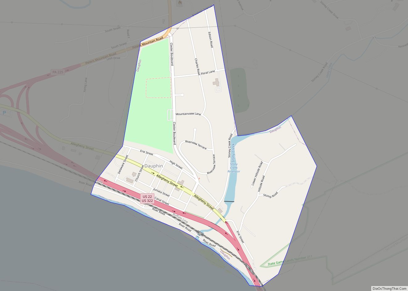
Progress /ˈproʊɡrɛs/ is an unincorporated community and census-designated place (CDP) mainly in Susquehanna Township but also in Lower Paxton Township, Dauphin County, Pennsylvania, United States. The population was 9,765 at the 2010 census. It is part of the Harrisburg–Carlisle Metropolitan Statistical Area.
Progress was named for the progressive spirit of its original inhabitants.
| Name: | Progress CDP |
|---|---|
| LSAD Code: | 57 |
| LSAD Description: | CDP (suffix) |
| State: | Pennsylvania |
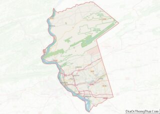
| County: | Dauphin County |
| Elevation: | 500 ft (200 m) |
| Total Area: | 3.02 sq mi (7.81 km²) |
| Land Area: | 3.02 sq mi (7.81 km²) |
| Water Area: | 0.00 sq mi (0.00 km²) |
| Total Population: | 11,168 |
| Population Density: | 3,704.15/sq mi (1,430.24/km²) |
| ZIP code: | 17109 |
| Area code: | 717 |
| FIPS code: | 4262736 |
| GNISfeature ID: | 1184434 |
Online Interactive Map
Click on ![]() to view map in "full screen" mode.
to view map in "full screen" mode.
Progress location map. Where is Progress CDP?
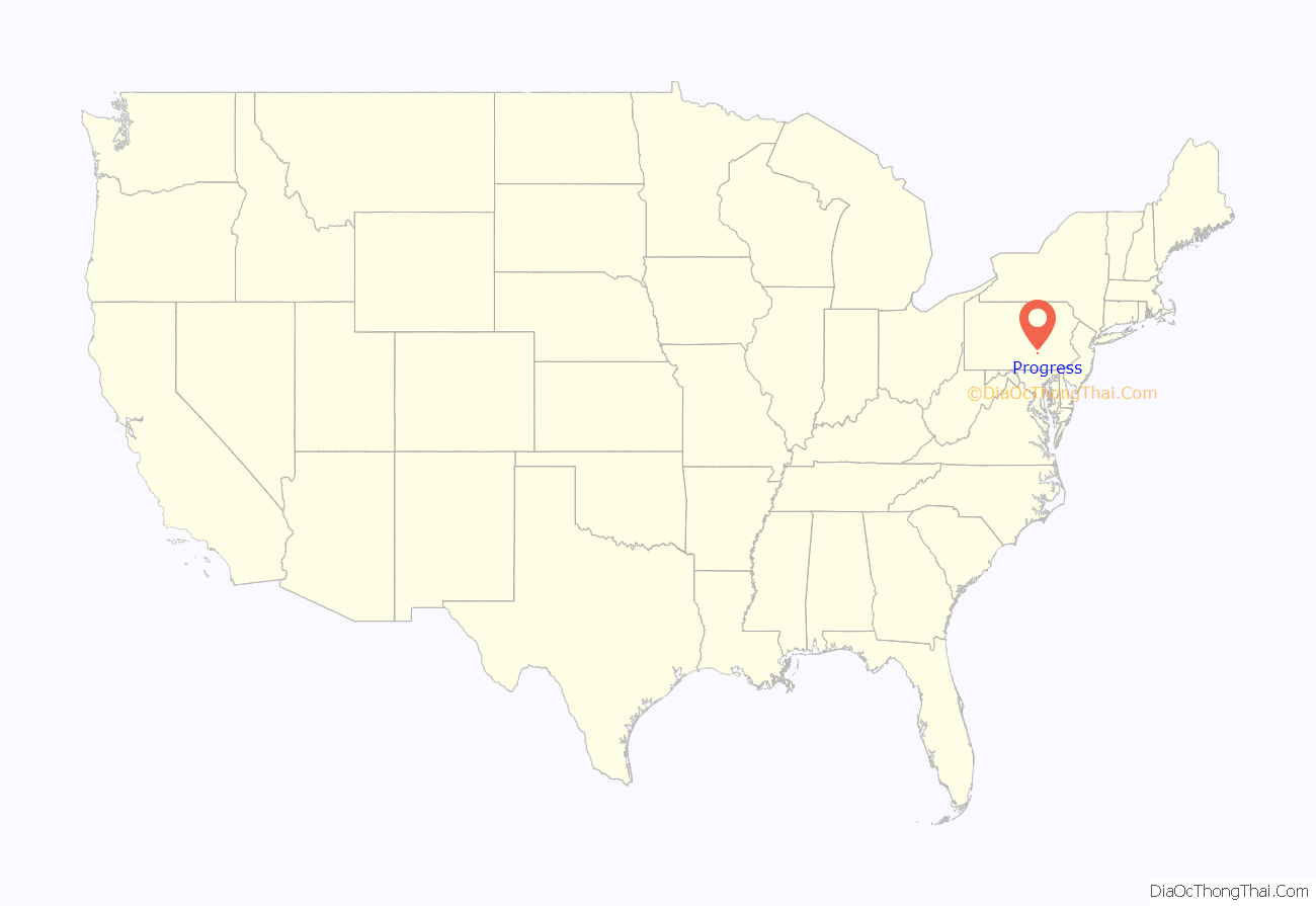
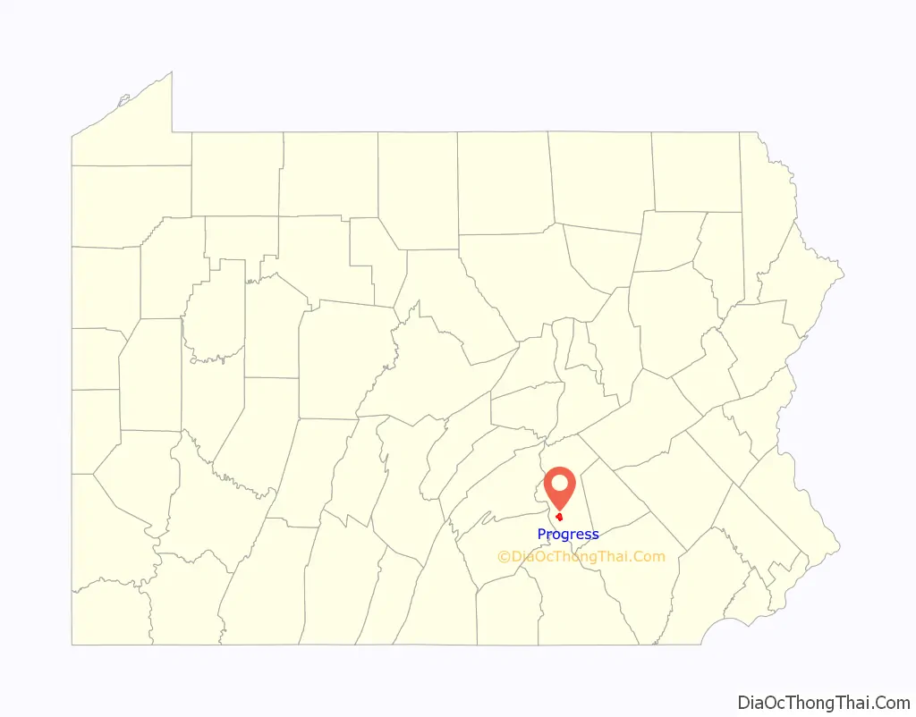
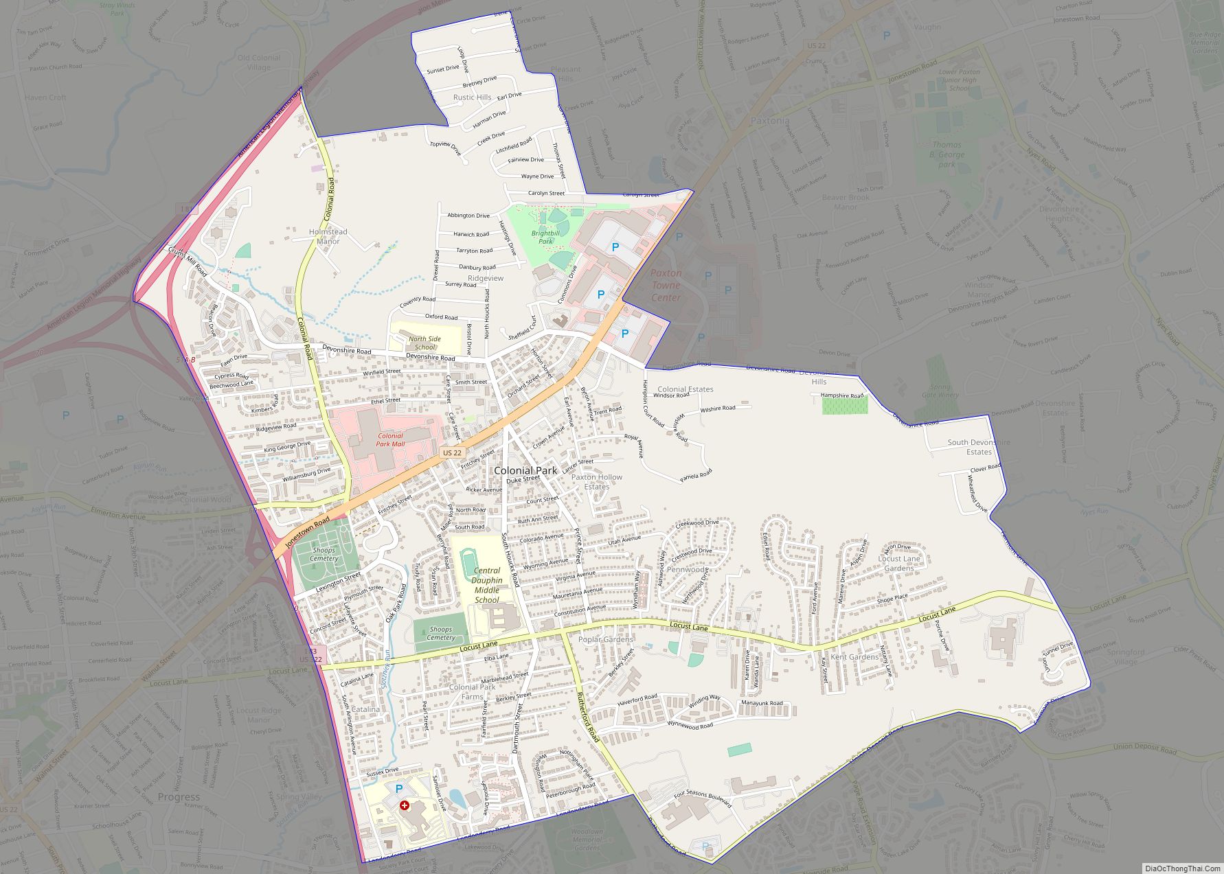
Progress Road Map
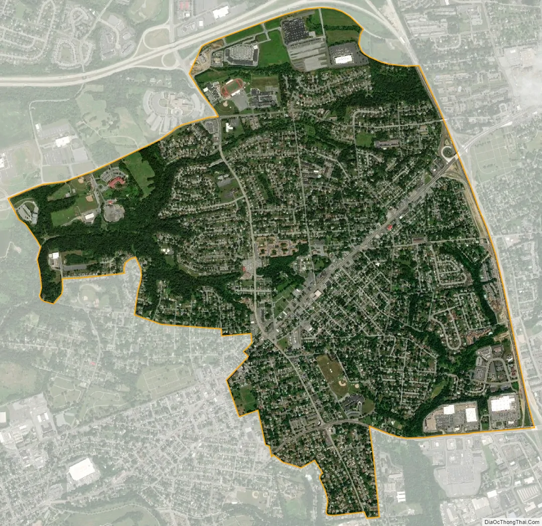
Progress city Satellite Map
Geography
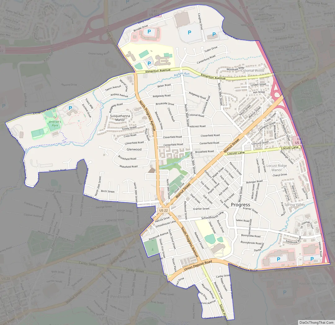
Progress is located in eastern Susquehanna Township at 40°17′18″N 76°50′8″W / 40.28833°N 76.83556°W / 40.28833; -76.83556 (40.288389, -76.835543), and extends east into the western part of Lower Paxton Township. It is bordered to the east by Colonial Park and to the southwest by the borough of Penbrook.
According to the United States Census Bureau, the CDP has a total area of 2.8 square miles (7.3 km), all land. The axis roads are Jonestown Road (U.S. Route 22, running northeast–southwest) and Progress Avenue (running north–south), which interchanges with Interstate 81 a short distance to the north. Interstate 83 serves as the eastern boundary, separating Progress from Colonial Park, and with access from Exit 48 (Union Deposit Road) and Exit 50 (U.S. Route 22). US 22 leads west 3 miles (5 km) into downtown Harrisburg.
See also
Map of Pennsylvania State and its subdivision:- Adams
- Allegheny
- Armstrong
- Beaver
- Bedford
- Berks
- Blair
- Bradford
- Bucks
- Butler
- Cambria
- Cameron
- Carbon
- Centre
- Chester
- Clarion
- Clearfield
- Clinton
- Columbia
- Crawford
- Cumberland
- Dauphin
- Delaware
- Elk
- Erie
- Fayette
- Forest
- Franklin
- Fulton
- Greene
- Huntingdon
- Indiana
- Jefferson
- Juniata
- Lackawanna
- Lancaster
- Lawrence
- Lebanon
- Lehigh
- Luzerne
- Lycoming
- Mc Kean
- Mercer
- Mifflin
- Monroe
- Montgomery
- Montour
- Northampton
- Northumberland
- Perry
- Philadelphia
- Pike
- Potter
- Schuylkill
- Snyder
- Somerset
- Sullivan
- Susquehanna
- Tioga
- Union
- Venango
- Warren
- Washington
- Wayne
- Westmoreland
- Wyoming
- York
- Alabama
- Alaska
- Arizona
- Arkansas
- California
- Colorado
- Connecticut
- Delaware
- District of Columbia
- Florida
- Georgia
- Hawaii
- Idaho
- Illinois
- Indiana
- Iowa
- Kansas
- Kentucky
- Louisiana
- Maine
- Maryland
- Massachusetts
- Michigan
- Minnesota
- Mississippi
- Missouri
- Montana
- Nebraska
- Nevada
- New Hampshire
- New Jersey
- New Mexico
- New York
- North Carolina
- North Dakota
- Ohio
- Oklahoma
- Oregon
- Pennsylvania
- Rhode Island
- South Carolina
- South Dakota
- Tennessee
- Texas
- Utah
- Vermont
- Virginia
- Washington
- West Virginia
- Wisconsin
- Wyoming