Reynoldsville is a borough in Jefferson County, Pennsylvania, United States. It is 73 miles (117 km) northeast of Pittsburgh in a productive soft coal region. The population was 2,759 at the 2010 census.
Reynoldsville was originally called Winslow Township and was renamed after local postmaster Thomas Reynolds in 1850.
| Name: | Reynoldsville borough |
|---|---|
| LSAD Code: | 21 |
| LSAD Description: | borough (suffix) |
| State: | Pennsylvania |
| County: | Jefferson County |
| Incorporated: | 1873 |
| Elevation: | 1,391 ft (424 m) |
| Total Area: | 1.49 sq mi (3.87 km²) |
| Land Area: | 1.47 sq mi (3.79 km²) |
| Water Area: | 0.03 sq mi (0.07 km²) |
| Total Population: | 2,549 |
| Population Density: | 1,707.74/sq mi (659.36/km²) |
| ZIP code: | 15851 |
| Area code: | 814 |
| FIPS code: | 4264376 |
| Website: | reynoldsvilleboro.com |
Online Interactive Map
Click on ![]() to view map in "full screen" mode.
to view map in "full screen" mode.
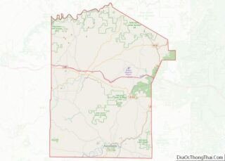
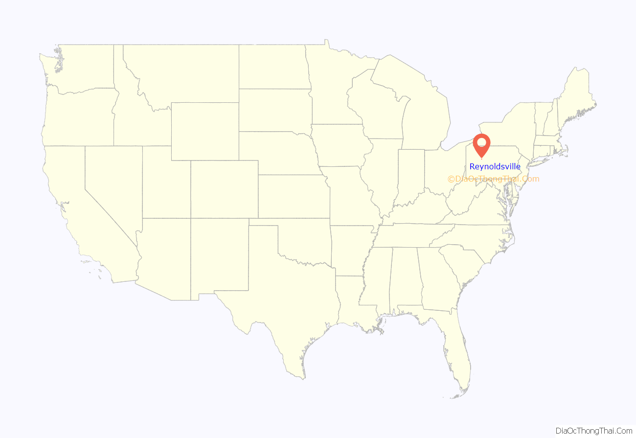
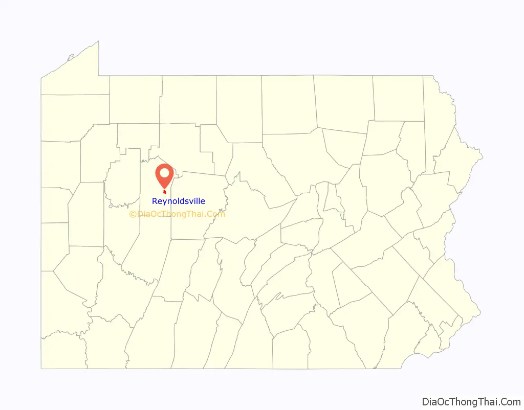
Reynoldsville location map. Where is Reynoldsville borough?
History
In 1855 a man by the name of Tilton Reynolds owned the land in what is today Reynoldsville. He began selling lots of property in the hopes of starting a town. Over the course of the 19th century, Reynoldsville would grow into the town that is it is today. Reynoldsville would grow its industries in the way of silk mills, brick and tile works, a tannery, a macaroni factory, and an asbestos plant to provide employment. The borough was greatly enlarged in 1913 when it annexed West Reynoldsville (population 993 in 1910) and three large adjacent areas.
The Herpel Brothers Foundry and Machine Shop was added to the National Register of Historic Places in 2004.
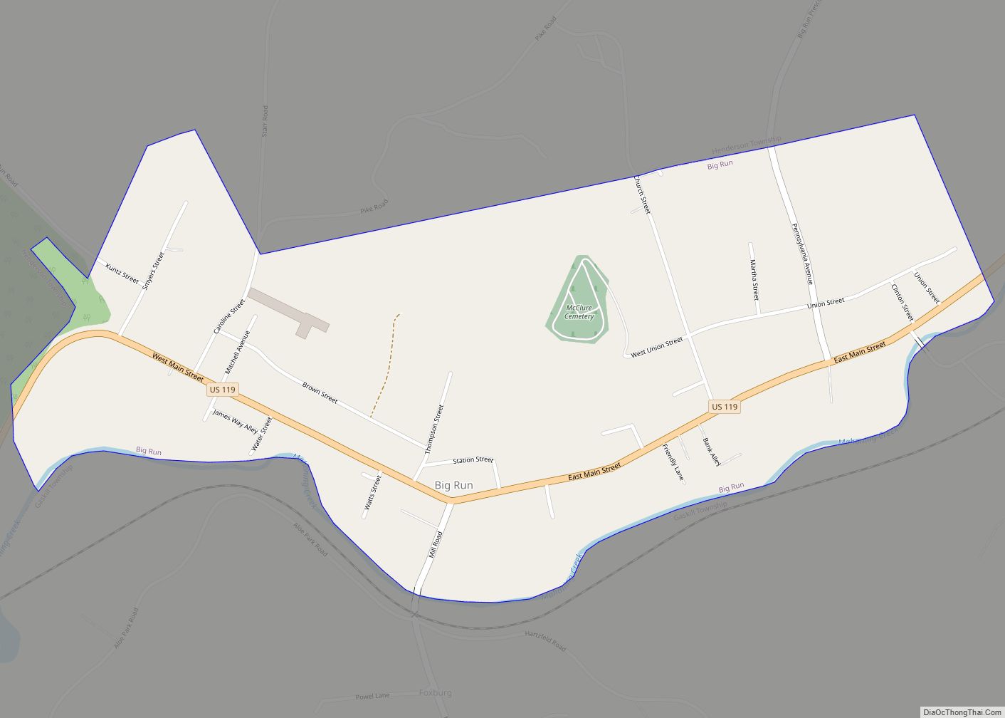
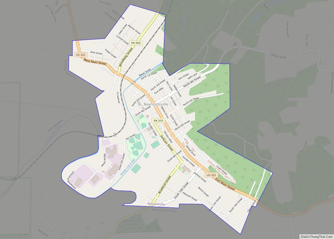
Reynoldsville Road Map
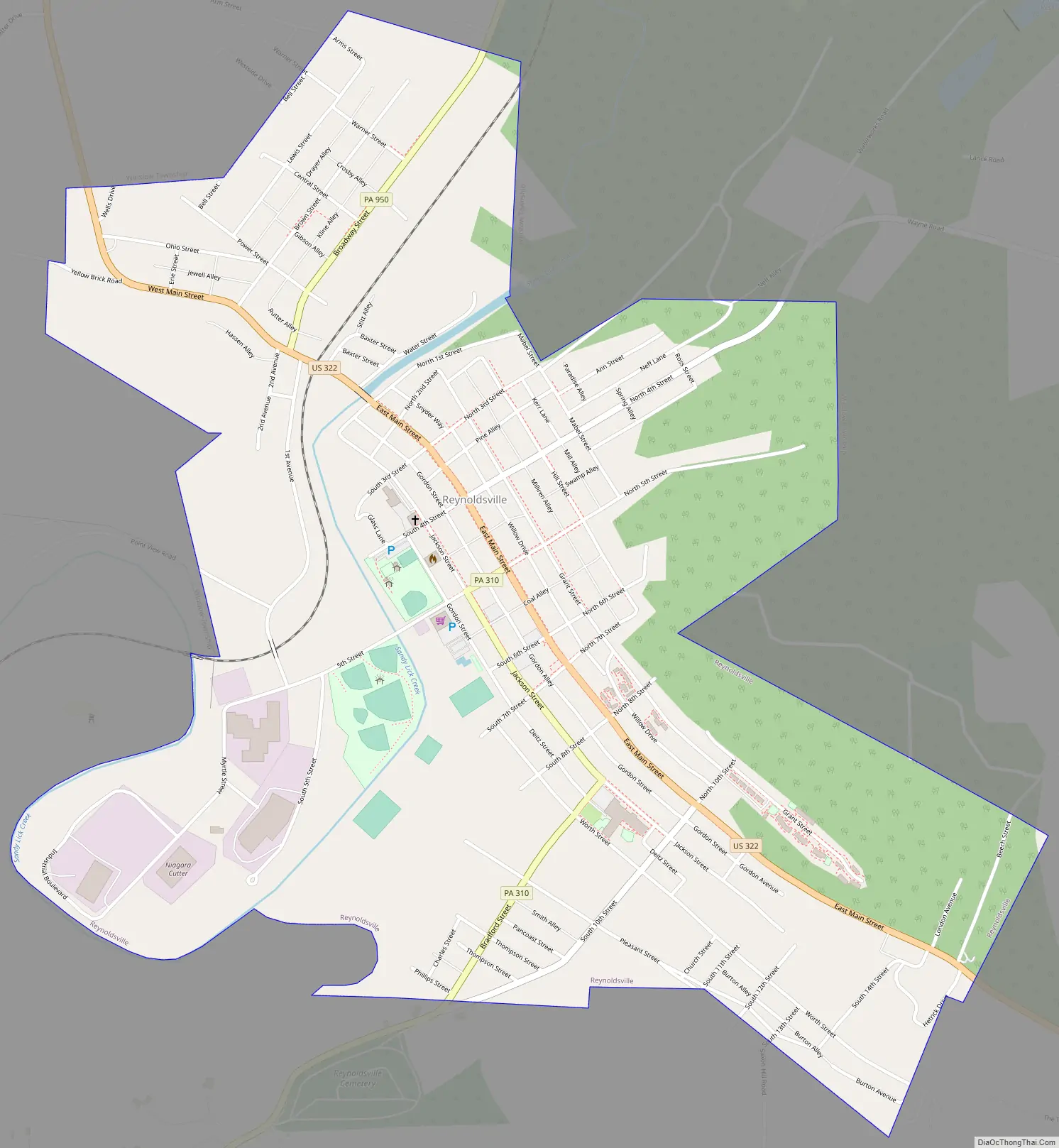
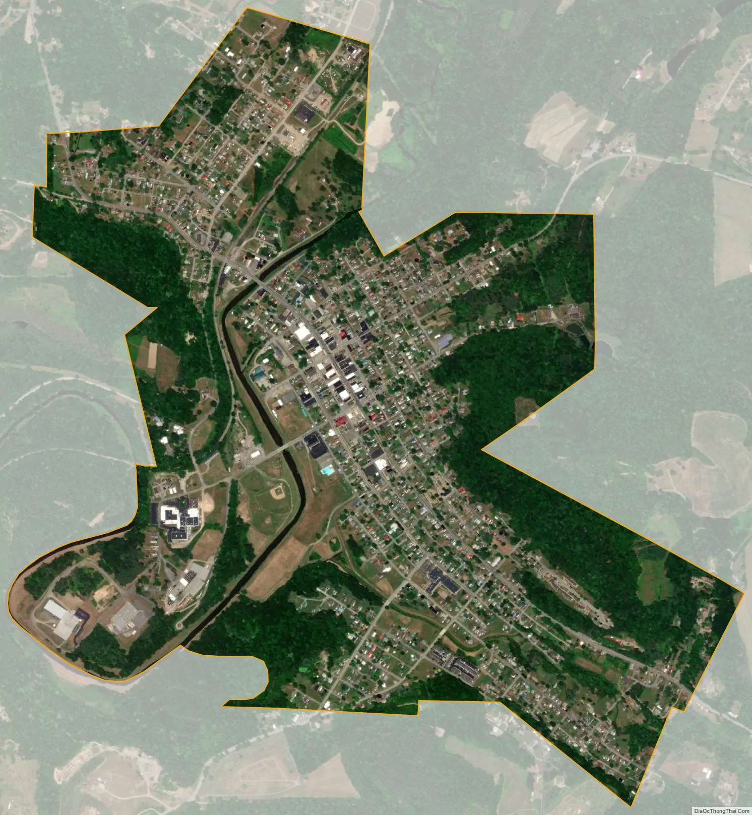
Reynoldsville city Satellite Map
Geography
Reynoldsville is located in eastern Jefferson County at 41°5′40″N 78°53′15″W / 41.09444°N 78.88750°W / 41.09444; -78.88750 (41.094465, -78.887604), in the valley of Sandy Lick Creek where it is joined by Soldier Run. U.S. Route 322 (Main Street) passes through the borough, leading northwest 12 miles (19 km) to Brookville, the county seat, and southeast 10 miles (16 km) to Luthersburg. Pennsylvania Route 950 runs northeast from Reynoldsville up the Sandy Lick Creek valley 6 miles (10 km) to Falls Creek, and Pennsylvania Route 310 leads south 12 miles (19 km) to Punxsutawney.
According to the United States Census Bureau, Reynoldsville has a total area of 1.49 square miles (3.87 km), of which 0.03 square miles (0.07 km), or 1.87%, are water. The borough, via Sandy Lick Creek, is part of the Redbank Creek watershed, flowing west to the Allegheny River and ultimately the Ohio River.
See also
Map of Pennsylvania State and its subdivision:- Adams
- Allegheny
- Armstrong
- Beaver
- Bedford
- Berks
- Blair
- Bradford
- Bucks
- Butler
- Cambria
- Cameron
- Carbon
- Centre
- Chester
- Clarion
- Clearfield
- Clinton
- Columbia
- Crawford
- Cumberland
- Dauphin
- Delaware
- Elk
- Erie
- Fayette
- Forest
- Franklin
- Fulton
- Greene
- Huntingdon
- Indiana
- Jefferson
- Juniata
- Lackawanna
- Lancaster
- Lawrence
- Lebanon
- Lehigh
- Luzerne
- Lycoming
- Mc Kean
- Mercer
- Mifflin
- Monroe
- Montgomery
- Montour
- Northampton
- Northumberland
- Perry
- Philadelphia
- Pike
- Potter
- Schuylkill
- Snyder
- Somerset
- Sullivan
- Susquehanna
- Tioga
- Union
- Venango
- Warren
- Washington
- Wayne
- Westmoreland
- Wyoming
- York
- Alabama
- Alaska
- Arizona
- Arkansas
- California
- Colorado
- Connecticut
- Delaware
- District of Columbia
- Florida
- Georgia
- Hawaii
- Idaho
- Illinois
- Indiana
- Iowa
- Kansas
- Kentucky
- Louisiana
- Maine
- Maryland
- Massachusetts
- Michigan
- Minnesota
- Mississippi
- Missouri
- Montana
- Nebraska
- Nevada
- New Hampshire
- New Jersey
- New Mexico
- New York
- North Carolina
- North Dakota
- Ohio
- Oklahoma
- Oregon
- Pennsylvania
- Rhode Island
- South Carolina
- South Dakota
- Tennessee
- Texas
- Utah
- Vermont
- Virginia
- Washington
- West Virginia
- Wisconsin
- Wyoming