Rimersburg (/ˈraɪmɛrzbərɡ/ RYE-merz-berg) is a borough in Clarion County in the U.S. state of Pennsylvania. The population was 945 at the 2020 census.
| Name: | Rimersburg borough |
|---|---|
| LSAD Code: | 21 |
| LSAD Description: | borough (suffix) |
| State: | Pennsylvania |
| County: | Clarion County |
| Incorporated: | 1853 |
| Elevation: | 1,480 ft (450 m) |
| Total Area: | 0.36 sq mi (0.94 km²) |
| Land Area: | 0.36 sq mi (0.94 km²) |
| Water Area: | 0.00 sq mi (0.00 km²) |
| Total Population: | 945 |
| Population Density: | 2,420.33/sq mi (935.26/km²) |
| ZIP code: | 16248 |
| Area code: | 814 |
| FIPS code: | 4264904 |
| Website: | www.rimersburgborough.com |
Online Interactive Map
Click on ![]() to view map in "full screen" mode.
to view map in "full screen" mode.
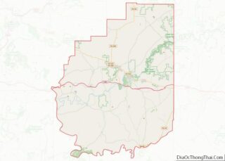
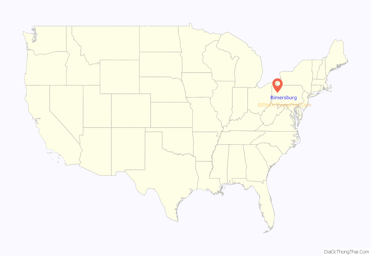
Rimersburg location map. Where is Rimersburg borough?

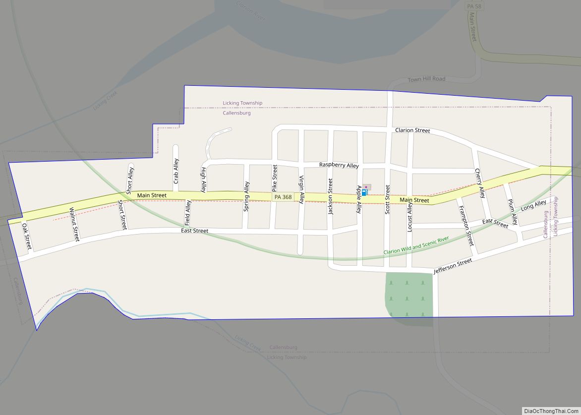
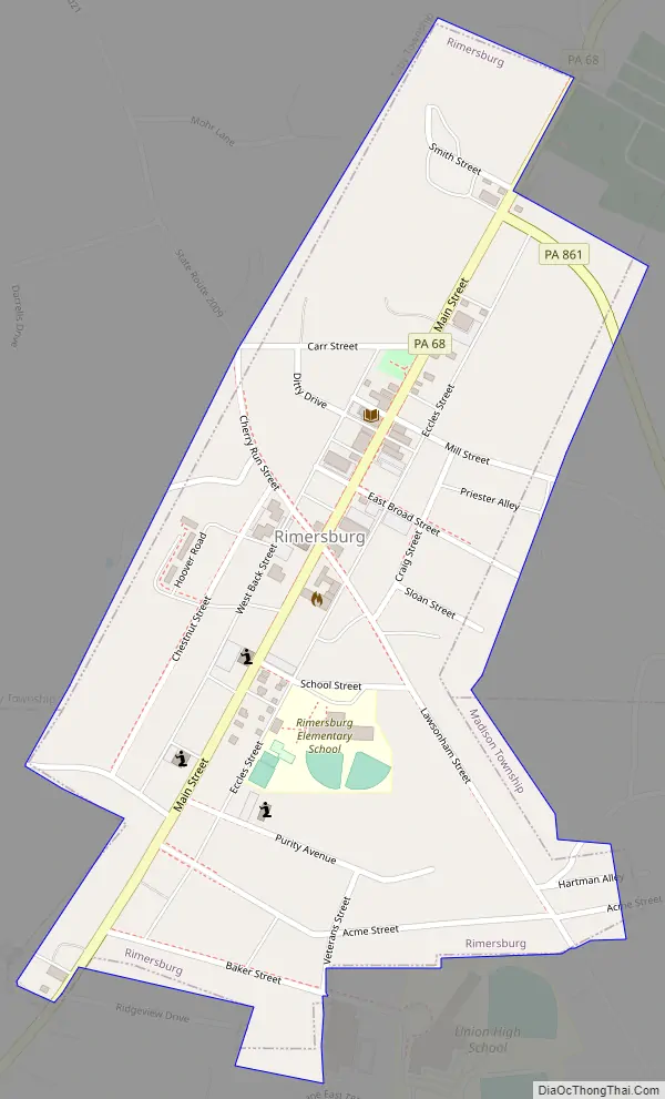
Rimersburg Road Map
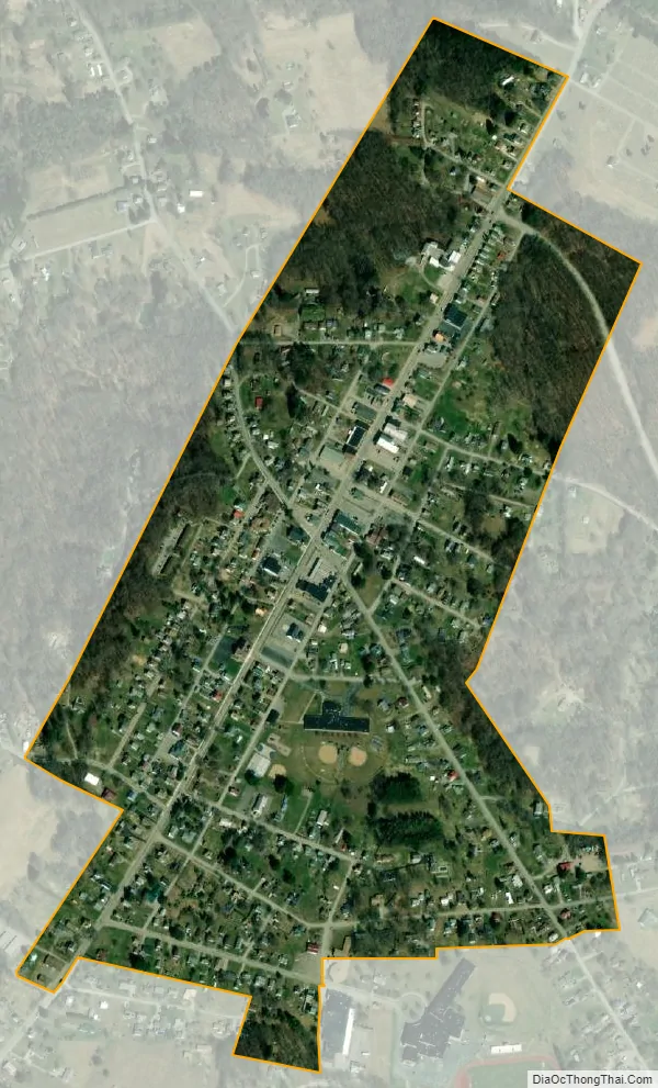
Rimersburg city Satellite Map
Geography
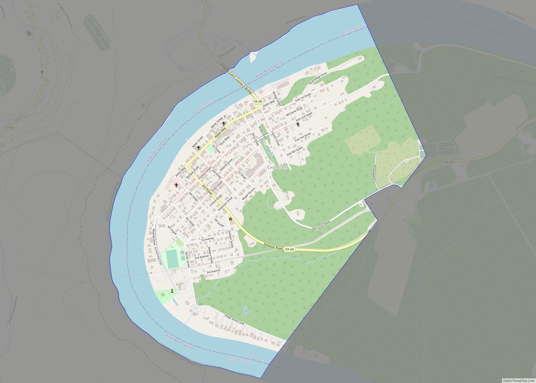
Rimersburg is located in southwestern Clarion County at 41°02′30″N 79°30′09″W / 41.041643°N 79.502583°W / 41.041643; -79.502583. Pennsylvania Route 68 passes through the center of the borough, leading northeast 5 miles (8 km) to Sligo and 16 miles (26 km) to Clarion, the county seat, and southwest 8 miles (13 km) to East Brady on the Allegheny River. Pennsylvania Route 861 leads east from Rimersburg 12 miles (19 km) to New Bethlehem.
According to the United States Census Bureau, Rimersburg has a total area of 0.36 square miles (0.94 km), all land.
See also
Map of Pennsylvania State and its subdivision:- Adams
- Allegheny
- Armstrong
- Beaver
- Bedford
- Berks
- Blair
- Bradford
- Bucks
- Butler
- Cambria
- Cameron
- Carbon
- Centre
- Chester
- Clarion
- Clearfield
- Clinton
- Columbia
- Crawford
- Cumberland
- Dauphin
- Delaware
- Elk
- Erie
- Fayette
- Forest
- Franklin
- Fulton
- Greene
- Huntingdon
- Indiana
- Jefferson
- Juniata
- Lackawanna
- Lancaster
- Lawrence
- Lebanon
- Lehigh
- Luzerne
- Lycoming
- Mc Kean
- Mercer
- Mifflin
- Monroe
- Montgomery
- Montour
- Northampton
- Northumberland
- Perry
- Philadelphia
- Pike
- Potter
- Schuylkill
- Snyder
- Somerset
- Sullivan
- Susquehanna
- Tioga
- Union
- Venango
- Warren
- Washington
- Wayne
- Westmoreland
- Wyoming
- York
- Alabama
- Alaska
- Arizona
- Arkansas
- California
- Colorado
- Connecticut
- Delaware
- District of Columbia
- Florida
- Georgia
- Hawaii
- Idaho
- Illinois
- Indiana
- Iowa
- Kansas
- Kentucky
- Louisiana
- Maine
- Maryland
- Massachusetts
- Michigan
- Minnesota
- Mississippi
- Missouri
- Montana
- Nebraska
- Nevada
- New Hampshire
- New Jersey
- New Mexico
- New York
- North Carolina
- North Dakota
- Ohio
- Oklahoma
- Oregon
- Pennsylvania
- Rhode Island
- South Carolina
- South Dakota
- Tennessee
- Texas
- Utah
- Vermont
- Virginia
- Washington
- West Virginia
- Wisconsin
- Wyoming