Rutledge is a borough in Delaware County, Pennsylvania, United States. The population was 784 at the 2010 census, down from 860 at the 2000 census.
| Name: | Rutledge borough |
|---|---|
| LSAD Code: | 21 |
| LSAD Description: | borough (suffix) |
| State: | Pennsylvania |
| County: | Delaware County |
| Elevation: | 128 ft (39 m) |
| Total Area: | 0.14 sq mi (0.37 km²) |
| Land Area: | 0.14 sq mi (0.37 km²) |
| Water Area: | 0.00 sq mi (0.00 km²) |
| Total Population: | 784 |
| Population Density: | 5,587.41/sq mi (2,157.51/km²) |
| ZIP code: | 19070 |
| Area code: | 610 and 484 |
| FIPS code: | 4266928 |
| GNISfeature ID: | 1204564 |
| Website: | www.rutledgepa.org |
Online Interactive Map
Click on ![]() to view map in "full screen" mode.
to view map in "full screen" mode.
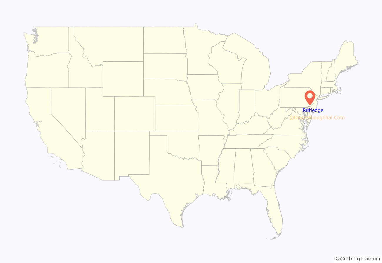
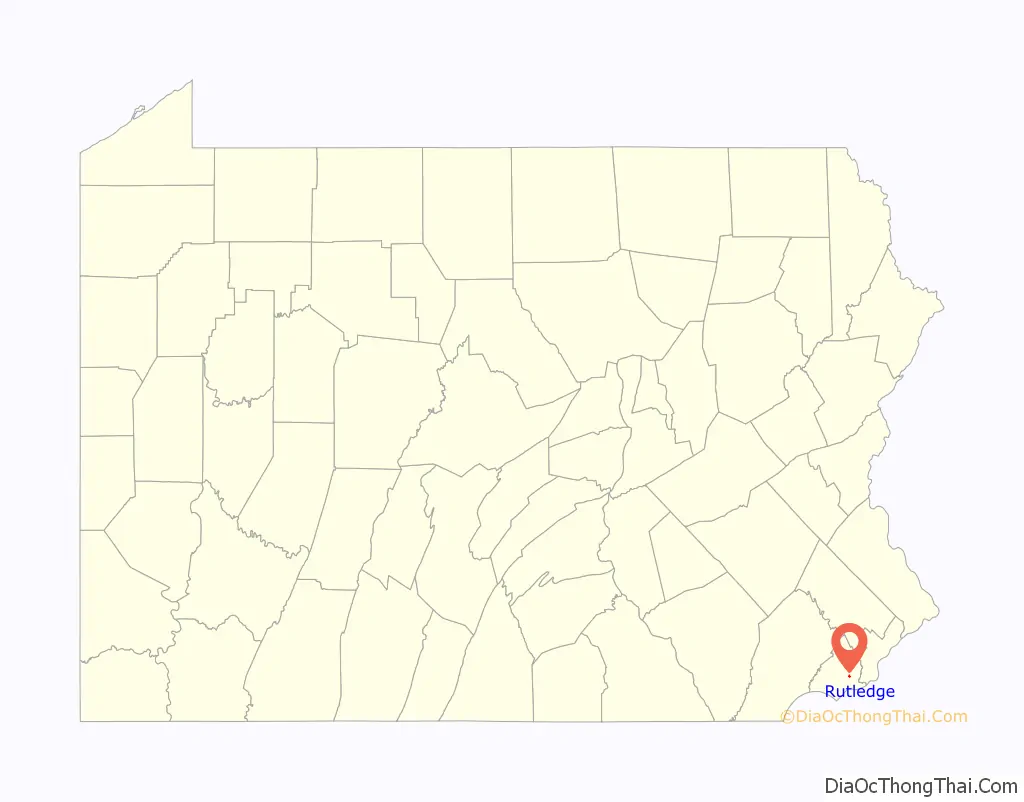
Rutledge location map. Where is Rutledge borough?
History
Rutledge was founded in 1885 by a group of Philadelphia businessmen, and incorporated as a borough in 1887. A promotional brochure produced in 1897 described the community as follows:
“Located ten miles from Philadelphia, on the line of the Central Division of the Philadelphia, Wilmington and Baltimore Railroad, three minutes walk from Morton Station – it is reached in from 20 to 30 minutes by 21 trains daily… To the west lies the magnificent Swarthmore College, and to the southeast, three miles away, lies the Delaware River… its school is one of the finest in the county; its houses are neat and attractive, and their owners take great pride in their homes and the adornment of their grounds.”
Since then, there have been a few name changes. The train line is SEPTA’s Media/Wawa Line, which provides 26 trains on weekdays from Philadelphia to what is now called the Morton-Rutledge Station. But in many ways, this description still holds true today. The schools in the Wallingford-Swarthmore School District are still among the finest in the county, and the homes, many of them dating back to the late 19th century, are still kept with pride by their owners.
There is a long-standing legend that the borough was named after Ann Rutledge, a sweetheart of Abraham Lincoln. This erroneous story is perpetuated in the Keystone Marker that greets those approaching Rutledge from the south on Morton Avenue. The actual story, according to the founders’ brochure, is that the town was named after a then-popular romantic novel written in the 1860s. However, the site of what is now Rutledge borough was once a section of land on the estate of Edward Rutledge, who served as Representative from South Carolina at the Constitutional Convention of July 4, 1776, in Philadelphia and was the youngest signer of the Declaration of Independence.
In 1958, George Raymond, the president of the NAACP Chester branch, purchased a house in Rutledge. The day before he was to move in, a fire burned down the house. After the fire, the township attempted to exercise eminent domain and claim Raymond’s property as a site for a new town hall. Raymond threatened legal action and the township backed down. The house was rebuilt and Raymond took residence in the house in 1959.
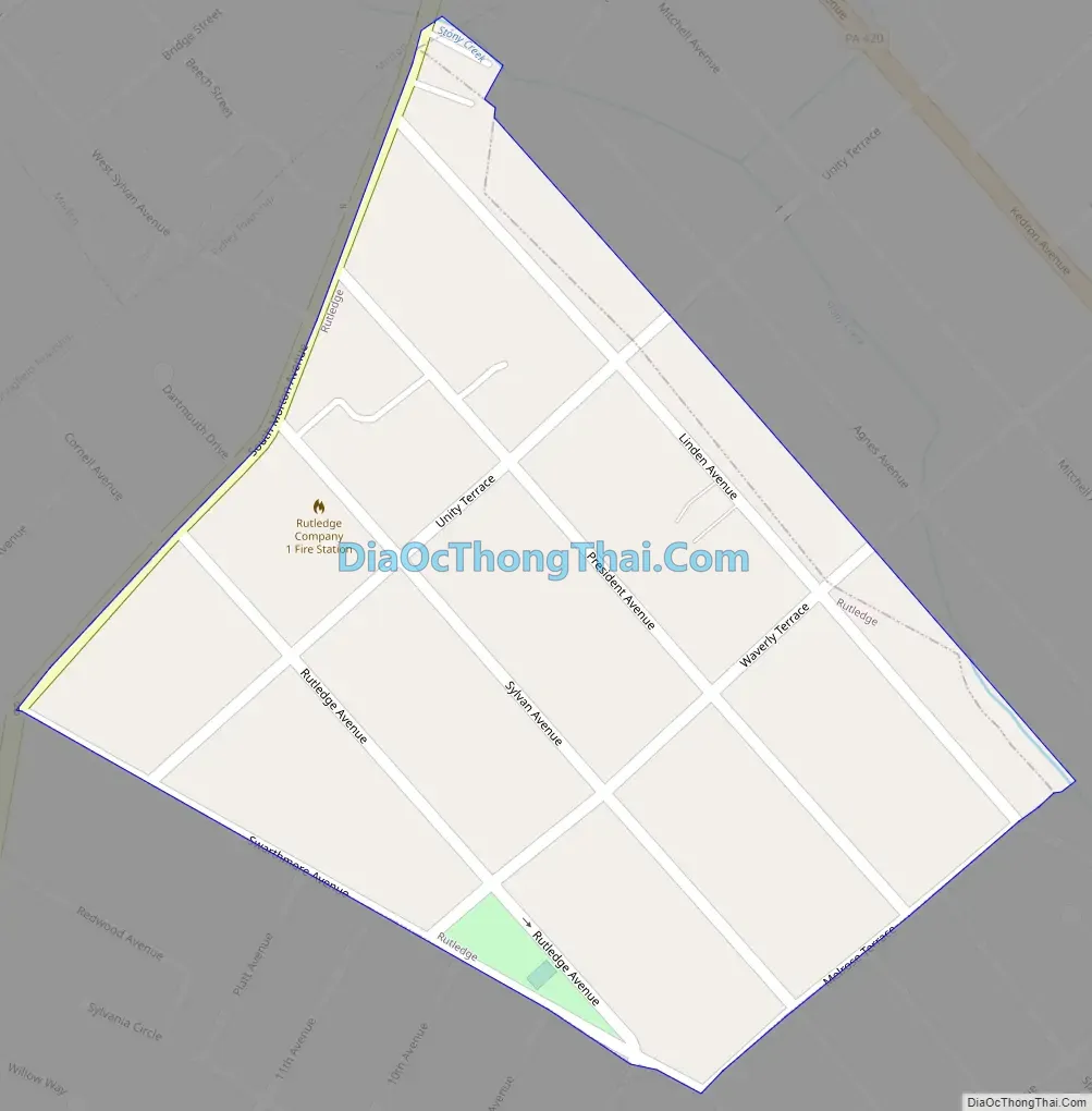
Rutledge Road Map
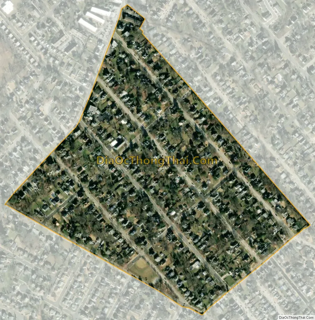
Rutledge city Satellite Map
Geography
Rutledge is located in eastern Delaware County at 39°54′3″N 75°19′39″W / 39.90083°N 75.32750°W / 39.90083; -75.32750 (39.900812, -75.327404). It is nearly surrounded by Ridley Township, with the northernmost tip of the borough touching the borough of Morton. The unincorporated community of Folsom in Ridley Township borders Rutledge to the south.
According to the United States Census Bureau, Rutledge has a total area of 0.14 square miles (0.37 km), all land.
Triangle Park, a children’s park, is located in the borough, as is a fire department.
See also
Map of Pennsylvania State and its subdivision:- Adams
- Allegheny
- Armstrong
- Beaver
- Bedford
- Berks
- Blair
- Bradford
- Bucks
- Butler
- Cambria
- Cameron
- Carbon
- Centre
- Chester
- Clarion
- Clearfield
- Clinton
- Columbia
- Crawford
- Cumberland
- Dauphin
- Delaware
- Elk
- Erie
- Fayette
- Forest
- Franklin
- Fulton
- Greene
- Huntingdon
- Indiana
- Jefferson
- Juniata
- Lackawanna
- Lancaster
- Lawrence
- Lebanon
- Lehigh
- Luzerne
- Lycoming
- Mc Kean
- Mercer
- Mifflin
- Monroe
- Montgomery
- Montour
- Northampton
- Northumberland
- Perry
- Philadelphia
- Pike
- Potter
- Schuylkill
- Snyder
- Somerset
- Sullivan
- Susquehanna
- Tioga
- Union
- Venango
- Warren
- Washington
- Wayne
- Westmoreland
- Wyoming
- York
- Alabama
- Alaska
- Arizona
- Arkansas
- California
- Colorado
- Connecticut
- Delaware
- District of Columbia
- Florida
- Georgia
- Hawaii
- Idaho
- Illinois
- Indiana
- Iowa
- Kansas
- Kentucky
- Louisiana
- Maine
- Maryland
- Massachusetts
- Michigan
- Minnesota
- Mississippi
- Missouri
- Montana
- Nebraska
- Nevada
- New Hampshire
- New Jersey
- New Mexico
- New York
- North Carolina
- North Dakota
- Ohio
- Oklahoma
- Oregon
- Pennsylvania
- Rhode Island
- South Carolina
- South Dakota
- Tennessee
- Texas
- Utah
- Vermont
- Virginia
- Washington
- West Virginia
- Wisconsin
- Wyoming


