Saegertown is a borough in Crawford County, Pennsylvania. The population was 859 at the time of the 2020 census, down from 997 at the 2010 census. It was established in 1824.
| Name: | Saegertown borough |
|---|---|
| LSAD Code: | 21 |
| LSAD Description: | borough (suffix) |
| State: | Pennsylvania |
| County: | Crawford County |
| Founded: | 1824 |
| Total Area: | 1.45 sq mi (3.74 km²) |
| Land Area: | 1.45 sq mi (3.74 km²) |
| Water Area: | 0.00 sq mi (0.00 km²) |
| Total Population: | 871 |
| Population Density: | 602.77/sq mi (232.73/km²) |
| Area code: | 814 |
| FIPS code: | 4267120 |
| Website: | www.saegertownpa.com |
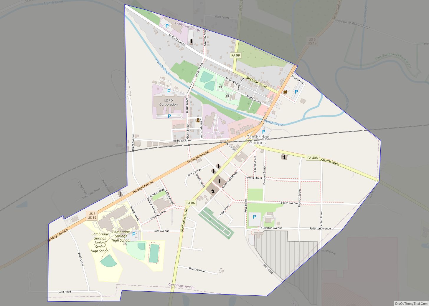
Online Interactive Map
Click on ![]() to view map in "full screen" mode.
to view map in "full screen" mode.
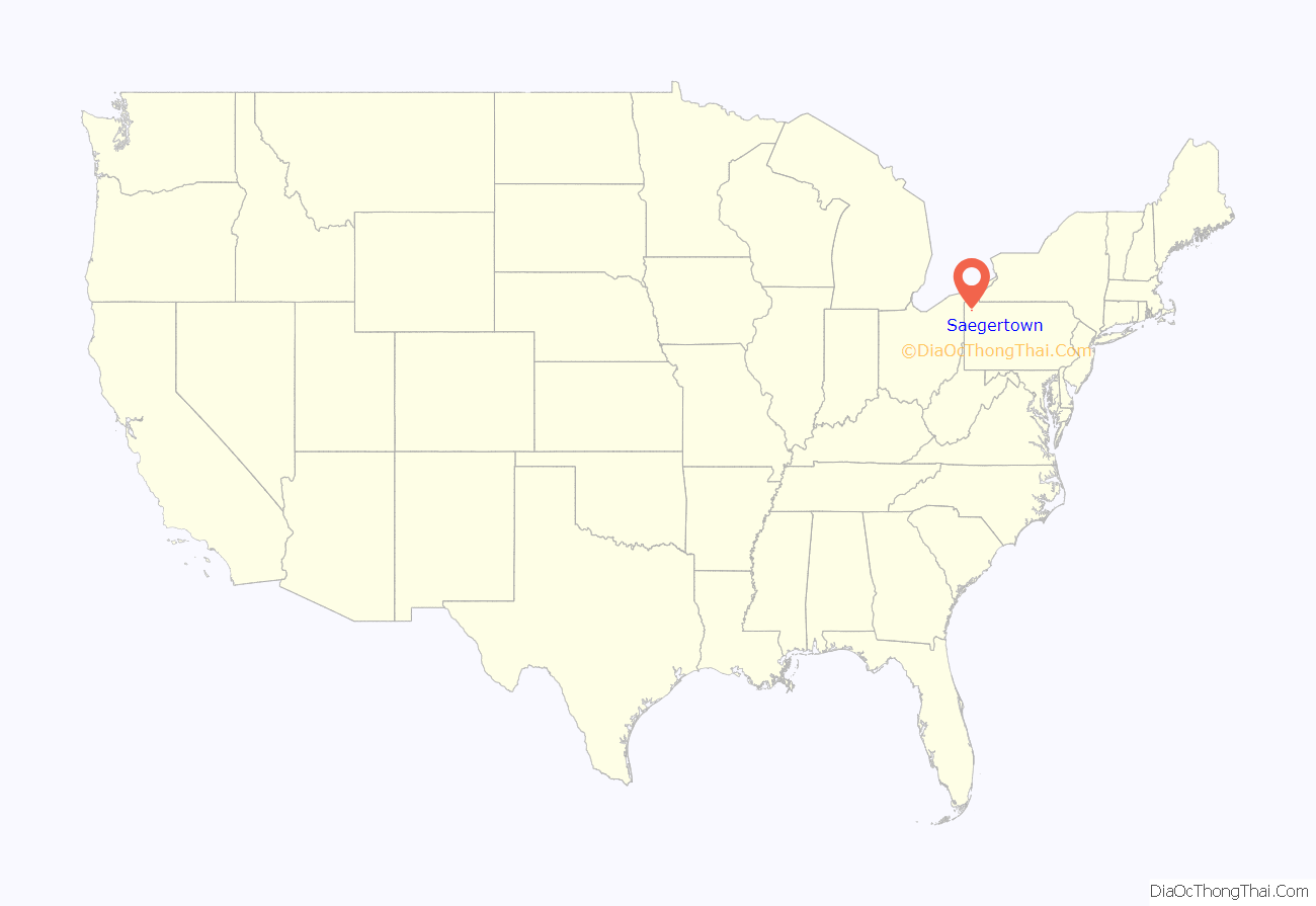
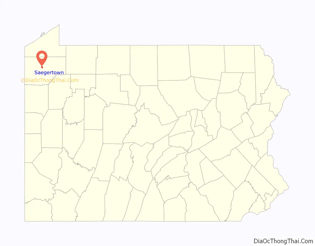
Saegertown location map. Where is Saegertown borough?
History
“The settlement began at was is now known as Saegertown ca. 1795, when the brothers, Arthur and Patrick McGill, came to Woodcock Township. After Major Roger Alden built a sawmill in Saegertown, approximately 1800, the settlement was known for several years as Aldens Mill. In 1824, Daniel Saeger bought Alden’s mill and adjacent lands and at the age of 44, he laid out the town under its present name. Saeger, a native of Pennsylvania of German descent, left Egypt, Pa. in 1823 to find a suitable place to settle. After he arrived in Saegertown, he attracted to the area a large number of German Yeomanry from Lehigh and other eastern Pa. counties. Being active in the community, Saeger was an early member of the Lutheran Church, the owner of a sawmill and general store, and a justice of the peace. He was a member of the Pa. State Legislature.”
The Edward Saeger House was added to the National Register of Historic Places in 1980.
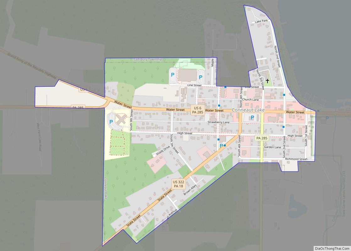
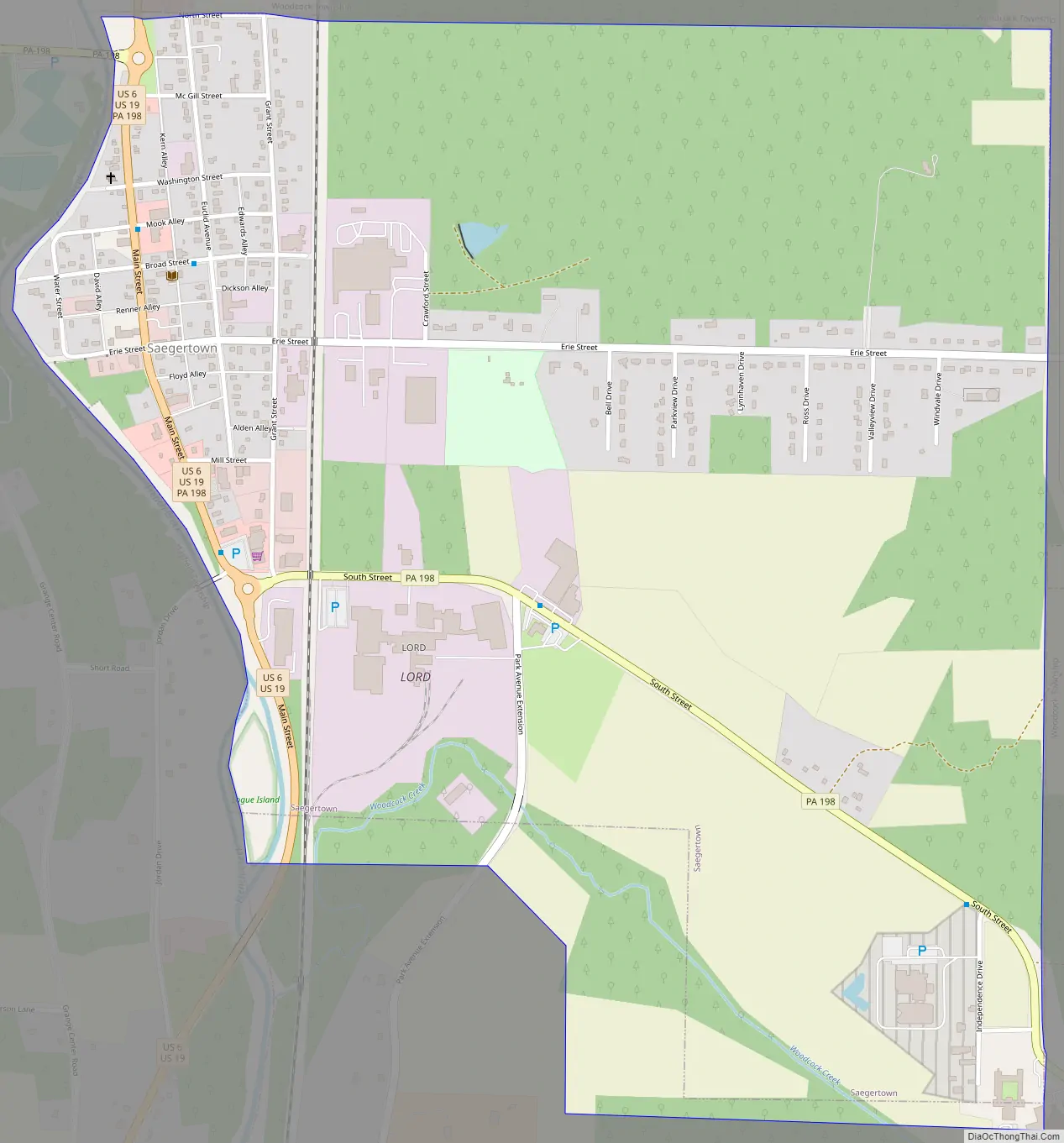
Saegertown Road Map
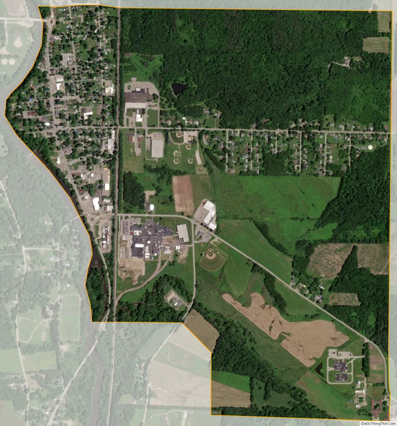
Saegertown city Satellite Map
Geography
Saegertown is located north of the center of Crawford County at 41°43′10″N 80°8′44″W / 41.71944°N 80.14556°W / 41.71944; -80.14556 (41.719482, -80.145660). It is bordered to the north, east, and south by Woodcock Township and to the west, across French Creek, by Hayfield Township.
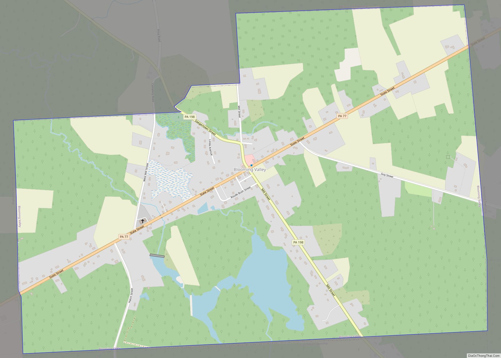
U.S. routes 19 and 6 pass together through the center of town, leading northeast 8 miles (13 km) to Cambridge Springs and south 6 miles (10 km) to Meadville, the Crawford County seat. Pennsylvania Route 198 leads southeast 6 miles (10 km) to Blooming Valley and west 3 miles (5 km) to Exit 154 on Interstate 79. Via I-79, it is 32 miles (51 km) north to Erie and 95 miles (153 km) south to Pittsburgh.
According to the United States Census Bureau, the borough has a total area of 1.5 square miles (4.0 km), all land.
See also
Map of Pennsylvania State and its subdivision:- Adams
- Allegheny
- Armstrong
- Beaver
- Bedford
- Berks
- Blair
- Bradford
- Bucks
- Butler
- Cambria
- Cameron
- Carbon
- Centre
- Chester
- Clarion
- Clearfield
- Clinton
- Columbia
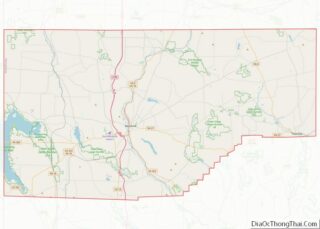
- Crawford
- Cumberland
- Dauphin
- Delaware
- Elk
- Erie
- Fayette
- Forest
- Franklin
- Fulton
- Greene
- Huntingdon
- Indiana
- Jefferson
- Juniata
- Lackawanna
- Lancaster
- Lawrence
- Lebanon
- Lehigh
- Luzerne
- Lycoming
- Mc Kean
- Mercer
- Mifflin
- Monroe
- Montgomery
- Montour
- Northampton
- Northumberland
- Perry
- Philadelphia
- Pike
- Potter
- Schuylkill
- Snyder
- Somerset
- Sullivan
- Susquehanna
- Tioga
- Union
- Venango
- Warren
- Washington
- Wayne
- Westmoreland
- Wyoming
- York
- Alabama
- Alaska
- Arizona
- Arkansas
- California
- Colorado
- Connecticut
- Delaware
- District of Columbia
- Florida
- Georgia
- Hawaii
- Idaho
- Illinois
- Indiana
- Iowa
- Kansas
- Kentucky
- Louisiana
- Maine
- Maryland
- Massachusetts
- Michigan
- Minnesota
- Mississippi
- Missouri
- Montana
- Nebraska
- Nevada
- New Hampshire
- New Jersey
- New Mexico
- New York
- North Carolina
- North Dakota
- Ohio
- Oklahoma
- Oregon
- Pennsylvania
- Rhode Island
- South Carolina
- South Dakota
- Tennessee
- Texas
- Utah
- Vermont
- Virginia
- Washington
- West Virginia
- Wisconsin
- Wyoming