Sewickley is a borough in Allegheny County, Pennsylvania, United States, 12 miles (19 km) west northwest of Pittsburgh along the Ohio River. It is a residential suburb of the Pittsburgh metropolitan area. The population was 3,907 at the 2020 census. The Sewickley Bridge crosses the Ohio River from Sewickley to Moon Township.
| Name: | Sewickley borough |
|---|---|
| LSAD Code: | 21 |
| LSAD Description: | borough (suffix) |
| State: | Pennsylvania |
| County: | Allegheny County |
| Elevation: | 741 ft (226 m) |
| Total Area: | 1.12 sq mi (2.90 km²) |
| Land Area: | 1.00 sq mi (2.59 km²) |
| Water Area: | 0.12 sq mi (0.31 km²) |
| Total Population: | 3,907 |
| Population Density: | 3,793.3/sq mi (1,464.62/km²) |
| ZIP code: | 15143 |
| Area code: | 412 |
| FIPS code: | 4269376 |
| GNISfeature ID: | 1187277 |
| Website: | www.sewickleyborough.org |
Online Interactive Map
Click on ![]() to view map in "full screen" mode.
to view map in "full screen" mode.
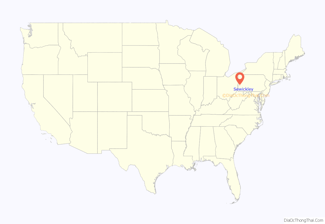
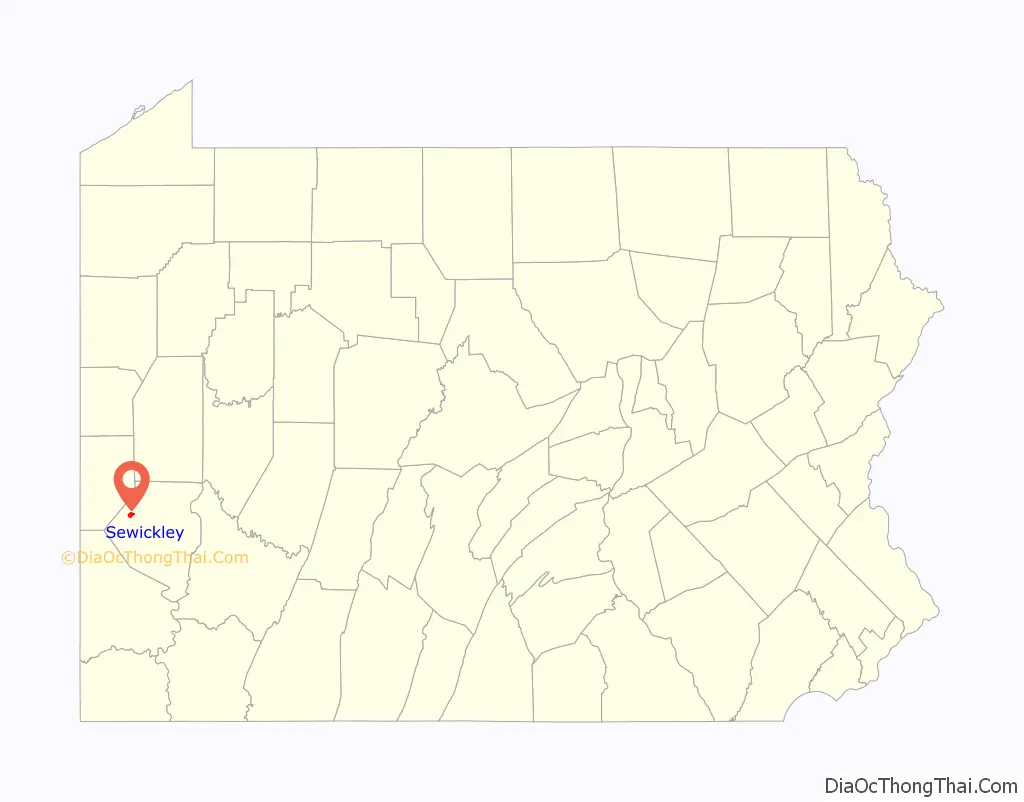
Sewickley location map. Where is Sewickley borough?
History
The valley surrounding the Big Sewickley Creek was surveyed in 1785 and sold to American Revolutionary War veterans. After the Battle of Fallen Timbers in 1794, settlers began to trickle in to the area, with flatboats, keelboats, and steamboats forming an industry along the Ohio River.
In 1837, the Edgeworth Female Seminary was moved from Pittsburgh to what was then called Sewickley Bottom. The following year, Sewickley Academy was founded. Becoming a small center for education, by 1840 the community was formally established as Sewickleyville. The borough was incorporated as simply Sewickley on July 6, 1853, after growth continued as the Pittsburgh, Fort Wayne and Chicago Railway was built through the area.
In 1911, the Sewickley Bridge was completed, bringing an end to the ferry industry. Ohio River Boulevard, later designated a part of Pennsylvania Route 65, was completed in 1934.
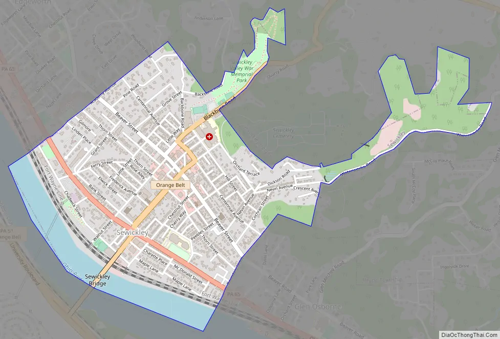
Sewickley Road Map
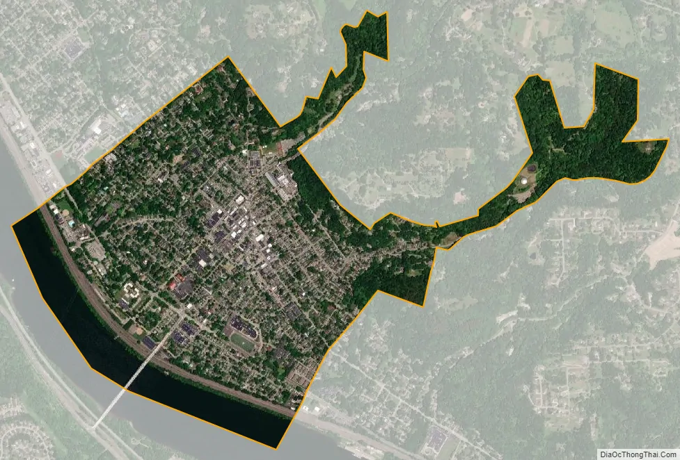
Sewickley city Satellite Map
Geography
Sewickley is located at 40°32.25′N 80°10.5′W (40.5390, -80.1807). According to the U.S. Census Bureau, the borough has a total area of 1.1 square miles (2.8 km), of which 1.0 square mile (2.6 km) is land and 0.1 square miles (0.26 km) (11.11%) is water.
Surrounding and adjacent neighborhoods
Sewickley has four land borders with Edgeworth to the northwest, Glen Osborne to the southwest, Sewickley Heights to the northeast, and Aleppo Township to the east. Across the Ohio River, Sewickley runs adjacent with Moon Township and Coraopolis with the Sewickley Bridge as the direct link to the former.
Along with the four land borders, plus Bell Acres, Glenfield, Haysville, Leetsdale, Leet Township, and Sewickley Hills, Sewickley is located in the Quaker Valley School District. Together, these boroughs and townships constitute a loosely defined region in northwestern Allegheny County. Most of these municipalities – not including Leetsdale and parts of Leet Township – share the Sewickley post office and its 15143 zip code.
See also
Map of Pennsylvania State and its subdivision:- Adams
- Allegheny
- Armstrong
- Beaver
- Bedford
- Berks
- Blair
- Bradford
- Bucks
- Butler
- Cambria
- Cameron
- Carbon
- Centre
- Chester
- Clarion
- Clearfield
- Clinton
- Columbia
- Crawford
- Cumberland
- Dauphin
- Delaware
- Elk
- Erie
- Fayette
- Forest
- Franklin
- Fulton
- Greene
- Huntingdon
- Indiana
- Jefferson
- Juniata
- Lackawanna
- Lancaster
- Lawrence
- Lebanon
- Lehigh
- Luzerne
- Lycoming
- Mc Kean
- Mercer
- Mifflin
- Monroe
- Montgomery
- Montour
- Northampton
- Northumberland
- Perry
- Philadelphia
- Pike
- Potter
- Schuylkill
- Snyder
- Somerset
- Sullivan
- Susquehanna
- Tioga
- Union
- Venango
- Warren
- Washington
- Wayne
- Westmoreland
- Wyoming
- York
- Alabama
- Alaska
- Arizona
- Arkansas
- California
- Colorado
- Connecticut
- Delaware
- District of Columbia
- Florida
- Georgia
- Hawaii
- Idaho
- Illinois
- Indiana
- Iowa
- Kansas
- Kentucky
- Louisiana
- Maine
- Maryland
- Massachusetts
- Michigan
- Minnesota
- Mississippi
- Missouri
- Montana
- Nebraska
- Nevada
- New Hampshire
- New Jersey
- New Mexico
- New York
- North Carolina
- North Dakota
- Ohio
- Oklahoma
- Oregon
- Pennsylvania
- Rhode Island
- South Carolina
- South Dakota
- Tennessee
- Texas
- Utah
- Vermont
- Virginia
- Washington
- West Virginia
- Wisconsin
- Wyoming


