Sinking Spring is a borough in Berks County, Pennsylvania, United States. The population was 4,008 at the 2010 census. Sinking Spring was given its name for a spring located in the center of town. The water in this spring would sink into the ground from time to time, giving the illusion that it had disappeared. The Sinking Spring area is served by the Wilson School District.
| Name: | Sinking Spring borough |
|---|---|
| LSAD Code: | 21 |
| LSAD Description: | borough (suffix) |
| State: | Pennsylvania |
| County: | Berks County |
| Incorporated: | March 13, 1913 |
| Elevation: | 338 ft (103 m) |
| Total Area: | 1.24 sq mi (3.22 km²) |
| Land Area: | 1.24 sq mi (3.21 km²) |
| Water Area: | 0.00 sq mi (0.01 km²) |
| Total Population: | 4,286 |
| Population Density: | 3,453.67/sq mi (1,333.80/km²) |
| ZIP code: | 19608 |
| Area code: | 610 & 484 |
| FIPS code: | 4270880 |
Online Interactive Map
Click on ![]() to view map in "full screen" mode.
to view map in "full screen" mode.
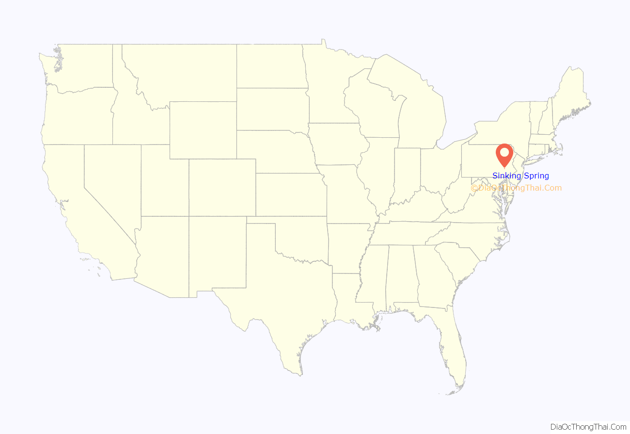
Sinking Spring location map. Where is Sinking Spring borough?
Sinking Spring Road Map
Sinking Spring city Satellite Map
Geography
According to the United States Census Bureau, the borough has a total area of 1.4 square miles (3.6 km), all land.
The Indians who first inhabited this area were the Lenni Lenape Indians (meaning the “original people”). The tribe in this immediate area was the Minsi or Wolf tribe. Indian inhabitants in the Sinking Spring area supposedly called the main spring as the sunken spring. White settlers later called it the “sinking spring.”
Penn Avenue is the main thoroughfare of Sinking Spring. There is a stone monument in the 3800 block of Penn Avenue. It was placed to identify “The Spring,” which is said to periodically appear and disappear. The Borough of Sinking Spring has a large number of underground streams that carve out limestone and form sinkholes; thus the name Sinking Spring.
The Borough of Sinking Spring was incorporated on March 13, 1913.
The borough has a hot-summer humid continental climate (Dfa) and average monthly temperatures range from 30.4 °F in January to 75.6 °F in July. The local hardiness zone is 6b bordering 7a.
See also
Map of Pennsylvania State and its subdivision:- Adams
- Allegheny
- Armstrong
- Beaver
- Bedford
- Berks
- Blair
- Bradford
- Bucks
- Butler
- Cambria
- Cameron
- Carbon
- Centre
- Chester
- Clarion
- Clearfield
- Clinton
- Columbia
- Crawford
- Cumberland
- Dauphin
- Delaware
- Elk
- Erie
- Fayette
- Forest
- Franklin
- Fulton
- Greene
- Huntingdon
- Indiana
- Jefferson
- Juniata
- Lackawanna
- Lancaster
- Lawrence
- Lebanon
- Lehigh
- Luzerne
- Lycoming
- Mc Kean
- Mercer
- Mifflin
- Monroe
- Montgomery
- Montour
- Northampton
- Northumberland
- Perry
- Philadelphia
- Pike
- Potter
- Schuylkill
- Snyder
- Somerset
- Sullivan
- Susquehanna
- Tioga
- Union
- Venango
- Warren
- Washington
- Wayne
- Westmoreland
- Wyoming
- York
- Alabama
- Alaska
- Arizona
- Arkansas
- California
- Colorado
- Connecticut
- Delaware
- District of Columbia
- Florida
- Georgia
- Hawaii
- Idaho
- Illinois
- Indiana
- Iowa
- Kansas
- Kentucky
- Louisiana
- Maine
- Maryland
- Massachusetts
- Michigan
- Minnesota
- Mississippi
- Missouri
- Montana
- Nebraska
- Nevada
- New Hampshire
- New Jersey
- New Mexico
- New York
- North Carolina
- North Dakota
- Ohio
- Oklahoma
- Oregon
- Pennsylvania
- Rhode Island
- South Carolina
- South Dakota
- Tennessee
- Texas
- Utah
- Vermont
- Virginia
- Washington
- West Virginia
- Wisconsin
- Wyoming
