Smithfield is a borough in Fayette County, Pennsylvania, United States. The population was 830 at the 2020 census. It is served by the Albert Gallatin Area School District. The town’s largest employer is a small wire producing plant run by Nelson Steel.
| Name: | Smithfield borough |
|---|---|
| LSAD Code: | 21 |
| LSAD Description: | borough (suffix) |
| State: | Pennsylvania |
| County: | Fayette County |
| Elevation: | 1,089 ft (332 m) |
| Total Area: | 0.71 sq mi (1.85 km²) |
| Land Area: | 0.71 sq mi (1.85 km²) |
| Water Area: | 0.00 sq mi (0.00 km²) |
| Total Population: | 830 |
| Population Density: | 1,155.24/sq mi (445.84/km²) |
| ZIP code: | 15478 |
| Area code: | 724 |
| FIPS code: | 4271320 |
Online Interactive Map
Click on ![]() to view map in "full screen" mode.
to view map in "full screen" mode.
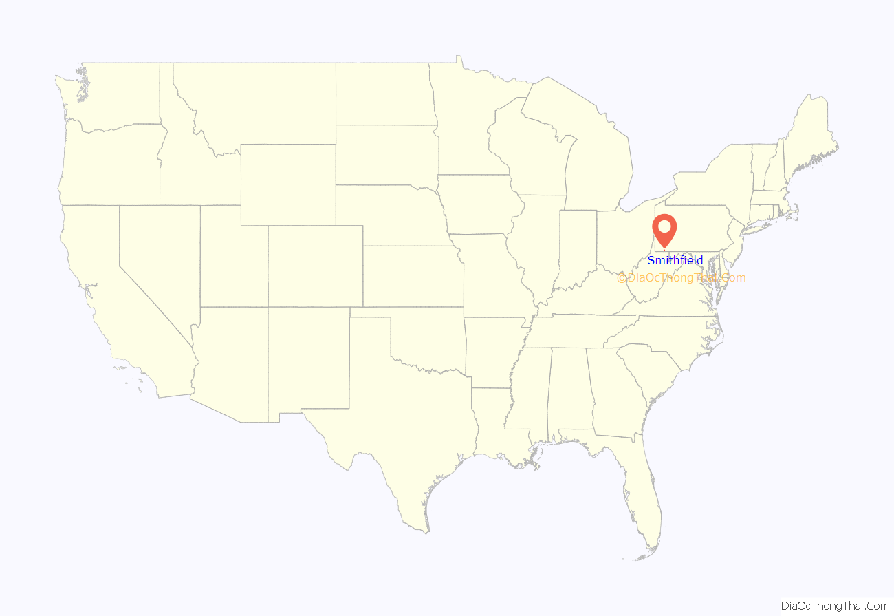
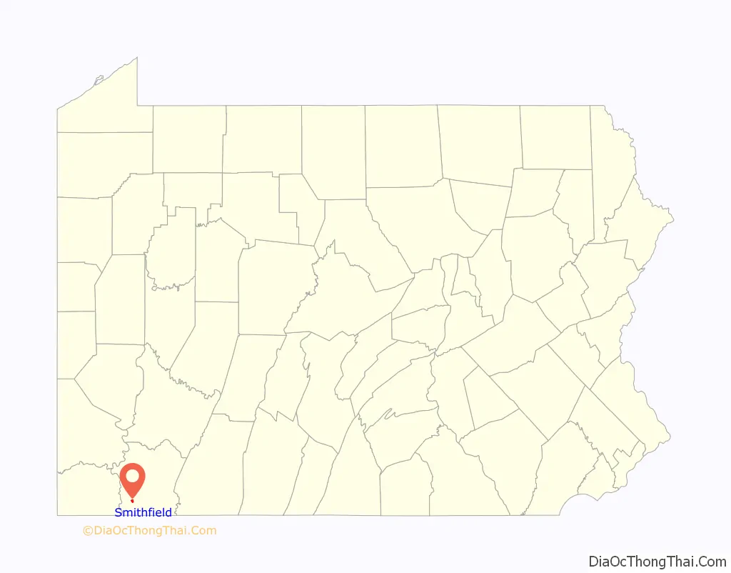
Smithfield location map. Where is Smithfield borough?
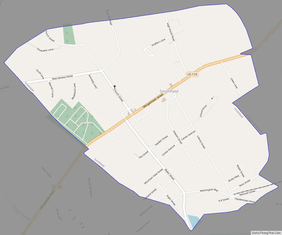
Smithfield Road Map
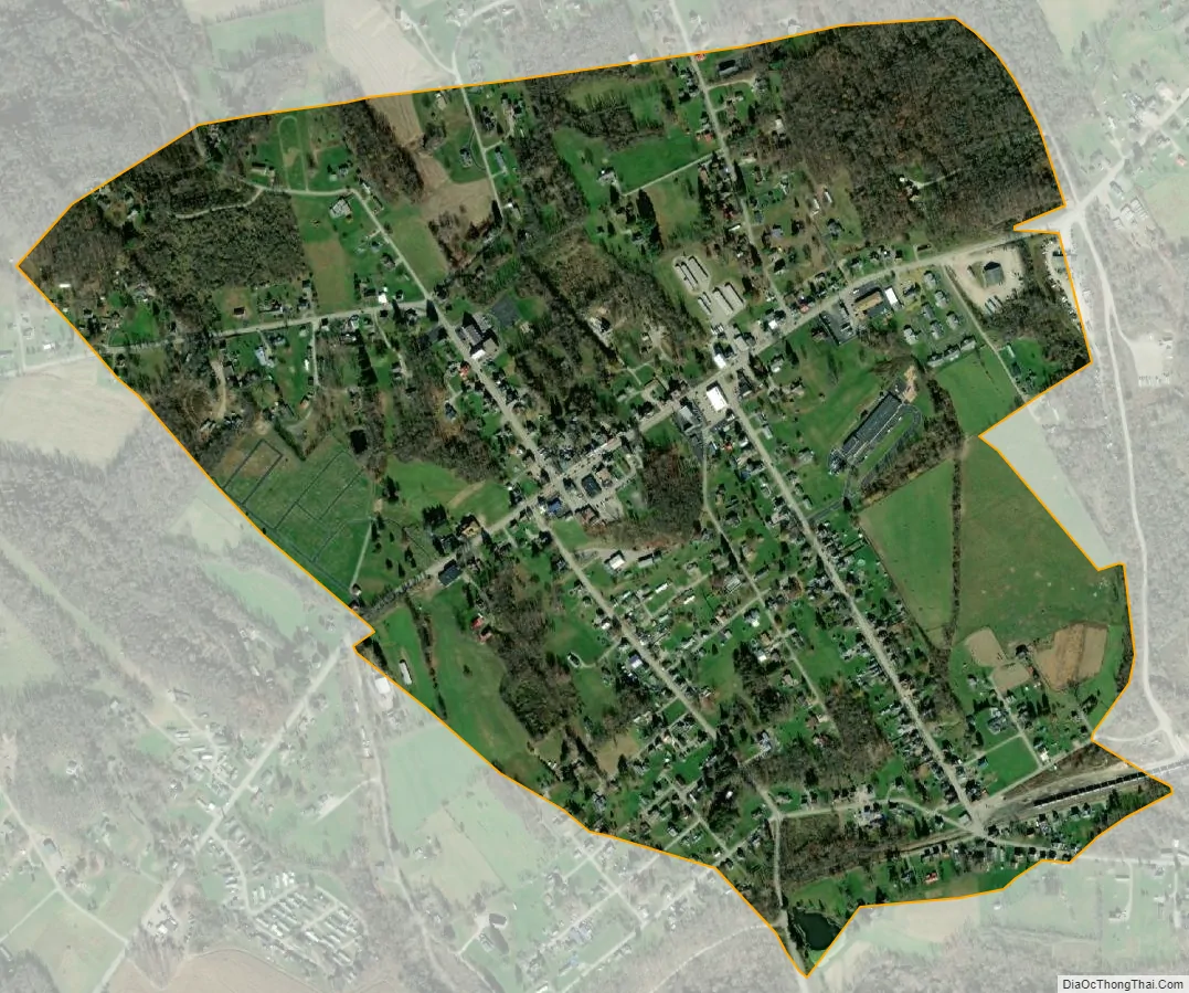
Smithfield city Satellite Map
Geography
Smithfield is located in southwestern Fayette County at 39°47′59″N 79°48′30″W / 39.79972°N 79.80833°W / 39.79972; -79.80833 (39.799664, -79.808197). According to the United States Census Bureau, the borough has a total area of 0.71 square miles (1.84 km), all land.
U.S. Route 119 passes through the center of the borough, leading northeast 9 miles (14 km) to Uniontown, the county seat, and southwest 8 miles (13 km) to Point Marion.
See also
Map of Pennsylvania State and its subdivision:- Adams
- Allegheny
- Armstrong
- Beaver
- Bedford
- Berks
- Blair
- Bradford
- Bucks
- Butler
- Cambria
- Cameron
- Carbon
- Centre
- Chester
- Clarion
- Clearfield
- Clinton
- Columbia
- Crawford
- Cumberland
- Dauphin
- Delaware
- Elk
- Erie
- Fayette
- Forest
- Franklin
- Fulton
- Greene
- Huntingdon
- Indiana
- Jefferson
- Juniata
- Lackawanna
- Lancaster
- Lawrence
- Lebanon
- Lehigh
- Luzerne
- Lycoming
- Mc Kean
- Mercer
- Mifflin
- Monroe
- Montgomery
- Montour
- Northampton
- Northumberland
- Perry
- Philadelphia
- Pike
- Potter
- Schuylkill
- Snyder
- Somerset
- Sullivan
- Susquehanna
- Tioga
- Union
- Venango
- Warren
- Washington
- Wayne
- Westmoreland
- Wyoming
- York
- Alabama
- Alaska
- Arizona
- Arkansas
- California
- Colorado
- Connecticut
- Delaware
- District of Columbia
- Florida
- Georgia
- Hawaii
- Idaho
- Illinois
- Indiana
- Iowa
- Kansas
- Kentucky
- Louisiana
- Maine
- Maryland
- Massachusetts
- Michigan
- Minnesota
- Mississippi
- Missouri
- Montana
- Nebraska
- Nevada
- New Hampshire
- New Jersey
- New Mexico
- New York
- North Carolina
- North Dakota
- Ohio
- Oklahoma
- Oregon
- Pennsylvania
- Rhode Island
- South Carolina
- South Dakota
- Tennessee
- Texas
- Utah
- Vermont
- Virginia
- Washington
- West Virginia
- Wisconsin
- Wyoming