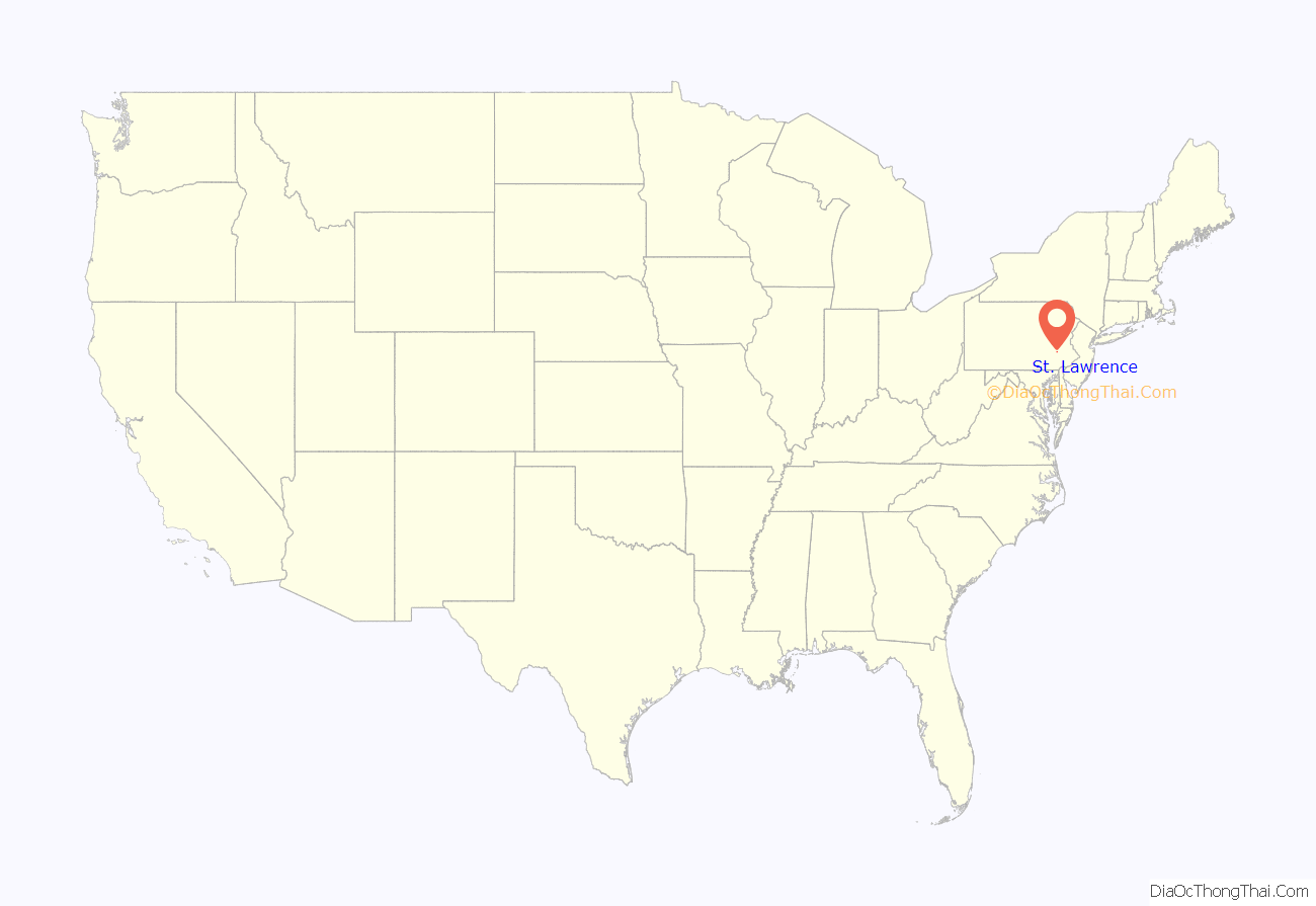
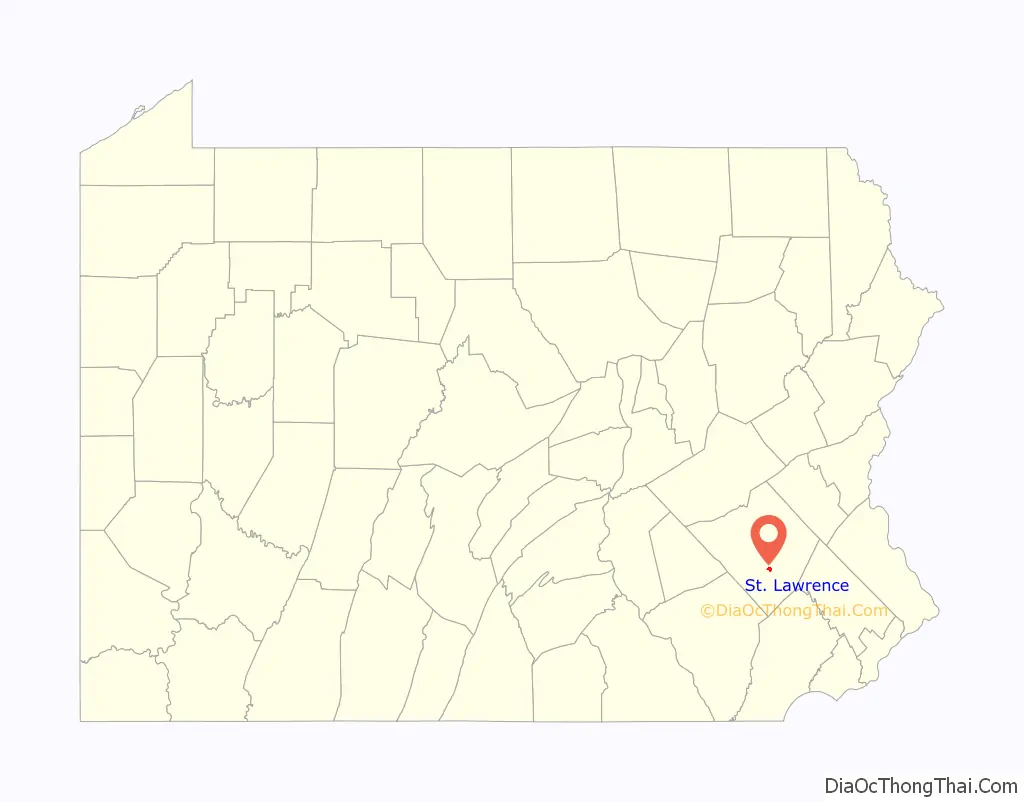
St. Lawrence is a borough in Berks County, Pennsylvania, United States. The population was 1,809 at the 2010 census.
| Name: | St. Lawrence borough |
|---|---|
| LSAD Code: | 21 |
| LSAD Description: | borough (suffix) |
| State: | Pennsylvania |
| County: | Berks County |
| Elevation: | 400 ft (100 m) |
| Total Area: | 0.90 sq mi (2.32 km²) |
| Land Area: | 0.90 sq mi (2.32 km²) |
| Water Area: | 0.00 sq mi (0.00 km²) |
| Total Population: | 1,892 |
| Population Density: | 2,109.25/sq mi (814.81/km²) |
| ZIP code: | 19606 |
| Area code: | 610 and 484 |
| FIPS code: | 4267304 |
| Website: | slboro.com |
Online Interactive Map
Click on ![]() to view map in "full screen" mode.
to view map in "full screen" mode.
St. Lawrence location map. Where is St. Lawrence borough?
History
The John F. Lutz Furniture Co. & Funerary buildings was added to the National Register of Historic Places in 1996.
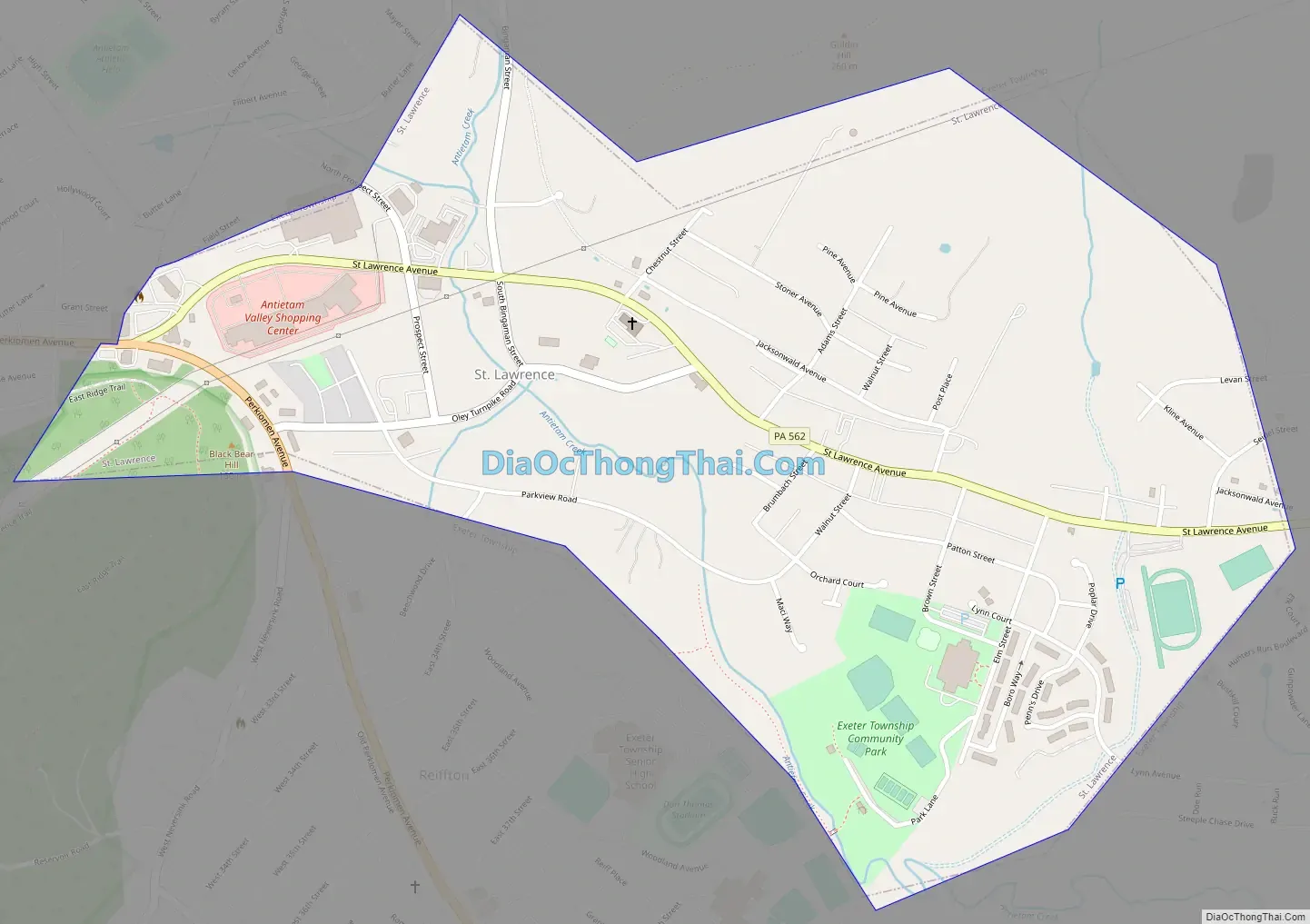
St. Lawrence Road Map
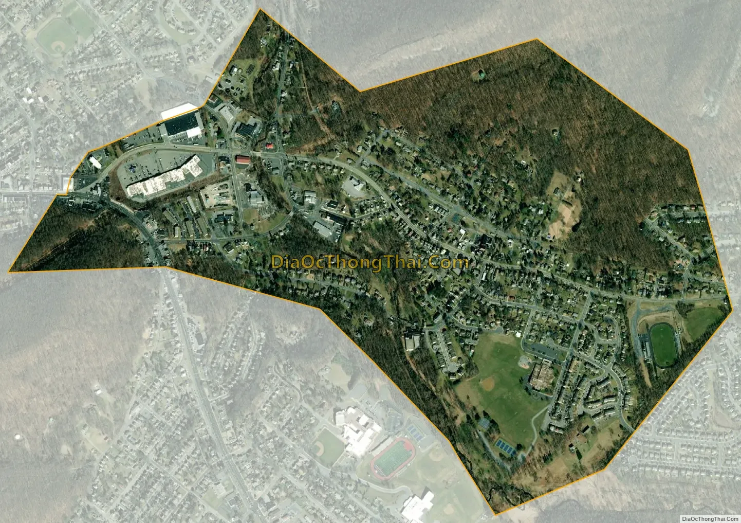
St. Lawrence city Satellite Map
Geography
St. Lawrence is located in south-central Berks County at 40°19′33″N 75°52′3″W / 40.32583°N 75.86750°W / 40.32583; -75.86750 (40.325814, -75.867418). It is bordered by the borough of Mount Penn to the west and by Exeter Township to the north, east, and south. The unincorporated communities of Pennside, Jacksonwald, and Reiffton border the borough on the northwest, east, and south, respectively.
According to the United States Census Bureau, St. Lawrence has a total area of 0.9 square miles (2.3 km), all land.
See also
Map of Pennsylvania State and its subdivision:- Adams
- Allegheny
- Armstrong
- Beaver
- Bedford
- Berks
- Blair
- Bradford
- Bucks
- Butler
- Cambria
- Cameron
- Carbon
- Centre
- Chester
- Clarion
- Clearfield
- Clinton
- Columbia
- Crawford
- Cumberland
- Dauphin
- Delaware
- Elk
- Erie
- Fayette
- Forest
- Franklin
- Fulton
- Greene
- Huntingdon
- Indiana
- Jefferson
- Juniata
- Lackawanna
- Lancaster
- Lawrence
- Lebanon
- Lehigh
- Luzerne
- Lycoming
- Mc Kean
- Mercer
- Mifflin
- Monroe
- Montgomery
- Montour
- Northampton
- Northumberland
- Perry
- Philadelphia
- Pike
- Potter
- Schuylkill
- Snyder
- Somerset
- Sullivan
- Susquehanna
- Tioga
- Union
- Venango
- Warren
- Washington
- Wayne
- Westmoreland
- Wyoming
- York
- Alabama
- Alaska
- Arizona
- Arkansas
- California
- Colorado
- Connecticut
- Delaware
- District of Columbia
- Florida
- Georgia
- Hawaii
- Idaho
- Illinois
- Indiana
- Iowa
- Kansas
- Kentucky
- Louisiana
- Maine
- Maryland
- Massachusetts
- Michigan
- Minnesota
- Mississippi
- Missouri
- Montana
- Nebraska
- Nevada
- New Hampshire
- New Jersey
- New Mexico
- New York
- North Carolina
- North Dakota
- Ohio
- Oklahoma
- Oregon
- Pennsylvania
- Rhode Island
- South Carolina
- South Dakota
- Tennessee
- Texas
- Utah
- Vermont
- Virginia
- Washington
- West Virginia
- Wisconsin
- Wyoming


