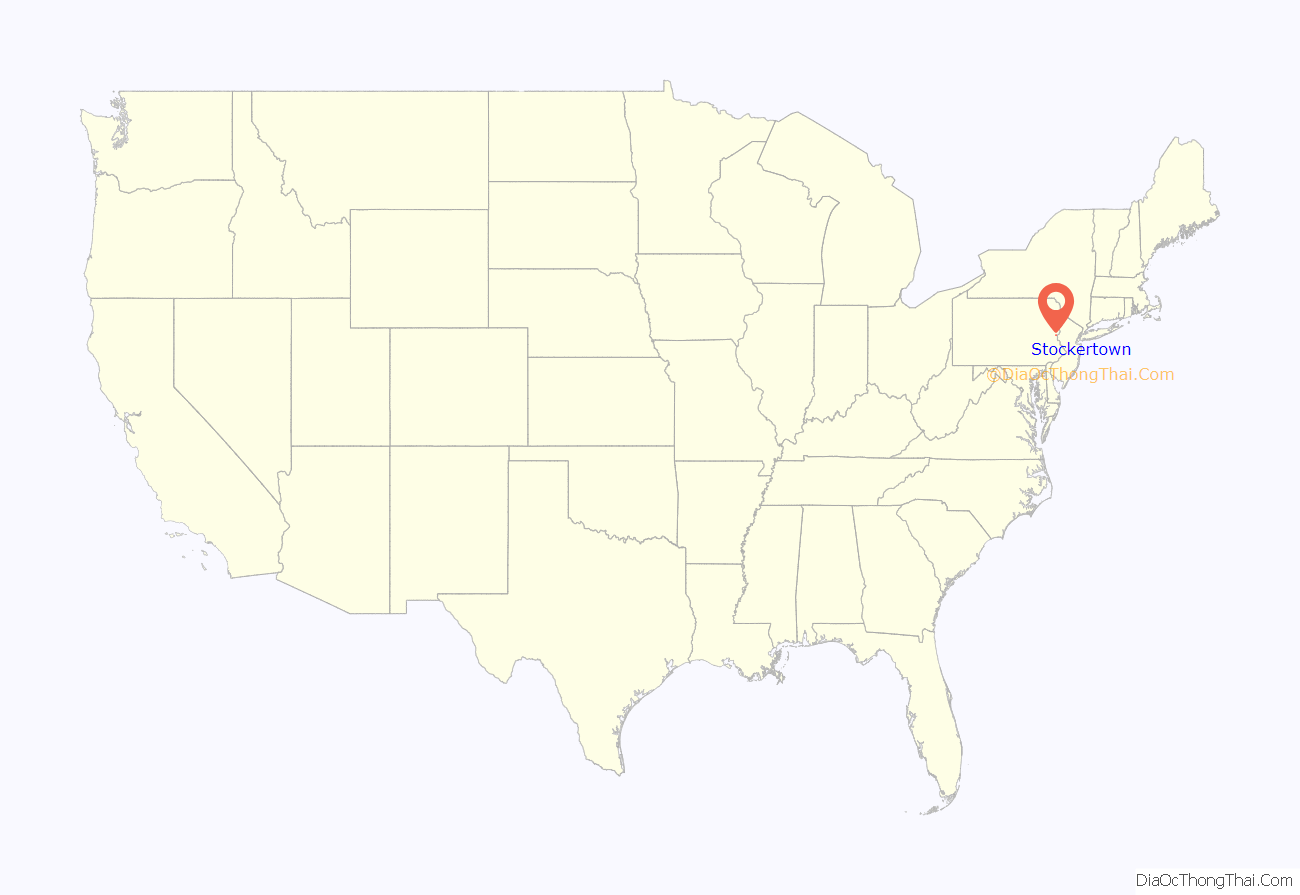
Stockertown is a borough in Northampton County, Pennsylvania. The borough’s population was 927 as of the 2010 census. It is part of the Lehigh Valley metropolitan area, which had a population of 861,899 and was the 68th most populous metropolitan area in the U.S. as of the 2010 census.
The borough contains large industries such as Hercules Cement, Polymer Products, and Praxair. The borough spans a 21⁄2-mile radius and provides services for a population of 927 residents. Stockertown is at the hub of five surrounding second-class townships, and until the Charles Chrin Interchange was built near Tatamy in 2015, provided the closest access to Pennsylvania Route 33 for many industrial parks in these townships.
Since 2006, Forks Township has been contracted to provide fire services to the borough, and the borough maintains its own police department. It is located in Pennsylvania’s 17th Congressional District, and in Pennsylvania’s 137th (State House of Representatives) and 18th (State Senate) Legislative Districts.
| Name: | Stockertown borough |
|---|---|
| LSAD Code: | 21 |
| LSAD Description: | borough (suffix) |
| State: | Pennsylvania |
| County: | Northampton County |
| Incorporated: | 1901 |
| Elevation: | 374 ft (114 m) |
| Land Area: | 0.97 sq mi (2.51 km²) |
| Water Area: | 0.03 sq mi (0.08 km²) |
| Population Density: | 954.64/sq mi (368.76/km²) |
| ZIP code: | 18083 |
| Area code: | 610 and 484 |
| FIPS code: | 4274232 |
| Website: | www.stockertown.org |
Online Interactive Map
Click on ![]() to view map in "full screen" mode.
to view map in "full screen" mode.
Stockertown location map. Where is Stockertown borough?
History
Stockertown was named for the Stockers, a Swiss family who settled on the land in the late 18th century. The post village was referred to as Stockersville as of 1845, and described as a very fertile area. In late 1900, by which time the village was being called Stockertown, a group of the village’s citizens petitioned Northampton County Court to grant the community the status of a borough. That petition was granted and, early in 1901, the borough government was organized.
In 1906, a cement plant (which later became Hercules Cement) was constructed as The Nazareth Works of Atlantic Portland Cement Company. It acquired the name of Hercules Cement Company in 1916 after its holdings after Atlantic Portland Cement filed for bankruptcy. It has changed owners many times through mergers, and as of 2008 is owned by Buzzi Unicem.
Liberty Hose Fire Company #1 formed in 1922, and the borough bought their first firetruck in 1925. After World War II, Liberty Hose opted to build a memorial in honor of the war’s veterans. The building became the borough’s Memorial Hall. In the late 1990s, Liberty Hose moved from its original building on Main Street to a new facility along State Street. This building is now the home to Stockertown’s police offices and other emergency vehicles. In 2006, Liberty Hose Fire Company was disbanded.
The freeway now known as Route 33, which runs through Stockertown, began construction in 1959 from Wind Gap to Saylorsburg. Meetings were first held with residents of Stockertown in the mid 1960s, and the Stockertown portion of the highway was constructed in 1971, opening in 1972.
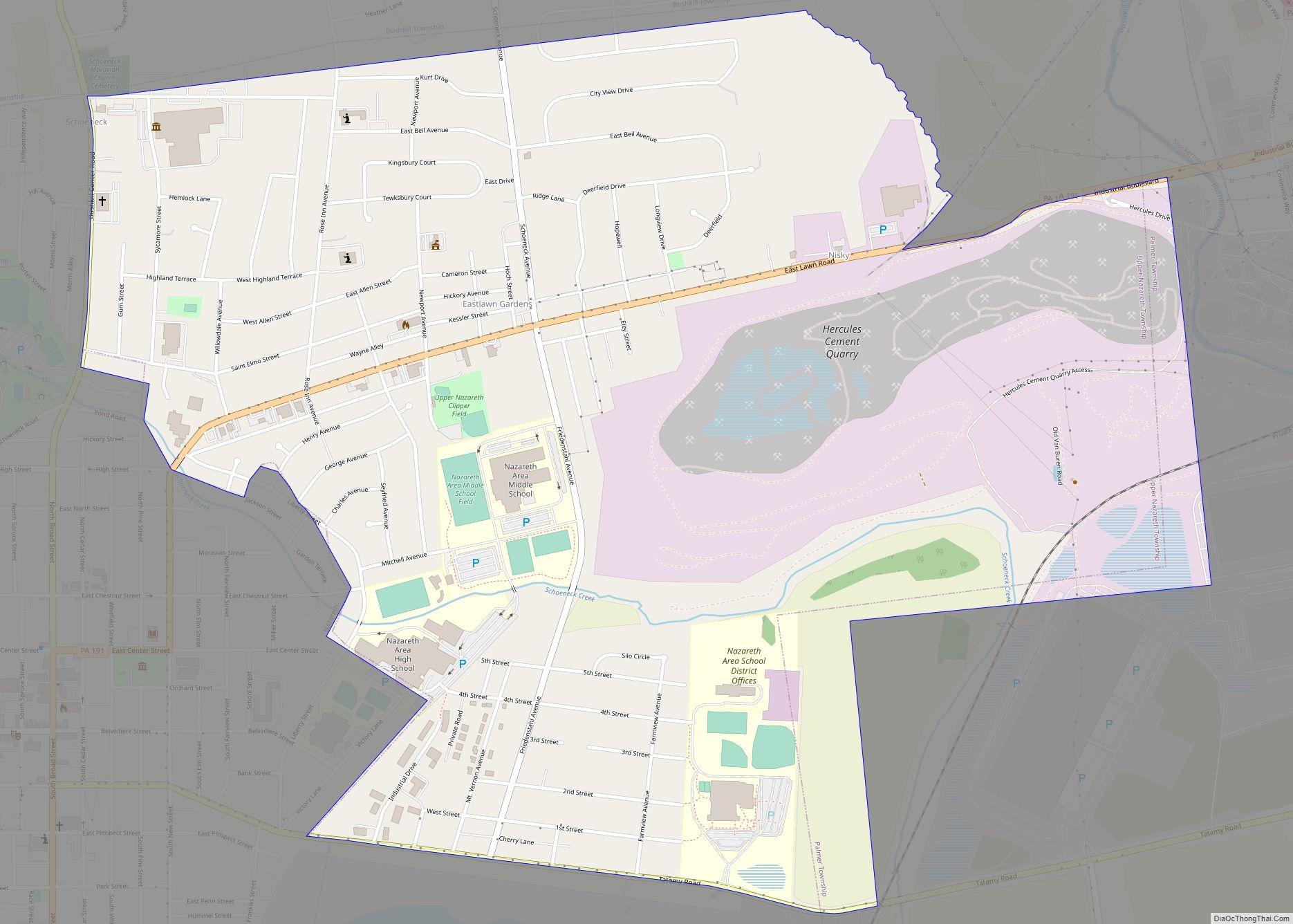
Stockertown Road Map
Stockertown city Satellite Map
Geography
Stockertown is located at 40°45′15″N 75°15′53″W / 40.75417°N 75.26472°W / 40.75417; -75.26472 (40.754064, -75.264775). According to the U.S. Census Bureau, the borough has a total area of 1.0 square mile (2.6 km), of which 1.0 square mile (2.6 km) is land and 0.99% is water.
Belts of limestone lie under a part of the borough that borders Palmer Township and the nearby borough of Tatamy. This along with Hercules Cement’s nearby quarrying makes these areas prone to sinkholes, (see Karst Topography) and led to the closure of a bridge that carried Bushkill Street, a state road, over the Bushkill Creek. This bridge remains closed as of 2018.
See also
Map of Pennsylvania State and its subdivision:- Adams
- Allegheny
- Armstrong
- Beaver
- Bedford
- Berks
- Blair
- Bradford
- Bucks
- Butler
- Cambria
- Cameron
- Carbon
- Centre
- Chester
- Clarion
- Clearfield
- Clinton
- Columbia
- Crawford
- Cumberland
- Dauphin
- Delaware
- Elk
- Erie
- Fayette
- Forest
- Franklin
- Fulton
- Greene
- Huntingdon
- Indiana
- Jefferson
- Juniata
- Lackawanna
- Lancaster
- Lawrence
- Lebanon
- Lehigh
- Luzerne
- Lycoming
- Mc Kean
- Mercer
- Mifflin
- Monroe
- Montgomery
- Montour
- Northampton
- Northumberland
- Perry
- Philadelphia
- Pike
- Potter
- Schuylkill
- Snyder
- Somerset
- Sullivan
- Susquehanna
- Tioga
- Union
- Venango
- Warren
- Washington
- Wayne
- Westmoreland
- Wyoming
- York
- Alabama
- Alaska
- Arizona
- Arkansas
- California
- Colorado
- Connecticut
- Delaware
- District of Columbia
- Florida
- Georgia
- Hawaii
- Idaho
- Illinois
- Indiana
- Iowa
- Kansas
- Kentucky
- Louisiana
- Maine
- Maryland
- Massachusetts
- Michigan
- Minnesota
- Mississippi
- Missouri
- Montana
- Nebraska
- Nevada
- New Hampshire
- New Jersey
- New Mexico
- New York
- North Carolina
- North Dakota
- Ohio
- Oklahoma
- Oregon
- Pennsylvania
- Rhode Island
- South Carolina
- South Dakota
- Tennessee
- Texas
- Utah
- Vermont
- Virginia
- Washington
- West Virginia
- Wisconsin
- Wyoming
