Bethlehem is a city in Northampton and Lehigh Counties in the Lehigh Valley region of eastern Pennsylvania, United States. As of the 2020 census, Bethlehem had a total population of 75,781. Among its total population as of 2020, 55,639 were in Northampton County and 19,343 were in Lehigh County. It is Pennsylvania’s seventh-most populous city. The city is located along the Lehigh River, a 109-mile-long (175 km) tributary of the Delaware River.
Bethlehem lies in the geographic center of the Lehigh Valley, a metropolitan region of 731 sq mi (1,890 km) with a population of 861,899 people as of the 2020 census that is Pennsylvania’s third-most populous metropolitan area and the 68th-most populated metropolitan area in the U.S. Smaller than Allentown but larger than Easton, Bethlehem is the Lehigh Valley’s second-most populous city. Bethlehem borders Allentown to its west and is 48 miles (77 km) north of Philadelphia and 72 miles (116 km) west of New York City.
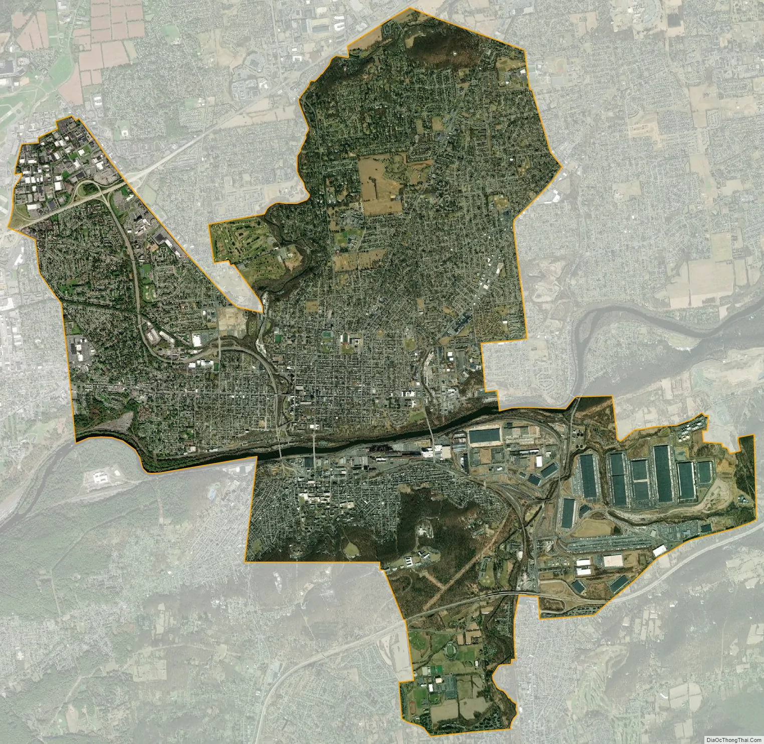
There are four sections to the city: central Bethlehem, the south side, the east side, and the west side. Each of these sections blossomed at different times in the city’s development and each contains areas recognized under the National Register of Historic Places. Norfolk Southern Railway’s Lehigh Line, formerly the main line of the Lehigh Valley Railroad, runs through Bethlehem heading east to Easton and across the Delaware River to Phillipsburg, New Jersey. The Norfolk Southern Railway’s Reading Line runs through Bethlehem and west to Allentown and Reading.
Bethlehem has a long historical relationship with the celebration of Christmas. The city was christened as Bethlehem on Christmas Eve 1741 by Nicolaus Zinzendorf, a Moravian bishop. In 1747, Bethlehem was the first U.S. city to feature a decorated Christmas tree. On December 7, 1937, at a grand ceremony during the Great Depression, the city adopted the nickname Christmas City USA in a large ceremony. It is one of several Lehigh Valley locations, including Emmaus, Egypt, Allentown’s Jordan Creek, and Nazareth whose names were inspired by locations referenced in the Bible.
| Name: | Bethlehem city |
|---|---|
| LSAD Code: | 25 |
| LSAD Description: | city (suffix) |
| State: | Pennsylvania |
| County: | Lehigh County, Northampton County |
| Founded: | December 24, 1741 |
| Elevation: | 360 ft (109.728 m) |
| Land Area: | 19.11 sq mi (49.51 km²) |
| Water Area: | 0.34 sq mi (0.89 km²) |
| Population Density: | 3,964.48/sq mi (1,530.67/km²) |
| FIPS code: | 4206088 |
| Website: | www.bethlehem-pa.gov |
Online Interactive Map
Click on ![]() to view map in "full screen" mode.
to view map in "full screen" mode.
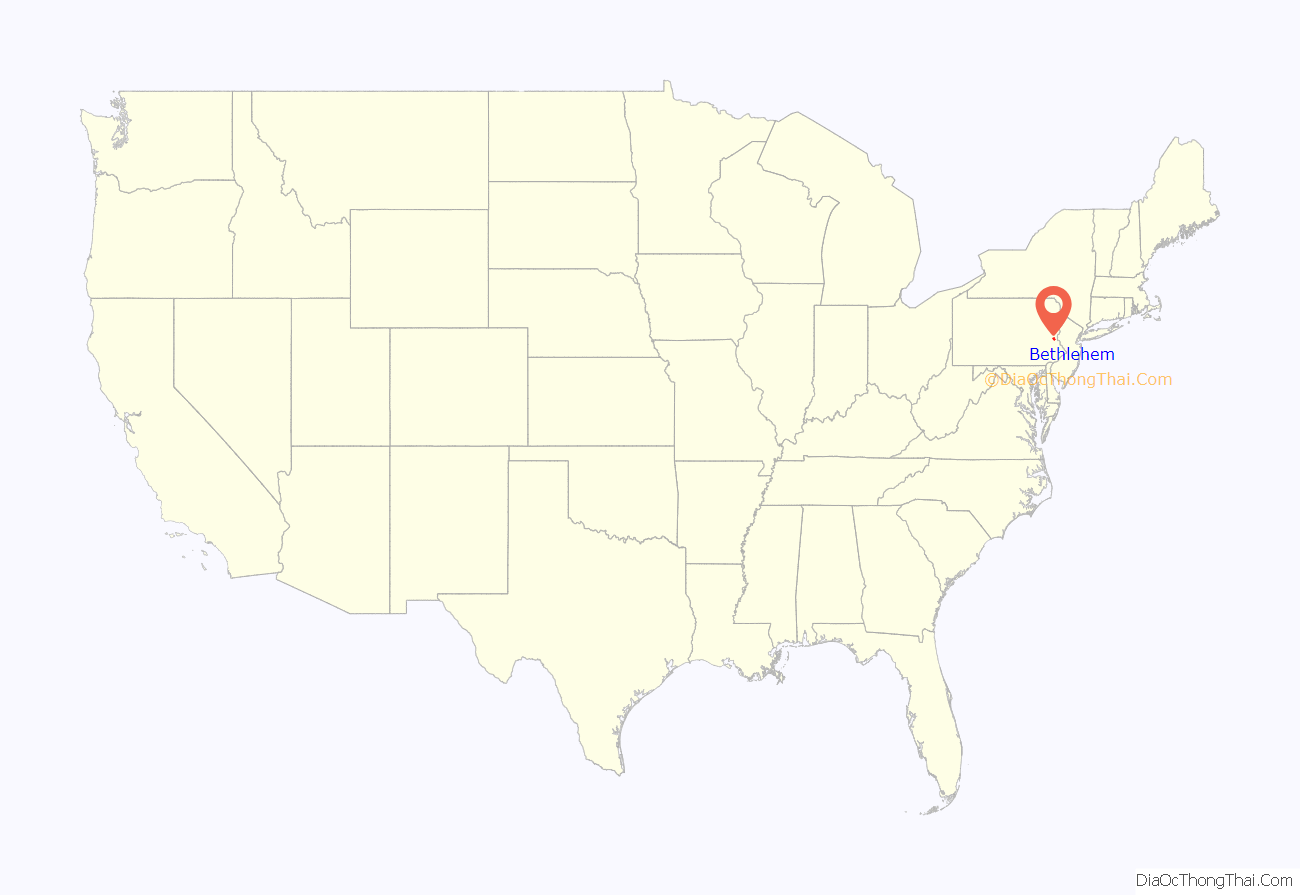
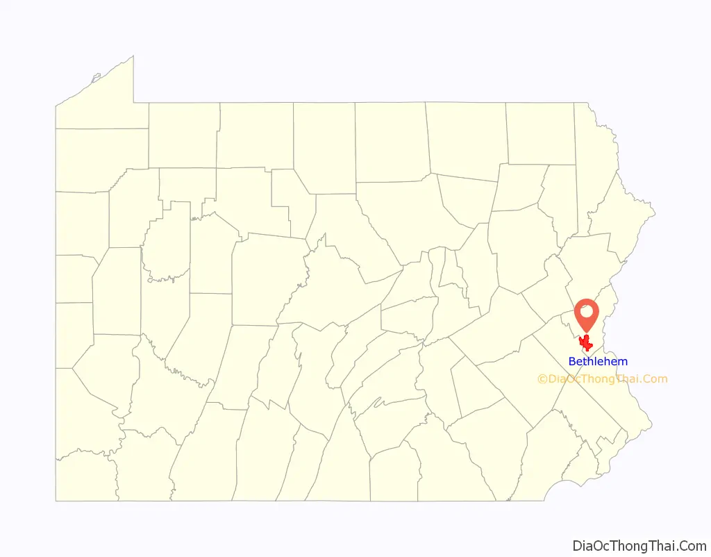
Bethlehem location map. Where is Bethlehem city?
History
Settlement
The areas along the Delaware River and its tributaries in eastern Pennsylvania were long inhabited by indigenous peoples of various cultures. By the time of European contact, these areas were the historic territory of the Algonquian-speaking Lenape Nation, which had three main divisions, known by the dialects, the Unami, Unalachtigo, and Munsee. They traded with the Dutch and then English colonists in the mid-Atlantic area, in territory ranging from what became Connecticut, Long Island, and the lower Hudson Valley in New York, New Jersey, Pennsylvania, Delaware and Maryland.
18th century
On April 2, 1741, William Allen, a wealthy Philadelphia merchant and political figure, who later founded the city of Allentown, deeded 500 acres along the banks of the Monocacy Creek and Lehigh River to the Moravian Church. On Christmas Eve of that year, David Nitschmann and Nicolaus Zinzendorf, leading a small group of Moravians, founded the mission community of Bethlehem at the confluence of the Monocacy and Lehigh rivers. They came to set up missionary communities among the Native Americans and unchurched German-speaking Christians. They named the settlement after the Biblical town Bethlehem of Judea, said to be the birthplace of Jesus. “Count Zinzendorf said, “Brothers, how more fittingly could we call our new home than to name it in honor of the spot where the event we now commemorate took place. We will call this place Bethlehem.’ And so was Bethlehem named after the birthplace of the Man of Peace.”
Bethlehem was started as a typical Moravian Settlement Congregation, where the Church owned all the property. Until the 1850s, officially only members of the Moravian Church were permitted to lease land plots in Bethlehem. But a member of a group of families who were Huguenots also settled in Bethlehem. In the late 1700s, Bethlehem established grist and saw mills, known as Calvin’s Mills. The historic Brethren’s House, Sisters’ House, Widows’ House, and Gemeinhaus (Congregation House), with the Old Chapel, are remnants of this period of communal living.
The Moravians ministered to the regional Lenape Native Americans through their mission in the area, as well as further east in the New York colony. In the historic Bethlehem God’s Acre cemetery, converted Lenape were buried alongside the Moravians. In 1762, Bethlehem built the first water-works in America to pump water for public use.
In the autumn of 1777, during the American Revolutionary War, many patriots fled from Philadelphia to Bethlehem and the surrounding area as the British advanced in the east. The Marquis de Lafayette recovered from an injury received at the Battle of Brandywine in Bethlehem. Several of the most prominent members of the Continental Congress fled north to Bethlehem before the congress eventually reconvened in Lancaster. Before, during and after the American Revolution, Bethlehem was visited by George Washington and his wife Martha, Alexander Hamilton, Benjamin Franklin, John Adams, Samuel Adams, John Hancock, and the Marquis de Lafayette. On September 22, 1777, fourteen members of the Continental Congress signed the Moravian Sun Inn register and stayed overnight.
George Washington stored his personal effects at the farm of James Burnside in Bethlehem; as of 1998, this is operated as a historical museum known as James Burnside Plantation.
19th century
In 1845, the prosperous village was incorporated into a free borough in the County of Northampton. After the Unity Synod of 1848, Bethlehem became the headquarters of the Northern Province of the Moravian Church in North America. On March 27, 1900, the Bach Choir of Bethlehem presented the United States debut of German Lutheran composer Johann Sebastian Bach’s Mass in B Minor (1749) in the city’s Central Moravian Church. Bethlehem was one of the four leading Moravian communities in the Northeastern United States (Emmaus, Lititz and Nazareth, each in Pennsylvania, were the three others).
Bethlehem Township has remained a separate political entity. Even after the merger of the two boroughs, the township initially provided a count for the original sections.
In 1865, after the Civil War, the Borough of South Bethlehem was formed. In 1886, the Borough of West Bethlehem (in Lehigh County) was formed. In 1904, the Boroughs of West Bethlehem (in Lehigh County) and Bethlehem (in Northampton County) merged.
20th century
In 1917, the Borough of South Bethlehem and Bethlehem merged to become the City of Bethlehem. Bethlehem Steel executive Archibald Johnston (1865-1948) was elected as the new city’s first mayor.
Bethlehem Road Map
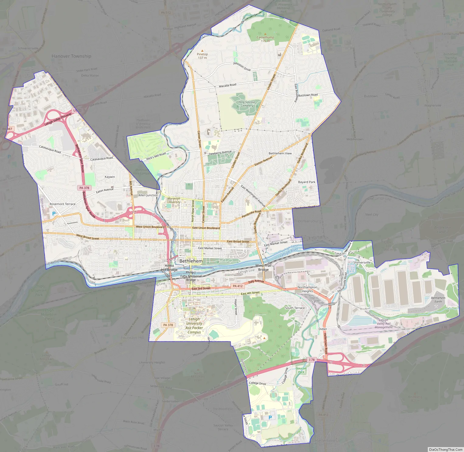
Bethlehem city Satellite Map
Geography
According to the U.S. Census Bureau, the city has a total area of 19.4 square miles (50 km), of which 19.3 square miles (50 km) is land and 0.2 square miles (0.52 km) (0.88%) is water. Bethlehem is approximately 50 miles (80 km) north of Philadelphia and about 80 miles (130 km) west of New York City. Because large volumes of water were required in the steelmaking process, the city purchased 22,000 acres (8,900 ha) of land in the Pocono Mountains, where its water is stored in reservoirs. The Lehigh River, a tributary of the Delaware, flows right through Bethlehem. The Monocacy and Saucon creeks empty into the Lehigh in Bethlehem.
Climate
Bethlehem has a humid continental climate (Dfa). Summers are typically hot and humid, fall and spring are generally mild, and winter is cold. Precipitation is distributed fairly uniformly throughout the year, with thunderstorms in the summer, showers in spring and fall, and snow in winter. The average high temperature varies widely, from 36 °F (2 °C) in January to 84 °F (29 °C) in July. The highest recorded temperature was 105 °F (41 °C), while the lowest recorded temperature was −16 °F (−27 °C).
Bethlehem falls under the USDA 6b Plant hardiness zone.
Neighborhoods
Bethlehem is divided into five main areas: Center City, West Side, East Side, South Side, and North Side. The West Side is located in Lehigh County and the other five neighborhoods are in Northampton County.
- Center City is bounded by Monocacy Creek to the west, Dewberry Ave. to the North , and Stefko Boulevard to the east.
- The West Side begins at the city’s western border with Allentown and continues east to the Monocacy Creek and north to Hanover Township.
- The Mount Airy Neighborhood is bounded by Pennsylvania Ave to the west, West Broad St to the north, 2nd Avenue to the east, and the Lehigh River to the south.
- The East Side is bordered to the west by Center City and to the east by Bethlehem Township and Freemansburg. The East Side includes the Pembroke Village area.
- The South Side’s borders are Fountain Hill to the west, the Lehigh River to the north, South Mountain to the south, and Hellertown to the east.
- The North Side begins above Dewberry Ave and extends up Route 191 (Linden Ave) to Oakland Road, where the city and township divide is. Northside extends as far West as Monocacy Creek on Macada Road and as far East as Easton Ave and Stefko Blvd. intersection. ‘North Side’ refers more to a cultural division, than an actual boundary.
See also
Map of Pennsylvania State and its subdivision:- Adams
- Allegheny
- Armstrong
- Beaver
- Bedford
- Berks
- Blair
- Bradford
- Bucks
- Butler
- Cambria
- Cameron
- Carbon
- Centre
- Chester
- Clarion
- Clearfield
- Clinton
- Columbia
- Crawford
- Cumberland
- Dauphin
- Delaware
- Elk
- Erie
- Fayette
- Forest
- Franklin
- Fulton
- Greene
- Huntingdon
- Indiana
- Jefferson
- Juniata
- Lackawanna
- Lancaster
- Lawrence
- Lebanon
- Lehigh
- Luzerne
- Lycoming
- Mc Kean
- Mercer
- Mifflin
- Monroe
- Montgomery
- Montour
- Northampton
- Northumberland
- Perry
- Philadelphia
- Pike
- Potter
- Schuylkill
- Snyder
- Somerset
- Sullivan
- Susquehanna
- Tioga
- Union
- Venango
- Warren
- Washington
- Wayne
- Westmoreland
- Wyoming
- York
- Alabama
- Alaska
- Arizona
- Arkansas
- California
- Colorado
- Connecticut
- Delaware
- District of Columbia
- Florida
- Georgia
- Hawaii
- Idaho
- Illinois
- Indiana
- Iowa
- Kansas
- Kentucky
- Louisiana
- Maine
- Maryland
- Massachusetts
- Michigan
- Minnesota
- Mississippi
- Missouri
- Montana
- Nebraska
- Nevada
- New Hampshire
- New Jersey
- New Mexico
- New York
- North Carolina
- North Dakota
- Ohio
- Oklahoma
- Oregon
- Pennsylvania
- Rhode Island
- South Carolina
- South Dakota
- Tennessee
- Texas
- Utah
- Vermont
- Virginia
- Washington
- West Virginia
- Wisconsin
- Wyoming