Summerville is a borough in Jefferson County, Pennsylvania, United States. The population was 528 at the 2010 census.
| Name: | Summerville borough |
|---|---|
| LSAD Code: | 21 |
| LSAD Description: | borough (suffix) |
| State: | Pennsylvania |
| County: | Jefferson County |
| Incorporated: | March 15, 1887 |
| Elevation: | 1,152 ft (351 m) |
| Total Area: | 0.62 sq mi (1.61 km²) |
| Land Area: | 0.59 sq mi (1.54 km²) |
| Water Area: | 0.03 sq mi (0.06 km²) |
| Total Population: | 504 |
| Population Density: | 812.33/sq mi (313.64/km²) |
| ZIP code: | 15864 |
| Area code: | 814 |
| FIPS code: | 4275168 |
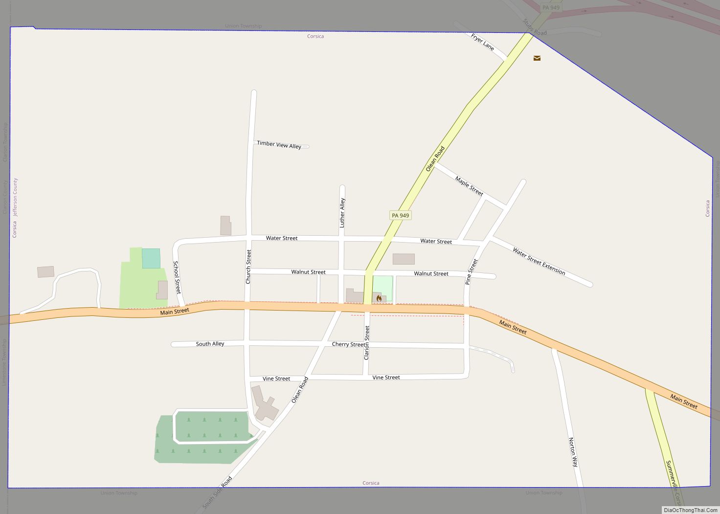
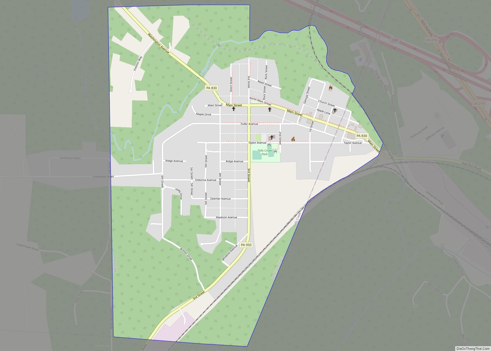
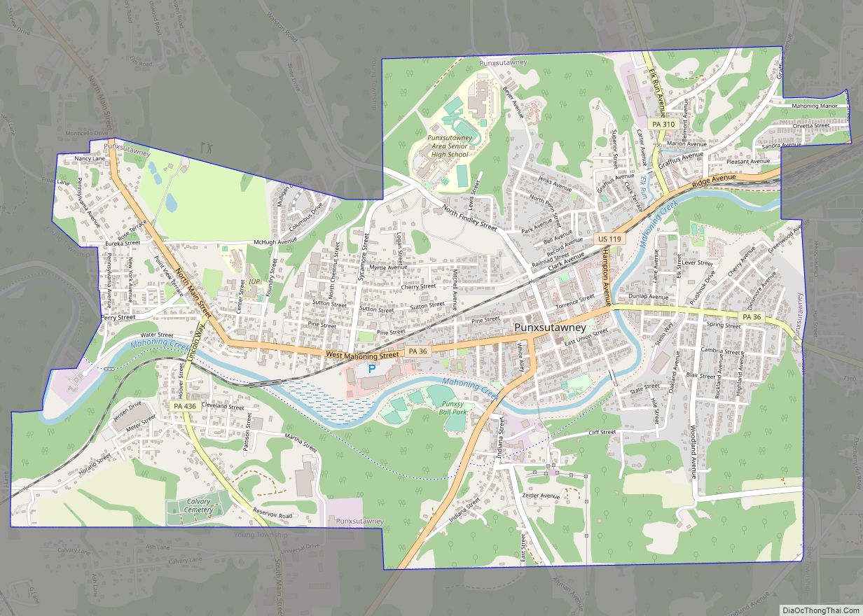
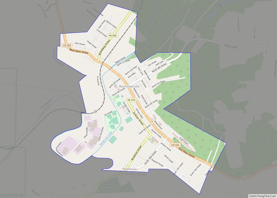
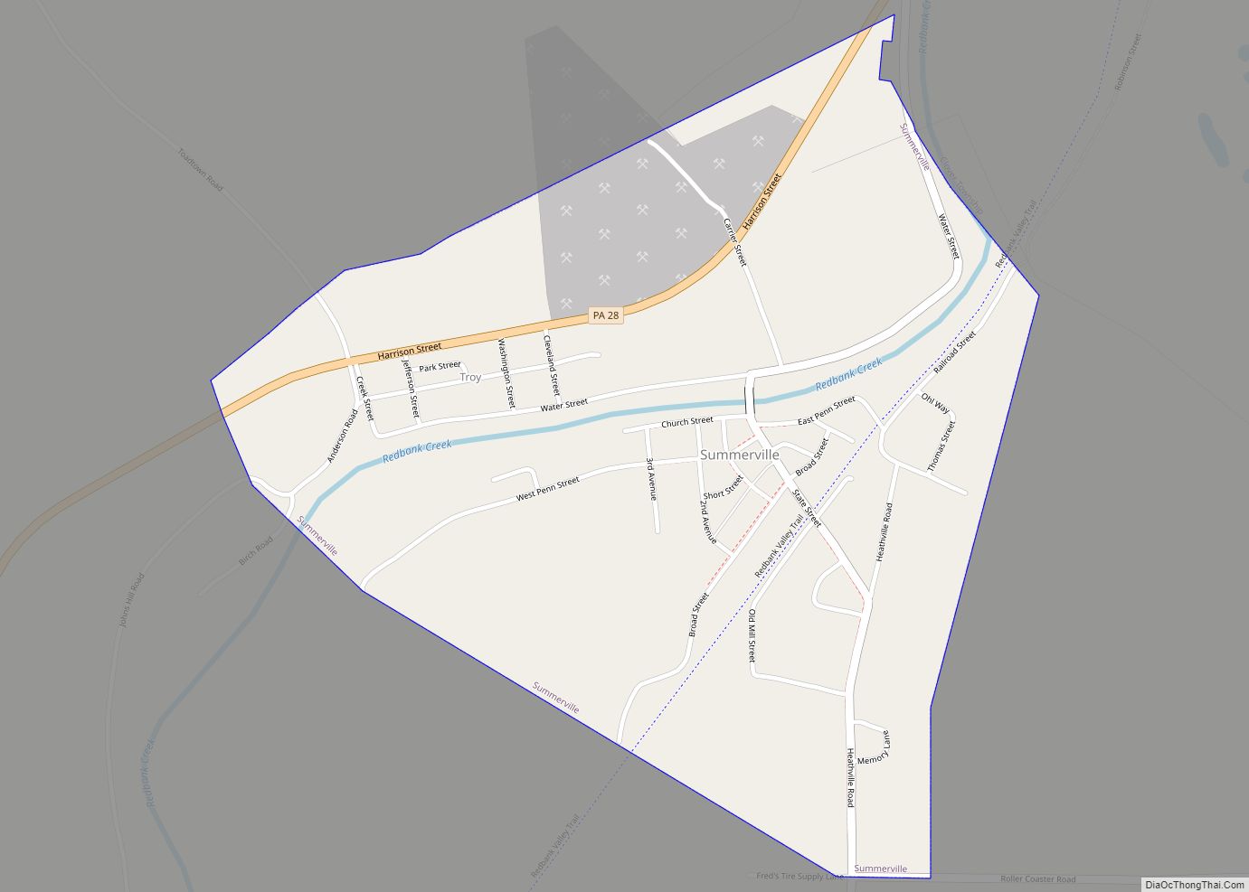
Online Interactive Map
Click on ![]() to view map in "full screen" mode.
to view map in "full screen" mode.
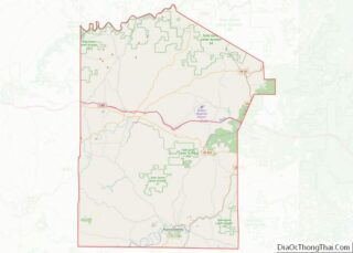
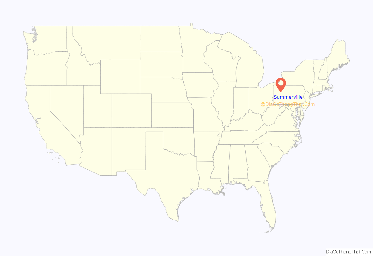
Summerville location map. Where is Summerville borough?
History
It was named after Summers Baldwin, the first settler in the area. It was formerly known as “Troy”. The borough was incorporated in 1887.
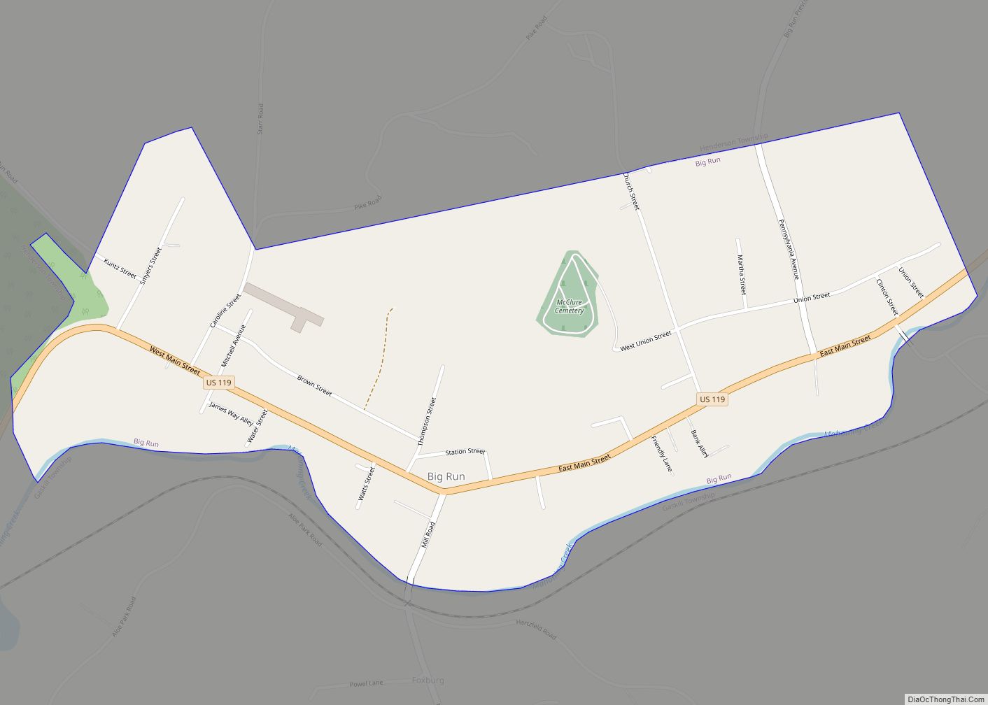
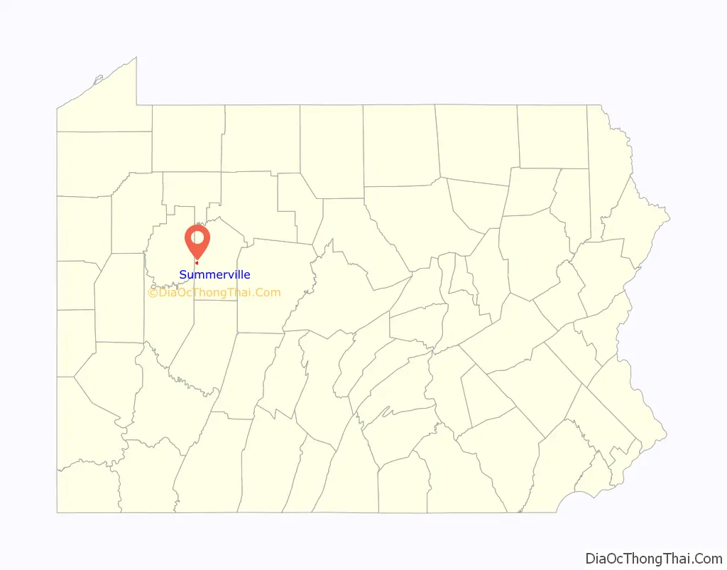
Summerville Road Map
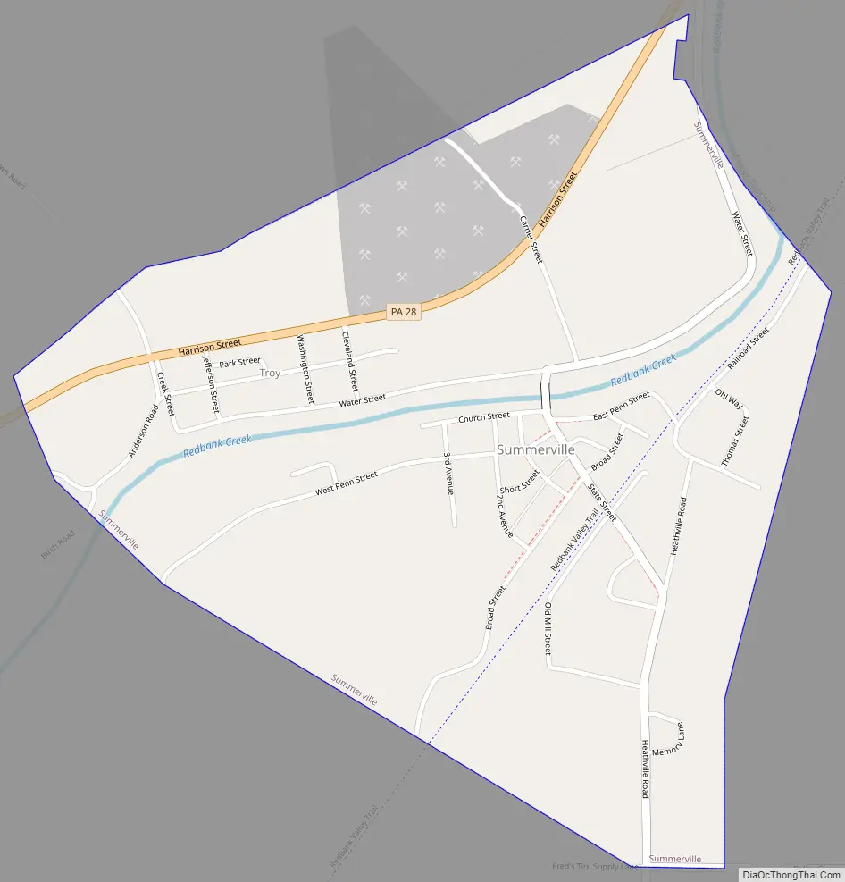
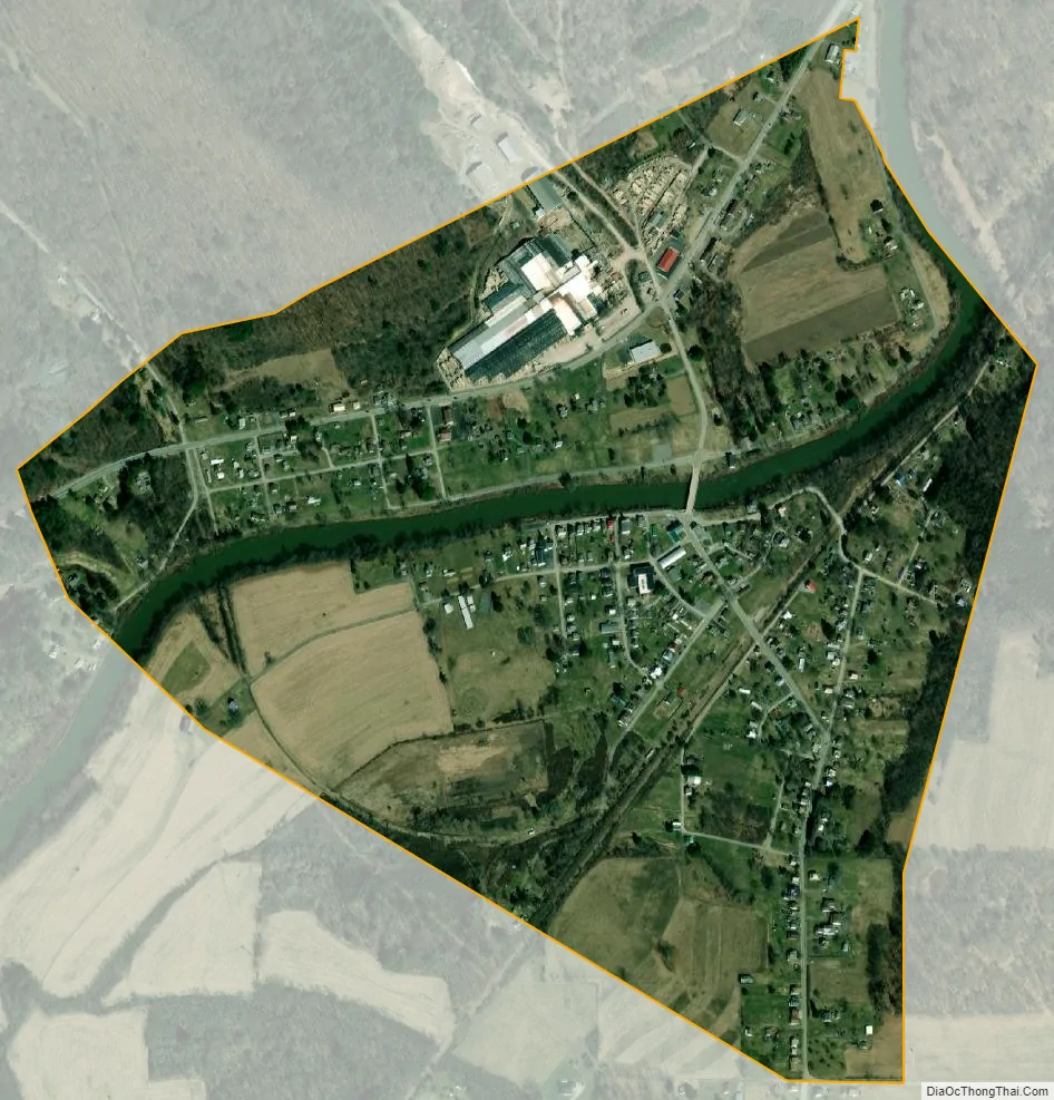
Summerville city Satellite Map
Geography
Summerville is located in western Jefferson County at 41°06′59″N 79°11′18″W / 41.116428°N 79.188391°W / 41.116428; -79.188391, in the valley of Redbank Creek. Pennsylvania Route 28 (Harrison Street) passes through the north side of the borough, leading northeast up the creek valley 7 miles (11 km) to Brookville, the county seat, and southwest 12 miles (19 km) to New Bethlehem.
According to the United States Census Bureau, Summerville has a total area of 0.62 square miles (1.6 km), of which 0.02 square miles (0.06 km), or 4.02%, are water.
See also
Map of Pennsylvania State and its subdivision:- Adams
- Allegheny
- Armstrong
- Beaver
- Bedford
- Berks
- Blair
- Bradford
- Bucks
- Butler
- Cambria
- Cameron
- Carbon
- Centre
- Chester
- Clarion
- Clearfield
- Clinton
- Columbia
- Crawford
- Cumberland
- Dauphin
- Delaware
- Elk
- Erie
- Fayette
- Forest
- Franklin
- Fulton
- Greene
- Huntingdon
- Indiana
- Jefferson
- Juniata
- Lackawanna
- Lancaster
- Lawrence
- Lebanon
- Lehigh
- Luzerne
- Lycoming
- Mc Kean
- Mercer
- Mifflin
- Monroe
- Montgomery
- Montour
- Northampton
- Northumberland
- Perry
- Philadelphia
- Pike
- Potter
- Schuylkill
- Snyder
- Somerset
- Sullivan
- Susquehanna
- Tioga
- Union
- Venango
- Warren
- Washington
- Wayne
- Westmoreland
- Wyoming
- York
- Alabama
- Alaska
- Arizona
- Arkansas
- California
- Colorado
- Connecticut
- Delaware
- District of Columbia
- Florida
- Georgia
- Hawaii
- Idaho
- Illinois
- Indiana
- Iowa
- Kansas
- Kentucky
- Louisiana
- Maine
- Maryland
- Massachusetts
- Michigan
- Minnesota
- Mississippi
- Missouri
- Montana
- Nebraska
- Nevada
- New Hampshire
- New Jersey
- New Mexico
- New York
- North Carolina
- North Dakota
- Ohio
- Oklahoma
- Oregon
- Pennsylvania
- Rhode Island
- South Carolina
- South Dakota
- Tennessee
- Texas
- Utah
- Vermont
- Virginia
- Washington
- West Virginia
- Wisconsin
- Wyoming