Telford is a borough in Bucks and Montgomery counties in the U.S. state of Pennsylvania. The population was 4,872 at the time of the 2010 census. Of this, 2,665 were in Montgomery County, and 2,207 were in Bucks County.
| Name: | Telford borough |
|---|---|
| LSAD Code: | 21 |
| LSAD Description: | borough (suffix) |
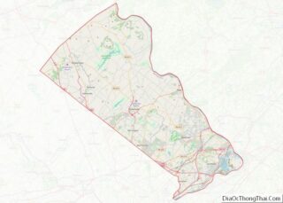
| State: | Pennsylvania |
| County: | Bucks County, Montgomery County |
| Incorporated: | 1886 |
| Elevation: | 423 ft (129 m) |
| Total Area: | 1.01 sq mi (2.61 km²) |
| Land Area: | 1.01 sq mi (2.61 km²) |
| Water Area: | 0.00 sq mi (0.00 km²) |
| Total Population: | 4,872 |
| Population Density: | 4,859.98/sq mi (1,876.06/km²) |
| ZIP code: | 18969 |
| Area code: | 215, 267, and 445 |
| FIPS code: | 4276304 |
| Website: | www.telfordborough.org |
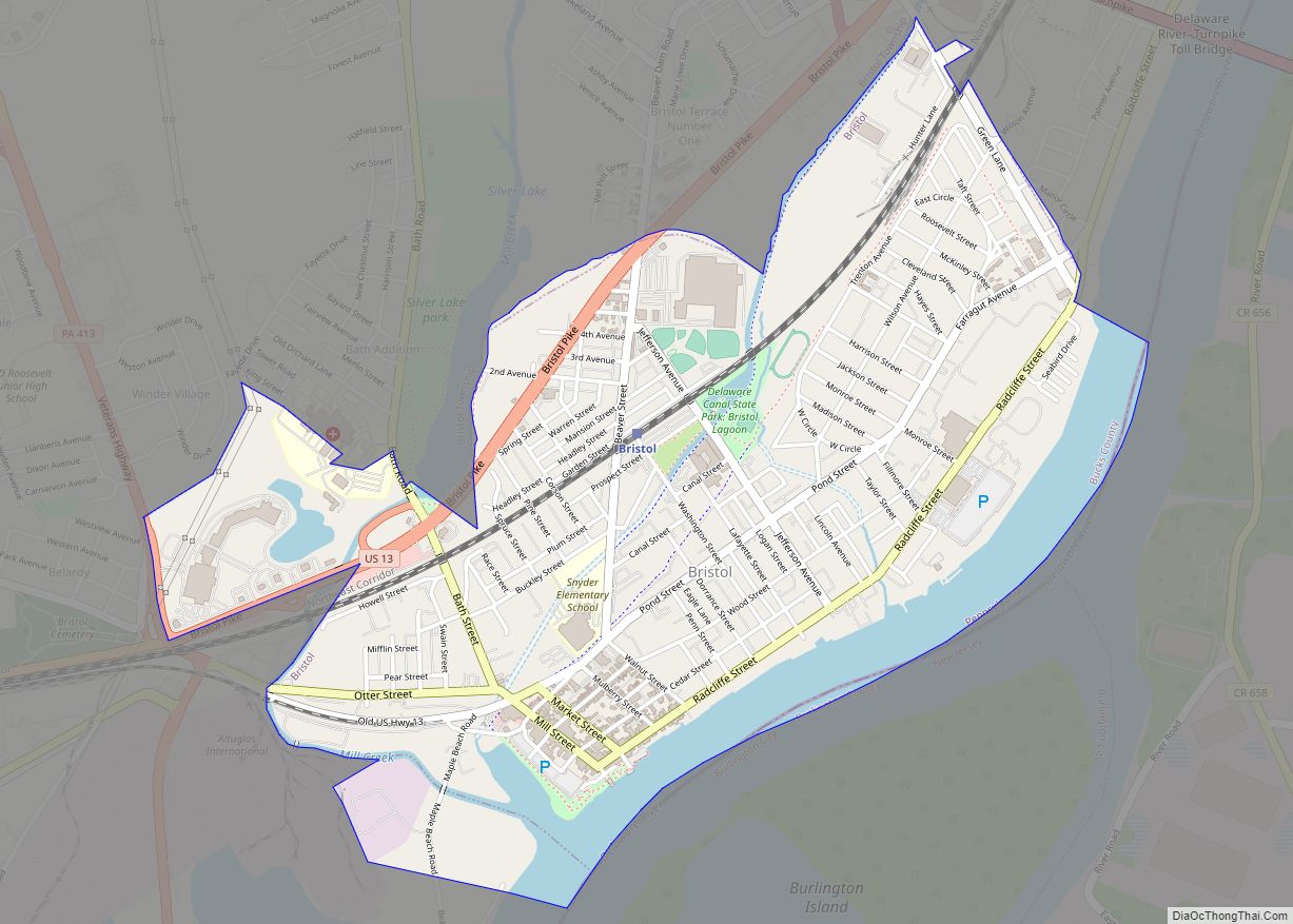
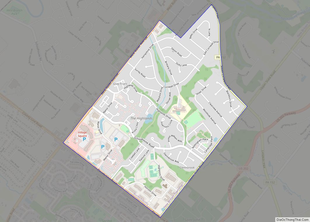
Online Interactive Map
Click on ![]() to view map in "full screen" mode.
to view map in "full screen" mode.
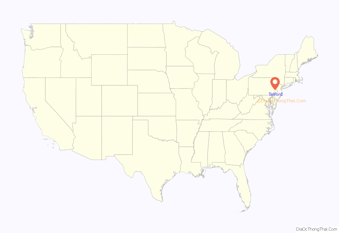
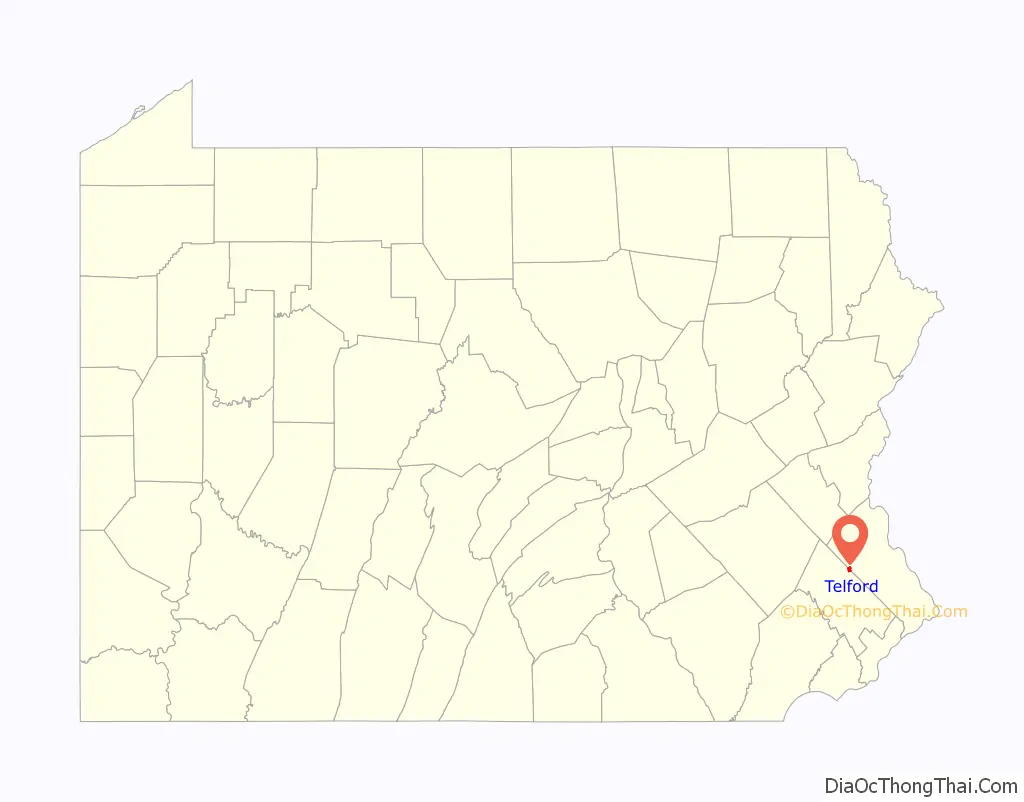
Telford location map. Where is Telford borough?
History
Founding
Originally inhabited by the Lenape people, the area surrounding Telford began to be settled in 1719 by Mennonites from the Palatinate of the Rhine. In 1857, the town known as County Line (the area had previously been known as Hendrick’s Blacksmith) changed its name to Telford after the North Pennsylvania Railroad Company (later absorbed into the Reading Railroad) named its new station there after civil engineer Thomas Telford.
Incorporation as a borough
The Borough of Telford was incorporated by decree of the Court of Quarter Sessions of Bucks County of November 10, 1886. A decade later, The Borough of West Telford was incorporated by decree of the Court of Quarter Sessions of Montgomery County of December 27, 1897. In 1934, the respective boroughs entered into an agreement for consolidation, and an election was held on this question on November 6, 1934. The voters of both boroughs approved the agreement, and on January 11, 1935, Governor Gifford Pinchot issued letters patent consolidating the two boroughs into the current Borough of Telford.
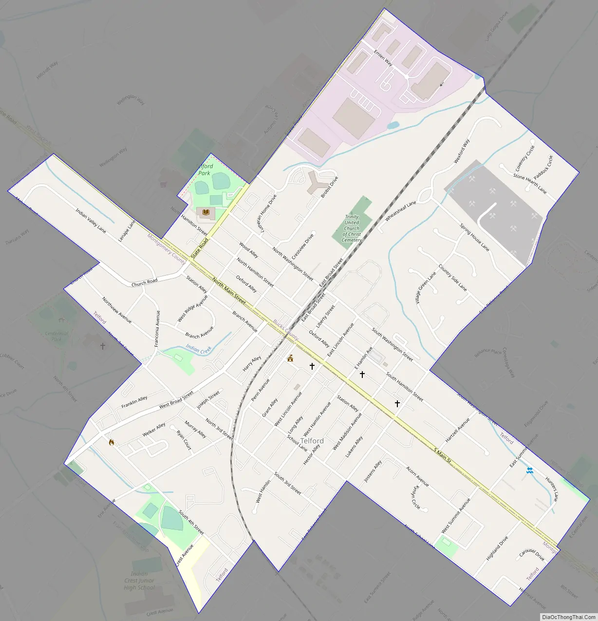
Telford Road Map
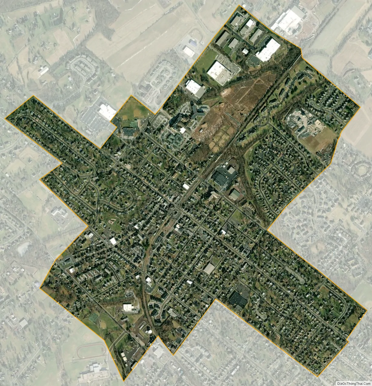
Telford city Satellite Map
Geography
Telford is located at 40°19′29″N 75°19′41″W / 40.32472°N 75.32806°W / 40.32472; -75.32806 (40.324786, -75.328045), elevation 449 feet (136.9 m).
According to the United States Census Bureau, the borough has a total area of 1.0 square mile (2.6 km²), all land.
See also
Map of Pennsylvania State and its subdivision:- Adams
- Allegheny
- Armstrong
- Beaver
- Bedford
- Berks
- Blair
- Bradford
- Bucks
- Butler
- Cambria
- Cameron
- Carbon
- Centre
- Chester
- Clarion
- Clearfield
- Clinton
- Columbia
- Crawford
- Cumberland
- Dauphin
- Delaware
- Elk
- Erie
- Fayette
- Forest
- Franklin
- Fulton
- Greene
- Huntingdon
- Indiana
- Jefferson
- Juniata
- Lackawanna
- Lancaster
- Lawrence
- Lebanon
- Lehigh
- Luzerne
- Lycoming
- Mc Kean
- Mercer
- Mifflin
- Monroe
- Montgomery
- Montour
- Northampton
- Northumberland
- Perry
- Philadelphia
- Pike
- Potter
- Schuylkill
- Snyder
- Somerset
- Sullivan
- Susquehanna
- Tioga
- Union
- Venango
- Warren
- Washington
- Wayne
- Westmoreland
- Wyoming
- York
- Alabama
- Alaska
- Arizona
- Arkansas
- California
- Colorado
- Connecticut
- Delaware
- District of Columbia
- Florida
- Georgia
- Hawaii
- Idaho
- Illinois
- Indiana
- Iowa
- Kansas
- Kentucky
- Louisiana
- Maine
- Maryland
- Massachusetts
- Michigan
- Minnesota
- Mississippi
- Missouri
- Montana
- Nebraska
- Nevada
- New Hampshire
- New Jersey
- New Mexico
- New York
- North Carolina
- North Dakota
- Ohio
- Oklahoma
- Oregon
- Pennsylvania
- Rhode Island
- South Carolina
- South Dakota
- Tennessee
- Texas
- Utah
- Vermont
- Virginia
- Washington
- West Virginia
- Wisconsin
- Wyoming