Upland is a borough in Delaware County, Pennsylvania, United States. Upland is governed by an elected seven-member borough council. The population was 3,239 at the 2010 census, up from 2,974 at the 2000 census.
| Name: | Upland borough |
|---|---|
| LSAD Code: | 21 |
| LSAD Description: | borough (suffix) |
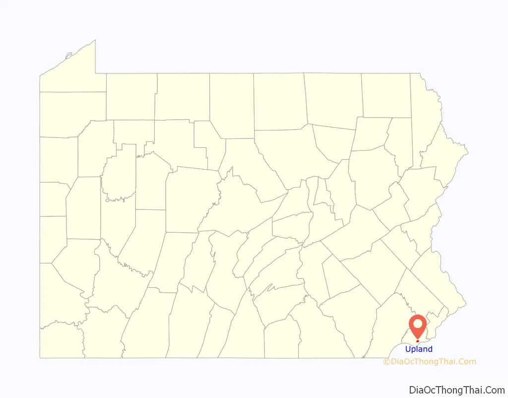
| State: | Pennsylvania |
| County: | Delaware County |
| Elevation: | 26 ft (8 m) |
| Total Area: | 0.65 sq mi (1.68 km²) |
| Land Area: | 0.65 sq mi (1.68 km²) |
| Water Area: | 0.00 sq mi (0.00 km²) |
| Total Population: | 3,239 |
| Population Density: | 5,124.81/sq mi (1,978.68/km²) |
| ZIP code: | 19013, 19015 |
| Area code: | 610 |
| FIPS code: | 4278712 |
| GNISfeature ID: | 1190221 |
| Website: | uplandboro.org |
Online Interactive Map
Click on ![]() to view map in "full screen" mode.
to view map in "full screen" mode.
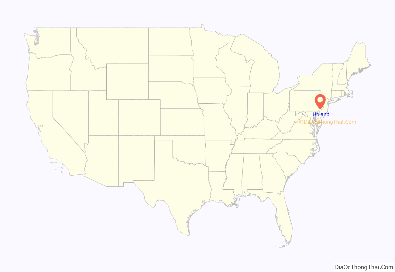
Upland location map. Where is Upland borough?
History
The first European settlers in this area were from the Swedish colony of New Sweden. They arrived in the area in 1643 and built a permanent settlement at Tinicum Island. Although the name literally means “up land”, it also reflects the Swedish province of Uppland.
The settlement of Upland was built around the point where Chester Creek flows into the Delaware River, which is part of the city of Chester (formerly also called “Upland”). The colonists had plantations devoted to the cultivation of tobacco for export to Sweden. Upland was reflected on the early map of New Sweden made by Peter Lindstrom in 1654.
During this period, three governments were competing for colonial supremacy in the mid-Atlantic coastal area: the Dutch, the Swedish and the English. The Swedish settlement was incorporated into Dutch New Netherland on September 15, 1655. In 1664, the English captured New Netherland from the Dutch. In 1676, the Duke of York’s laws were promulgated as the rule of conduct on the Delaware River, and courts were established, one of which was the Upland.
By the mid-1800s, the Upland Mills were built along Chester Creek in Upland by the wealthy textile manufacturer John Price Crozer. The mills produced clothing for the US Army and other customers.
The borough of Upland, as opposed to the historic town of Upland (which was later renamed Chester), was founded May 24, 1869.
The John P. Crozer II Mansion, George K. Crozer Mansion, Caleb Pusey House, Old Main of the Crozer Theological Seminary, and Pusey-Crozier Mill Historic District are listed on the National Register of Historic Places. The Pusey House is one of the oldest buildings in the United States, completed in 1696, and one of the only extant buildings known to have been visited by William Penn (in addition to the Merion Friends Meeting House).
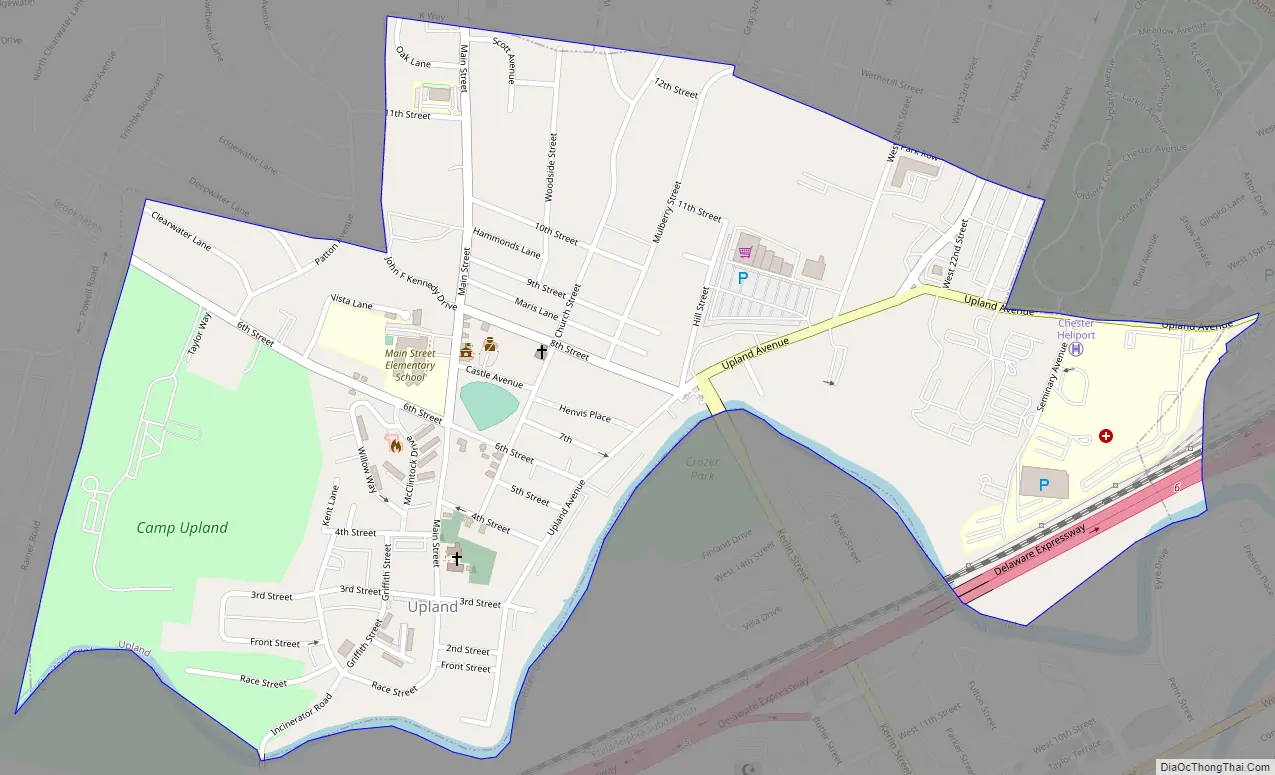
Upland Road Map
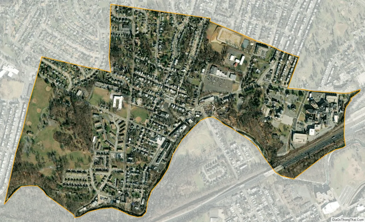
Upland city Satellite Map
Geography
Upland is located in southern Delaware County at 39°51′24″N 75°22′46″W / 39.85667°N 75.37944°W / 39.85667; -75.37944 (39.856762, -75.379429). It is bordered to the west by Chester Township, to the north by the boroughs of Brookhaven and Parkside, and to the northeast, east, and south by the city of Chester. Chester Creek, a southeastward-flowing tributary of the Delaware River, forms the southern boundary of the borough.
According to the United States Census Bureau, the borough has a total area of 0.65 square miles (1.68 km), all land.
See also
Map of Pennsylvania State and its subdivision:- Adams
- Allegheny
- Armstrong
- Beaver
- Bedford
- Berks
- Blair
- Bradford
- Bucks
- Butler
- Cambria
- Cameron
- Carbon
- Centre
- Chester
- Clarion
- Clearfield
- Clinton
- Columbia
- Crawford
- Cumberland
- Dauphin
- Delaware
- Elk
- Erie
- Fayette
- Forest
- Franklin
- Fulton
- Greene
- Huntingdon
- Indiana
- Jefferson
- Juniata
- Lackawanna
- Lancaster
- Lawrence
- Lebanon
- Lehigh
- Luzerne
- Lycoming
- Mc Kean
- Mercer
- Mifflin
- Monroe
- Montgomery
- Montour
- Northampton
- Northumberland
- Perry
- Philadelphia
- Pike
- Potter
- Schuylkill
- Snyder
- Somerset
- Sullivan
- Susquehanna
- Tioga
- Union
- Venango
- Warren
- Washington
- Wayne
- Westmoreland
- Wyoming
- York
- Alabama
- Alaska
- Arizona
- Arkansas
- California
- Colorado
- Connecticut
- Delaware
- District of Columbia
- Florida
- Georgia
- Hawaii
- Idaho
- Illinois
- Indiana
- Iowa
- Kansas
- Kentucky
- Louisiana
- Maine
- Maryland
- Massachusetts
- Michigan
- Minnesota
- Mississippi
- Missouri
- Montana
- Nebraska
- Nevada
- New Hampshire
- New Jersey
- New Mexico
- New York
- North Carolina
- North Dakota
- Ohio
- Oklahoma
- Oregon
- Pennsylvania
- Rhode Island
- South Carolina
- South Dakota
- Tennessee
- Texas
- Utah
- Vermont
- Virginia
- Washington
- West Virginia
- Wisconsin
- Wyoming


