Valencia is a borough in Butler County, Pennsylvania, United States. The population was 551 at the 2010 census.
| Name: | Valencia borough |
|---|---|
| LSAD Code: | 21 |
| LSAD Description: | borough (suffix) |
| State: | Pennsylvania |
| County: | Butler County |
| Total Area: | 0.34 sq mi (0.88 km²) |
| Land Area: | 0.34 sq mi (0.88 km²) |
| Water Area: | 0.00 sq mi (0.00 km²) |
| Total Population: | 537 |
| Population Density: | 1,579.41/sq mi (610.38/km²) |
| Area code: | 724 |
| FIPS code: | 4279504 |
Online Interactive Map
Click on ![]() to view map in "full screen" mode.
to view map in "full screen" mode.
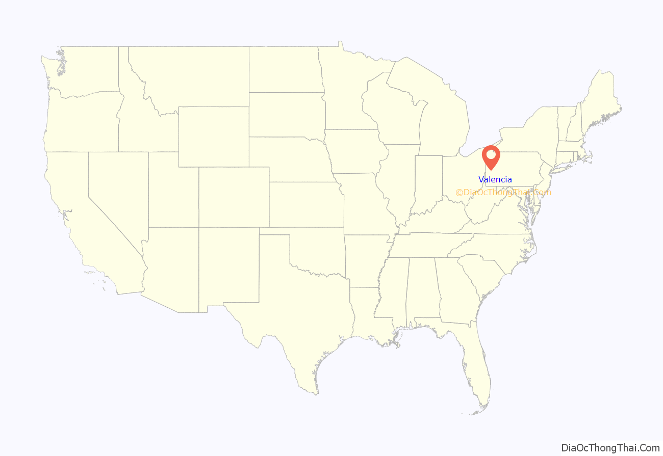
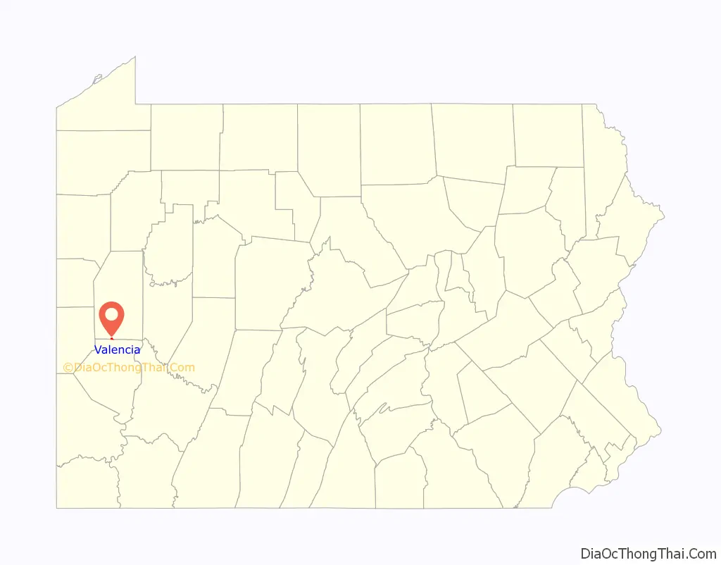
Valencia location map. Where is Valencia borough?
History
The original name of the town was Brookside, and subsequently Sunnyside in the 1890s, but was changed for the railroad, by the time of its incorporation as a borough, due to an existing stop with the same name in Lancaster, Pennsylvania. It is unknown how the name Valencia was chosen. The borough’s application for incorporation was granted in September 1896, and the office of burgess (later mayor) was established, to which James Douthett Magee was appointed, together with a seven-member council consisting of Edward Cowan, J. D. Perry, C. F. Harrobin, J. A. Cox, J. C. Barr, P. E. Cooper, and W. J. Craig.
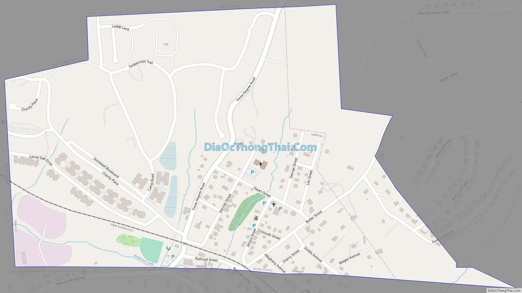
Valencia Road Map
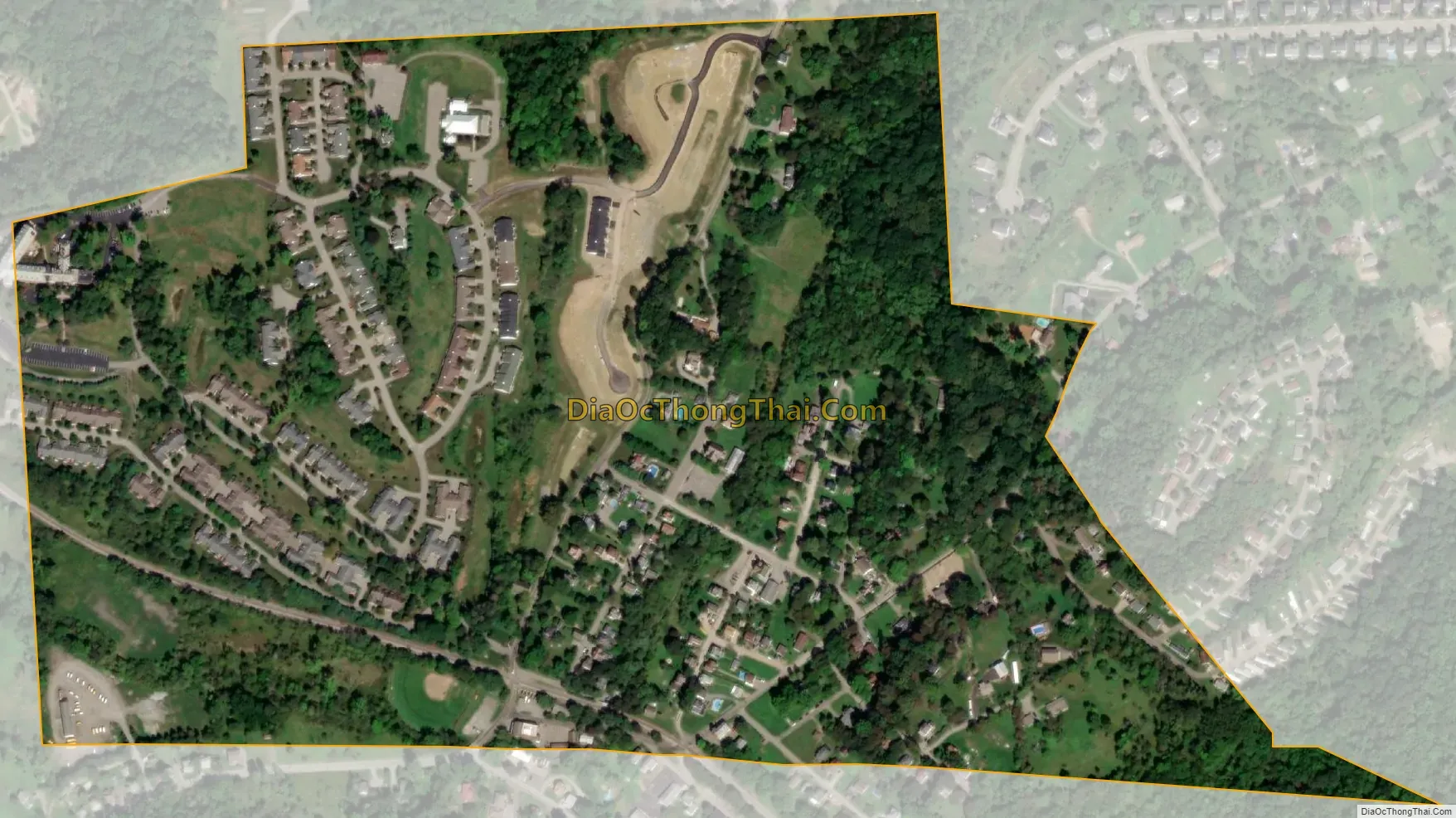
Valencia city Satellite Map
Geography
Valencia is located along the southern border of Butler County at 40°40′30″N 79°59′19″W / 40.67500°N 79.98861°W / 40.67500; -79.98861 (40.674906, -79.988493), in the valley of Breakneck Creek near its source. It is bordered to the north, east, and west by Adams Township and to the south by Richland and Pine townships in Allegheny County.
According to the United States Census Bureau, Valencia has a total area of 0.34 square miles (0.87 km), all land.
See also
Map of Pennsylvania State and its subdivision:- Adams
- Allegheny
- Armstrong
- Beaver
- Bedford
- Berks
- Blair
- Bradford
- Bucks
- Butler
- Cambria
- Cameron
- Carbon
- Centre
- Chester
- Clarion
- Clearfield
- Clinton
- Columbia
- Crawford
- Cumberland
- Dauphin
- Delaware
- Elk
- Erie
- Fayette
- Forest
- Franklin
- Fulton
- Greene
- Huntingdon
- Indiana
- Jefferson
- Juniata
- Lackawanna
- Lancaster
- Lawrence
- Lebanon
- Lehigh
- Luzerne
- Lycoming
- Mc Kean
- Mercer
- Mifflin
- Monroe
- Montgomery
- Montour
- Northampton
- Northumberland
- Perry
- Philadelphia
- Pike
- Potter
- Schuylkill
- Snyder
- Somerset
- Sullivan
- Susquehanna
- Tioga
- Union
- Venango
- Warren
- Washington
- Wayne
- Westmoreland
- Wyoming
- York
- Alabama
- Alaska
- Arizona
- Arkansas
- California
- Colorado
- Connecticut
- Delaware
- District of Columbia
- Florida
- Georgia
- Hawaii
- Idaho
- Illinois
- Indiana
- Iowa
- Kansas
- Kentucky
- Louisiana
- Maine
- Maryland
- Massachusetts
- Michigan
- Minnesota
- Mississippi
- Missouri
- Montana
- Nebraska
- Nevada
- New Hampshire
- New Jersey
- New Mexico
- New York
- North Carolina
- North Dakota
- Ohio
- Oklahoma
- Oregon
- Pennsylvania
- Rhode Island
- South Carolina
- South Dakota
- Tennessee
- Texas
- Utah
- Vermont
- Virginia
- Washington
- West Virginia
- Wisconsin
- Wyoming


