West Liberty is a borough in Butler County, Pennsylvania, United States. The population was 343 at the 2010 census.
| Name: | West Liberty borough |
|---|---|
| LSAD Code: | 21 |
| LSAD Description: | borough (suffix) |
| State: | Pennsylvania |
| County: | Butler County |
| Incorporated: | 1903 |
| Elevation: | 1,210 ft (370 m) |
| Total Area: | 3.88 sq mi (10.04 km²) |
| Land Area: | 3.85 sq mi (9.97 km²) |
| Water Area: | 0.03 sq mi (0.08 km²) |
| Total Population: | 343 |
| Population Density: | 85.76/sq mi (33.11/km²) |
| FIPS code: | 4283376 |
Online Interactive Map
Click on ![]() to view map in "full screen" mode.
to view map in "full screen" mode.
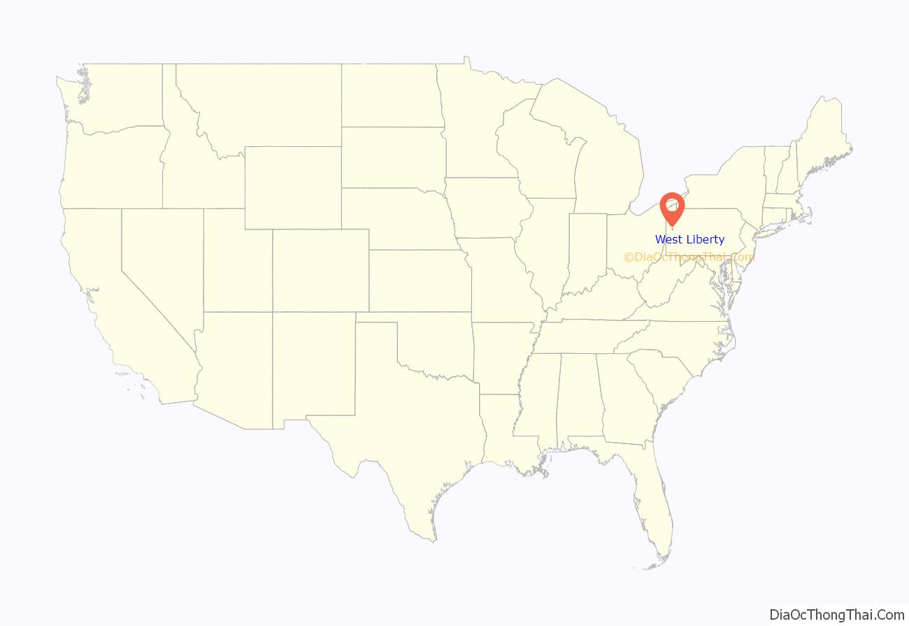
West Liberty location map. Where is West Liberty borough?
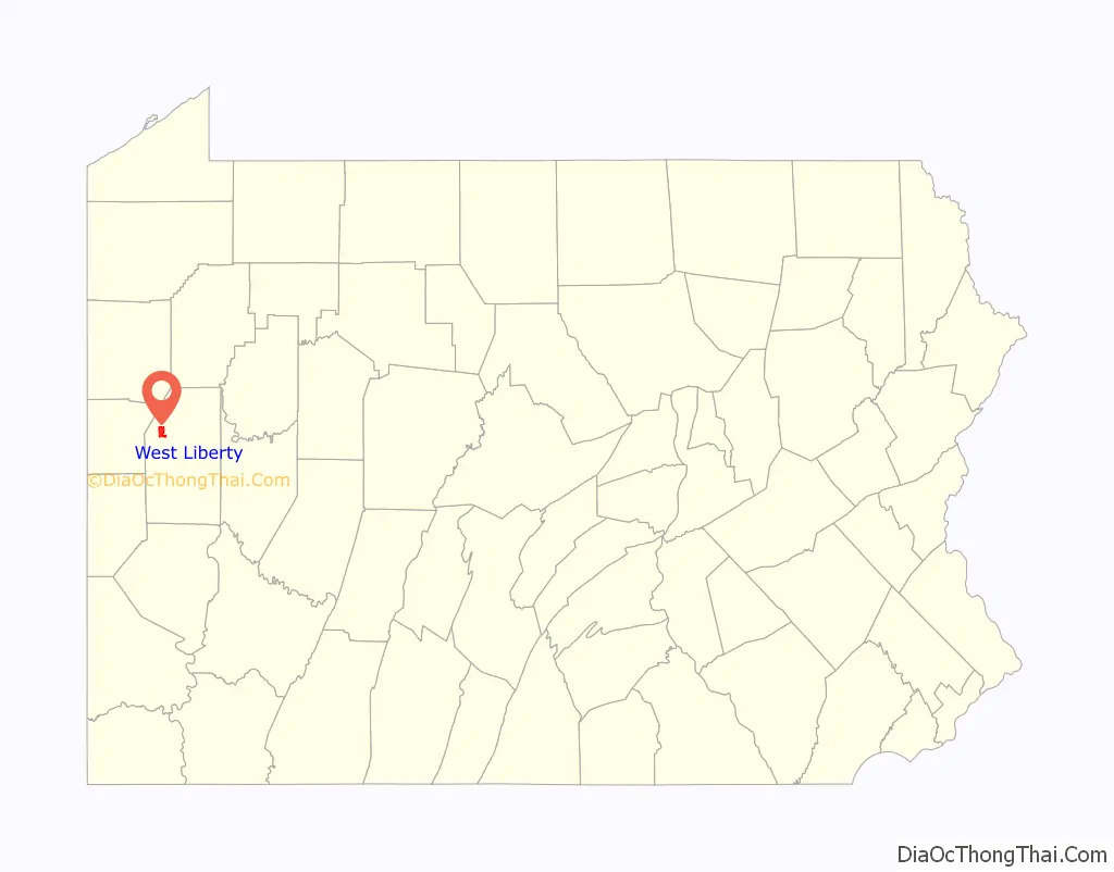
West Liberty Road Map
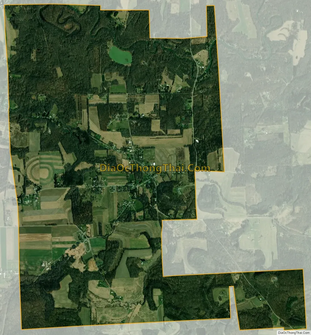
West Liberty city Satellite Map
Geography
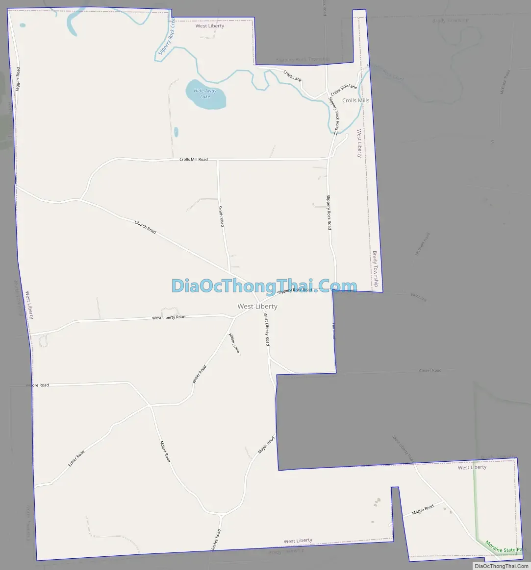
West Liberty is located in northwestern Butler County at 41°0′34″N 80°3′33″W / 41.00944°N 80.05917°W / 41.00944; -80.05917 (41.009509, -80.059073). It is bordered to the east and south by Brady Township, to the west by Worth Township, and to the north by Slippery Rock Township. The borough includes the main settlement of West Liberty in the valley of Hogue Run but extends north as far as Slippery Rock Creek.
According to the United States Census Bureau, the borough has a total area of 3.9 square miles (10.0 km), of which 0.031 square miles (0.08 km), or 0.77%, is water.
See also
Map of Pennsylvania State and its subdivision:- Adams
- Allegheny
- Armstrong
- Beaver
- Bedford
- Berks
- Blair
- Bradford
- Bucks
- Butler
- Cambria
- Cameron
- Carbon
- Centre
- Chester
- Clarion
- Clearfield
- Clinton
- Columbia
- Crawford
- Cumberland
- Dauphin
- Delaware
- Elk
- Erie
- Fayette
- Forest
- Franklin
- Fulton
- Greene
- Huntingdon
- Indiana
- Jefferson
- Juniata
- Lackawanna
- Lancaster
- Lawrence
- Lebanon
- Lehigh
- Luzerne
- Lycoming
- Mc Kean
- Mercer
- Mifflin
- Monroe
- Montgomery
- Montour
- Northampton
- Northumberland
- Perry
- Philadelphia
- Pike
- Potter
- Schuylkill
- Snyder
- Somerset
- Sullivan
- Susquehanna
- Tioga
- Union
- Venango
- Warren
- Washington
- Wayne
- Westmoreland
- Wyoming
- York
- Alabama
- Alaska
- Arizona
- Arkansas
- California
- Colorado
- Connecticut
- Delaware
- District of Columbia
- Florida
- Georgia
- Hawaii
- Idaho
- Illinois
- Indiana
- Iowa
- Kansas
- Kentucky
- Louisiana
- Maine
- Maryland
- Massachusetts
- Michigan
- Minnesota
- Mississippi
- Missouri
- Montana
- Nebraska
- Nevada
- New Hampshire
- New Jersey
- New Mexico
- New York
- North Carolina
- North Dakota
- Ohio
- Oklahoma
- Oregon
- Pennsylvania
- Rhode Island
- South Carolina
- South Dakota
- Tennessee
- Texas
- Utah
- Vermont
- Virginia
- Washington
- West Virginia
- Wisconsin
- Wyoming


