Wilkinsburg is a borough in Allegheny County, Pennsylvania, United States. The borough has a population of 14,349 as of the 2020 census. Wilkinsburg is part of the Pittsburgh metropolitan area. The borough was named for John Wilkins Jr., a United States Army officer who served as Quartermaster General of the United States Army from 1796 to 1802.
| Name: | Wilkinsburg borough |
|---|---|
| LSAD Code: | 21 |
| LSAD Description: | borough (suffix) |
| State: | Pennsylvania |
| County: | Allegheny County |
| Total Area: | 2.25 sq mi (5.83 km²) |
| Land Area: | 2.25 sq mi (5.83 km²) |
| Water Area: | 0.00 sq mi (0.00 km²) |
| Total Population: | 14,349 |
| Population Density: | 6,368.84/sq mi (2,459.15/km²) |
| FIPS code: | 4285188 |
| Website: | www.wilkinsburgpa.gov |
Online Interactive Map
Click on ![]() to view map in "full screen" mode.
to view map in "full screen" mode.
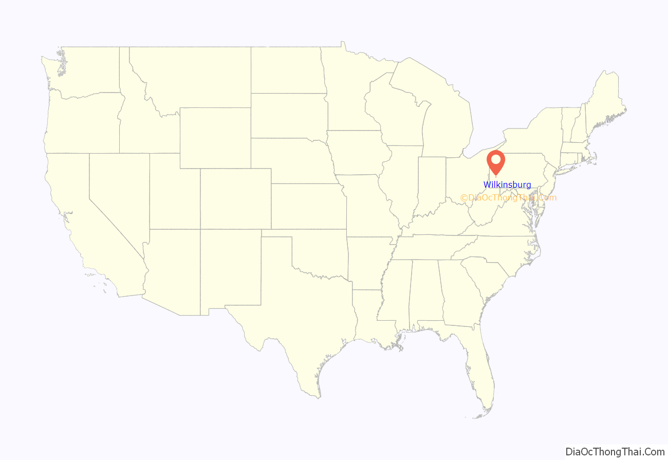
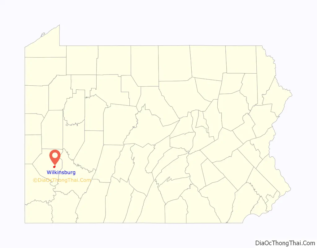
Wilkinsburg location map. Where is Wilkinsburg borough?
History
Historically, Wilkinsburg was located in an area on the Appalachian Plateau where various land and water transportation routes joined, which had been inhabited by Native Americans for thousands of years. Wilkinsburg was formed from the area of a valley going through the hills located east of the three rivers confluence, the Allegheny River, the Monongahela River, and the Ohio River: this natural valley allowed passage by land through the east–west barrier of the Appalachian Mountains to and from the east, whether to or from Philadelphia or other parts of the Atlantic coast, along the rivers (which eventually join the Mississippi River and flow into the Gulf of Mexico), through the Cumberland Gap (to or from the south), or by other transportation routes. A vital section of this major land road or pathway is now known as Penn Avenue, a major street and area of Wilkinsburg.
In the early 1700s, European traders arrived, and by mid-century had some established colonial sites, including Fort Duquesne, established by France. Subsequently, the general area became a major battleground during the French and Indian Wars, during which George Washington (who passed through what is now Wilkinsburg in 1753, on a diplomatic mission to French territory), General Braddock, and General Forbes gained fame and enhanced the land transportation routes. The French and Indian War (1754–1763) was fought between France, England, and various Native groups for territorial control. France lost control of the area in 1758. British forces built Fort Pitt between 1759 and 1761, near the three river junction. France subsequently relinquished claims on the area. In 1776, the British colonies declared independence, and the Treaty of Paris (1783) confirmed the area west of the Appalachians as part of the newly formed United States. In 1780, Pennsylvania and Virginia agreed to extend the Mason–Dixon line westward, and the region became part of Pennsylvania, settling a dispute of whether the area would be part of which state. The Treaty of Fort Stanwix (1784) resulted in the Iroquois Nations also relinquishing their claims to the area, but this was not necessarily the case for other Native American polities.
In the 1800s, trade was increasingly augmented by major mining and manufacturing operations. The area’s population continued to proliferate from the late 1800s and the early 1900s, with numerous immigrants from various parts of Europe and African Americans of the Great Migration migrating from the Southern United States. For Wilkinsburg, this process sometimes proceeded slowly and sometimes more rapidly.
The Land Company of the Colony of Pennsylvania began to offer deeds in the general area to become Wilkinsburg in 1769. Andrew Levi Levy Sr., purchased 266 acres of woodland, to which he officially gave the name of Africa (for reasons which remain obscure). In 1788, Levy sold his deed to William Thompson (a retired brigadier general who had served in the Continental Army during the American Revolutionary War). Thompson died shortly after, and the land was sold to Col. Dunning Mcnair (the father of Dunning R. McNair, who would become the Sergeant at Arms of the United States Senate, 1853–1861).
Dunning McNair was a significant landholder. In 1790, Dunning McNair laid out a village called McNairstown on the “Great Road” later known as Penn Avenue. In a deed dated September 1812, McNair deeded land to a certain Patrick Green, by which Wilkinsburgh was officially registered. In 1825, Dunning McNair died. By 1812, the village was referred to as “Wilkinsburgh” in honor of John Wilkins Jr., a wartime friend of McNair.
James Kelly began a half-century or so of heavy involvement with the area when he paid $12,000 for McNair’s former land, which Kelly subsequently added to. James Kelly was involved in much of the civic, religious, educational and other activities during this period. In 1873 the City of Pittsburgh annexed a portion of Wilkins Township containing Wilkinsburg, but less than three years later, a legal action reversed the annexation.
On October 5, 1887, Wilkinsburg separated from the recently created Sterrett Township to become an independent borough.
Although the borough has been economically depressed in recent years, many efforts are being made to change this. In 2004, the Pittsburgh History and Landmarks Foundation launched initiatives in partnership with its for-profit development affiliate, Landmark Development Corporation, to begin restoration work on historic structures in Wilkinsburg’s Hamnett Place neighborhood. Within a decade, more than 70 structures were improved, a new neighborhood center was opened, and the community’s supply of affordable housing was increased. The collaborators were subsequently honored with the Richard H. Driehaus Foundation National Preservation Award to recognize their accomplishments. During this time, the Hamnett Historic District was also established; that historic district was then approved on June 28, 2010, for listing on the National Register of Historic Places.
In 2015, the Pittsburgh History and Landmarks Foundation and its for-profit affiliate, Landmark Development Corporation, entered into a collaboration with Falconhurst Development to begin an $11.5 million multi-site restoration within and near the Hamnett Historic District. In addition to restoring four vacant buildings which had been built sometime around the beginning of the 20th century, the developer had plans to open a series of new townhouses in the same area by 2016, with the collaborators again indicating that the housing would be affordable, based on United States Housing and Urban Development Department (HUD) guidelines. The ground was broken on the project in late September 2015.
Home of modern broadcasting
Modern broadcasting as known in its current form began when Wilkinsburg resident Frank Conrad spearheaded a radio laboratory at his home, coordinated with Westinghouse Electric Corporation and the United States Signal Corps, under a special war time permit (using call signs 2-WM and 2-WE). After moving from Swissvale to Wilkinsburg, Conrad installed a radio station on the top floor of his backyard two-story garage, with a microphone, where he worked into the wee hours of the morning, eventually resulting in the development of modern broadcasting, as do it yourself listeners who had made their own crystal radio sets began to respond, some quite enthused by the music broadcast when Frank Conrad coupled a phonograph to radio. Wilkinsburg thus became the original location for modern broadcasting, combining the concepts of “the station, the audience, the programs, and a means to pay for the programs” after Conrad accepted a donation from a Wilkinsburg music store to promote its musical offerings. This was all before and leading up to KDKA and the development of commercial radio. In 1916, KDKA began broadcasting, as experimental station 8XK, from the Westinghouse plant in East Pittsburgh and in a small garage owned by Frank Conrad, before it was launched with its current call letters on November 2, 1920. In 1923, Wilkinsburg-based Russian immigrant Vladimir Zworykin designed and patented the iconoscope, the photocell “eye” of early television cameras. Today, ABC affiliate WTAE-TV is located in the borough on Ardmore Boulevard.
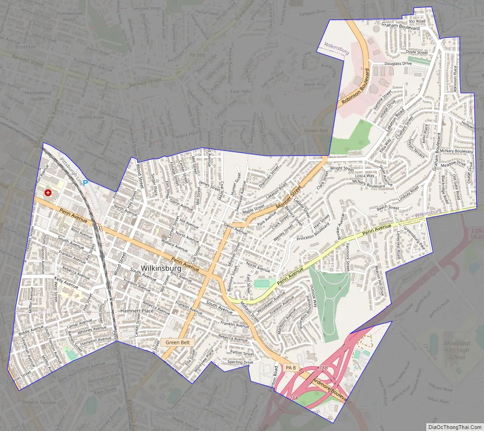
Wilkinsburg Road Map
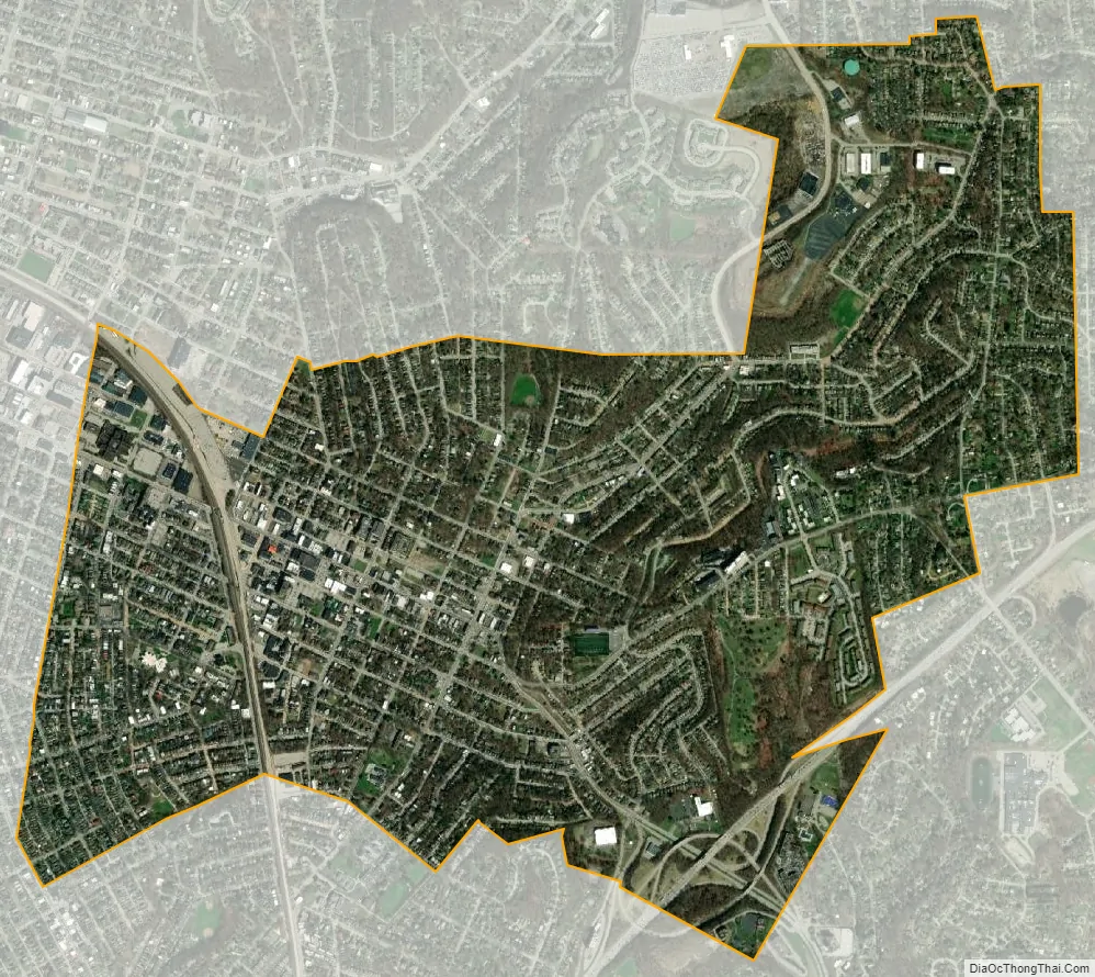
Wilkinsburg city Satellite Map
Geography
According to the U.S. Census Bureau, the borough has a total area of 2.3 square miles (6.0 km), all land.
Surrounding neighborhoods
Wilkinsburg has ten borders, including Penn Hills Township to the northeast, Churchill to the east, Forest Hills to the southeast, Edgewood to the south, Swissvale to the southwest, and the Pittsburgh neighborhoods of Regent Square, Point Breeze, and North Point Breeze to the west, Homewood South to the northwest, and East Hills to the north.
See also
Map of Pennsylvania State and its subdivision:- Adams
- Allegheny
- Armstrong
- Beaver
- Bedford
- Berks
- Blair
- Bradford
- Bucks
- Butler
- Cambria
- Cameron
- Carbon
- Centre
- Chester
- Clarion
- Clearfield
- Clinton
- Columbia
- Crawford
- Cumberland
- Dauphin
- Delaware
- Elk
- Erie
- Fayette
- Forest
- Franklin
- Fulton
- Greene
- Huntingdon
- Indiana
- Jefferson
- Juniata
- Lackawanna
- Lancaster
- Lawrence
- Lebanon
- Lehigh
- Luzerne
- Lycoming
- Mc Kean
- Mercer
- Mifflin
- Monroe
- Montgomery
- Montour
- Northampton
- Northumberland
- Perry
- Philadelphia
- Pike
- Potter
- Schuylkill
- Snyder
- Somerset
- Sullivan
- Susquehanna
- Tioga
- Union
- Venango
- Warren
- Washington
- Wayne
- Westmoreland
- Wyoming
- York
- Alabama
- Alaska
- Arizona
- Arkansas
- California
- Colorado
- Connecticut
- Delaware
- District of Columbia
- Florida
- Georgia
- Hawaii
- Idaho
- Illinois
- Indiana
- Iowa
- Kansas
- Kentucky
- Louisiana
- Maine
- Maryland
- Massachusetts
- Michigan
- Minnesota
- Mississippi
- Missouri
- Montana
- Nebraska
- Nevada
- New Hampshire
- New Jersey
- New Mexico
- New York
- North Carolina
- North Dakota
- Ohio
- Oklahoma
- Oregon
- Pennsylvania
- Rhode Island
- South Carolina
- South Dakota
- Tennessee
- Texas
- Utah
- Vermont
- Virginia
- Washington
- West Virginia
- Wisconsin
- Wyoming


