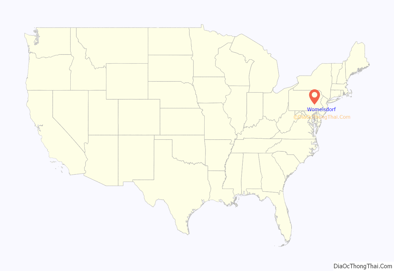
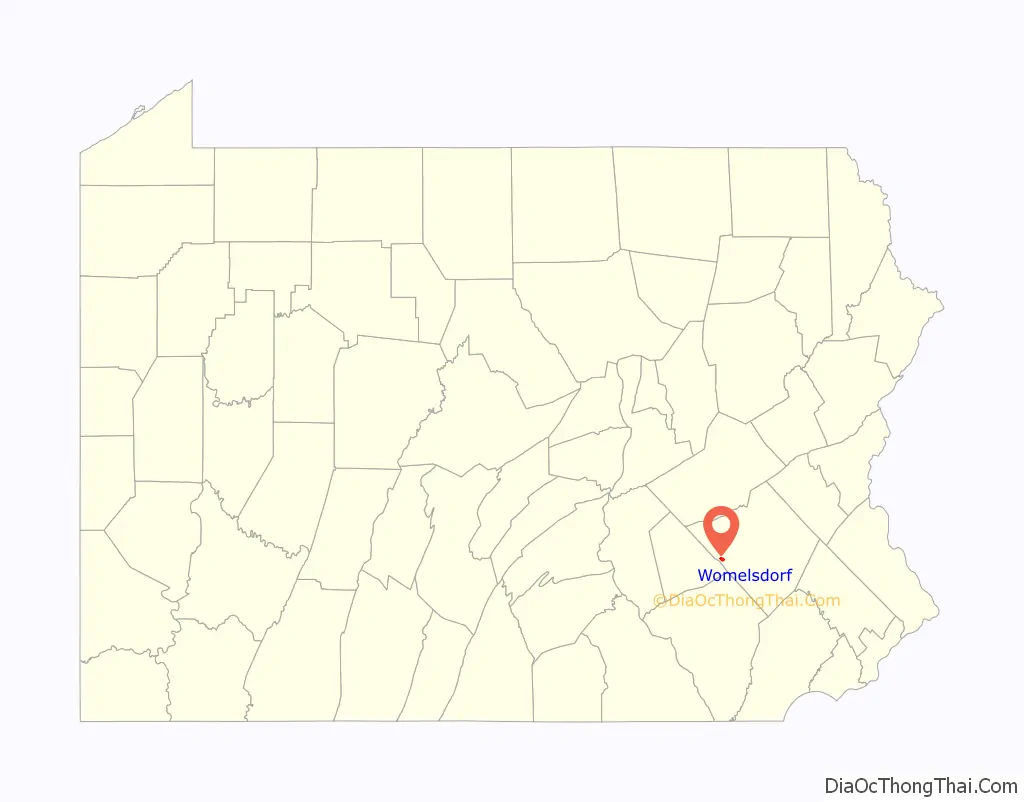
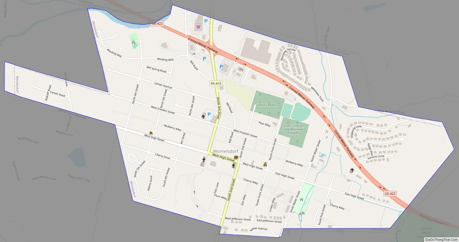
Womelsdorf is a borough in Berks County, Pennsylvania, United States. The population was 2,810 at the 2010 census. The main thoroughfares through Womelsdorf are High Street, which runs east–west, and Pennsylvania Route 419, which runs north–south. U.S. Route 422 runs along the northern edge of town.
| Name: | Womelsdorf borough |
|---|---|
| LSAD Code: | 21 |
| LSAD Description: | borough (suffix) |
| State: | Pennsylvania |
| County: | Berks County |
| Elevation: | 449 ft (137 m) |
| Total Area: | 0.87 sq mi (2.25 km²) |
| Land Area: | 0.87 sq mi (2.24 km²) |
| Water Area: | 0.00 sq mi (0.00 km²) |
| Total Population: | 2,810 |
| Population Density: | 3,356.81/sq mi (1,295.38/km²) |
| ZIP code: | 19567 |
| Area code: | 610 and 484 |
| FIPS code: | 4286056 |
| Website: | www.womelsdorfboro.org |
Online Interactive Map
Click on ![]() to view map in "full screen" mode.
to view map in "full screen" mode.
Womelsdorf location map. Where is Womelsdorf borough?
History
The area had been occupied by Native American peoples before European colonization. German immigrant John Womelsdorf founded the community in 1762. It was originally named Middletown, as it was halfway between the cities of Lebanon and Reading, but roughly 50 years later the name was changed to Womelsdorf in honor of its founder.
Conrad Weiser, another German immigrant, settled here with his family as a young adult. Due to his importance as an interpreter and diplomat to the Iroquois and other Native American nations in the colonial period, the Conrad Weiser Homestead has been preserved as a Pennsylvania state historic site. It has materials to interpret his life and important aspects of 18th-century colonial Pennsylvania.
The Womelsdorf Historic District was listed on the National Register of Historic Places in 1982.
Womelsdorf Road Map
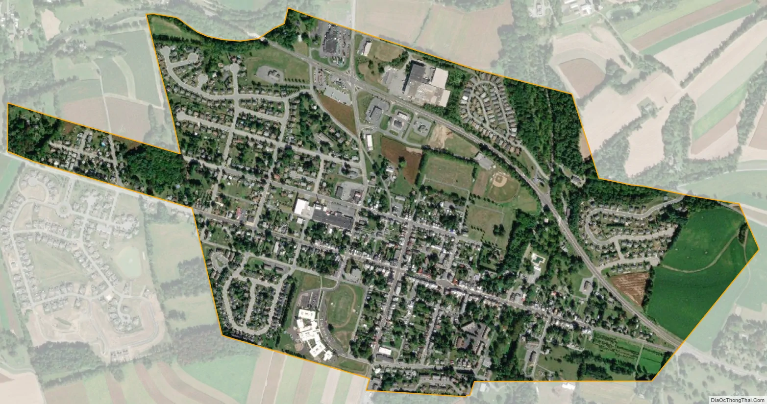
Womelsdorf city Satellite Map
Geography
Womelsdorf is located at 40°21′55″N 76°11′16″W / 40.36528°N 76.18778°W / 40.36528; -76.18778 (40.365201, -76.187815).
According to the United States Census Bureau, the borough has a total area of 0.9 square miles (2.3 km), all land.
See also
Map of Pennsylvania State and its subdivision:- Adams
- Allegheny
- Armstrong
- Beaver
- Bedford
- Berks
- Blair
- Bradford
- Bucks
- Butler
- Cambria
- Cameron
- Carbon
- Centre
- Chester
- Clarion
- Clearfield
- Clinton
- Columbia
- Crawford
- Cumberland
- Dauphin
- Delaware
- Elk
- Erie
- Fayette
- Forest
- Franklin
- Fulton
- Greene
- Huntingdon
- Indiana
- Jefferson
- Juniata
- Lackawanna
- Lancaster
- Lawrence
- Lebanon
- Lehigh
- Luzerne
- Lycoming
- Mc Kean
- Mercer
- Mifflin
- Monroe
- Montgomery
- Montour
- Northampton
- Northumberland
- Perry
- Philadelphia
- Pike
- Potter
- Schuylkill
- Snyder
- Somerset
- Sullivan
- Susquehanna
- Tioga
- Union
- Venango
- Warren
- Washington
- Wayne
- Westmoreland
- Wyoming
- York
- Alabama
- Alaska
- Arizona
- Arkansas
- California
- Colorado
- Connecticut
- Delaware
- District of Columbia
- Florida
- Georgia
- Hawaii
- Idaho
- Illinois
- Indiana
- Iowa
- Kansas
- Kentucky
- Louisiana
- Maine
- Maryland
- Massachusetts
- Michigan
- Minnesota
- Mississippi
- Missouri
- Montana
- Nebraska
- Nevada
- New Hampshire
- New Jersey
- New Mexico
- New York
- North Carolina
- North Dakota
- Ohio
- Oklahoma
- Oregon
- Pennsylvania
- Rhode Island
- South Carolina
- South Dakota
- Tennessee
- Texas
- Utah
- Vermont
- Virginia
- Washington
- West Virginia
- Wisconsin
- Wyoming


