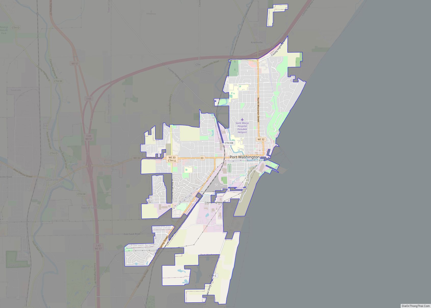
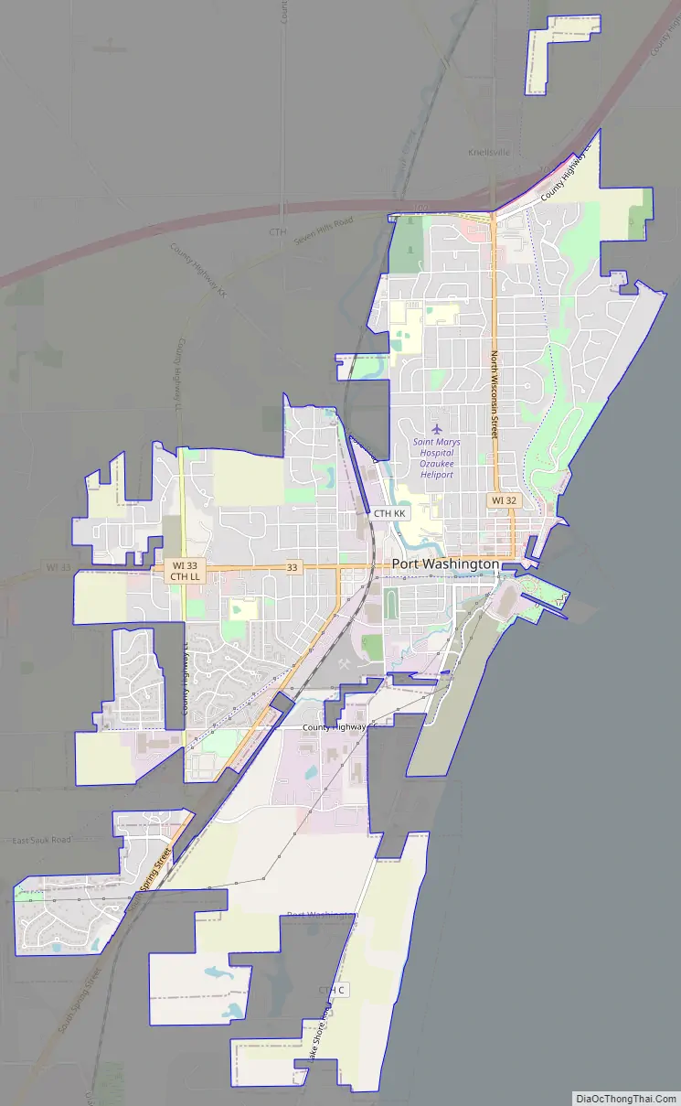
Port Washington is the county seat of Ozaukee County in the U.S. state of Wisconsin. Located on Lake Michigan’s western shore east of Interstate 43, the community is a suburb in the Milwaukee metropolitan area 27 miles north of the City of Milwaukee. The city’s artificial harbor at the mouth of Sauk Creek was dredged in the 1870s and was a commercial port until the early 2000s. The population was 11,250 at the 2010 census.
When French explorers arrived in the area in the 17th century, they found a Native American village at the mouth of Sauk Creek—the present location of historic downtown Port Washington. The United States Federal Government forcibly expelled the Native Americans in the 1830s, and the first settlers arrived in 1835, calling their settlement “Wisconsin City” before renaming it “Port Washington” in honor of President George Washington. In the late 1840s and early 1850s, the community was a candidate to be the Washington County seat. Disagreements between municipalities and election fraud prevented Washington County from having a permanent seat of government until the Wisconsin State Legislature intervened, creating Ozaukee County out of the eastern third of Washington County and making Port Washington the seat of the new county.
For much of its history, Port Washington has been tied to the Great Lakes. Early settlers used boats to transport goods including lumber, fish, and grains, although the community’s early years were marred by shipwrecks, which led the U.S. Federal Government to construct Port Washington Harbor in 1871. Commercial fishing prospered in Port Washington until the mid-20th century, and beginning in the 1930s, the Port Washington Generating Station used the harbor to receive large shipments of coal to burn for electricity. The commercial harbor closed in 2004 when the power station switched to natural gas for fuel, but the community maintains an active marina for recreational boaters. In the 21st century, Port Washington celebrates its lacustrine heritage with museums, public fish fries, sport fishing derbies, and sailboat races.
| Name: | Port Washington city |
|---|---|
| LSAD Code: | 25 |
| LSAD Description: | city (suffix) |
| State: | Wisconsin |
| County: | Ozaukee County |
| Incorporated: | 1882; 141 years ago (1882) |
| Total Area: | 5.86 sq mi (15.19 km²) |
| Land Area: | 5.86 sq mi (15.19 km²) |
| Water Area: | 0.00 sq mi (0.00 km²) |
| Total Population: | 11,250 |
| Population Density: | 2,031.21/sq mi (784.29/km²) |
| ZIP code: | 53074 |
| Area code: | 262 |
| FIPS code: | 5564450 |
| Website: | portwashingtonwi.gov |
Online Interactive Map
Click on ![]() to view map in "full screen" mode.
to view map in "full screen" mode.
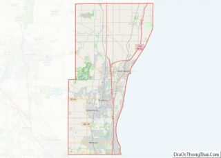
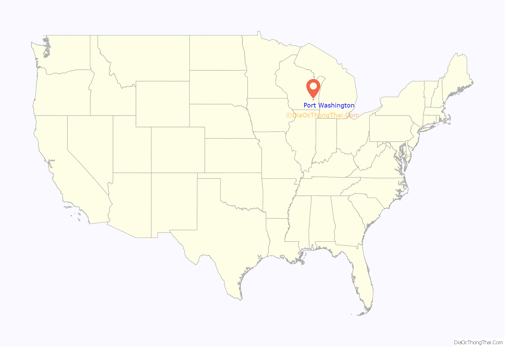
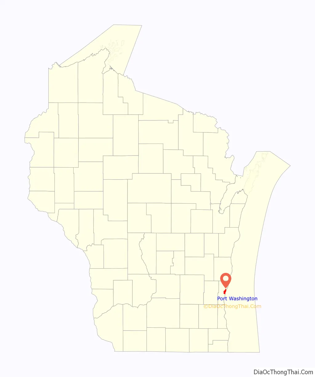
Port Washington location map. Where is Port Washington city?
History
Early history and settlement
The area that became Port Washington was originally inhabited by the Menominee, Potawatomi, and Sauk Native Americans. In 1679, the French explorers Louis Hennepin and René-Robert Cavelier, Sieur de La Salle described stopping at the first landing north of the Milwaukee River to procure provisions at a Potawatomi village at the mouth of a small river, which may have been Sauk Creek, a stream that empties into the present-day Port Washington’s artificial harbor.
The 1830s saw the forced removal of Wisconsin’s Native American population, followed by land speculation by merchants and investors. One of these land speculators was General Wooster Harrison, who purchased the land that would become Port Washington in 1835, which he originally named “Wisconsin City.” Harrison’s wife, Rhoda, died in 1837 and was the first white settler to be buried in the town. The settlement was abandoned that same year.
In 1843, Harrison returned with a party of settlers. The Town of Port Washington was formed in January 1846 and until 1847 included the surrounding areas of Fredonia, Saukville, and Belgium. At the time, the land was part of Washington County, and in the late 1840s, Port Washington was a candidate for the county seat. However, the community was far from the county’s other early settlements, including Mequon, Grafton and Germantown. In 1850, the Wisconsin legislature voted to bisect Washington County into northern and southern counties, with Port Washington and Cedarburg as the respective county seats. County residents failed to ratify the bill, and in 1853, the legislature instead bisected the county into eastern and western sections, creating Ozaukee County. Port Washington became the seat of the new county, and the Washington County seat moved to West Bend. The bisection was controversial. When Washington County officials from West Bend arrived in Port Washington to correct relevant county records, they were run out of town, and Ozaukee County officials refused to hand over the records for several months.
19th century growth and industrialization
The early settlers saw potential in the community’s lakeside location and built piers to make their city into a port on Lake Michigan. The city exported cord wood, wheat and rye flour, bricks, fish, and hides, among other things. However, Port Washington did not have a natural harbor and its first decades were marred by shipwrecks, including the 1856 Toledo disaster, in which between 30 and 80 people died.
In 1843, the first Christian religious services were held by the Methodist Episcopal Church in private homes. The first Catholic Church services were held in a similar manner in 1847. The Washington Democrat, the town’s first newspaper, was started in 1847 by Flavius J. Mills.
The population reached 2,500 in 1853 and continued to increase, with an influx of immigrants from Germany and Luxembourg between 1853 and 1865. When the American Civil War started, some of these immigrants found themselves in opposition to the federal government. The United States Congress implemented the draft in 1862, and Port Washington’s immigrants, particularly those from Prussia and Luxembourg, were unpleasantly reminded of mandatory conscription in the countries they had left behind. On November 10, 1862, several hundred Port Washington residents marched on the courthouse, attacked the official in charge of implementing the draft, burned draft records, and vandalized the homes of Union supporters. The riot ended when eight detachments of Union troops from Milwaukee were deployed.
The early 1870s saw improvements to the community’s transportation infrastructure. In 1870, Port Washington became a stop on the Lake Shore Railroad, which was later incorporated into the Chicago and North Western Railway. In response to the numerous shipwrecks in the area, local officials also petitioned the federal government for assistance to dredge and create an artificial harbor. When the project was completed in 1871, the harbor was a channel 14 feet deep and 1,500 feet long in which ships could dock to unload as well as shelter during storms.
The City of Port Washington was incorporated in 1882. In the 1880s and 1890s, a large number of French and Belgian immigrants arrived in Port Washington. Between 1900 and 1910, two relatively large groups of English immigrants also arrived in Port Washington. One group came directly from England and the other group had previously been residents of Canada.
The last years of the 19th century saw Port Washington’s economy become more industrial. In September 1888, J. M. Bostwick opened the Wisconsin Chair Company in the city. At its height, the company employed 30% of the county’s population and accounted for roughly half of Port Washington’s jobs. Between 1890 and 1900, Port Washington’s population nearly doubled due to the company’s success. Additionally, the Bolens tractor company built its main factory in the city in 1894, and in 1896, Delos and Herbert Smith brought their commercial fishing business to Port Washington. The Smith Bros. company grew to a fleet of gillnetting fishing tugs, and they sold fish, whitefish caviar, and burbot oil in addition to operating restaurants and a hotel.
On February 19, 1899, the Wisconsin Chair Company’s factory caught fire. The building was destroyed and the conflagration spread, burning nearly half of Port Washington. The damages were covered by fire insurance, and the company built an even bigger factory on the waterfront with direct rail access.
20th century industrial decline and suburbanization
In the early 20th Century, the Wisconsin Chair Company opened additional factories in neighboring communities and bought tracts of forest in Green Bay, Chambers Island, Harbor Springs, Michigan, and the Upper Peninsula of Michigan to supply wood. During the Panic of 1907 when there were currency shortages, the company’s checks were treated as an informal currency in the community. Among its products, the company manufactured phonographs for Thomas Edison. In an effort to boost sales, the company also started its Paramount Records subsidiary, which was one of the first record labels devoted to African-American music. Paramount operated in neighboring Grafton until it closed in 1935 during the Great Depression. The Wisconsin Chair Company closed in 1954.
In November 1907, Port Washington became a stop on the Milwaukee-Northern interurban passenger line, and a power station on the lakefront provided electricity for the trains. The community was the halfway point between Milwaukee and the line’s northern terminus in Sheboygan. In the 1920s, The Milwaukee Electric Railway and Light Company purchased the line and continued to operate it until March 28, 1948, when the Ozaukee County line declined due to increased use of personal automobiles and better roads.
Wisconsin Electric Power Company, now known as We Energies, built the Port Washington power plant in 1931. The project included an expansion of Port Washington’s harbor and the construction of a large coal dock to accommodate the daily coal shipments the station received.
The mid-20th century saw a decline in commercial fishing on the Great Lakes. Populations of fish including herring, lake trout, lake whitefish, and yellow perch declined due to decades of overfishing, pollution, and the arrival of invasive species, such as the alewife, the parasitic sea lamprey, and the zebra mussel. The Smith Bros. fishing company closed in 1988, and when the Port Washington power station took its coal-fired boilers out of service in 2004 and converted to natural gas, Port Washington’s harbor closed as a commercial port.
Despite the decline of decades-old industries, Port Washington experienced significant population growth during the suburbanization that followed World War II. Between 1940 and 1970, the population more than doubled, from 4,046 to 8,752, and the City of Port Washington annexed rural land from the surrounding Town of Port Washington and Town of Grafton for residential subdivisions. The construction of Interstate 43 west of Port Washington in the mid-1960s connected the city to neighboring communities and allowed more residents to commute for work.
On August 22, 1964, an F4 tornado touched down in Port Washington, totally destroying twenty houses and causing severe damage to thirty-four others in a newly constructed subdivision. No one died, but thirty people were reported to have been injured. There were approximately $2 million in damages, which would have been over $16 million as of November 2019, if adjusted for inflation.
Port Washington Road Map
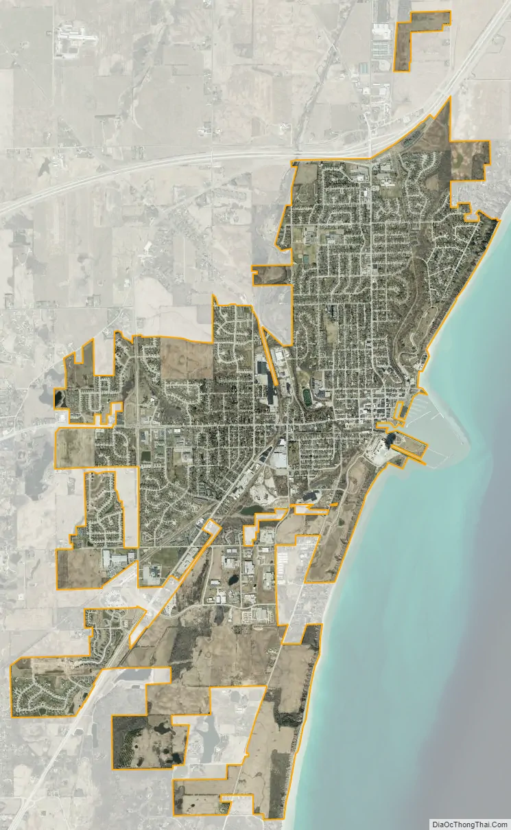
Port Washington city Satellite Map
Geography
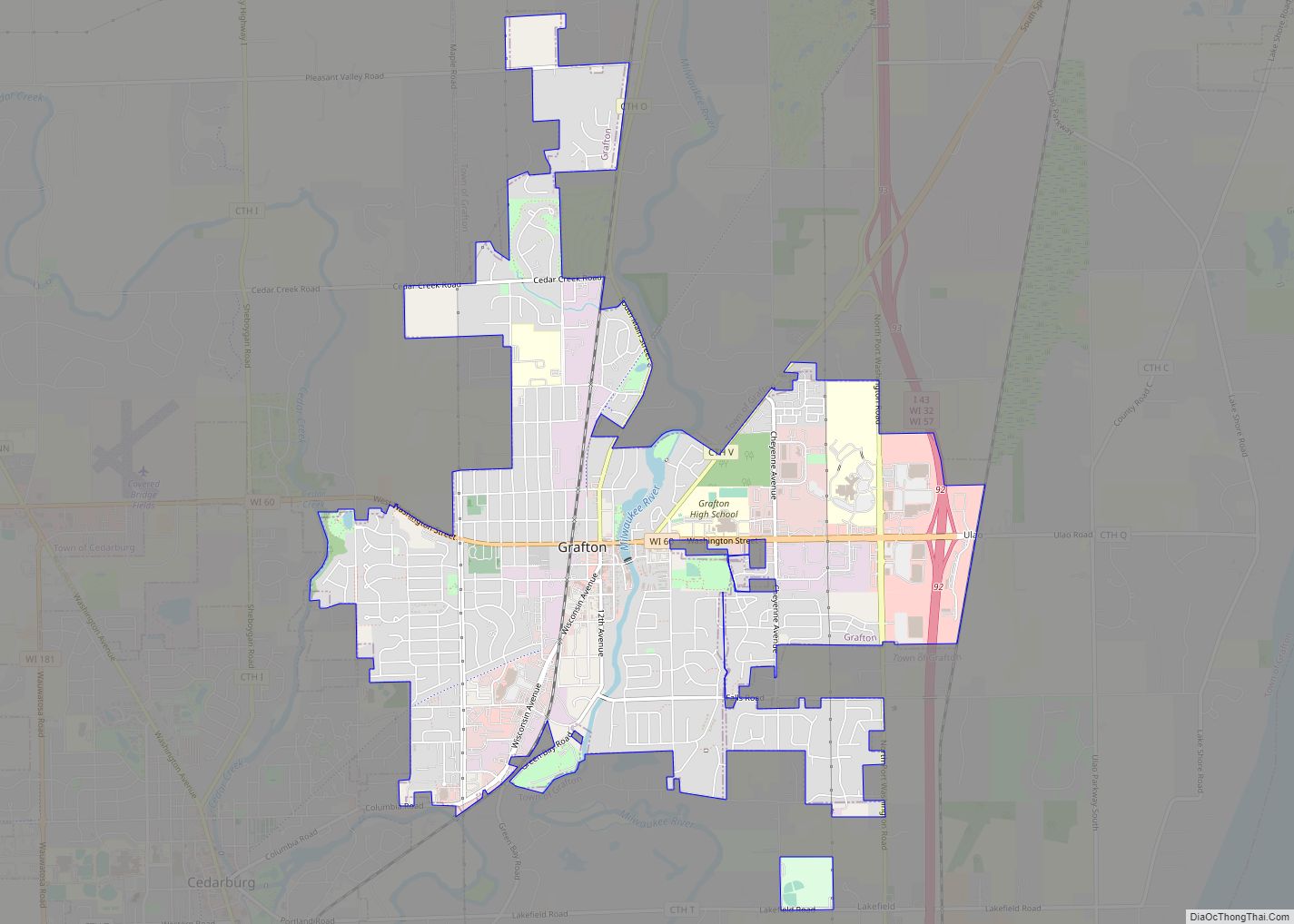
According to the United States Census Bureau, the city has a total area of 7.08 square miles (18.34 km), of which 5.82 square miles (15.07 km) is land and 1.26 square miles (3.26 km) is water. The city is bordered by the Town of Port Washington to the north and west, the Town of Grafton to the south, and Lake Michigan to the east.
The city is located on the western shore of Lake Michigan. In northern and southern parts of the city, the coastline is characterized by clay bluffs ranging from 80 feet (24 meters) to 130 feet (40 meters) in height with deep ravines where streams flow into the lake. Clay bluffs are a geological formation characteristic of the Lake Michigan shoreline, and are found in few other areas of the world. Much of the coastline adjacent to the bluffs has mixed gravel and sand beaches. Port Washington’s historic downtown in the central part of the city is in the Sauk Creek valley, at a lower elevation than the rest of the city. The valley is a break in the bluffs, providing easy access to the lakeshore, which attracted early settlers to the area. Port Washington’s artificial harbor, dredged in 1871 with subsequently constructed breakwaters, is located at the mouth of Sauk Creek, adjacent to downtown.
The city is located in the Southeastern Wisconsin glacial till plains that were created by the Wisconsin glaciation during the most recent ice age. The soil is clayey glacial till with a thin layer of loess on the surface. The Wisconsin Department of Natural Resources considers the city to be in the Central Lake Michigan Coastal ecological landscape.
As land development continues to reduce wild areas, wildlife is forced into closer proximity with human communities like Grafton. Large mammals, including white-tailed deer, coyotes, and red foxes can be seen in the city. There have been infrequent sightings of black bears in Ozaukee County communities, including a 2010 sighting of a bear in a Port Washington residential neighborhood.
The region struggles with many invasive species, including the emerald ash borer, common carp, reed canary grass, the common reed, purple loosestrife, garlic mustard, Eurasian buckthorns, and honeysuckles.
Climate
See also
Map of Wisconsin State and its subdivision:- Adams
- Ashland
- Barron
- Bayfield
- Brown
- Buffalo
- Burnett
- Calumet
- Chippewa
- Clark
- Columbia
- Crawford
- Dane
- Dodge
- Door
- Douglas
- Dunn
- Eau Claire
- Florence
- Fond du Lac
- Forest
- Grant
- Green
- Green Lake
- Iowa
- Iron
- Jackson
- Jefferson
- Juneau
- Kenosha
- Kewaunee
- La Crosse
- Lafayette
- Lake Michigan
- Lake Superior
- Langlade
- Lincoln
- Manitowoc
- Marathon
- Marinette
- Marquette
- Menominee
- Milwaukee
- Monroe
- Oconto
- Oneida
- Outagamie
- Ozaukee
- Pepin
- Pierce
- Polk
- Portage
- Price
- Racine
- Richland
- Rock
- Rusk
- Saint Croix
- Sauk
- Sawyer
- Shawano
- Sheboygan
- Taylor
- Trempealeau
- Vernon
- Vilas
- Walworth
- Washburn
- Washington
- Waukesha
- Waupaca
- Waushara
- Winnebago
- Wood
- Alabama
- Alaska
- Arizona
- Arkansas
- California
- Colorado
- Connecticut
- Delaware
- District of Columbia
- Florida
- Georgia
- Hawaii
- Idaho
- Illinois
- Indiana
- Iowa
- Kansas
- Kentucky
- Louisiana
- Maine
- Maryland
- Massachusetts
- Michigan
- Minnesota
- Mississippi
- Missouri
- Montana
- Nebraska
- Nevada
- New Hampshire
- New Jersey
- New Mexico
- New York
- North Carolina
- North Dakota
- Ohio
- Oklahoma
- Oregon
- Pennsylvania
- Rhode Island
- South Carolina
- South Dakota
- Tennessee
- Texas
- Utah
- Vermont
- Virginia
- Washington
- West Virginia
- Wisconsin
- Wyoming