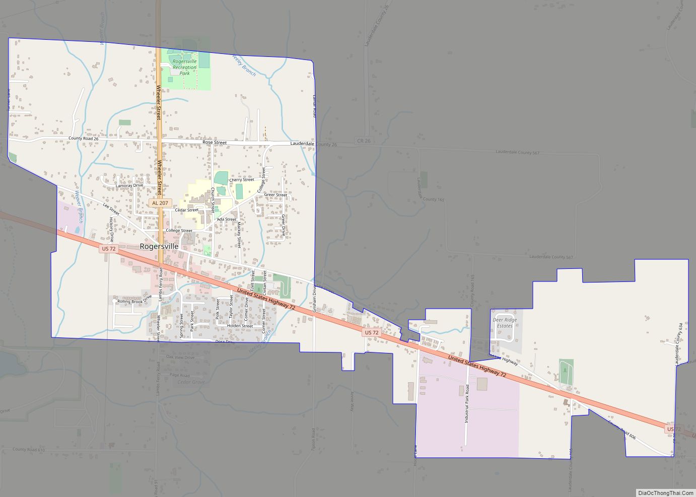
Rogersville is a town in Lauderdale County, Alabama, United States. As of the 2018 census, the population of the town is 1,231, up from 1,199 in 2000.
| Name: | Rogersville town |
|---|---|
| LSAD Code: | 43 |
| LSAD Description: | town (suffix) |
| State: | Alabama |
| County: | Lauderdale County |
| Elevation: | 646 ft (197 m) |
| Total Area: | 3.03 sq mi (7.86 km²) |
| Land Area: | 3.03 sq mi (7.86 km²) |
| Water Area: | 0.00 sq mi (0.01 km²) |
| Total Population: | 1,286 |
| Population Density: | 424.00/sq mi (163.71/km²) |
| ZIP code: | 35652 |
| Area code: | 256 |
| FIPS code: | 0166216 |
| GNISfeature ID: | 2407235 |
Online Interactive Map
Click on ![]() to view map in "full screen" mode.
to view map in "full screen" mode.
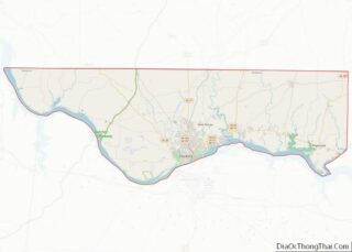
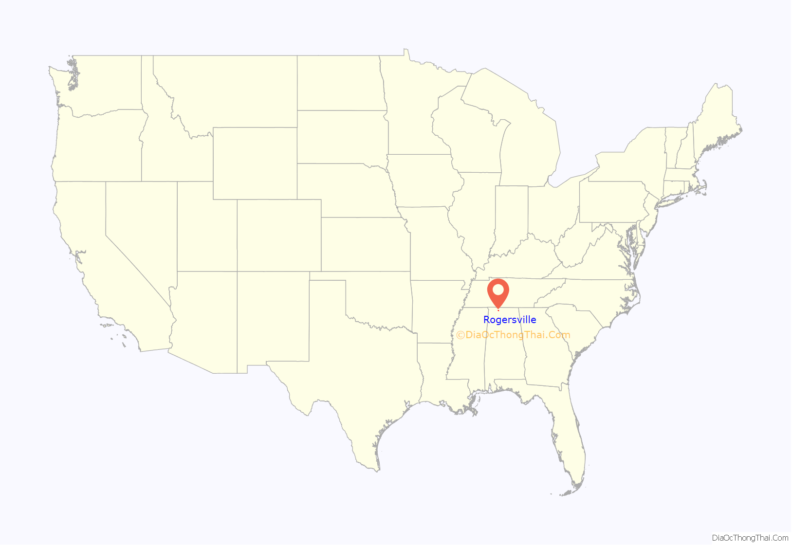
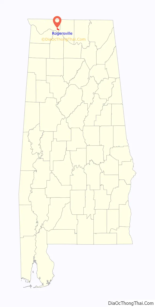
Rogersville location map. Where is Rogersville town?
History
The town became an incorporated municipality on February 2, 1858. Originally known as “Rodgersville”, it took its name from Andrew and Patience Rodgers of South Carolina who moved into the area and purchased 79.8 acres (323,000 m) at a public land sale in Huntsville on May 3, 1818. Their land eventually became what is now the downtown business district. When the Rogersville Post Office was established on October 4, 1825, with Thomas Cunningham as the postmaster, the ‘d’ was dropped from the town’s name and it has been known as Rogersville ever since.
The town became a popular trading center due in part to its location near the intersection of three early thoroughfares, U.S. 72, Snake Road and Lamb’s Ferry Road. U.S. 72, which now connects Chattanooga and Memphis, Tennessee, was once part of an Indian trail from Ditto’s Landing on the Tennessee River south of Huntsville and was used to bypass the Muscle Shoals river barrier. Snake Road leads out of Rogersville into neighboring Limestone County and provided passage from Florence to Athens by way of a shallow ford across Elk River. Lamb’s Ferry Road was named for John Lamb who moved from Indian Creek in Giles County, Tennessee in 1816 to establish a ferry across the Tennessee River south of what would later become Rogersville. Lamb’s Ferry became an important river port where boats from Knoxville and other points on the upper Tennessee River would unload supplies that were taken over land to areas around Pulaski, TN.
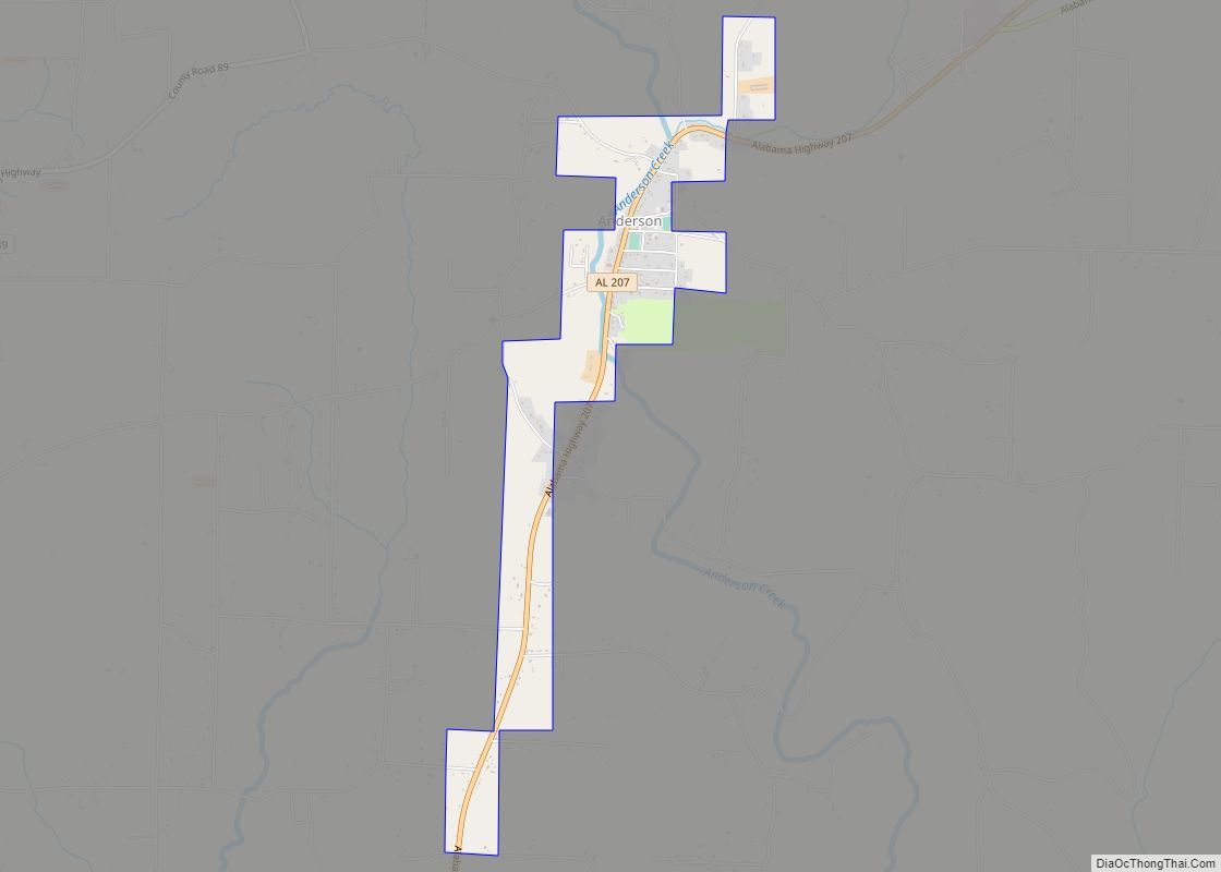
Rogersville Road Map
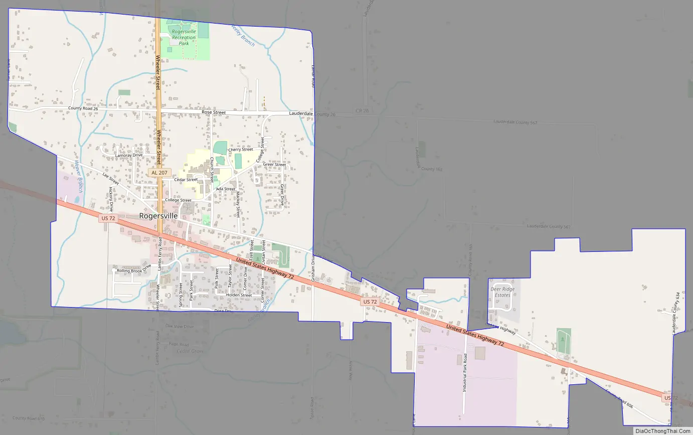
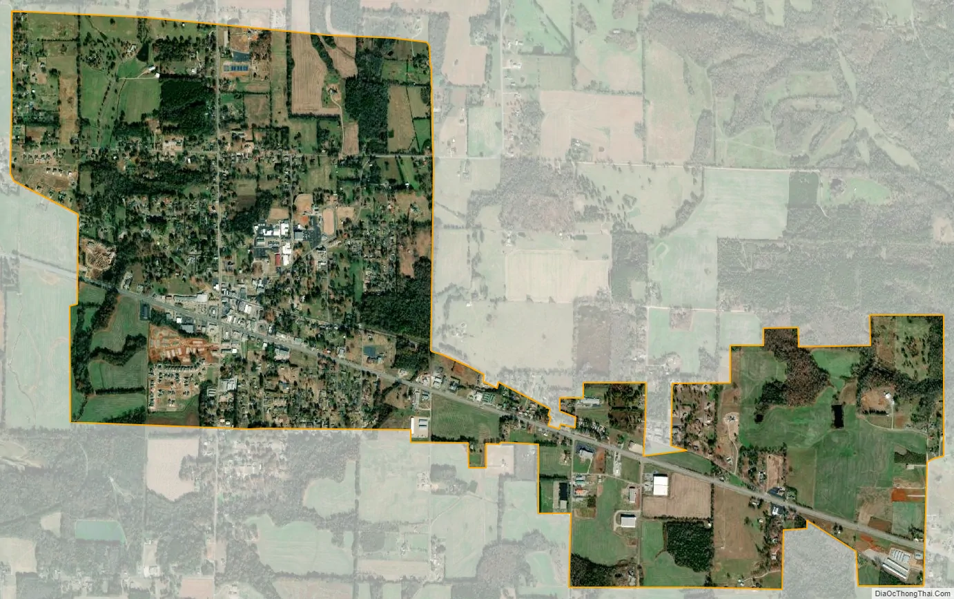
Rogersville city Satellite Map
Geography
Rogersville is located at 34°49′24″N 87°17′8″W / 34.82333°N 87.28556°W / 34.82333; -87.28556 (34.823444, -87.285693). According to the U.S. Census Bureau, the town has a total area of 3.1 square miles (8.0 km), all land.
See also
Map of Alabama State and its subdivision:- Autauga
- Baldwin
- Barbour
- Bibb
- Blount
- Bullock
- Butler
- Calhoun
- Chambers
- Cherokee
- Chilton
- Choctaw
- Clarke
- Clay
- Cleburne
- Coffee
- Colbert
- Conecuh
- Coosa
- Covington
- Crenshaw
- Cullman
- Dale
- Dallas
- De Kalb
- Elmore
- Escambia
- Etowah
- Fayette
- Franklin
- Geneva
- Greene
- Hale
- Henry
- Houston
- Jackson
- Jefferson
- Lamar
- Lauderdale
- Lawrence
- Lee
- Limestone
- Lowndes
- Macon
- Madison
- Marengo
- Marion
- Marshall
- Mobile
- Monroe
- Montgomery
- Morgan
- Perry
- Pickens
- Pike
- Randolph
- Russell
- Saint Clair
- Shelby
- Sumter
- Talladega
- Tallapoosa
- Tuscaloosa
- Walker
- Washington
- Wilcox
- Winston
- Alabama
- Alaska
- Arizona
- Arkansas
- California
- Colorado
- Connecticut
- Delaware
- District of Columbia
- Florida
- Georgia
- Hawaii
- Idaho
- Illinois
- Indiana
- Iowa
- Kansas
- Kentucky
- Louisiana
- Maine
- Maryland
- Massachusetts
- Michigan
- Minnesota
- Mississippi
- Missouri
- Montana
- Nebraska
- Nevada
- New Hampshire
- New Jersey
- New Mexico
- New York
- North Carolina
- North Dakota
- Ohio
- Oklahoma
- Oregon
- Pennsylvania
- Rhode Island
- South Carolina
- South Dakota
- Tennessee
- Texas
- Utah
- Vermont
- Virginia
- Washington
- West Virginia
- Wisconsin
- Wyoming