Pulaski is a city in and the county seat of Giles County, which is located on the central-southern border of Tennessee, United States. The population was 8,397 at the 2020 census. It was named after Casimir Pulaski, a noted Polish-born general on the Patriot side in the American Revolutionary War.
| Name: | Pulaski city |
|---|---|
| LSAD Code: | 25 |
| LSAD Description: | city (suffix) |
| State: | Tennessee |
| County: | Giles County |
| Incorporated: | 1809 |
| Elevation: | 699 ft (213 m) |
| Total Area: | 7.51 sq mi (19.44 km²) |
| Land Area: | 7.51 sq mi (19.44 km²) |
| Water Area: | 0.00 sq mi (0.00 km²) |
| Total Population: | 8,397 |
| Population Density: | 1,118.71/sq mi (431.92/km²) |
| ZIP code: | 38478 |
| Area code: | 931 |
| FIPS code: | 4761040 |
| GNISfeature ID: | 1298659 |
| Website: | www.pulaski-tn.com |
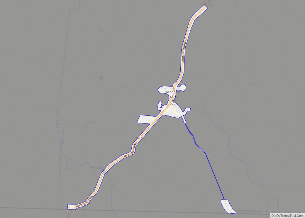
Online Interactive Map
Click on ![]() to view map in "full screen" mode.
to view map in "full screen" mode.
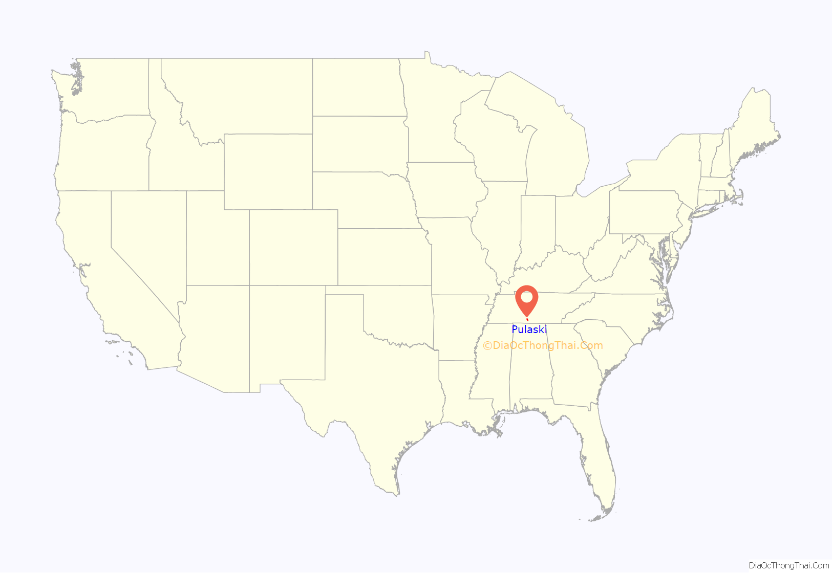
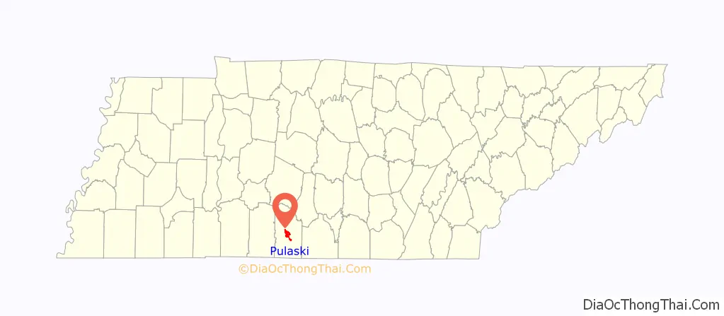
Pulaski location map. Where is Pulaski city?
History
Pulaski was founded in 1809.
During the Civil War, after the Union took control of Tennessee in 1862, thousands of African Americans left plantations and farms to join their lines for refuge. The Army set up a contraband camp in Pulaski to help house the freedmen and their families, feed them, and put them to work. In addition, education classes were started.
Shortly after the war ended, in late 1865, Pulaski was the site of Confederate veterans organizing the first chapter of what became known as the Ku Klux Klan, a secret, white supremacist group. Union troops continued to occupy much of the state until 1870. The KKK members often attacked staff of the Freedmen’s Bureau, established during the Reconstruction era to help negotiate new labor contracts and assist with changes in society.
In 1870 Martin Methodist College was founded in Pulaski for white students in the area.
During the American Civil War, the vicinity of Pulaski was the site of a number of skirmishes during the Franklin–Nashville Campaign. Union troops occupied the state from 1862, and hundreds of African Americans left plantations even before the Emancipation Proclamation to join their lines. The Army set up a contraband camp in Pulaski to help organize the freedmen and their families with shelter, food, and beginning classes in reading and writing.
In 1863, Confederate courier Sam Davis was hanged in Pulaski by the Union Army on suspicion of espionage.
After the war, in late 1865, six Tennessee veterans of the Confederate Army founded a secret society, later known as the Ku Klux Klan (KKK). This was the first chapter. These men: John C. Lester, John B. Kennedy, James R. Crowe, Frank O. McCord, Richard R. Reed, and J. Calvin Jones established the KKK on December 25, 1865. They created rules for a secret, hierarchical society devoted to suppressing freedmen and their white allies, and maintaining white supremacy.
The white insurgents were determined to fight secretly against the political advancement of freedmen and of sympathetic whites. Chapters of the KKK quickly were organized in other parts of the state and the South. KKK members often attacked their victims at night, to increase the intimidation of threats and assaults. Other incidents of racial violence against blacks also took place. The Pulaski riot was a race riot initiated against blacks that took place in the city in the winter of 1868, following a heated election season.
Martin Methodist College was founded in Pulaski in 1870 as a private college for white students. Martin Methodist College was merged with the UT System in 2021 to become the new campus under the University of Tennessee System. It is now known as University of Tennessee Southern and is a public university.
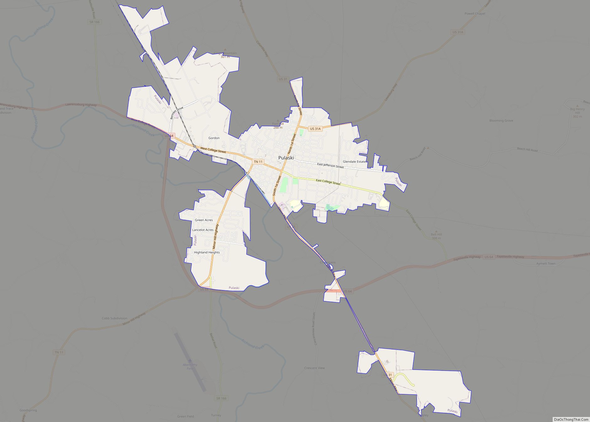
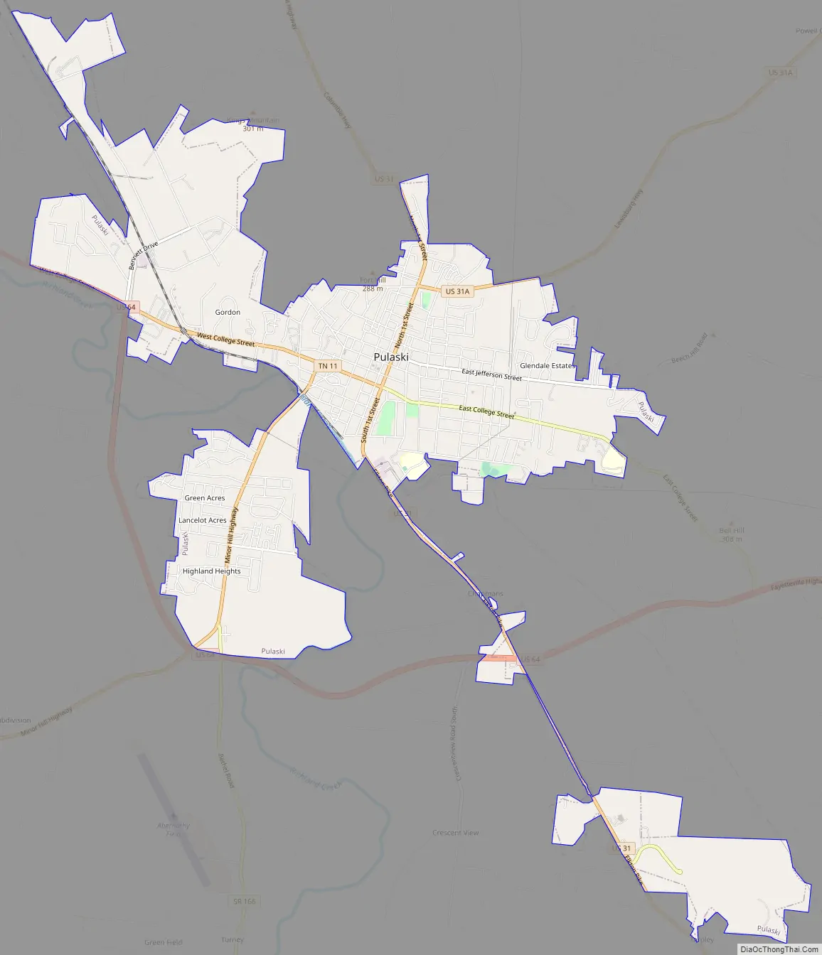
Pulaski Road Map
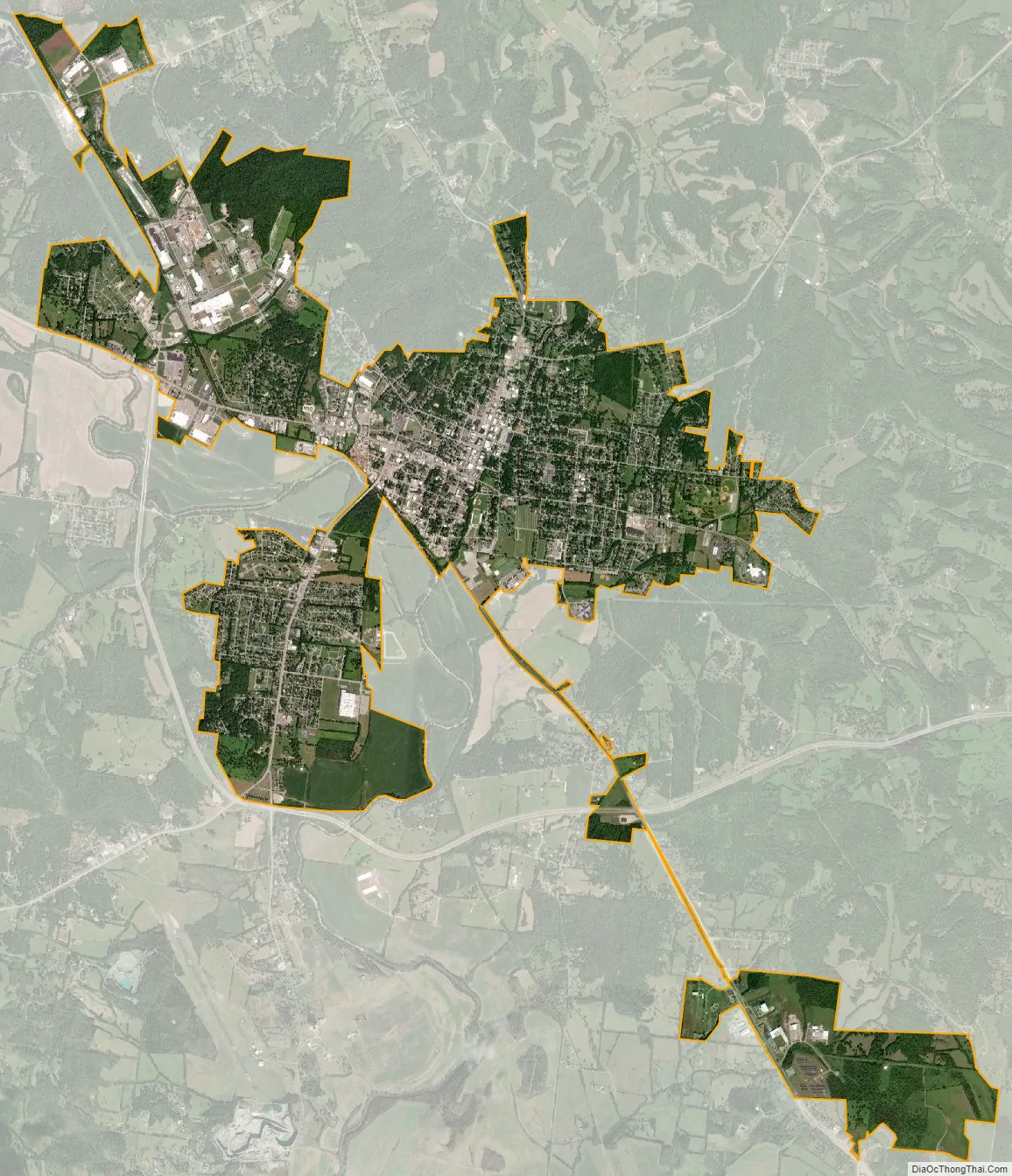
Pulaski city Satellite Map
Geography
Pulaski is located in central Giles County at 35°11′45″N 87°2′4″W / 35.19583°N 87.03444°W / 35.19583; -87.03444 (35.195786, -87.034328). The downtown area is on the north side of Richland Creek, a south-flowing tributary of the Elk River.
U.S. Route 31 passes through the center of Pulaski as First Street, leading north 30 miles (48 km) to Columbia and southeast 19 miles (31 km) to Ardmore at the Alabama border. U.S. Route 31 Alternate (E. Grigsby Street) leaves U.S. 31 in the north part of Pulaski and heads northeast 23 miles (37 km) to Lewisburg. U.S. Route 64 passes south of Pulaski on a bypass route; it leads east 29 miles (47 km) to Fayetteville and west 18 miles (29 km) to Lawrenceburg.
According to the United States Census Bureau, the city has a total area of 7.2 square miles (18.7 km), all land.
Climate
See also
Map of Tennessee State and its subdivision:- Anderson
- Bedford
- Benton
- Bledsoe
- Blount
- Bradley
- Campbell
- Cannon
- Carroll
- Carter
- Cheatham
- Chester
- Claiborne
- Clay
- Cocke
- Coffee
- Crockett
- Cumberland
- Davidson
- Decatur
- DeKalb
- Dickson
- Dyer
- Fayette
- Fentress
- Franklin
- Gibson
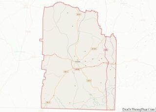
- Giles
- Grainger
- Greene
- Grundy
- Hamblen
- Hamilton
- Hancock
- Hardeman
- Hardin
- Hawkins
- Haywood
- Henderson
- Henry
- Hickman
- Houston
- Humphreys
- Jackson
- Jefferson
- Johnson
- Knox
- Lake
- Lauderdale
- Lawrence
- Lewis
- Lincoln
- Loudon
- Macon
- Madison
- Marion
- Marshall
- Maury
- McMinn
- McNairy
- Meigs
- Monroe
- Montgomery
- Moore
- Morgan
- Obion
- Overton
- Perry
- Pickett
- Polk
- Putnam
- Rhea
- Roane
- Robertson
- Rutherford
- Scott
- Sequatchie
- Sevier
- Shelby
- Smith
- Stewart
- Sullivan
- Sumner
- Tipton
- Trousdale
- Unicoi
- Union
- Van Buren
- Warren
- Washington
- Wayne
- Weakley
- White
- Williamson
- Wilson
- Alabama
- Alaska
- Arizona
- Arkansas
- California
- Colorado
- Connecticut
- Delaware
- District of Columbia
- Florida
- Georgia
- Hawaii
- Idaho
- Illinois
- Indiana
- Iowa
- Kansas
- Kentucky
- Louisiana
- Maine
- Maryland
- Massachusetts
- Michigan
- Minnesota
- Mississippi
- Missouri
- Montana
- Nebraska
- Nevada
- New Hampshire
- New Jersey
- New Mexico
- New York
- North Carolina
- North Dakota
- Ohio
- Oklahoma
- Oregon
- Pennsylvania
- Rhode Island
- South Carolina
- South Dakota
- Tennessee
- Texas
- Utah
- Vermont
- Virginia
- Washington
- West Virginia
- Wisconsin
- Wyoming