Felton is a census-designated place (CDP) in Santa Cruz County, California, United States. The population was 4,489 as of 2020 census and according to the United States Census Bureau, the CDP has a total area of 4.6 square miles (12 km), all of it land.
| Name: | Felton CDP |
|---|---|
| LSAD Code: | 57 |
| LSAD Description: | CDP (suffix) |
| State: | California |
| County: | Santa Cruz County |
| Elevation: | 285 ft (87 m) |
| Total Area: | 4.552 sq mi (11.790 km²) |
| Land Area: | 4.552 sq mi (11.790 km²) |
| Water Area: | 0 sq mi (0 km²) 0% |
| Total Population: | 4,489 |
| Population Density: | 990/sq mi (380/km²) |
| ZIP code: | 95018 |
| Area code: | 831 |
| FIPS code: | 0623826 |
| GNISfeature ID: | 0277512 |
Online Interactive Map
Click on ![]() to view map in "full screen" mode.
to view map in "full screen" mode.
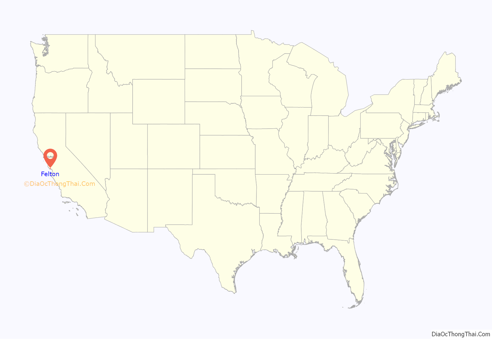
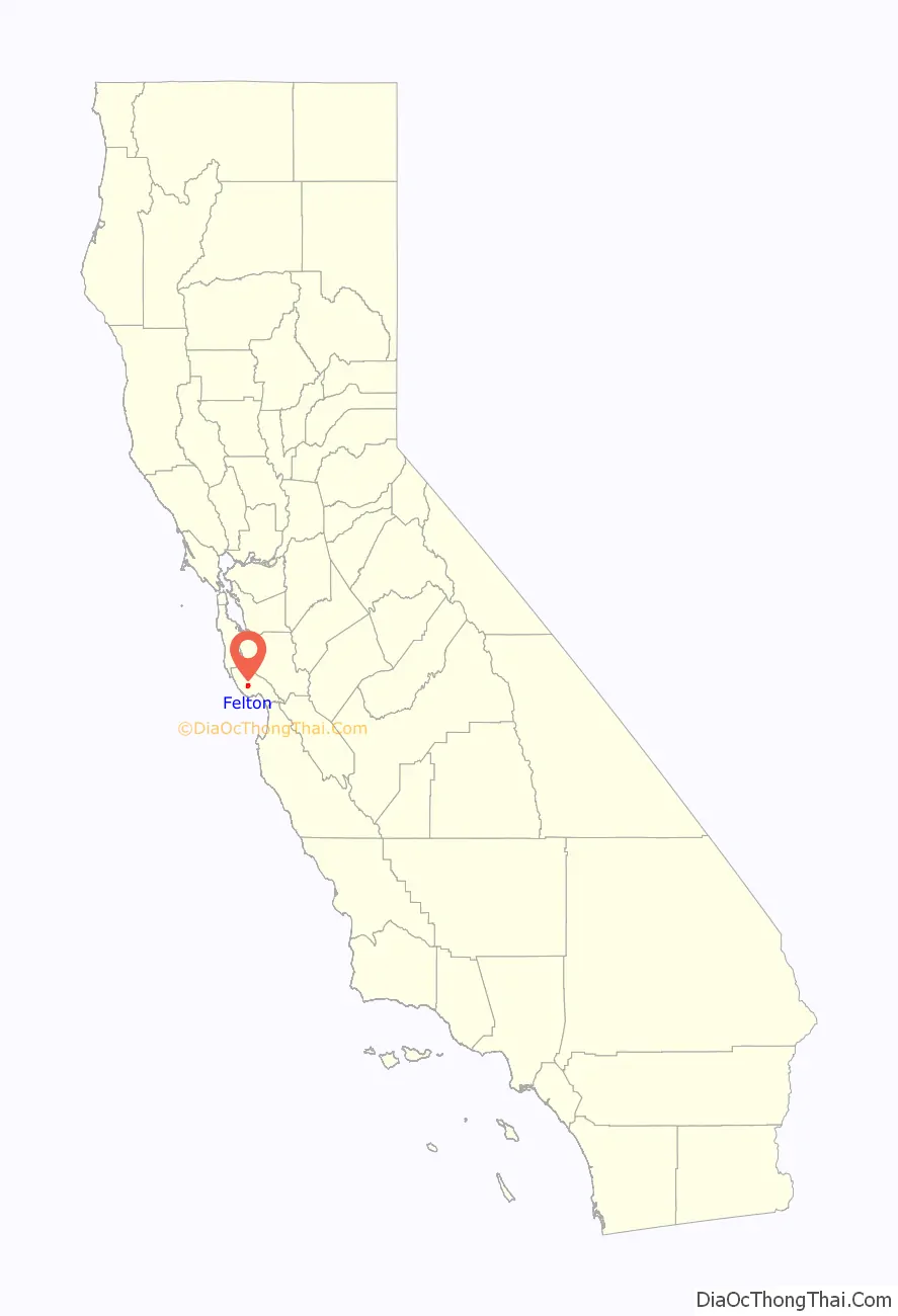
Felton location map. Where is Felton CDP?
History
Named for John B. Felton, a former Oakland, California mayor, a judge and a San Francisco Bay Area investor in his day, the town is an historic logging community. Felton served as the lower terminus of the San Lorenzo Valley Logging Flume from Boulder Creek, which began construction in 1874 and when formally opened in October 1875 was augmented by a new rail line to transport logs to the wharf in Santa Cruz.
Felton was incorporated on March 8, 1878, by the Legislature, thereby becoming a town.
Shortly after the Santa Cruz & Felton Railroad began operation, a second rail line began operation in 1880 from Alameda, California, and San Jose, California. A new depot was constructed at “New Felton” using salvaged materials from a dismantled portion of the San Lorenzo Valley Logging Flume from Boulder Creek. The railroads, limekilns and forest in this area provided a majority of the repair materials for the great 1906 San Francisco earthquake. The standard gauge railroad line came into Felton by 1909.
In 1917, Felton was disincorporated by the Legislature, thereby ceasing to exist as a town while relinquishing the responsibilities thereof to the county of Santa Cruz.
In 1927, the Felton community of Lompico, California, was established.
In 1963, the steam-powered Roaring Camp Railroad began tourist operations on the Big Trees Ranch out of the Old Felton Depot. The company later constructed a replica logging camp and another depot farther down the property, and in 1985, took over operations on the old SPC/Southern Pacific standard gauge line to Santa Cruz. Roaring Camp is a re-creation of an 1880s logging camp and home to the original South Pacific Coast (later Southern Pacific) Felton depot and freight shed, as well as two unique railroads — the Roaring Camp and Big Trees Narrow Gauge Railroad, a steam-powered line up Bear Mountain, and the Santa Cruz, Big Trees and Pacific Railway.
Felton is home to the Felton Covered Bridge, an 80-foot-long covered bridge over the San Lorenzo River built in 1892 and placed on the National Register of Historic Places in 1973.
The Trout Farm Inn was located in Felton. It burned down on June 5, 2016. It reopened in 2022.
The local high school is San Lorenzo Valley High School. The 2007 boys basketball team won the only Boys Basketball SCCAL Championship in school history. Led by five players who all went to elementary school at the now closed Quail Hollow School. Scott Krueger, Josh Payne, Kyle Morris, Clint Gorman and Taylor West were known as the “Quail Hollow 5.” Their success was helped by the students who would regularly attend their games and called themselves, “The Red Sea.”
On August 20, 2020 at 8:00 AM Pacific Time, due to the CZU Lightning Incident fires of 2020, Felton was ordered to evacuate by the California Department of Forestry and Fire Protection.
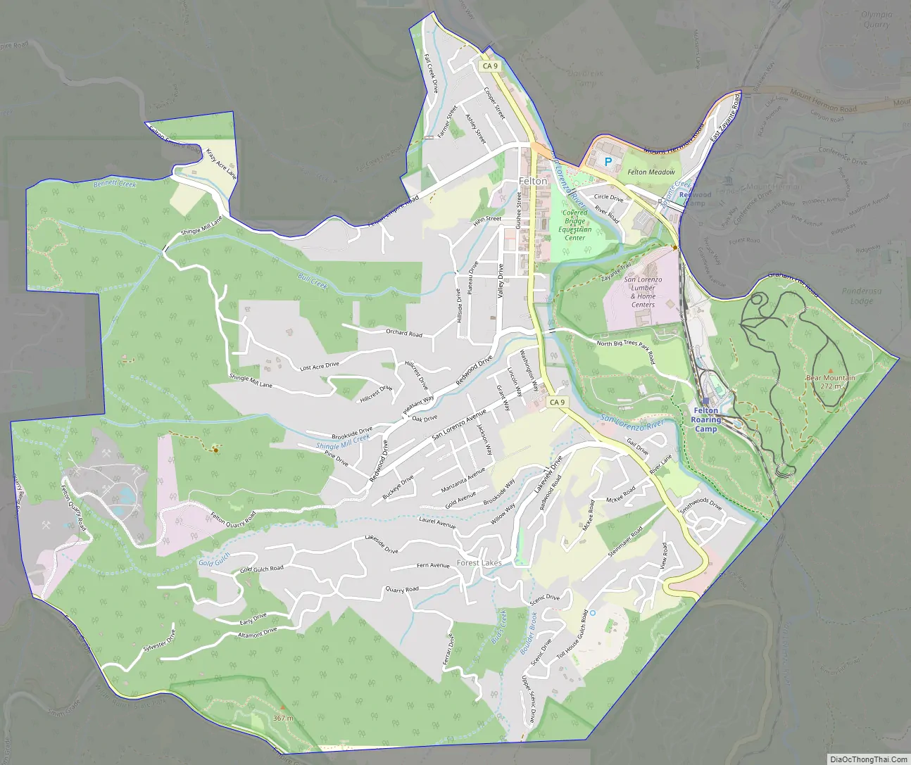
Felton Road Map
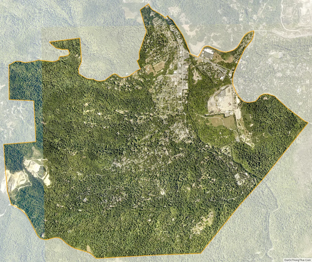
Felton city Satellite Map
See also
Map of California State and its subdivision:- Alameda
- Alpine
- Amador
- Butte
- Calaveras
- Colusa
- Contra Costa
- Del Norte
- El Dorado
- Fresno
- Glenn
- Humboldt
- Imperial
- Inyo
- Kern
- Kings
- Lake
- Lassen
- Los Angeles
- Madera
- Marin
- Mariposa
- Mendocino
- Merced
- Modoc
- Mono
- Monterey
- Napa
- Nevada
- Orange
- Placer
- Plumas
- Riverside
- Sacramento
- San Benito
- San Bernardino
- San Diego
- San Francisco
- San Joaquin
- San Luis Obispo
- San Mateo
- Santa Barbara
- Santa Clara
- Santa Cruz
- Shasta
- Sierra
- Siskiyou
- Solano
- Sonoma
- Stanislaus
- Sutter
- Tehama
- Trinity
- Tulare
- Tuolumne
- Ventura
- Yolo
- Yuba
- Alabama
- Alaska
- Arizona
- Arkansas
- California
- Colorado
- Connecticut
- Delaware
- District of Columbia
- Florida
- Georgia
- Hawaii
- Idaho
- Illinois
- Indiana
- Iowa
- Kansas
- Kentucky
- Louisiana
- Maine
- Maryland
- Massachusetts
- Michigan
- Minnesota
- Mississippi
- Missouri
- Montana
- Nebraska
- Nevada
- New Hampshire
- New Jersey
- New Mexico
- New York
- North Carolina
- North Dakota
- Ohio
- Oklahoma
- Oregon
- Pennsylvania
- Rhode Island
- South Carolina
- South Dakota
- Tennessee
- Texas
- Utah
- Vermont
- Virginia
- Washington
- West Virginia
- Wisconsin
- Wyoming


