Palo Alto (/ˌpæloʊ ˈæltoʊ/; Spanish for “tall stick”) is a charter city in the northwestern corner of Santa Clara County, California, United States, in the San Francisco Bay Area, named after a coastal redwood tree known as El Palo Alto.
Originally formed as the township of Mayfield in 1855, the city was established in 1894 by the American industrialist Leland Stanford when he founded Stanford University in memory of his son, Leland Stanford Jr. Palo Alto includes portions of Stanford University and borders East Palo Alto, Mountain View, Los Altos, Los Altos Hills, Stanford, Portola Valley, and Menlo Park. At the 2020 census, the population was 68,572. Palo Alto is one of the most expensive cities in the United States in which to live, and its residents are among the most educated in the country. However, it also has a youth suicide rate four times higher than the national average, often attributed to academic pressure.
As one of the principal cities of Silicon Valley, Palo Alto is home to the headquarters of multiple tech companies, including HP, Space Systems/Loral, VMware, PARC, and Houzz. Palo Alto has also served as headquarters or the founding location of several other tech companies, including Apple, Google, Facebook, Logitech, Tesla, Intuit, IDEO, Pinterest, and PayPal; Ford Motor Company and Lockheed Martin each additionally maintain major research and technology facilities within Palo Alto.
| Name: | Palo Alto city |
|---|---|
| LSAD Code: | 25 |
| LSAD Description: | city (suffix) |
| State: | California |
| County: | Santa Clara County |
| Incorporated: | April 23, 1894 |
| Elevation: | 30 ft (9 m) |
| Total Area: | 26.00 sq mi (67.35 km²) |
| Land Area: | 24.10 sq mi (62.41 km²) |
| Water Area: | 1.91 sq mi (4.94 km²) 7.38% |
| Total Population: | 68,572 |
| Population Density: | 2,871.52/sq mi (1,047.35/km²) |
| Area code: | 650 |
| FIPS code: | 0655282 |
| Website: | www.cityofpaloalto.org |
Online Interactive Map
Click on ![]() to view map in "full screen" mode.
to view map in "full screen" mode.
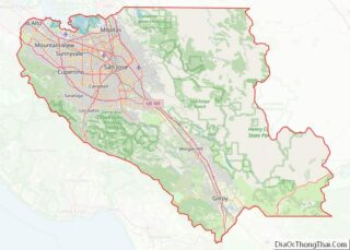
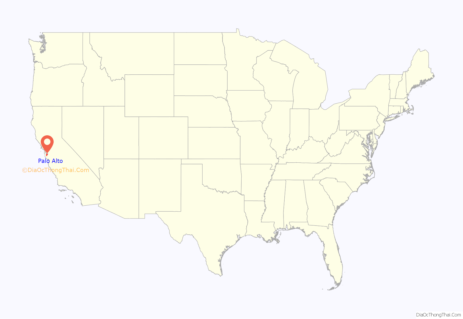
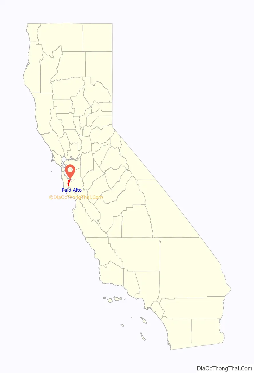
Palo Alto location map. Where is Palo Alto city?
History
Prior to the arrival of Europeans, the Ohlone lived on the San Francisco peninsula; in particular, the Puichon Ohlone lived in the Palo Alto area. The area of modern Palo Alto was first recorded by the 1769 party of Gaspar de Portolá, a 64-man, 200-horse expedition setting out from San Diego to find Monterey Bay. The group trekked past the bay without recognizing it and continued north. When they reached modern-day Pacifica, they ascended Sweeney Ridge and saw the San Francisco Bay on November 2. Portolá descended from Sweeney Ridge southeast down San Andreas Creek to Laguna Creek (now Crystal Springs Reservoir), thence to the San Francisquito Creek watershed, ultimately camping from November 6–11, 1769, by a tall redwood later to be known as El Palo Alto.
In 1777, Father Junipero Serra established the Mission Santa Clara de Asis, whose northern boundary was San Francisquito Creek and whose lands included modern Palo Alto. The area was under the control of the viceroy of Mexico and ultimately under the control of Spain. On November 29, 1777, Pueblo de San Jose de Guadalupe (now the city of San Jose a few miles to the south of what was to be Palo Alto) was established by order of the viceroy despite the displeasure of the local mission. The Mexican War of Independence ending in 1821 led to Mexico becoming an independent country, though San Jose did not recognize rule by the new Mexico until May 10, 1825. Mexico proceeded to sell off or grant much of the mission land.
During the Mexican–American War, the United States seized Alta California in 1846; however, this was not legalized until the Treaty of Guadalupe Hidalgo was signed on July 4, 1848. Mexican citizens in the area could choose to become United States citizens and their land grants were to be recognized if they chose to do so (though many legal disputes arose over this).
The land grant, Rancho Rinconada del Arroyo de San Francisquito, of about 2,230 acres (9.0 km) on the lower reaches of San Francisquito Creek (i.e., parts of modern Menlo Park and northern Palo Alto) was given to Maria Antonia Mesa in 1841. She and her husband Rafael Soto (who had died in 1839) had settled in 1835 near present-day Newell and Middlefield roads and sold supplies. In 1839, their daughter María Luisa Soto (1817–1883) married John Coppinger, who was to be, in 1841, the grantee of Rancho Cañada de Raymundo (in modern San Mateo county). Upon Coppinger’s death in 1847, Maria inherited it and later married a visiting boat captain, John Greer. Greer owned a home on the site that is now Town & Country Village on Embarcadero and El Camino Real. Greer Avenue and Court are named for him.
To the south of the Sotos, the brothers Secundino and Teodoro Robles in 1849 bought Rancho Rincon de San Francisquito from José Peña, the 1841 grantee. The grant covered the area south of Rancho Rinconada del Arroyo de San Francisquito to more or less present-day Mountain View. The grant was bounded on the south by Mariano Castro’s Rancho Pastoria de las Borregas grant across San Antonio Road. This later became the Robles Rancho, which constitutes about 80% of Palo Alto and Stanford University today. In 1863, it was whittled down in the courts to 6,981 acres (28.25 km). Stories say the grand hacienda was built on the former meager adobe of José Peña near Ferne off San Antonio Road, midway between Middlefield and Alma Street. Their hacienda hosted fiestas and bull fights. It was ruined in the 1906 earthquake and its lumber was used to build a large barn nearby, which was said to have lingered until the early 1950s. On April 10, 1853, 250 acres (1.0 km), comprising the present-day Barron Park, Matadero Creek and Stanford Business Park, was sold for $2,000 to Elisha Oscar Crosby, who called his new property Mayfield Farm. The name of Mayfield was later attached to the community that started nearby. On September 23, 1856, the Crosby land was transferred to Sarah Wallis to satisfy a debt he owed her. In 1880, Secundino Robles, father to twenty-nine children, still lived just south of Palo Alto, near the location of the present-day San Antonio Shopping Center in Mountain View.
Many of the Spanish names in the Palo Alto area represent the local heritage, descriptive terms, and former residents. Pena Court, Miranda Avenue, which was essentially Foothill Expressway, was the married name of Juana Briones and the name occurs in Courts and Avenues and other street names in Palo Alto and Mountain View in the quadrant where she owned vast areas between Stanford University, Grant Road in Mountain View and west of El Camino Real. Yerba Buena was to her credit. Rinconada was the major Mexican land grant name.
The township of Mayfield was formed in 1855, around the site of a stagecoach stop and saloon known as “Uncle Jim’s Cabin” near the intersection of El Camino Real and today’s California Avenue in what is now southern Palo Alto. In October 1863 the San Francisco to San Jose railroad had been built as far as Mayfield and service started between San Francisco and Mayfield (the station is now California Avenue); train service all the way to San Jose started in January 1864. El Camino became Main Street; the northeast-southwest cross streets were named for Civil War heroes, with California Avenue originally being Lincoln Street. The town had its own newspaper by 1869 (the Mayfield Enterprise, in English and Spanish), incorporated in 1903, and had breweries and a cannery.
In 1875, French financier Jean Baptiste Paulin Caperon, better known as Peter Coutts, purchased land in Mayfield and four other parcels around three sides of today’s College Terrace – more than a thousand acres extending from today’s Page Mill Road to Serra Street and from El Camino Real to the foothills. Coutts named his property Ayrshire Farm. His fanciful 50-foot-tall brick tower near Matadero Creek likely marked the south corner of his property. Leland Stanford started buying land in the area in 1876 for a horse farm, called the Palo Alto Stock Farm. Stanford bought Ayrshire Farm in 1882.
Creation of the town
In 1884, Leland Stanford and his wife, Jane lost their only child Leland Stanford Jr. when he died of typhoid fever at age 15 and decided to create a university in his memory. In 1886, they proposed having the university’s gateway be Mayfield. However, they had one condition: alcohol had to be banned from the town. Known for its 13 rowdy saloons, Mayfield rejected his request. This led them to drive the formation of a new temperance town with the help of their friend Timothy Hopkins of the Southern Pacific Railroad, who in 1887 bought 740 acres (3.0 km) of private land for the new townsite. This Hopkins Tract, bounded by El Camino Real, San Francisquito Creek, Boyce, Channing, Melville, and Hopkins Avenues, and Embarcadero Road, was proclaimed a local Heritage District during Palo Alto’s centennial in 1994. The Stanfords set up their university, Stanford University, and a train stop (on University Avenue) by the new town. This new community was initially called University Park (the name “Palo Alto” at that time was attached to what is now College Terrace), but was incorporated in 1894 with the name Palo Alto. With the Stanfords’ support, Palo Alto grew to the size of Mayfield. Mayfield eventually passed an ordinance banning saloons that took effect in January 1905.
Later history
On July 2, 1925, Palo Alto voters approved the annexation of Mayfield and the two communities were officially consolidated on July 6, 1925. As a result Palo Alto has two downtown areas: one along University Avenue and one along California Avenue (renamed after the annexation since Palo Alto already had a Lincoln Avenue).
The Mayfield News wrote its own obituary four days later:
Palo Alto continued to annex more land, including the Stanford Shopping Center area in 1953. Stanford Research Park, Embarcadero Road northeast of Bayshore, and the West Bayshore/San Antonio Road area were also annexed during the 1950s. Large amounts of land west of Foothill Expressway were annexed between 1959 and 1968; this is mostly undeveloped and includes Foothills Park and Arastradero Preserve. The last major annexations were of Barron Park in 1975 and, in 1979, a large area of marshlands bordering the bay.
Many of Stanford University’s first faculty members settled in the Professorville neighborhood of Palo Alto. Professorville, now a registered national historic district, is bounded by Kingsley, Lincoln, and Addison Avenues and the cross streets of Ramona, Bryant, and Waverley. The district includes a large number of well-preserved residences dating from the 1890s, including 833 Kingsley, 345 Lincoln, and 450 Kingsley. 1044 Bryant was the home of Russell Varian, co-inventor of the Klystron tube. The Federal Telegraph laboratory site, situated at 218 Channing, is a California Historical Landmark recognizing Lee de Forest’s 1911 invention of the vacuum tube and electronic oscillator at that location. While not open to the public, the garage that housed the launch of Hewlett Packard is located at 367 Addison Avenue. Hewlett Packard recently restored the house and garage. A second historic district on Ramona Street can be found downtown between University and Hamilton Avenues. The Palo Alto Chinese School is the oldest in the entire Bay Area. It is also home to the second oldest opera company in California, the West Bay Opera.
One early major business was when Thomas Foon Chew, owner of the Bayside Canning Company in Alviso founded by his father, expanded his business by starting a cannery in 1918 in what was then Mayfield that initially employed 350 workers but later expanded. In the 1920s the Bayside Canning Company became one of the largest in the world. In 1949 the Palo Alto cannery, now part of the Sutter Packing Company under the ownership of Safeway, closed; at the time it was the largest employer in Palo Alto with about a 1,000 workers. Various businesses used the building since including Fry’s Electronics.
Palo Alto is also home to a long-standing baseball tradition. The Palo Alto Oaks are a collegiate summer baseball club that has been in the Bay Area since 1950, eight years longer than the San Francisco Giants. The Oaks were originally managed by Tony Makjavich for 49 years. The Oaks were going to fold before the summer 2016 season but were taken on by Daniel Palladino and Whaylan Price, Bay Area baseball coaches who didn’t want to see the team die. The Oaks have a rich history within the Palo Alto community.
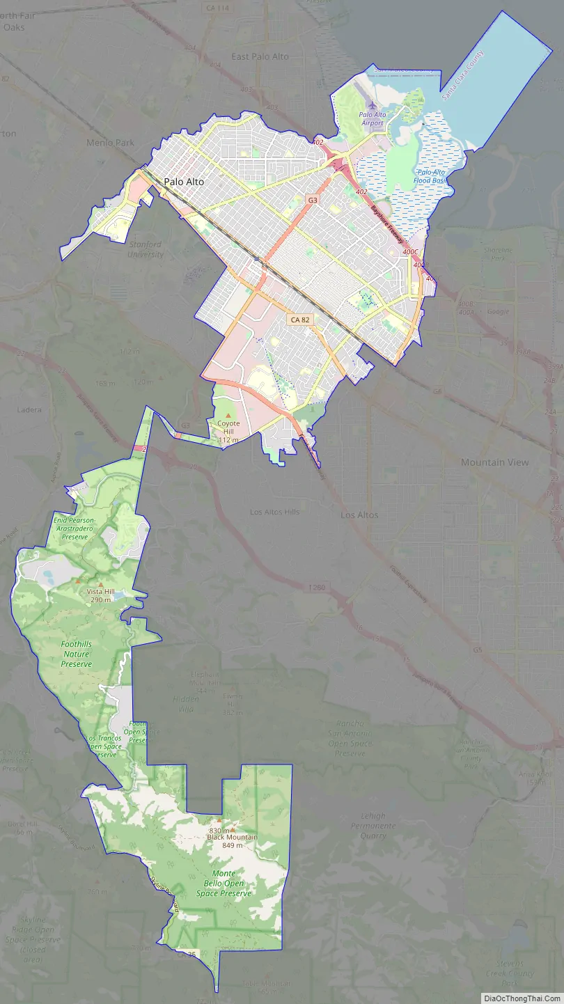
Palo Alto Road Map
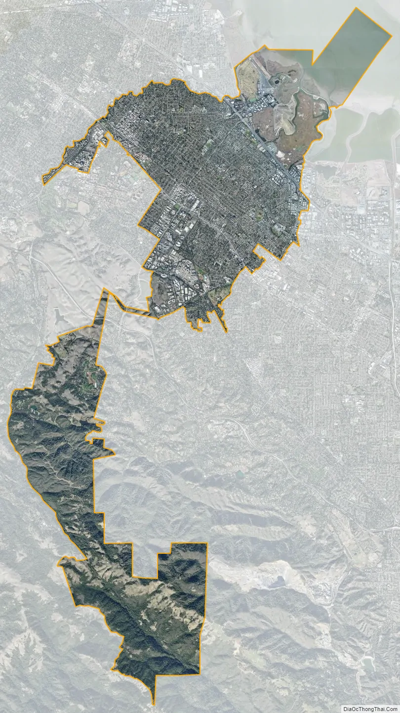
Palo Alto city Satellite Map
Geography
Palo Alto lies in the southeastern section of the San Francisco Peninsula.
It consists of two large parcels of land connected by a narrow corridor. The southern inland section, located south of Interstate 280, is hilly, rural, and lightly populated and is the site of Pearson–Arastradero Preserve and Foothills Park both part of the Palo Alto park system and also large parts of the Los Trancos and Monte Bello Open Space Preserves part of the Midpeninsula Regional Open Space District. The city extends as far as Skyline Boulevard along the ridge of the Santa Cruz Mountains.
The northern more densely populated parcel is bordered by San Francisquito Creek (with Menlo Park and East Palo Alto in adjacent San Mateo County beyond) to the north, San Francisco Bay to the north-east, Mountain View, Los Altos, and Los Altos Hills to the east and south-east and Stanford University to the south-west and west. Several major transit routes cross this parcel from the north-west to the south-east. The biggest and closest to the bay is the Bayshore Freeway and going inland are Alma Street/Central Expressway, El Camino Real, and Foothill Expressway. Interstate 280 is parallel and crosses the narrow corridor of land that connects the two parcels that makeup Palo Alto. Somewhat perpendicular to these roads are Sand Hill Road from El Camino until it crosses San Francisquito Creek into Menlo Park, Embarcadero Road, Oregon Expressway/Page Mill Road, Arastradero Road/East Charleston Road, and San Antonio Road (the last forms part of the boundary with Mountain View).
According to the United States Census Bureau, the city has a total area of 25.8 square miles (67 km), of which 23.9 square miles (62 km) is land and 1.9 square miles (4.9 km), comprising 7.38%, is water.
The official elevation is 30 feet (9 m) above sea level, but the city boundaries reach well into the northern section of the Santa Cruz Mountains.
Water
Palo Alto is crossed by several creeks that flow north in the direction of the San Francisco Bay, Adobe Creek near its eastern boundary, San Francisquito Creek on its western boundary, and Matadero Creek in between the other two. Arastradero Creek is a tributary to Matadero Creek, and Barron Creek is now diverted to Adobe Creek just south of Highway 101 by a diversion channel. The San Francisquito Creek mainstem is formed by the confluence of Corte Madera Creek and Bear Creek not far below Searsville Dam. Further downstream, Los Trancos Creek is a tributary to San Francisquito Creek below Interstate 280.
Environmental features
Palo Alto has a number of significant natural habitats, including estuarine, riparian, and oak forest. Many of these habitats are visible in Foothills Park, which is owned by the city. The Charleston Slough contains a rich marsh and littoral zone, providing feeding areas for a variety of shorebirds and other estuarine wildlife.
Climate
Typical of the South Peninsula region of the San Francisco Bay Area, Palo Alto has a Mediterranean climate with mild, moderately wet winters and warm, dry summers. Typically, in the warmer months, as the sun goes down, the fog bank flows over the foothills to the west and covers the night sky, thus creating a blanket that helps trap the summer warmth absorbed during the day. Even so, it is rare for the overnight low temperature to exceed 60 °F (16 °C).
In January, average daily temperatures range from a low of 39.0 °F (3.9 °C) to a high of 57.8 °F (14.3 °C). In July, average temperatures range from 55.7 °F (13.2 °C) to 79.4 °F (26.3 °C). The record high temperature was 108 °F (42 °C) on September 6, 2022 and the record low temperature was 20 °F (−7 °C) on January 11, 1949, December 24, 1990, and February 12, 2013. Temperatures reach 90 °F (32 °C) or higher on an average of 12.0 days. Temperatures drop to 32 °F (0 °C) or lower on an average of 14.0 days.
Due to the Santa Cruz Mountains to the west, there is a “rain shadow” in Palo Alto, resulting in an average annual rainfall of only 15.12 inches (384 mm). Measurable rainfall occurs on an average of 55.8 days annually. The wettest year on record was 1983 with 32.51 inches (826 mm) and the driest year was 2013 with 3.81 inches (97 mm). The most rainfall in one month was 12.43 inches (316 mm) in February 1998 and the most rainfall in one day was 3.75 inches (95 mm) on February 3, 1998. Measurable snowfall is very rare in the populated areas of Palo Alto, but 1.5 inches (3.8 cm) fell on January 21, 1962. A dusting of snow occasionally occurs in the highest (unpopulated) section of Palo Alto near Skyline Ridge, where the elevation reaches up to 2,812 feet (857 m).
According to the Köppen Climate Classification system, Palo Alto has a warm-summer Mediterranean climate (Csb).
See also
Map of California State and its subdivision:- Alameda
- Alpine
- Amador
- Butte
- Calaveras
- Colusa
- Contra Costa
- Del Norte
- El Dorado
- Fresno
- Glenn
- Humboldt
- Imperial
- Inyo
- Kern
- Kings
- Lake
- Lassen
- Los Angeles
- Madera
- Marin
- Mariposa
- Mendocino
- Merced
- Modoc
- Mono
- Monterey
- Napa
- Nevada
- Orange
- Placer
- Plumas
- Riverside
- Sacramento
- San Benito
- San Bernardino
- San Diego
- San Francisco
- San Joaquin
- San Luis Obispo
- San Mateo
- Santa Barbara
- Santa Clara
- Santa Cruz
- Shasta
- Sierra
- Siskiyou
- Solano
- Sonoma
- Stanislaus
- Sutter
- Tehama
- Trinity
- Tulare
- Tuolumne
- Ventura
- Yolo
- Yuba
- Alabama
- Alaska
- Arizona
- Arkansas
- California
- Colorado
- Connecticut
- Delaware
- District of Columbia
- Florida
- Georgia
- Hawaii
- Idaho
- Illinois
- Indiana
- Iowa
- Kansas
- Kentucky
- Louisiana
- Maine
- Maryland
- Massachusetts
- Michigan
- Minnesota
- Mississippi
- Missouri
- Montana
- Nebraska
- Nevada
- New Hampshire
- New Jersey
- New Mexico
- New York
- North Carolina
- North Dakota
- Ohio
- Oklahoma
- Oregon
- Pennsylvania
- Rhode Island
- South Carolina
- South Dakota
- Tennessee
- Texas
- Utah
- Vermont
- Virginia
- Washington
- West Virginia
- Wisconsin
- Wyoming