Westminster is a city in northern Orange County, California, known for its many Vietnamese refugees who immigrated to the city during the 1980s. They settled largely in Little Saigon, and the city is known as the “capital” of overseas Vietnamese with 36,058 Vietnamese Americans and at 40.2% (2010), the highest municipal prevalence of Vietnamese Americans. The Little Saigon is a district of the town. Westminster was founded in 1870 by Rev. Lemuel Webber as a Presbyterian temperance colony and was incorporated in 1957.
Westminster is bordered by the city of Seal Beach on the west, by Garden Grove on the north and east, and by Huntington Beach and Fountain Valley on the south. Santa Ana, the county seat of Orange County, is east of Westminster.
Westminster won the All-America City Award in 1996.
In the court case Mendez v. Westminster (1947), a Hispanic man sued the Westminster School District for forcing his daughter, Sylvia Mendez, to attend a school for Mexican children. They eventually won and thus began the process of desegregation. Sylvia Mendez was later awarded the Presidential Medal of Freedom from President Barack Obama on February 15, 2011.
| Name: | Westminster city |
|---|---|
| LSAD Code: | 25 |
| LSAD Description: | city (suffix) |
| State: | California |
| County: | Orange County |
| Elevation: | 39 ft (12 m) |
| Total Area: | 10.04 sq mi (26.00 km²) |
| Land Area: | 10.04 sq mi (26.00 km²) |
| Water Area: | 0.00 sq mi (0.00 km²) 0% |
| Total Population: | 89,701 |
| Population Density: | 9,029.99/sq mi (3,486.51/km²) |
| FIPS code: | 0684550 |
| Website: | www.westminster-ca.gov |
Online Interactive Map
Click on ![]() to view map in "full screen" mode.
to view map in "full screen" mode.
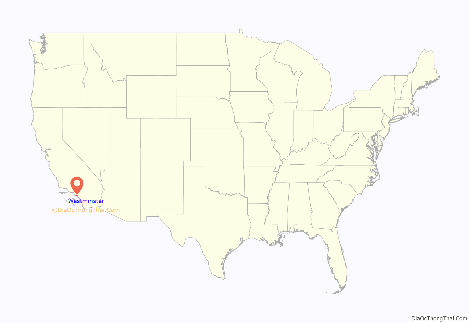
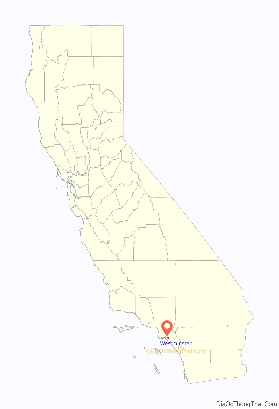
Westminster location map. Where is Westminster city?
History
Westminster was founded in 1870 by Rev. Lemuel Webber as a Presbyterian temperance colony. The name is derived from the Westminster Assembly of 1643, which established the basic tenets of the Presbyterian faith. During the early years of its history, farmers refused to harvest grapes since they associated grapes with alcohol.
Westminster was incorporated in 1957, at which time it had 10,755 residents. Originally, the city was named Tri-City because it was to be the amalgamation of three cities: Westminster, Barber City, and Midway City. Midway City ultimately refused incorporation, leaving only Barber City to be absorbed into the newly incorporated Westminster. The former Barber City was located in the western portion of the current city of Westminster.
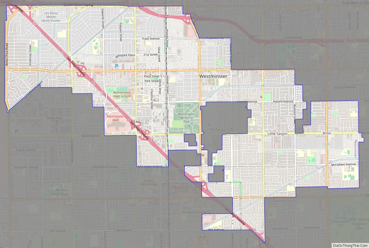
Westminster Road Map
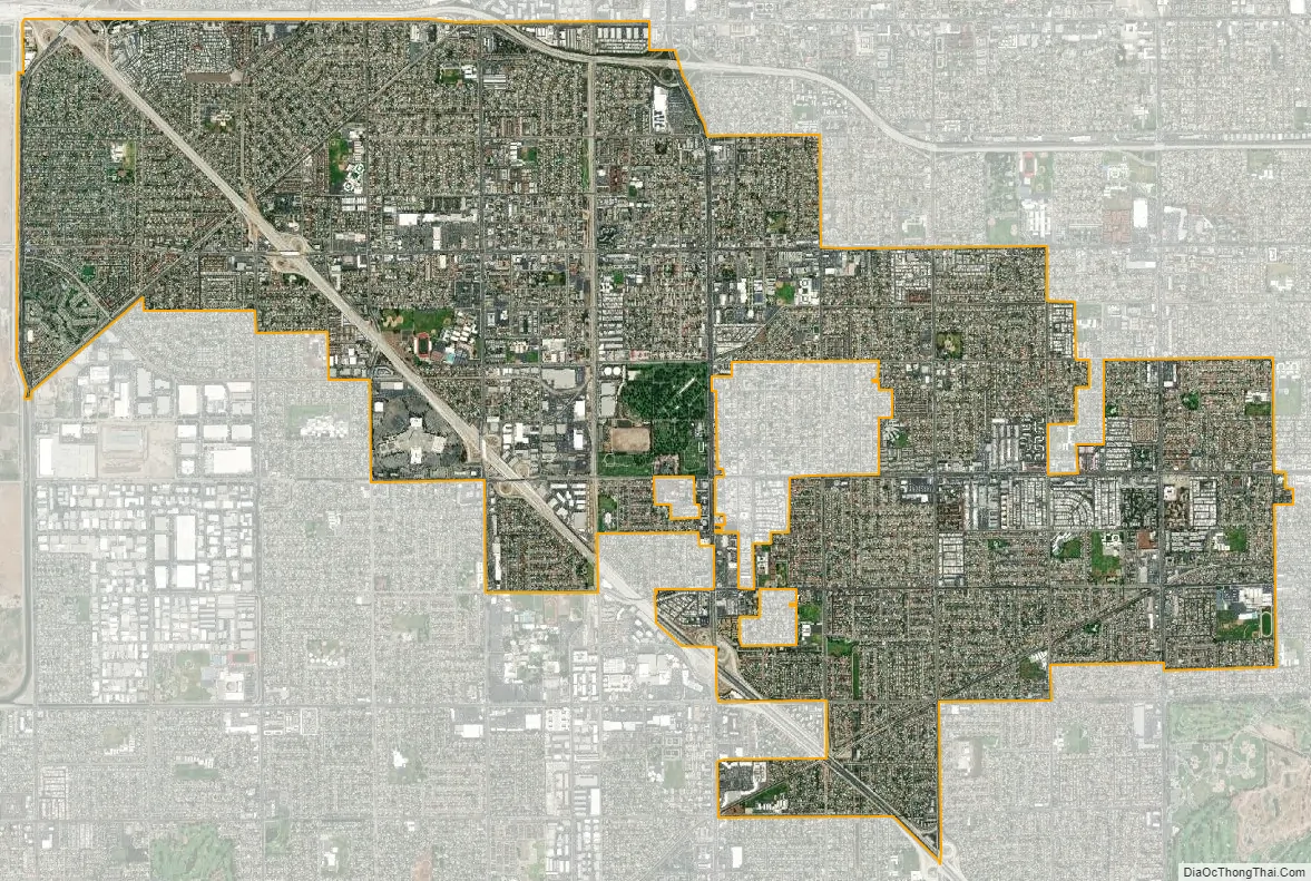
Westminster city Satellite Map
Geography
According to the United States Census Bureau, the city has a total area of 10.0 square miles (26 km), all land. The San Diego Freeway and a short segment of the Garden Grove Freeway pass through Westminster.
Westminster is bordered by the city of Seal Beach on the west, by Garden Grove on the north and east, and by Huntington Beach and Fountain Valley on the south. Santa Ana, the county seat of Orange County, is east of Westminster, although a small portion of Garden Grove lies between the two cities. Westminster borders the unincorporated area of Midway City, except for a small portion where Midway City borders Huntington Beach on the south. The Little Saigon district of the town is mostly situated between Hazard Avenue and Bolsa Avenue.
Climate
See also
Map of California State and its subdivision:- Alameda
- Alpine
- Amador
- Butte
- Calaveras
- Colusa
- Contra Costa
- Del Norte
- El Dorado
- Fresno
- Glenn
- Humboldt
- Imperial
- Inyo
- Kern
- Kings
- Lake
- Lassen
- Los Angeles
- Madera
- Marin
- Mariposa
- Mendocino
- Merced
- Modoc
- Mono
- Monterey
- Napa
- Nevada
- Orange
- Placer
- Plumas
- Riverside
- Sacramento
- San Benito
- San Bernardino
- San Diego
- San Francisco
- San Joaquin
- San Luis Obispo
- San Mateo
- Santa Barbara
- Santa Clara
- Santa Cruz
- Shasta
- Sierra
- Siskiyou
- Solano
- Sonoma
- Stanislaus
- Sutter
- Tehama
- Trinity
- Tulare
- Tuolumne
- Ventura
- Yolo
- Yuba
- Alabama
- Alaska
- Arizona
- Arkansas
- California
- Colorado
- Connecticut
- Delaware
- District of Columbia
- Florida
- Georgia
- Hawaii
- Idaho
- Illinois
- Indiana
- Iowa
- Kansas
- Kentucky
- Louisiana
- Maine
- Maryland
- Massachusetts
- Michigan
- Minnesota
- Mississippi
- Missouri
- Montana
- Nebraska
- Nevada
- New Hampshire
- New Jersey
- New Mexico
- New York
- North Carolina
- North Dakota
- Ohio
- Oklahoma
- Oregon
- Pennsylvania
- Rhode Island
- South Carolina
- South Dakota
- Tennessee
- Texas
- Utah
- Vermont
- Virginia
- Washington
- West Virginia
- Wisconsin
- Wyoming


