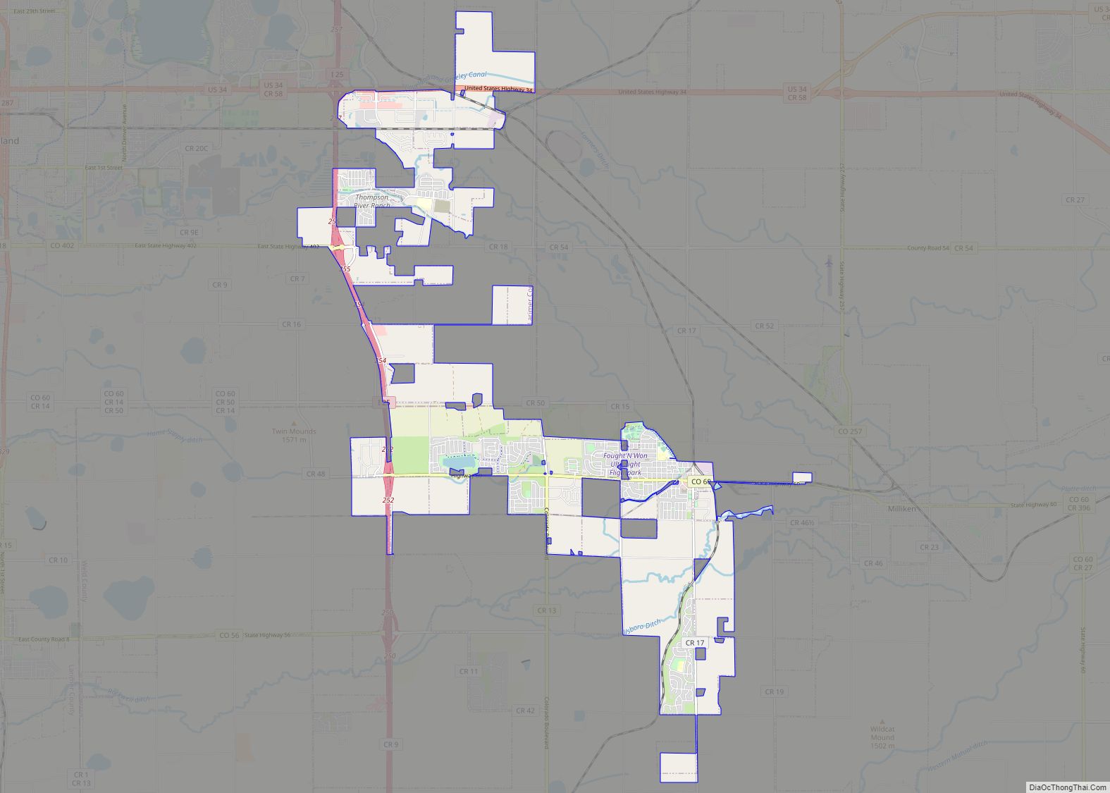
The Town of Timnath is a Statutory Town located in Larimer County, Colorado, United States. Founded in 1882, Timnath is a small agricultural/farming community located southeast of Fort Collins, Colorado, approximately one-half mile east of the Harmony Road/Interstate 25 interchange, on a small bluff east of the Cache la Poudre River. The surrounding farmlands have been used primarily for potatoes, alfalfa, sugar beets, and cattle. Although the town has remained virtually unchanged in recent decades, the encroaching growth of both Fort Collins to the west and Windsor to the south have placed the town in an area considered favorable to development. The population was 6,487 at the 2020 census. Timnath has been one of the fastest-growing communities in Colorado since 2020, and in 2021 had an estimated population of 7,839.
| Name: | Timnath town |
|---|---|
| LSAD Code: | 43 |
| LSAD Description: | town (suffix) |
| State: | Colorado |
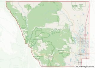
| County: | Larimer County |
| Incorporated: | July 6, 1920 |
| Elevation: | 4,867 ft (1,483 m) |
| Total Area: | 7.045 sq mi (18.25 km²) |
| Land Area: | 7.02 sq mi (18.18 km²) |
| Water Area: | 0.025 sq mi (0.065 km²) 0.0% |
| Total Population: | 6,487 |
| Population Density: | 165.87/sq mi (429.6/km²) |
| ZIP code: | 80547 (PO Box) |
| Area code: | 970 |
| FIPS code: | 0877510 |
| GNISfeature ID: | 0180510 |
| Website: | timnath.org |
Online Interactive Map
Click on ![]() to view map in "full screen" mode.
to view map in "full screen" mode.
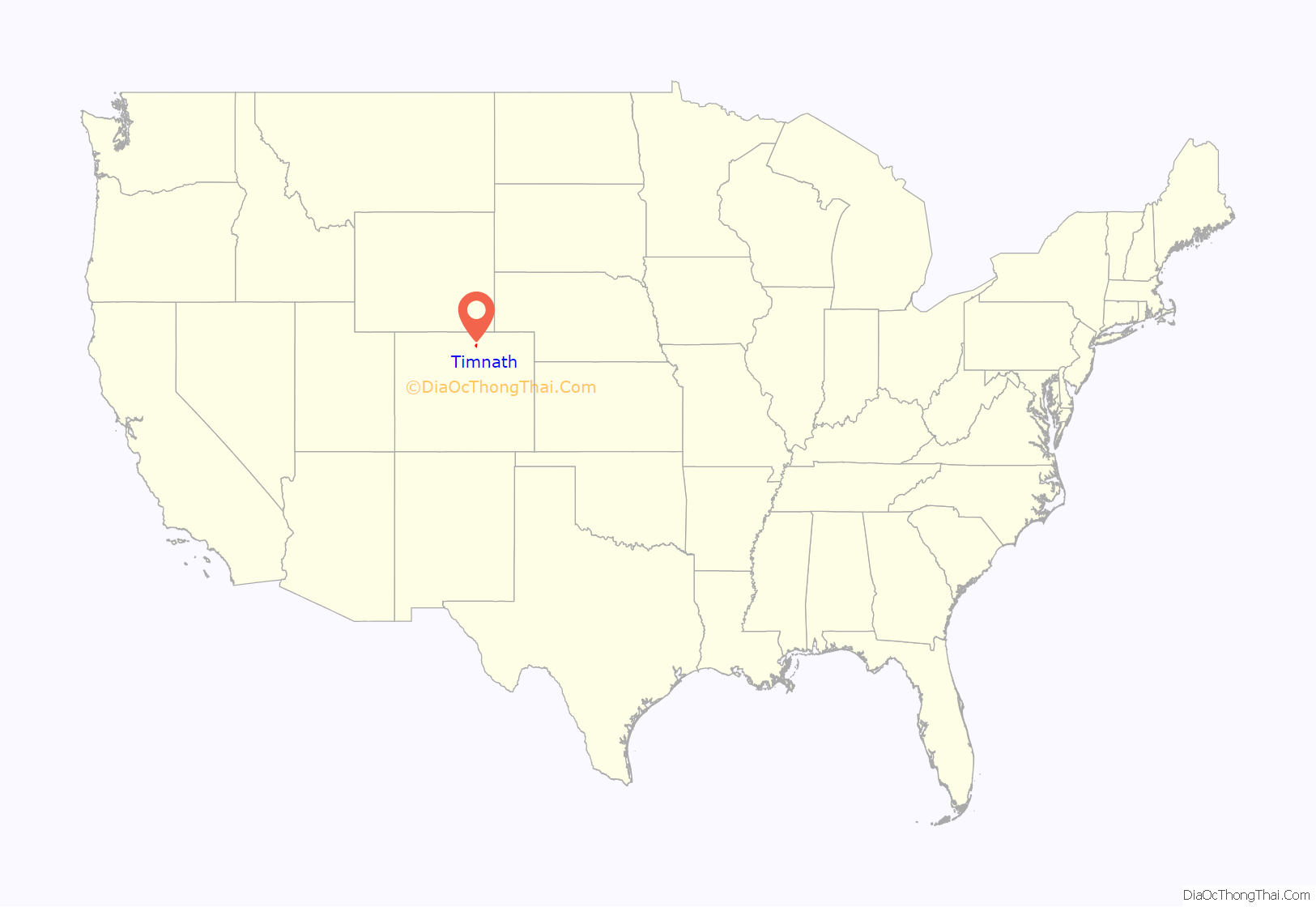
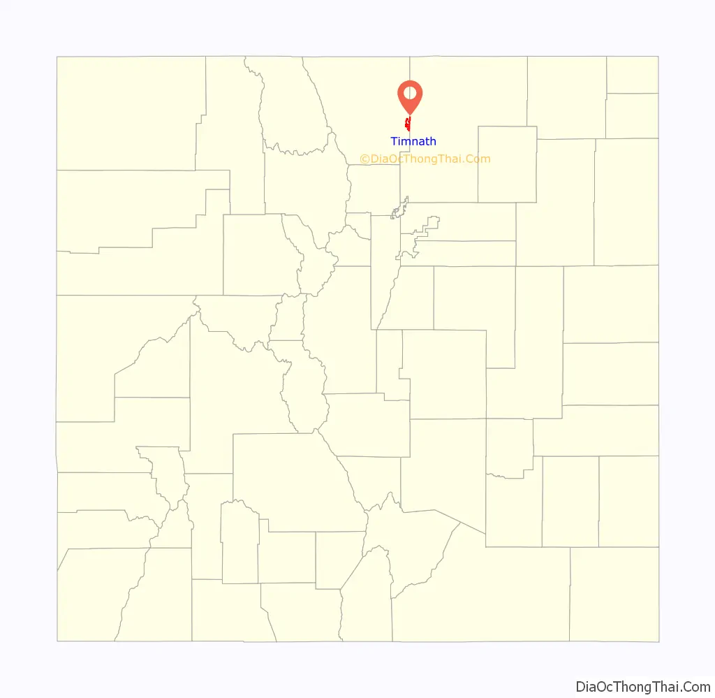
Timnath location map. Where is Timnath town?
History
The area was first homesteaded by settlers in 1869. The first schoolhouse was constructed that year, approximately one-half mile west of the current town, and was named “Fairview”. By 1880, the community had outgrown the schoolhouse, and new “Fairview” school was built just north of the current town. The school also served as an early meeting place for the Presbyterian Church. The turning point in the early history of the community was in 1882, with the arrival of the Greeley, Salt Lake and Pacific Railroad (controlled by the Union Pacific) linking Greeley and Fort Collins. The following year, the Presbyterian Church, petitioned by local residents, sent a missionary to found a congregation. The current structure along Main Street dates from that year.
A post office was established in 1884, headed by Reverend Charles A. Taylor, the local Presbyterian minister. When the post office was formed, Taylor bestowed the current name of the town from the 14th chapter of the Book of Judges, as the place where Samson went to obtain a Philistine wife. In 1900 the second school became outdated and a new one was built, dropping the name “Fairview” permanently. This structure currently stands as an out-building to the current elementary school. A larger school was built in 1918 (which burned in 1935 and was rebuilt the following year). The school district was consolidated with that of Fort Collins in 1960.
During World War II, the Empire of Japan launched Fu-Go balloon bombs that floated across the Pacific to the U.S. One of these bombs dropped and exploded in a field in Timnath.
Timnath Road Map
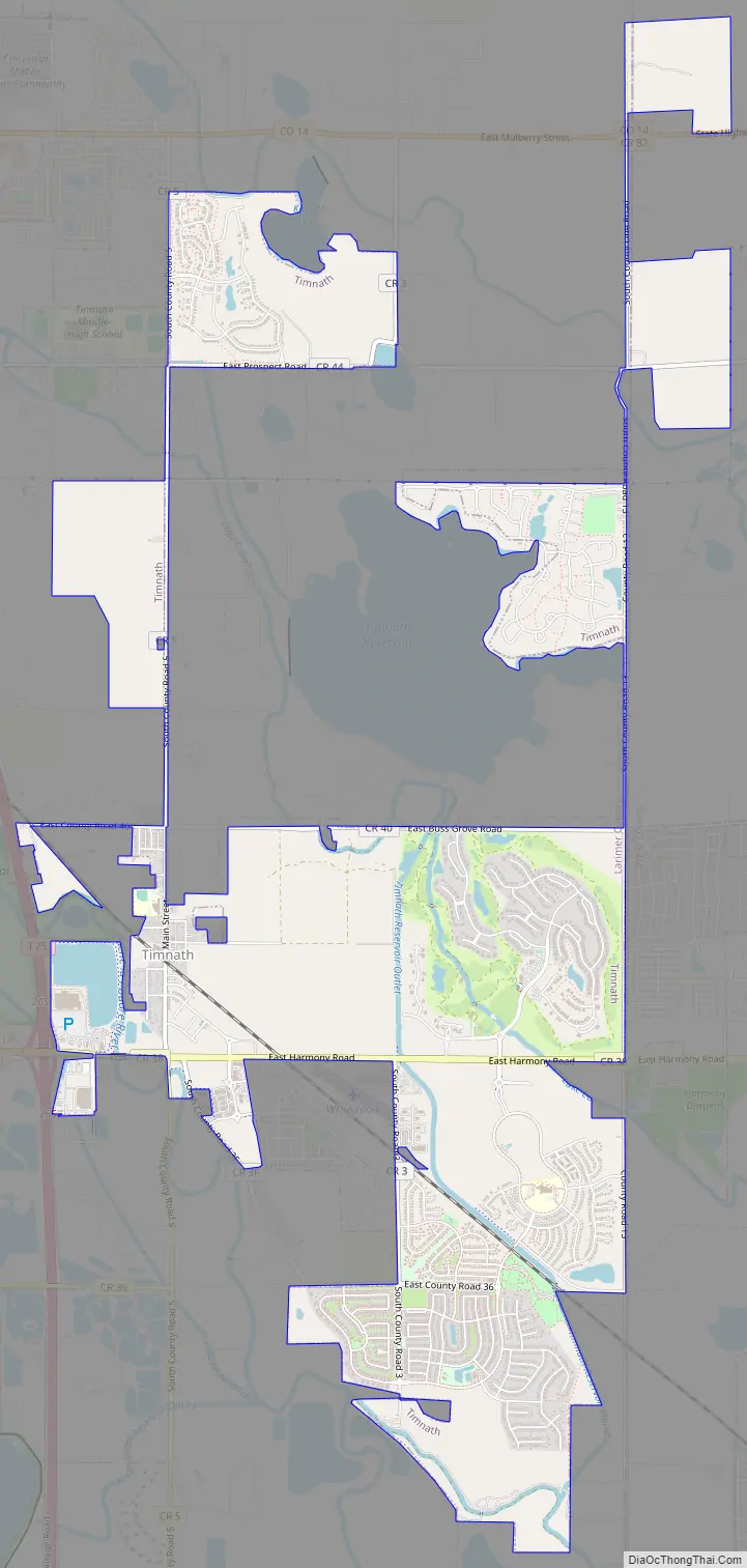
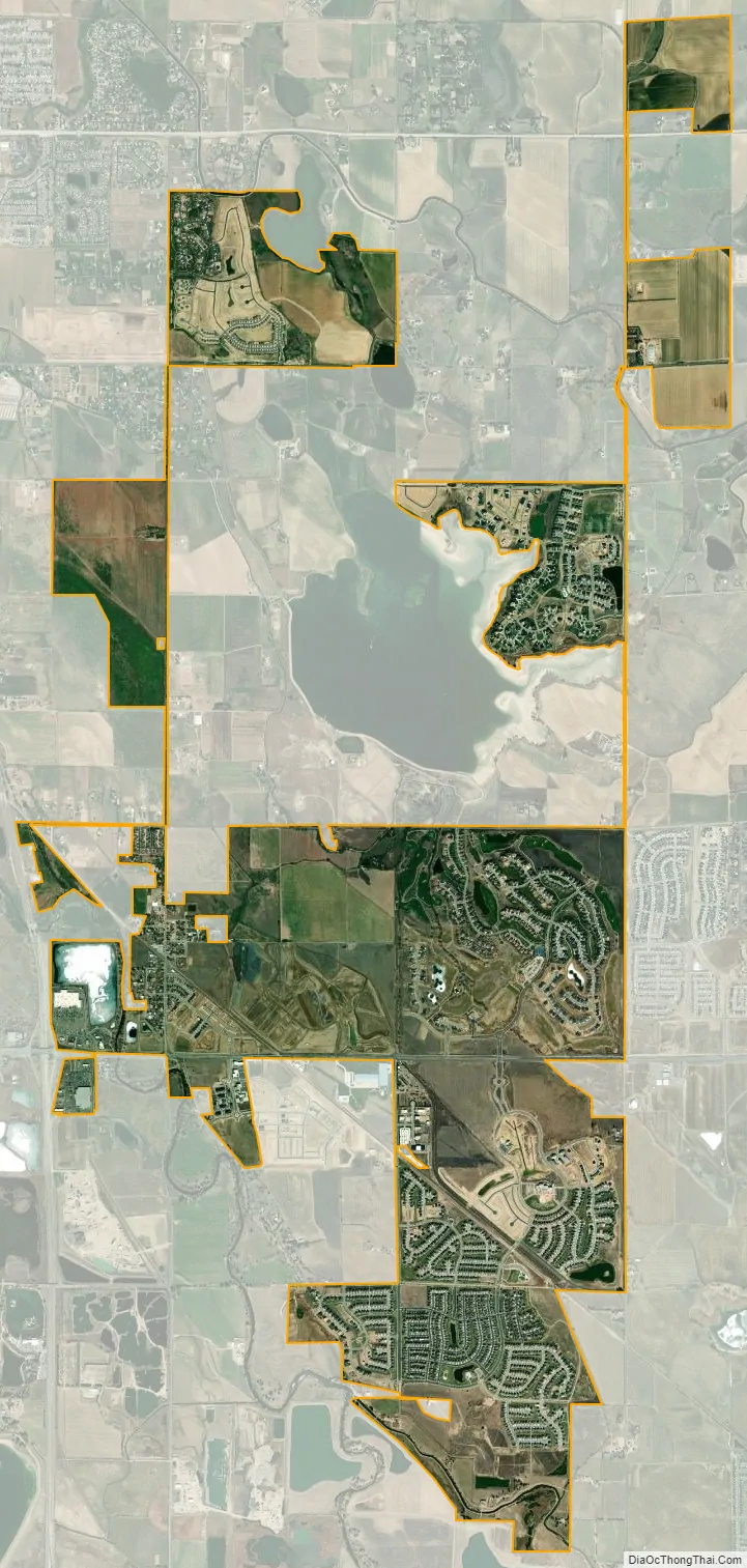
Timnath city Satellite Map
Geography
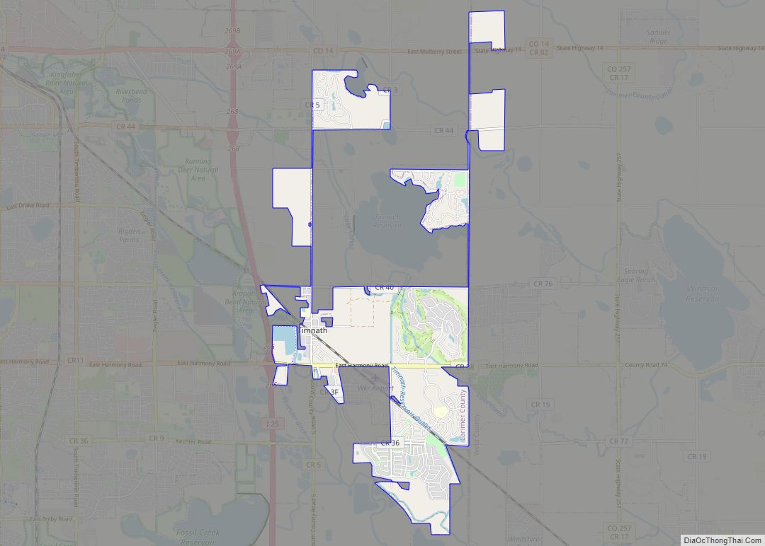
Timnath is located at 40°31’47” North, 104°58’54” West (40.529718, -104.981654).
As of 2013, the incorporated area of Timnath comprises 5.05 square miles of land.
The historical downtown lies along County Road Five, which runs north–south parallel to Interstate 25 half a mile to the east. Since the 2000 census, the town of Timnath has annexed several square miles of land to the east and southeast; the town has experienced significant commercial development along the east–west corridor of County Road 38 (Harmony Road), including Wal-Mart and Costco. The majority of the six mile (north-south) by three mile (east-west) block of land that lies within Timnath’s growth management area is low-density residential or agricultural, and is designated to remain so, with open space and parkland filling the remainder of the area, particularly near the Poudre River and Timnath Reservoir.
See also
Map of Colorado State and its subdivision:- Adams
- Alamosa
- Arapahoe
- Archuleta
- Baca
- Bent
- Boulder
- Broomfield
- Chaffee
- Cheyenne
- Clear Creek
- Conejos
- Costilla
- Crowley
- Custer
- Delta
- Denver
- Dolores
- Douglas
- Eagle
- El Paso
- Elbert
- Fremont
- Garfield
- Gilpin
- Grand
- Gunnison
- Hinsdale
- Huerfano
- Jackson
- Jefferson
- Kiowa
- Kit Carson
- La Plata
- Lake
- Larimer
- Las Animas
- Lincoln
- Logan
- Mesa
- Mineral
- Moffat
- Montezuma
- Montrose
- Morgan
- Otero
- Ouray
- Park
- Phillips
- Pitkin
- Prowers
- Pueblo
- Rio Blanco
- Rio Grande
- Routt
- Saguache
- San Juan
- San Miguel
- Sedgwick
- Summit
- Teller
- Washington
- Weld
- Yuma
- Alabama
- Alaska
- Arizona
- Arkansas
- California
- Colorado
- Connecticut
- Delaware
- District of Columbia
- Florida
- Georgia
- Hawaii
- Idaho
- Illinois
- Indiana
- Iowa
- Kansas
- Kentucky
- Louisiana
- Maine
- Maryland
- Massachusetts
- Michigan
- Minnesota
- Mississippi
- Missouri
- Montana
- Nebraska
- Nevada
- New Hampshire
- New Jersey
- New Mexico
- New York
- North Carolina
- North Dakota
- Ohio
- Oklahoma
- Oregon
- Pennsylvania
- Rhode Island
- South Carolina
- South Dakota
- Tennessee
- Texas
- Utah
- Vermont
- Virginia
- Washington
- West Virginia
- Wisconsin
- Wyoming