Albia is a city in and the county seat of Monroe County, in southern Iowa, United States. The population was 3,721 at the 2020 census.
The city of Albia is known for its historic square and city-wide Victorian Architecture. Albia is also known for the annual “Restoration” days celebration which commemorates the refurbishment of the square and the town which began in the mid-1960s.
| Name: | Albia city |
|---|---|
| LSAD Code: | 25 |
| LSAD Description: | city (suffix) |
| State: | Iowa |
| County: | Monroe County |
| Elevation: | 961 ft (293 m) |
| Total Area: | 3.23 sq mi (8.37 km²) |
| Land Area: | 3.23 sq mi (8.37 km²) |
| Water Area: | 0.00 sq mi (0.00 km²) |
| Total Population: | 3,721 |
| Population Density: | 1,151.30/sq mi (444.50/km²) |
| ZIP code: | 52531 |
| Area code: | 641 |
| FIPS code: | 1900910 |
| GNISfeature ID: | 0454114 |
| Website: | www.albia.com |
Online Interactive Map
Click on ![]() to view map in "full screen" mode.
to view map in "full screen" mode.
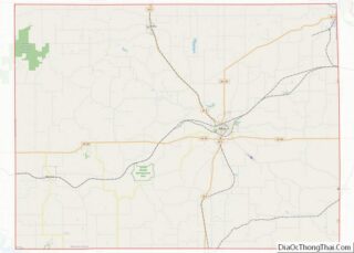
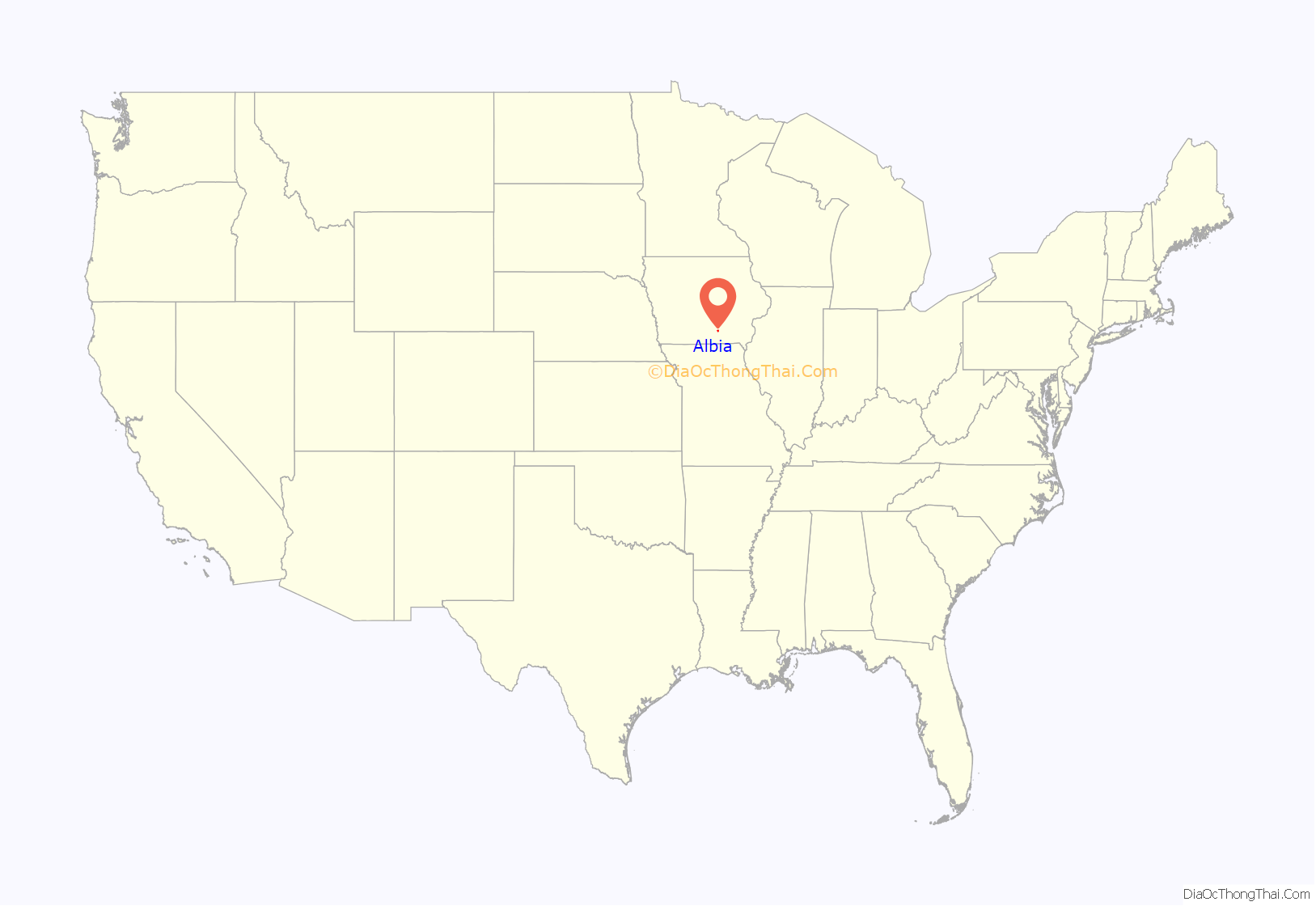
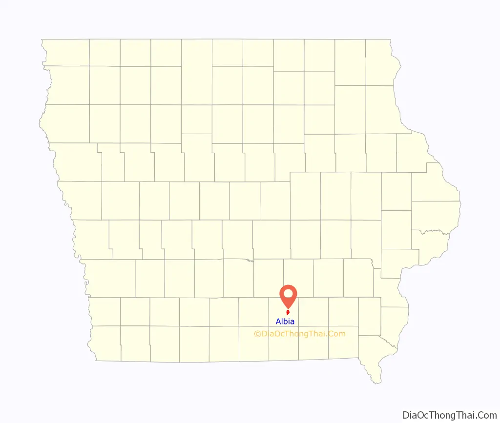
Albia location map. Where is Albia city?
History
Albia was incorporated as a town in 1856. The town was named after Albia, New York, the former home of an early settler.
On Feb. 14, 1893, there was a coal mine explosion in the Chicago and Iowa mine, about 2.5 miles west of Albia. This room and pillar mine had opened around 1877. By the time of the explosion, mining extended more than 1,000 yards from the hoisting shaft, and the mine employed 60 miners and 20 other men. One miner was killed outright and seven died later of their injuries, after a “shot” (gunpowder charge used to bring down the coal) ignited a dust explosion in the mine. This was one of only two major mine disasters in Iowa between 1888 and 1913.
In the early 20th century, the region around Albia was dotted with coal mining camps and company towns. Of these, Buxton, 9 miles north of Albia, is the most widely studied. It had a large Black population. Other former coal camps in the area include Hiteman, Bluff Creek, Lockman, Coalfield, Hocking, and Hynes.
The growth in membership in the United Mine Workers union, as shown by the following data, is a useful measure of the importance of mining in the region. In 1902, UMW Locals 692 and 793 in Albia had an aggregate membership of 216. By 1912, UMW Locals 407, 782 and 793 in Albia had an aggregate membership of 338 (about 7.2% of the 1910 population). Miners in Hiteman, 5 miles northwest of town, joined the UMWA in 1898; between 1902 and 1912, membership grew from 450 to 688. Miners in Hynes, 7 miles east, joined the UMWA in 1896; between 1902 and 1912, membership grew from 330 to 543.
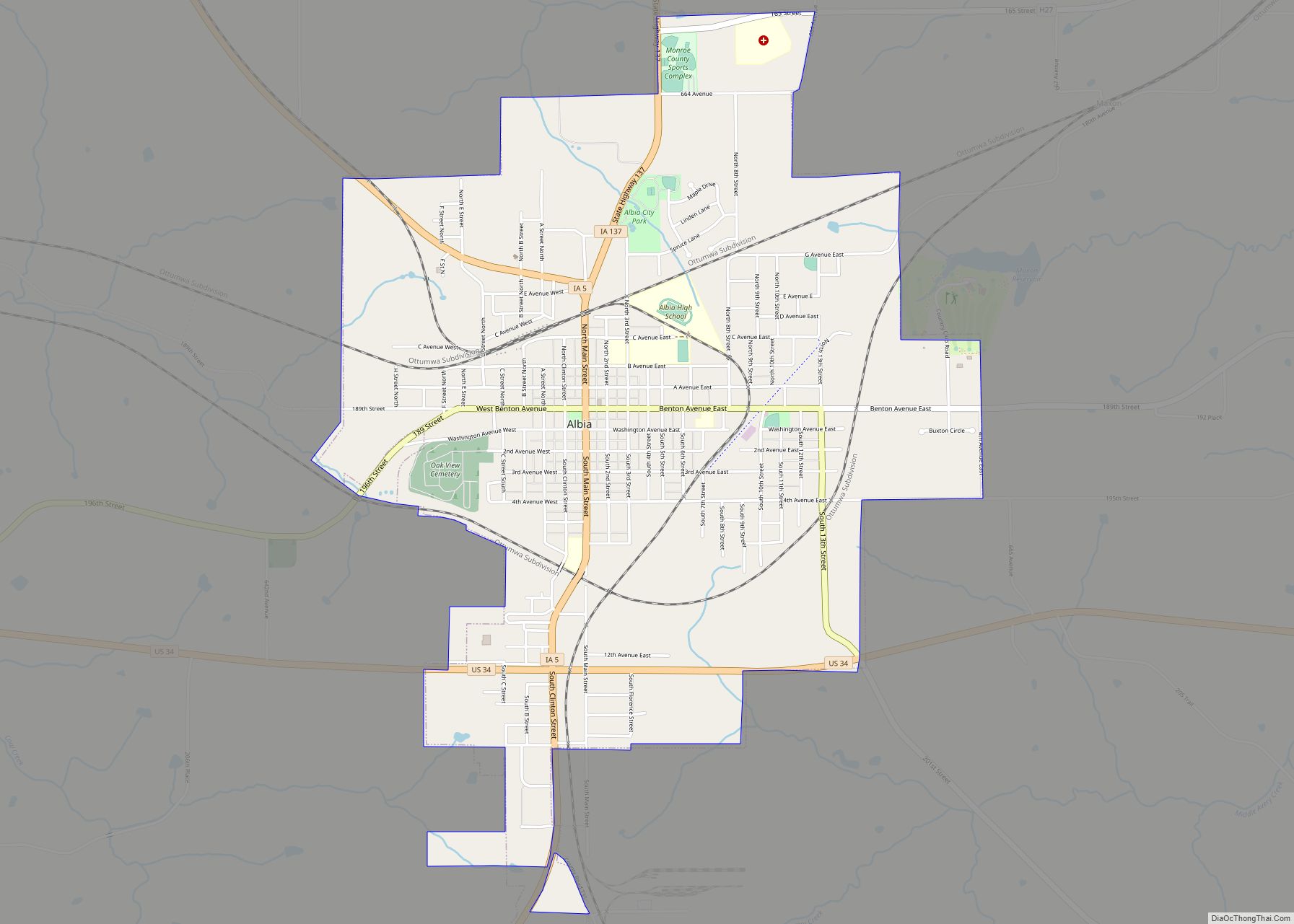
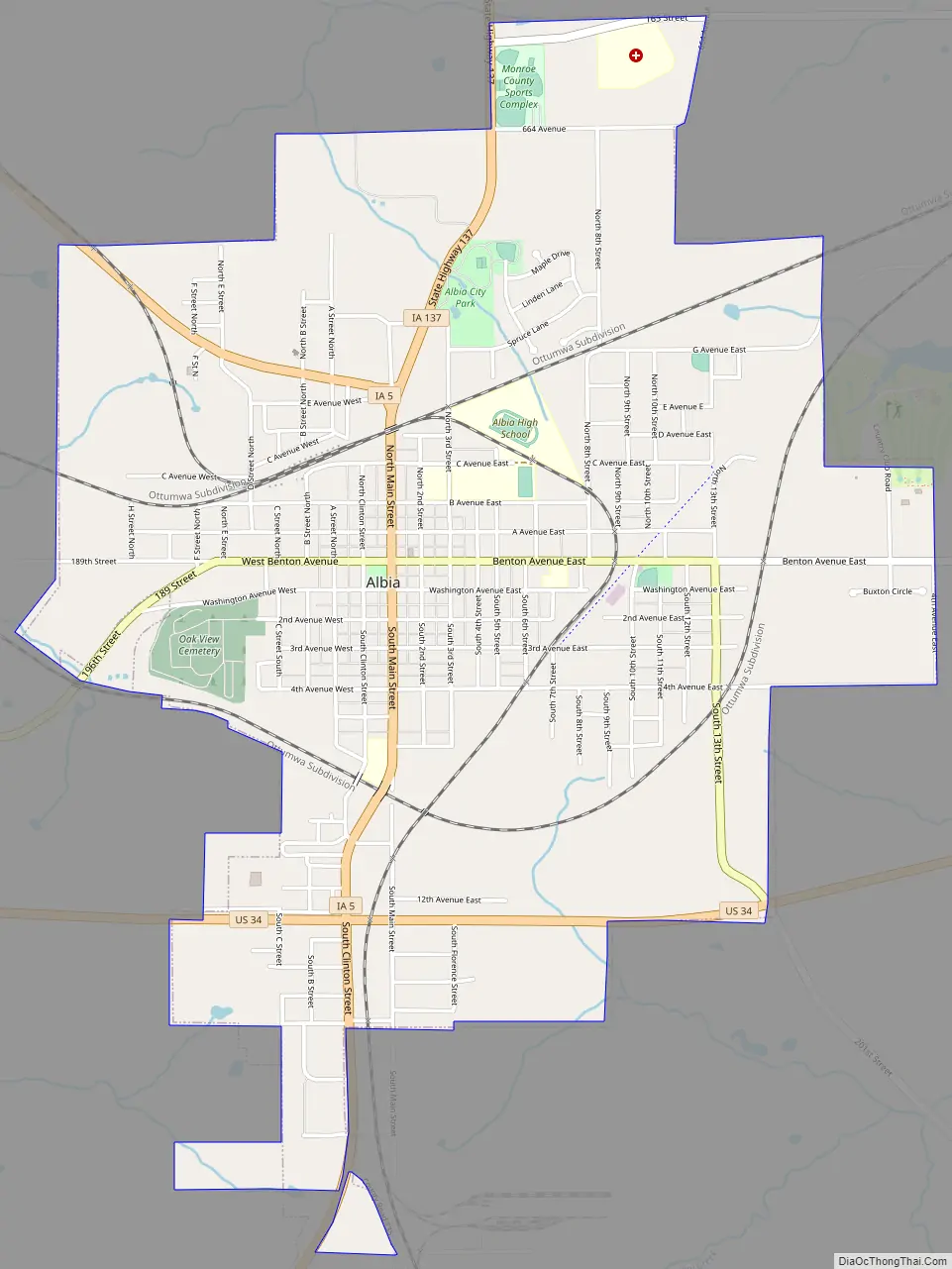
Albia Road Map
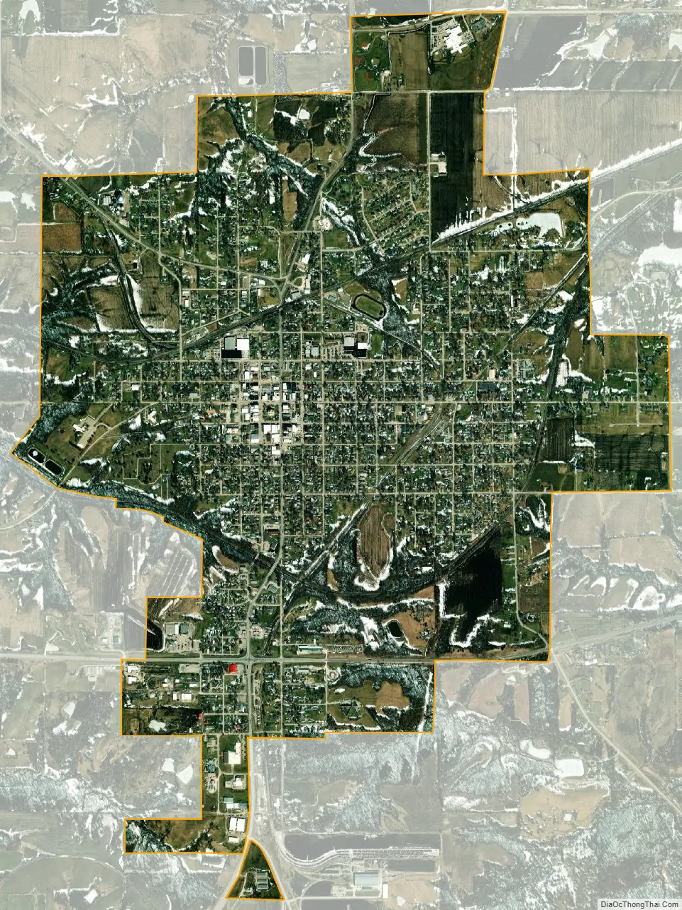
Albia city Satellite Map
Geography
Albia’s longitude and latitude coordinates in decimal form are 41.026600, −92.805262.
According to the United States Census Bureau, the city has a total area of 3.19 square miles (8.26 km), all land.
See also
Map of Iowa State and its subdivision:- Adair
- Adams
- Allamakee
- Appanoose
- Audubon
- Benton
- Black Hawk
- Boone
- Bremer
- Buchanan
- Buena Vista
- Butler
- Calhoun
- Carroll
- Cass
- Cedar
- Cerro Gordo
- Cherokee
- Chickasaw
- Clarke
- Clay
- Clayton
- Clinton
- Crawford
- Dallas
- Davis
- Decatur
- Delaware
- Des Moines
- Dickinson
- Dubuque
- Emmet
- Fayette
- Floyd
- Franklin
- Fremont
- Greene
- Grundy
- Guthrie
- Hamilton
- Hancock
- Hardin
- Harrison
- Henry
- Howard
- Humboldt
- Ida
- Iowa
- Jackson
- Jasper
- Jefferson
- Johnson
- Jones
- Keokuk
- Kossuth
- Lee
- Linn
- Louisa
- Lucas
- Lyon
- Madison
- Mahaska
- Marion
- Marshall
- Mills
- Mitchell
- Monona
- Monroe
- Montgomery
- Muscatine
- O'Brien
- Osceola
- Page
- Palo Alto
- Plymouth
- Pocahontas
- Polk
- Pottawattamie
- Poweshiek
- Ringgold
- Sac
- Scott
- Shelby
- Sioux
- Story
- Tama
- Taylor
- Union
- Van Buren
- Wapello
- Warren
- Washington
- Wayne
- Webster
- Winnebago
- Winneshiek
- Woodbury
- Worth
- Wright
- Alabama
- Alaska
- Arizona
- Arkansas
- California
- Colorado
- Connecticut
- Delaware
- District of Columbia
- Florida
- Georgia
- Hawaii
- Idaho
- Illinois
- Indiana
- Iowa
- Kansas
- Kentucky
- Louisiana
- Maine
- Maryland
- Massachusetts
- Michigan
- Minnesota
- Mississippi
- Missouri
- Montana
- Nebraska
- Nevada
- New Hampshire
- New Jersey
- New Mexico
- New York
- North Carolina
- North Dakota
- Ohio
- Oklahoma
- Oregon
- Pennsylvania
- Rhode Island
- South Carolina
- South Dakota
- Tennessee
- Texas
- Utah
- Vermont
- Virginia
- Washington
- West Virginia
- Wisconsin
- Wyoming