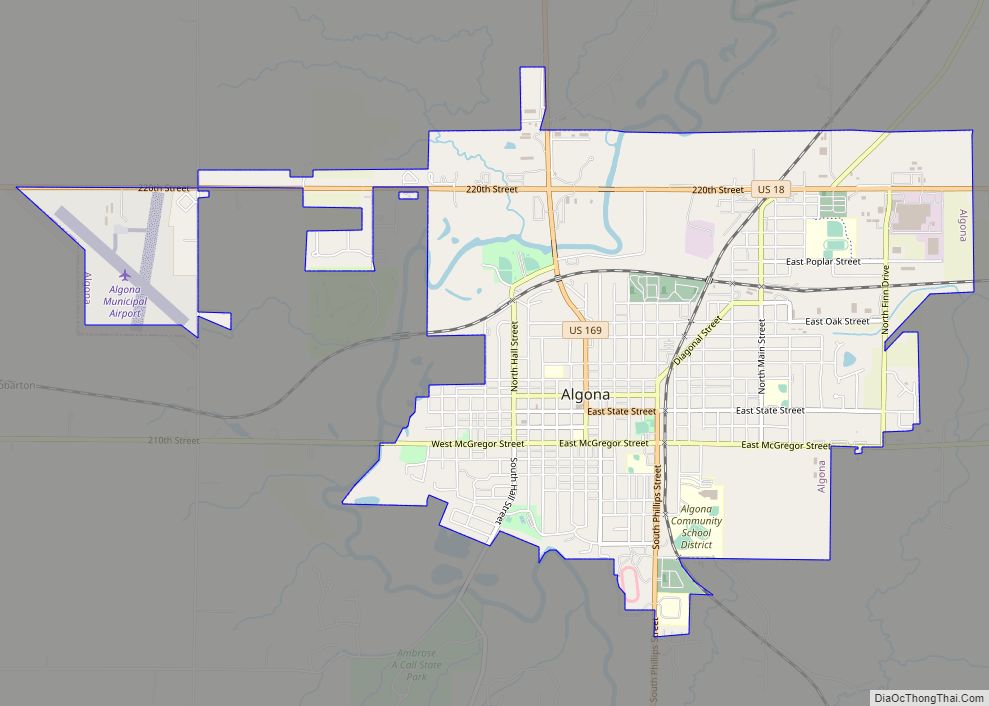
Algona is the county seat of Kossuth County, Iowa, United States. The population was 5,487 at the 2020 census. Ambrose A. Call State Park is located two miles southwest of the city.
| Name: | Algona city |
|---|---|
| LSAD Code: | 25 |
| LSAD Description: | city (suffix) |
| State: | Iowa |
| County: | Kossuth County |
| Elevation: | 1,194 ft (364 m) |
| Total Area: | 4.62 sq mi (11.97 km²) |
| Land Area: | 4.61 sq mi (11.95 km²) |
| Water Area: | 0.01 sq mi (0.02 km²) |
| Total Population: | 5,487 |
| Population Density: | 1,189.21/sq mi (459.18/km²) |
| ZIP code: | 50511 |
| Area code: | 515 |
| FIPS code: | 1901135 |
| GNISfeature ID: | 0454126 |
| Website: | http://www.ci.algona.ia.us/ |
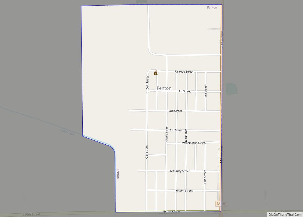
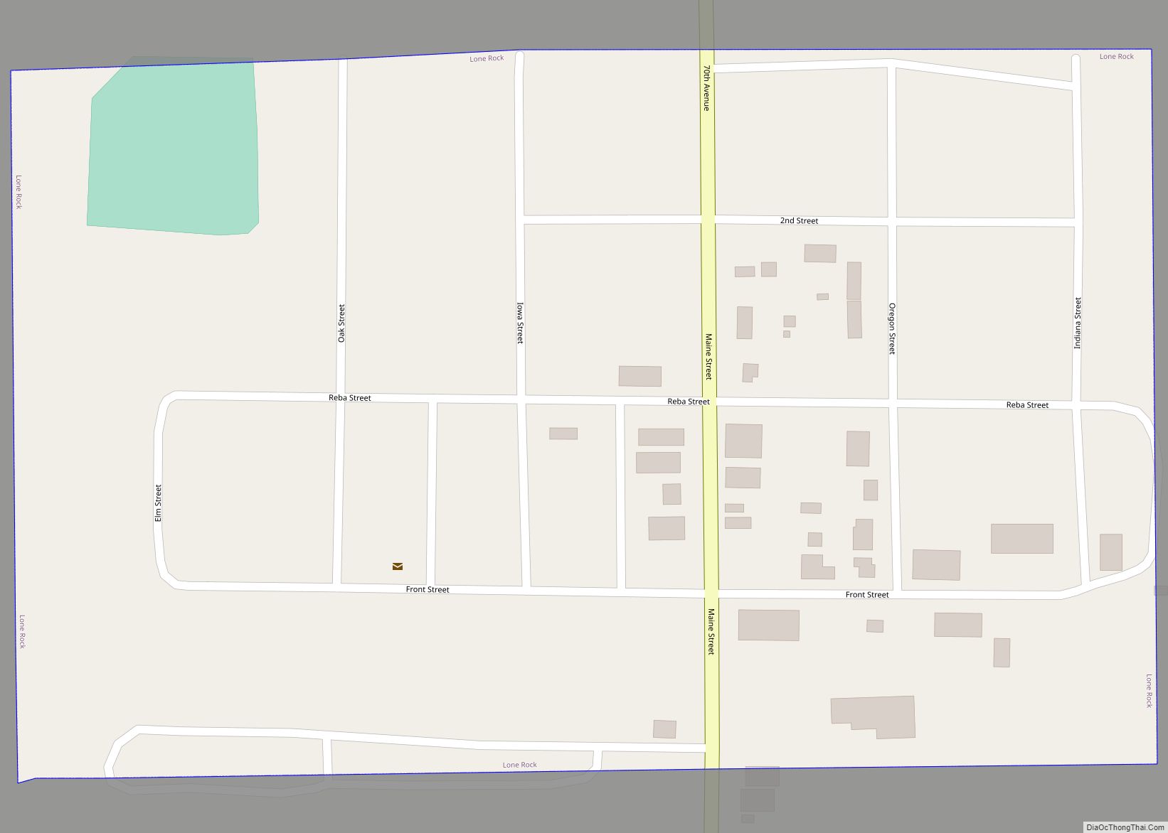
Online Interactive Map
Click on ![]() to view map in "full screen" mode.
to view map in "full screen" mode.
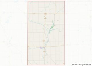
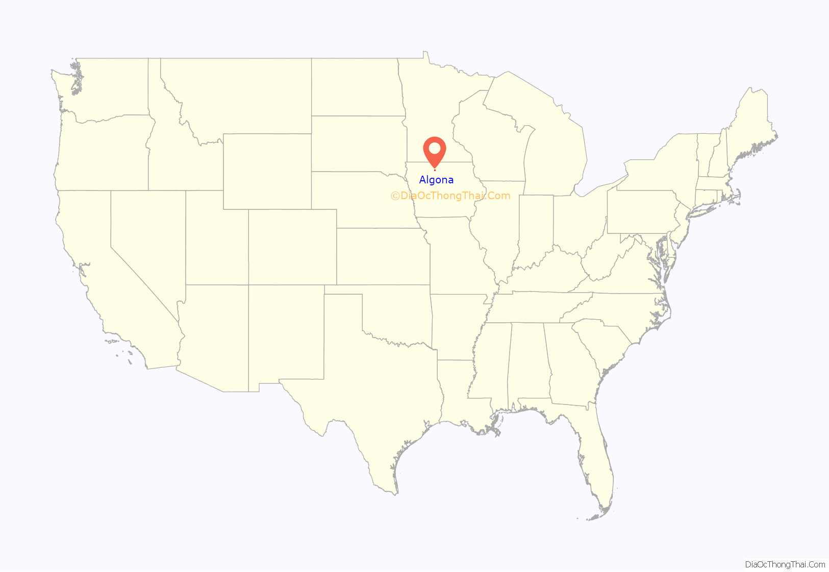
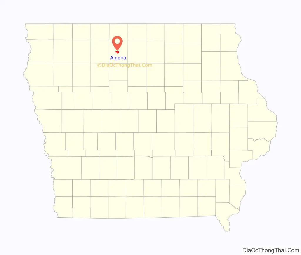
Algona location map. Where is Algona city?
History
Algona was founded in 1854 and was named after the Algonquian word for “Algonquin waters”.
Between 1869 and 1875 the community was the location of Algona College, an institution sponsored by the Methodist Church.
In 1894, Algona, along with other Iowa communities such as Dysart and Wesley, became part of the project known as the “Orphan Trains”. As New York City saw booming immigration, it also inevitably saw a rise in the number of orphans in its asylums. Unable to provide adequate care for them, it saw fit to ship nearly 100,000 westward to start a new life with families across America. Algona itself welcomed nearly 100 orphans into the town, many of whom remained lifelong residents.
From 1902 to 1906, Algona played host to the Algona Brownies, an African American barnstorming baseball team and interracial team the first two seasons. Despite being declared Western champions in 1903, the team disbanded as an interracial team that same year. The Algona Brownies were an independent interracial baseball team that played in the 1902 and 1903 seasons. They primarily made up of former members of the Chicago Unions, Columbia Giants, and Chicago Union Giants teams. After 1903, the team makeup changed from having both black and white players to a team of only black players. That year, their final year, they won the Western championship, defeating the Chicago Union Giants in a challenge playoff.
The Henry Adams Building, designed by Louis Sullivan in 1913 is located at the northwest corner of East State and Moore streets. Although not designed to be a bank, the building is nonetheless considered to be one of Sullivan’s “Jewel Boxes,” a series of banks built in the Midwest from 1909 through 1919.
Algona was the location of a German prisoner of war camp during World War II. From 1943 to 1946 Camp Algona held nearly 10,000 prisoners, many of whom were put to work on farms that had family fighting overseas. As a main camp Algona had numerous sub-camps with a couple dozen in Minnesota. A museum now commemorates the camp’s history including a nativity scene created by the POWs.
A destructive F3 tornado killed two people and destroyed a large part of Algona on June 28, 1979, about 7:15 PM. The tornado moved in a south-southeast direction through Algona. Severe damage was done to the central business district and a number of homes were rendered uninhabitable. Near F4 damage was reported in some locations. There was about 15 minutes’ warning and the tornado sirens were sounded well before the arrival of the tornado. The fact that it was still daylight also contributed to the relatively low death count from this destructive storm.
In 2003, Algona drew national attention when it announced the purchase of the world’s largest Cheetos puff. It was meant as a plan to bring tourism to the town to see the puff by a local radio DJ.
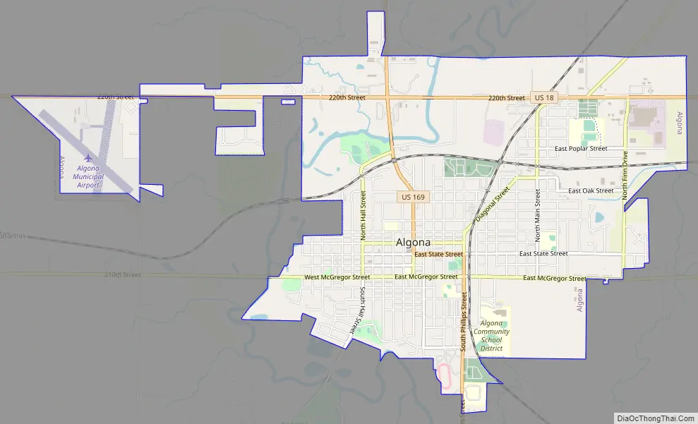
Algona Road Map
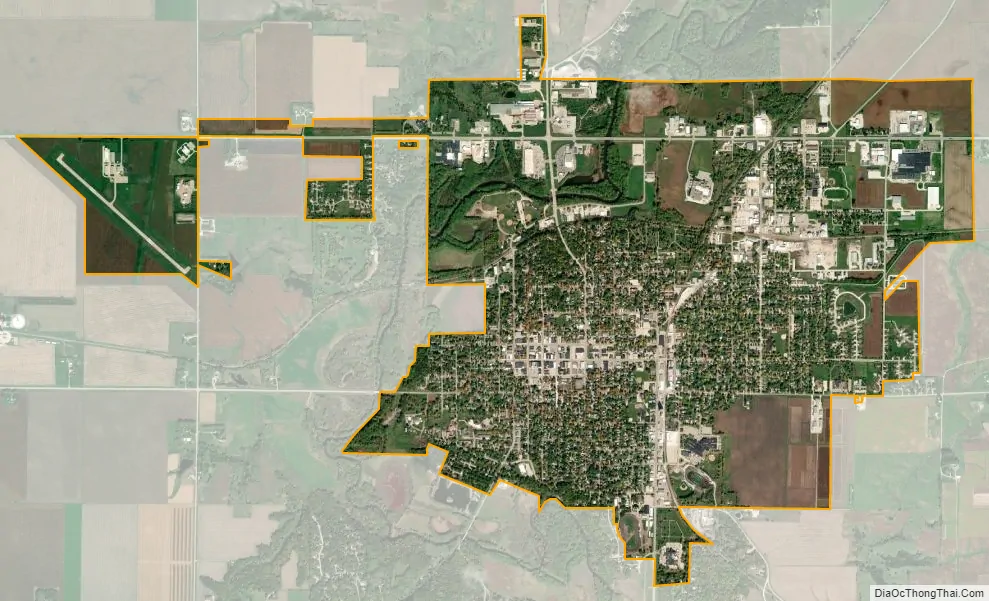
Algona city Satellite Map
Geography
Algona is located along the East Fork Des Moines River.
According to the United States Census Bureau, the city has a total area of 4.51 square miles (11.7 km), of which 4.49 square miles (11.6 km) is land and 0.02 square mile (0.05 km) is water.
Climate
See also
Map of Iowa State and its subdivision:- Adair
- Adams
- Allamakee
- Appanoose
- Audubon
- Benton
- Black Hawk
- Boone
- Bremer
- Buchanan
- Buena Vista
- Butler
- Calhoun
- Carroll
- Cass
- Cedar
- Cerro Gordo
- Cherokee
- Chickasaw
- Clarke
- Clay
- Clayton
- Clinton
- Crawford
- Dallas
- Davis
- Decatur
- Delaware
- Des Moines
- Dickinson
- Dubuque
- Emmet
- Fayette
- Floyd
- Franklin
- Fremont
- Greene
- Grundy
- Guthrie
- Hamilton
- Hancock
- Hardin
- Harrison
- Henry
- Howard
- Humboldt
- Ida
- Iowa
- Jackson
- Jasper
- Jefferson
- Johnson
- Jones
- Keokuk
- Kossuth
- Lee
- Linn
- Louisa
- Lucas
- Lyon
- Madison
- Mahaska
- Marion
- Marshall
- Mills
- Mitchell
- Monona
- Monroe
- Montgomery
- Muscatine
- O'Brien
- Osceola
- Page
- Palo Alto
- Plymouth
- Pocahontas
- Polk
- Pottawattamie
- Poweshiek
- Ringgold
- Sac
- Scott
- Shelby
- Sioux
- Story
- Tama
- Taylor
- Union
- Van Buren
- Wapello
- Warren
- Washington
- Wayne
- Webster
- Winnebago
- Winneshiek
- Woodbury
- Worth
- Wright
- Alabama
- Alaska
- Arizona
- Arkansas
- California
- Colorado
- Connecticut
- Delaware
- District of Columbia
- Florida
- Georgia
- Hawaii
- Idaho
- Illinois
- Indiana
- Iowa
- Kansas
- Kentucky
- Louisiana
- Maine
- Maryland
- Massachusetts
- Michigan
- Minnesota
- Mississippi
- Missouri
- Montana
- Nebraska
- Nevada
- New Hampshire
- New Jersey
- New Mexico
- New York
- North Carolina
- North Dakota
- Ohio
- Oklahoma
- Oregon
- Pennsylvania
- Rhode Island
- South Carolina
- South Dakota
- Tennessee
- Texas
- Utah
- Vermont
- Virginia
- Washington
- West Virginia
- Wisconsin
- Wyoming