Atalissa is a city in Muscatine County, Iowa, United States. The population was 296 at the 2020 census. It is part of the Muscatine Micropolitan Statistical Area.
| Name: | Atalissa city |
|---|---|
| LSAD Code: | 25 |
| LSAD Description: | city (suffix) |
| State: | Iowa |
| County: | Muscatine County |
| Elevation: | 659 ft (201 m) |
| Total Area: | 0.14 sq mi (0.36 km²) |
| Land Area: | 0.14 sq mi (0.36 km²) |
| Water Area: | 0.00 sq mi (0.00 km²) |
| Total Population: | 296 |
| Population Density: | 2,129.50/sq mi (821.29/km²) |
| ZIP code: | 52720 |
| Area code: | 563 |
| FIPS code: | 1903385 |
| GNISfeature ID: | 0454271 |
Online Interactive Map
Click on ![]() to view map in "full screen" mode.
to view map in "full screen" mode.
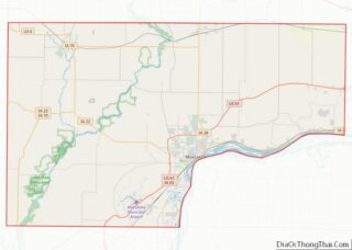
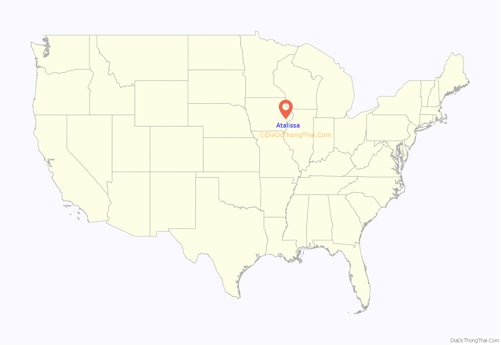
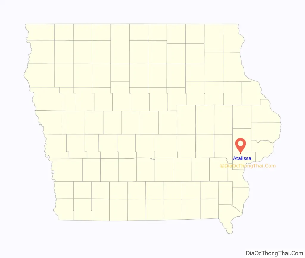
Atalissa location map. Where is Atalissa city?
History
Atalissa was platted in 1859. It was named by its founder, William Lundy, for a mining town in California, which in turn was named for an Indian queen Atalissa.
From 1974 to 2009 Atalissa was the home of a few dozen intellectually challenged men who worked in a nearby turkey processing plant. They lived together in an old schoolhouse and were taken each workday to the plant, and after expenses were taken out, were paid no more than $65/month. They were removed and relocated by state agencies in 2009, after being found to be living in unacceptable conditions. A 2013 verdict awarded the men a total of $240 million in damages, since reduced to $50,000/man. The men’s plight had a profound effect on social services in Iowa, and their experiences and subsequent court case was the subject of the documentary film The Men of Atalissa.
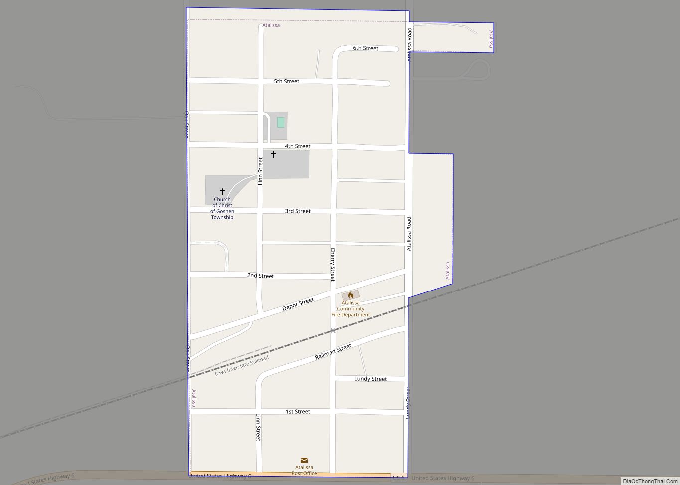
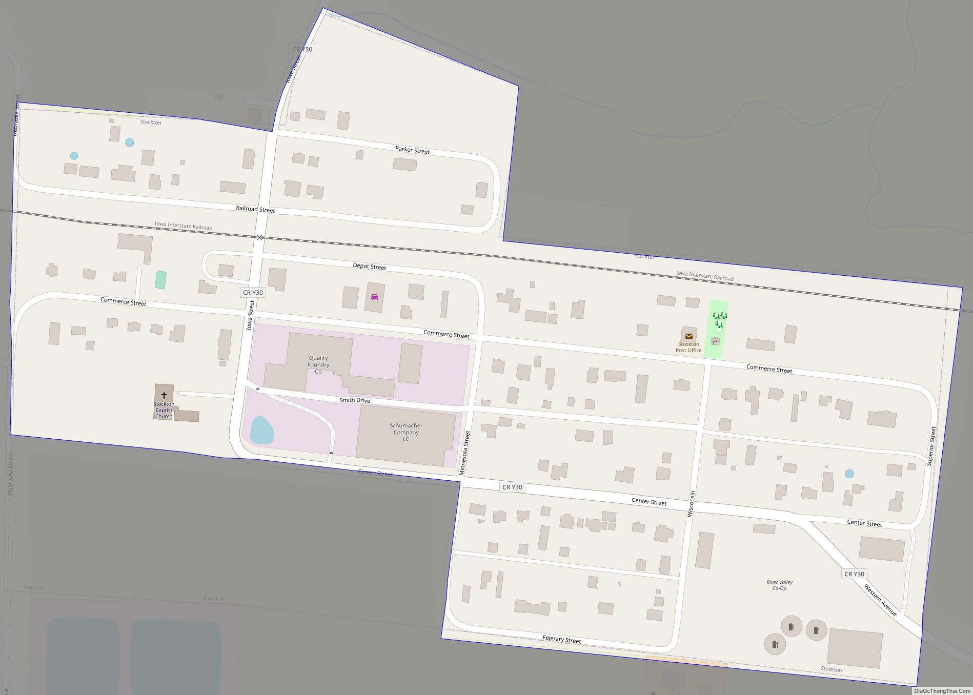
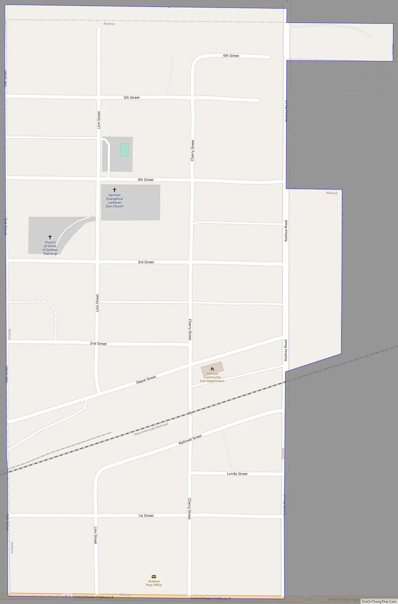
Atalissa Road Map
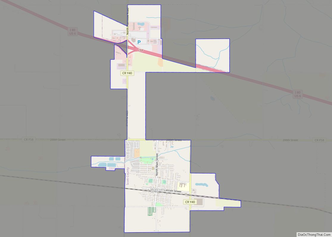
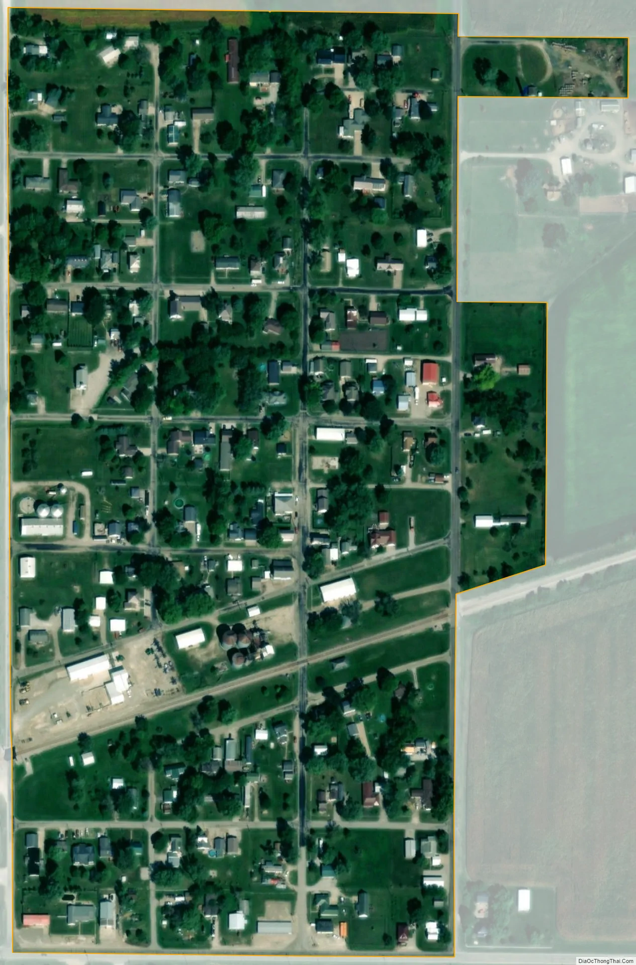
Atalissa city Satellite Map
Geography
Atalissa is located at 41°34′18″N 91°10′0″W / 41.57167°N 91.16667°W / 41.57167; -91.16667 (41.571568, -91.166707).
According to the United States Census Bureau, the city has a total area of 0.14 square miles (0.36 km), all land.
See also
Map of Iowa State and its subdivision:- Adair
- Adams
- Allamakee
- Appanoose
- Audubon
- Benton
- Black Hawk
- Boone
- Bremer
- Buchanan
- Buena Vista
- Butler
- Calhoun
- Carroll
- Cass
- Cedar
- Cerro Gordo
- Cherokee
- Chickasaw
- Clarke
- Clay
- Clayton
- Clinton
- Crawford
- Dallas
- Davis
- Decatur
- Delaware
- Des Moines
- Dickinson
- Dubuque
- Emmet
- Fayette
- Floyd
- Franklin
- Fremont
- Greene
- Grundy
- Guthrie
- Hamilton
- Hancock
- Hardin
- Harrison
- Henry
- Howard
- Humboldt
- Ida
- Iowa
- Jackson
- Jasper
- Jefferson
- Johnson
- Jones
- Keokuk
- Kossuth
- Lee
- Linn
- Louisa
- Lucas
- Lyon
- Madison
- Mahaska
- Marion
- Marshall
- Mills
- Mitchell
- Monona
- Monroe
- Montgomery
- Muscatine
- O'Brien
- Osceola
- Page
- Palo Alto
- Plymouth
- Pocahontas
- Polk
- Pottawattamie
- Poweshiek
- Ringgold
- Sac
- Scott
- Shelby
- Sioux
- Story
- Tama
- Taylor
- Union
- Van Buren
- Wapello
- Warren
- Washington
- Wayne
- Webster
- Winnebago
- Winneshiek
- Woodbury
- Worth
- Wright
- Alabama
- Alaska
- Arizona
- Arkansas
- California
- Colorado
- Connecticut
- Delaware
- District of Columbia
- Florida
- Georgia
- Hawaii
- Idaho
- Illinois
- Indiana
- Iowa
- Kansas
- Kentucky
- Louisiana
- Maine
- Maryland
- Massachusetts
- Michigan
- Minnesota
- Mississippi
- Missouri
- Montana
- Nebraska
- Nevada
- New Hampshire
- New Jersey
- New Mexico
- New York
- North Carolina
- North Dakota
- Ohio
- Oklahoma
- Oregon
- Pennsylvania
- Rhode Island
- South Carolina
- South Dakota
- Tennessee
- Texas
- Utah
- Vermont
- Virginia
- Washington
- West Virginia
- Wisconsin
- Wyoming