Muscatine (/ˌmʌskəˈtin/ muss-kə-TEEN) is a city in Muscatine County, Iowa, United States. The population was 23,797 at the time of the 2020 census, an increase from 22,697 in 2000. The county seat of Muscatine County, it is located along the Mississippi River. The local business association states that the name Muscatine is not used by any other community.
Muscatine is the principal city of the Muscatine Micropolitan Statistical Area (2010 census population 54,132) as of 2011 the estimate was 54,184, which includes all of Muscatine and Louisa counties, making it the 283rd-largest micropolitan statistical area.
| Name: | Muscatine city |
|---|---|
| LSAD Code: | 25 |
| LSAD Description: | city (suffix) |
| State: | Iowa |
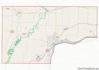
| County: | Muscatine County |
| Incorporated: | 1839 |
| Elevation: | 587 ft (179 m) |
| Land Area: | 18.20 sq mi (47.13 km²) |
| Water Area: | 1.05 sq mi (2.73 km²) |
| Population Density: | 1,307.81/sq mi (504.95/km²) |
| ZIP code: | 52761 |
| Area code: | 563 |
| FIPS code: | 1955110 |
| GNISfeature ID: | 0465186 |
| Website: | www.muscatineiowa.gov |
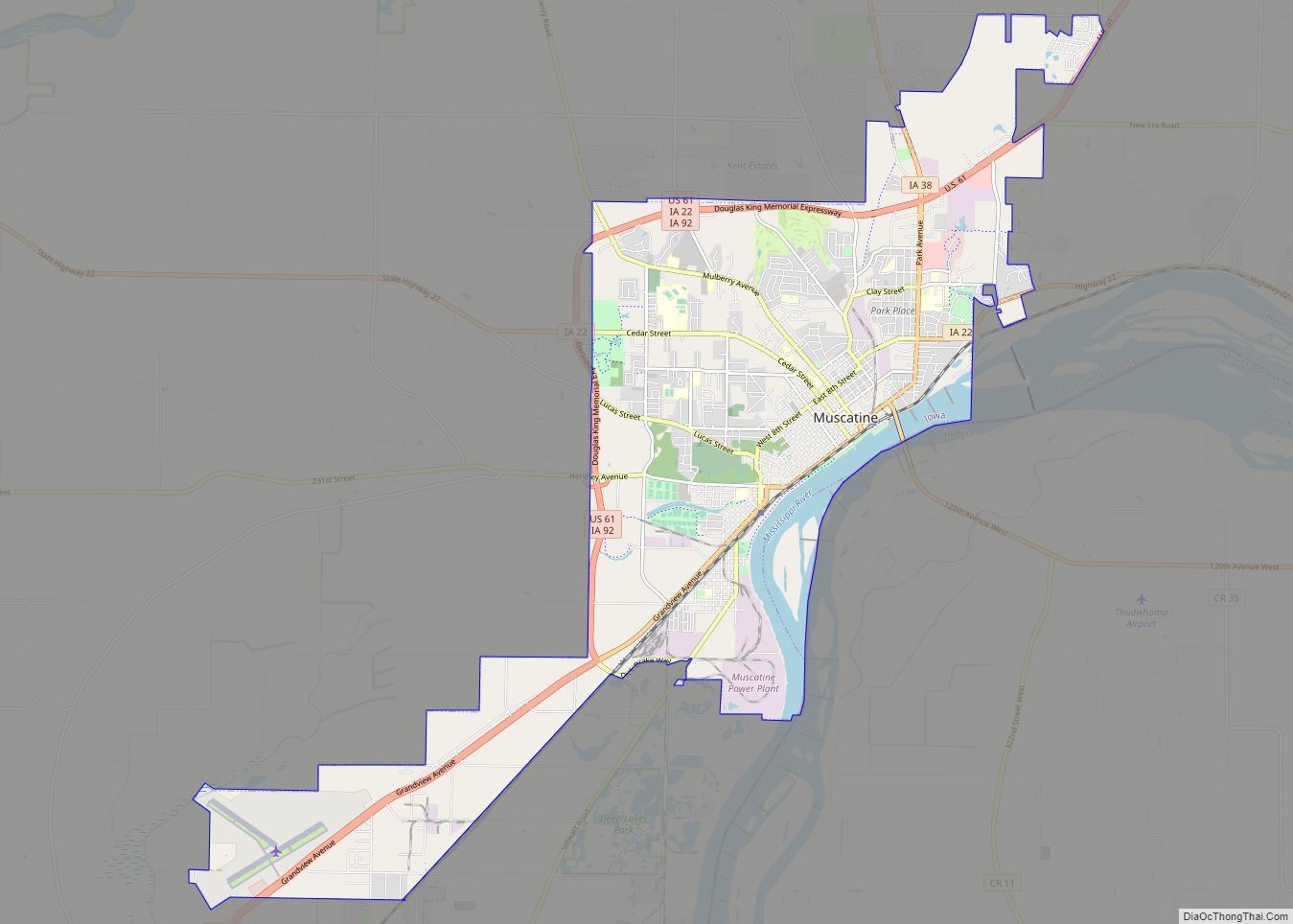
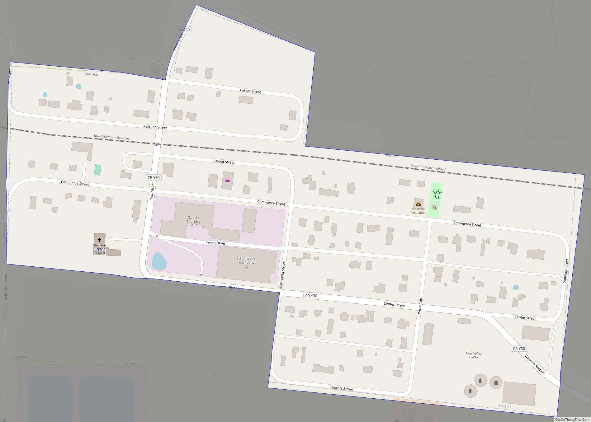
Online Interactive Map
Click on ![]() to view map in "full screen" mode.
to view map in "full screen" mode.
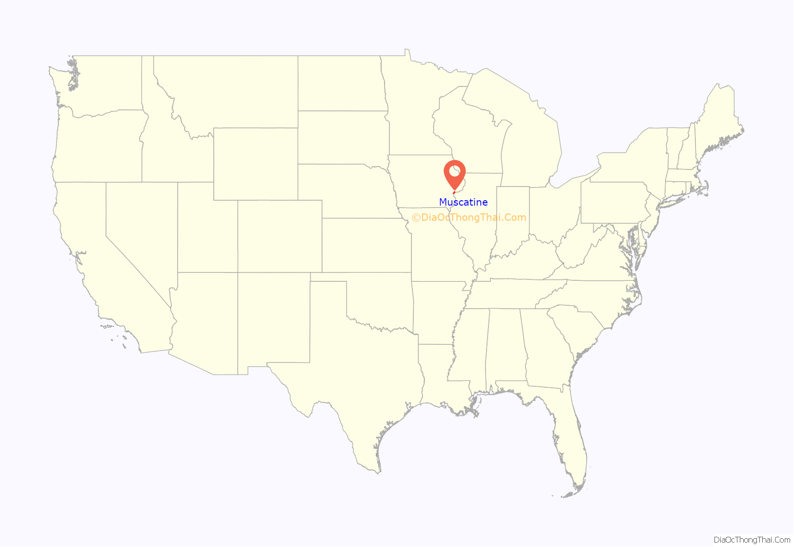
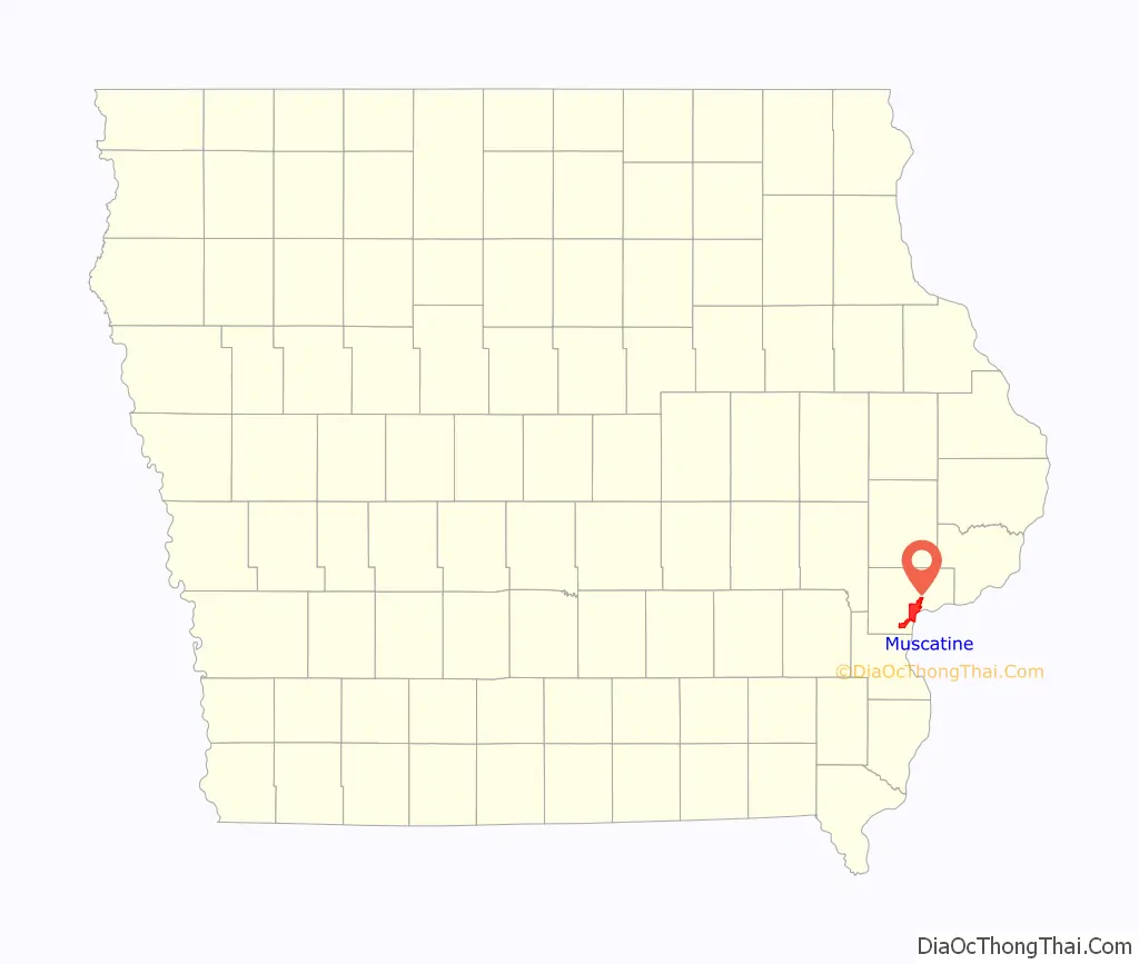
Muscatine location map. Where is Muscatine city?
History
Muscatine began as a trading post founded by representatives of Colonel George Davenport in 1833. Muscatine was incorporated as Bloomington in 1839; the name was changed to reduce mail delivery confusion, as there were several Bloomingtons in the Midwest. Before that, Muscatine had also been known as “Newburg” and “Casey’s Landing”.
The origin of the name Muscatine is debated. It may have been derived from the Mascouten Native American tribe. The Mascoutin lived along the Mississippi in the 1700s. In 1819 Muscatine Island was known as Mascoutin Island.
In the 1838 General Land Office map, the town is labelled Musquitine, which may be a variation of Musquakeen, an alternative name for Muscatine Island; Musquakeen may have derived from the Meskwaki indigenous people who lived close by. Major William Williams, who was visiting in 1849 when the town was still called both Bloomington and Muscatine, claimed, “Muscatine in English is Fire Island,” in his list of the meanings of Siouan language names.
Williams wrote a brief description of the settlement:
From the 1840s to the Civil War, Muscatine had Iowa’s largest black community, consisting of fugitive slaves who had traveled the Mississippi from the South and free blacks who had migrated from the eastern states. One of the most prominent community leaders was Alexander G. Clark Sr., born free in Pennsylvania. He was a barber, a respected position at the time, and eventually became a wealthy timber salesman and real estate speculator. In 1848 he was among the founders of the local African Methodist Episcopal Church, which had been established as the first independent black denomination in the US.
In the antebellum period he assisted fugitive slaves, and petitioned the state government to overturn racist laws before the Civil War. In 1863, Clark helped organize Iowa’s black regiment, the 60th United States Colored Infantry (originally known as the 1st Iowa Infantry, African Descent), though an injury prevented him from serving.
In 1868, he gained desegregation of Iowa’s public schools by suing the Muscatine school board after his daughter Susan was turned away from her neighborhood school. Eleven years later, in 1879 his son Alexander Jr. became the first black graduate of the University of Iowa College of Law and its first black graduate from any department. Clark Sr. went to the college and became its second black law graduate five years later, despite being 58 years old. He said that he wanted to serve “as an example to young men of his own race.” Clark rose to prominence in the Republican Party, serving as a delegate to state and national conventions.
In 1890, Clark was appointed ambassador to Liberia by President Benjamin Harrison. He was one of four Muscatine residents to be appointed as a diplomatic envoy between 1855 and 1900, a remarkable feat for a town of such small size: George Van Horne was consul at Marseilles, France during the 1860s; Samuel McNutt served at Maracaibo, Venezuela in 1890; and Frank W. Mahin represented his country in Reichenberg, Austria in 1900.
Less than a year after arriving in Liberia, Clark died of fever. His body was returned to the US, where he was buried in Muscatine’s Greenwood Cemetery. In 1975 the city moved his former house about 200 feet, to make room for a low-income apartment complex for senior citizens; the latter was named in his honor. The University of Iowa’s chapter of the Black Law Students Association (BLSA) is named for the Clarks, as a testament to the accomplishments of father and son, and their places in the history of civil rights in Iowa.
Mark Twain lived in the city briefly during the summer of 1855 while working at the local newspaper, the Muscatine Journal, which was partly owned by his brother, Orion Clemens.
He noted some recollections of Muscatine in his book Life on the Mississippi:
In 1884, J. F. Boepple, a German immigrant, founded a pearl button company. He produced buttons that looked like pearls by machine-punching them from freshwater mussel shells harvested from the Mississippi River. Muscatine’s slogan, “Pearl of the Mississippi,” refers to the days when pearl button manufacturing by the McKee Button Company was a significant economic contributor. In 1915, Weber & Sons Button Co., Inc. was the world’s largest producer of fancy freshwater pearl buttons. From that time forward, Muscatine was known as “The Pearl Button Capital of the World”. Weber is still manufacturing today and celebrated its 100-year anniversary in 2004.
Muscatine is nearly as well known as the “Watermelon Capital of the World”, a title that reflects the agricultural rural nature of the county.
Muscatine was home to minor league baseball. The Muscatine Muskies was the last moniker of the minor league teams that played in Muscatine from 1910 to 1916. Muscatine was a member of the Northern Association (1910) and Central Association (1911–1916). Baseball Hall of Fame member Sam Rice played for the Muscatine Wallopers in 1912. Muscatine played at League Field, now named “Tom Bruner Field”.
Muscatine was the home town and operating location of broadcaster Norman G. Baker, inventor of the calliaphone. In 1925–1931, Baker operated the powerful radio station KTNT, published a newspaper, and operated the Baker Institute, a clinic. He also owned numerous businesses in the town.
Muscatine was formerly a stop on the shared Chicago, Rock Island and Pacific Railroad and Milwaukee Road line. Restructuring of the railroads followed declines in passenger traffic and the Rock Island station was eventually demolished. The two railroads split near the railroad crossing on county highway X61. A portion of the Milwaukee Road’s line is extant; it serves business and is used for the storage of rolling stock.
Muscatine was hit by an EF3 tornado on June 1, 2007, which destroyed or damaged areas of the city.
On February 15, 2012, Xi Jinping, Vice President of the People’s Republic of China, visited Muscatine. He had previously visited in 1985 as part of a Chinese delegation to learn about American agriculture. He returned to Muscatine when he toured the U.S. in 2012 before becoming president. The visit prompted the public appearance of both supporters and protesters. The latter criticized China’s human rights record in Tibet.
In 2017, the 33,000 square foot Sino-U.S. Cultural Center was established for $1 million by Glad Cheng (born 1971), owner of Muscatine Travel and chairman of the China Windows Group Inc.
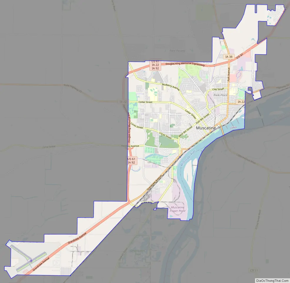
Muscatine Road Map
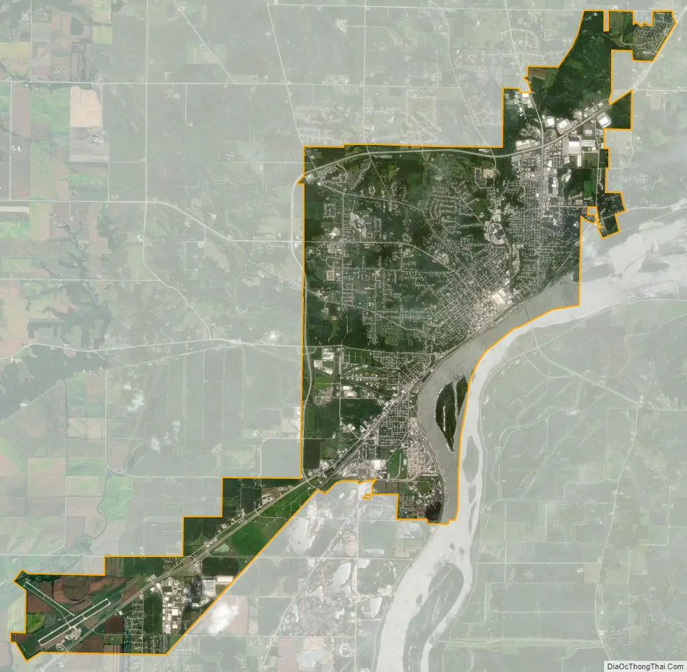
Muscatine city Satellite Map
Geography
According to the United States Census Bureau, the city has a total area of 18.35 square miles (47.53 km), of which 17.30 square miles (44.81 km) is land and 1.05 square miles (2.72 km) is water.
Muscatine is primarily located on a series of bluffs and hills at a major west-south bend in the Mississippi River. The river-bend gives the city roughly 260 degrees of riverfront. The “highland” area of the town is divided into three ridge-like hills by Papoose Creek and Mad Creek, each of which flow individually into the Mississippi in downtown Muscatine. The city’s main roads follow these ridges and valleys in a radial fashion.
Several large working-class neighborhoods and industrial sectors have been built on what is called “Muscatine Island”. This flat, sandy expanse was largely underwater before a portion of the Mississippi River rerouted to follow the course of the present-day Muscatine Slough. It is unclear when the river changed course. The hills, river, and island are all integral to the diversity of Muscatine’s economy and housing sector. As the city’s urbanized area develops, the areas of highest elevation in the “High Prairie” crescent (between the Cedar and Mississippi Rivers) are increasingly taken from agricultural use and developed as suburban housing.
Positioned some 25 miles (40 km) (30 minutes) from the Quad Cities, 38 miles (61 km) (52 minutes) from Iowa City and some 68 miles (109 km) (75 minutes) from Cedar Rapids, Muscatine is the smallest link in a non-contiguous populated area which surpassed 800,000 residents in the decade following the 2000 census. The key feature of this region is that although the populated areas are non-contiguous, a high percentage of residents commute among the cities for work, particularly those in professional fields.
Climate
See also
Map of Iowa State and its subdivision:- Adair
- Adams
- Allamakee
- Appanoose
- Audubon
- Benton
- Black Hawk
- Boone
- Bremer
- Buchanan
- Buena Vista
- Butler
- Calhoun
- Carroll
- Cass
- Cedar
- Cerro Gordo
- Cherokee
- Chickasaw
- Clarke
- Clay
- Clayton
- Clinton
- Crawford
- Dallas
- Davis
- Decatur
- Delaware
- Des Moines
- Dickinson
- Dubuque
- Emmet
- Fayette
- Floyd
- Franklin
- Fremont
- Greene
- Grundy
- Guthrie
- Hamilton
- Hancock
- Hardin
- Harrison
- Henry
- Howard
- Humboldt
- Ida
- Iowa
- Jackson
- Jasper
- Jefferson
- Johnson
- Jones
- Keokuk
- Kossuth
- Lee
- Linn
- Louisa
- Lucas
- Lyon
- Madison
- Mahaska
- Marion
- Marshall
- Mills
- Mitchell
- Monona
- Monroe
- Montgomery
- Muscatine
- O'Brien
- Osceola
- Page
- Palo Alto
- Plymouth
- Pocahontas
- Polk
- Pottawattamie
- Poweshiek
- Ringgold
- Sac
- Scott
- Shelby
- Sioux
- Story
- Tama
- Taylor
- Union
- Van Buren
- Wapello
- Warren
- Washington
- Wayne
- Webster
- Winnebago
- Winneshiek
- Woodbury
- Worth
- Wright
- Alabama
- Alaska
- Arizona
- Arkansas
- California
- Colorado
- Connecticut
- Delaware
- District of Columbia
- Florida
- Georgia
- Hawaii
- Idaho
- Illinois
- Indiana
- Iowa
- Kansas
- Kentucky
- Louisiana
- Maine
- Maryland
- Massachusetts
- Michigan
- Minnesota
- Mississippi
- Missouri
- Montana
- Nebraska
- Nevada
- New Hampshire
- New Jersey
- New Mexico
- New York
- North Carolina
- North Dakota
- Ohio
- Oklahoma
- Oregon
- Pennsylvania
- Rhode Island
- South Carolina
- South Dakota
- Tennessee
- Texas
- Utah
- Vermont
- Virginia
- Washington
- West Virginia
- Wisconsin
- Wyoming