| Name: | Atlantic city |
|---|---|
| LSAD Code: | 25 |
| LSAD Description: | city (suffix) |
| State: | Iowa |
| County: | Cass County |
| Elevation: | 1,211 ft (369 m) |
| Total Area: | 8.34 sq mi (21.60 km²) |
| Land Area: | 8.29 sq mi (21.48 km²) |
| Water Area: | 0.04 sq mi (0.11 km²) |
| Total Population: | 6,792 |
| Population Density: | 818.81/sq mi (316.15/km²) |
| ZIP code: | 50022 |
| Area code: | 712 |
| FIPS code: | 1903520 |
| GNISfeature ID: | 0454275 |
| Website: | atlanticiowa.com |
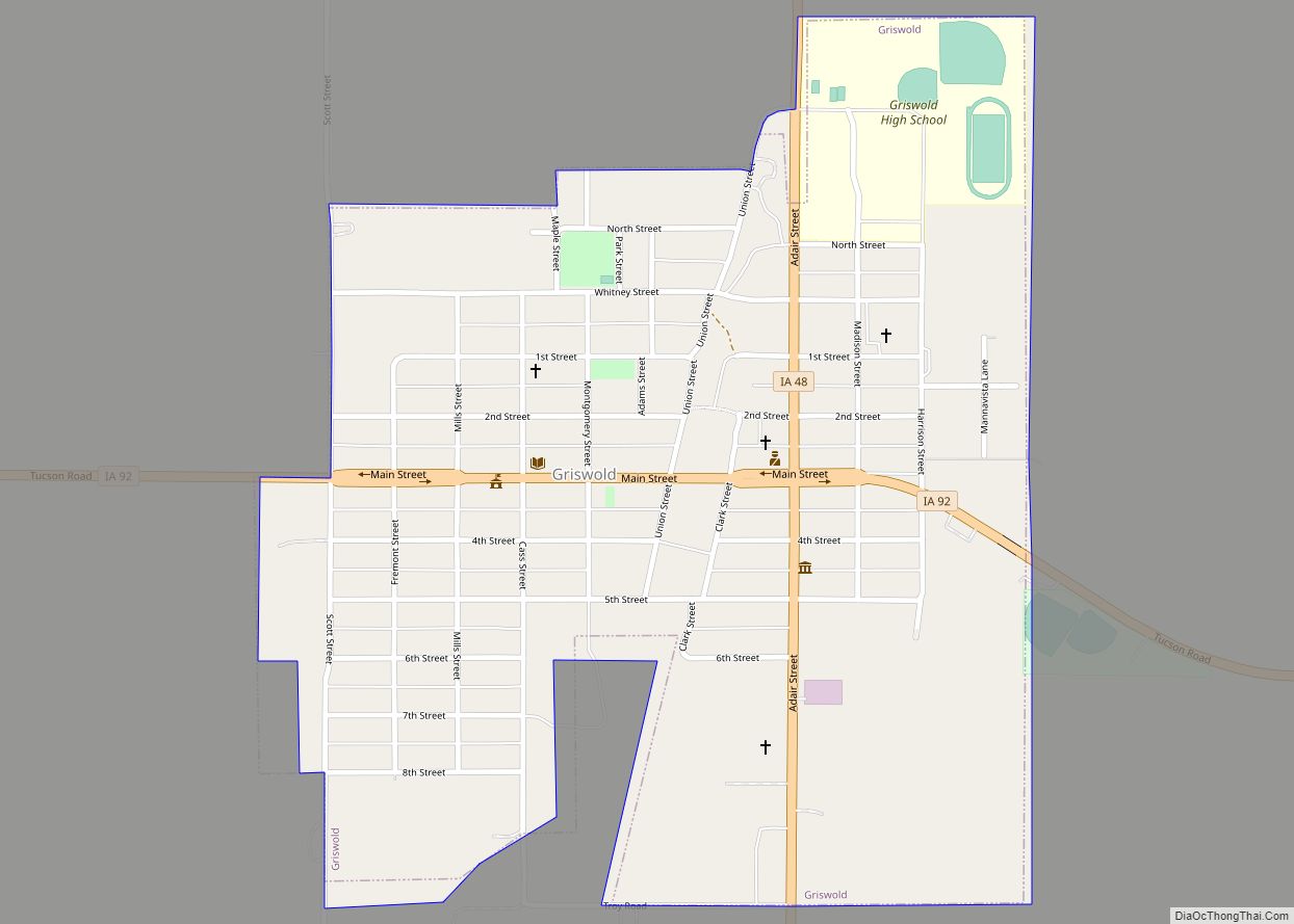
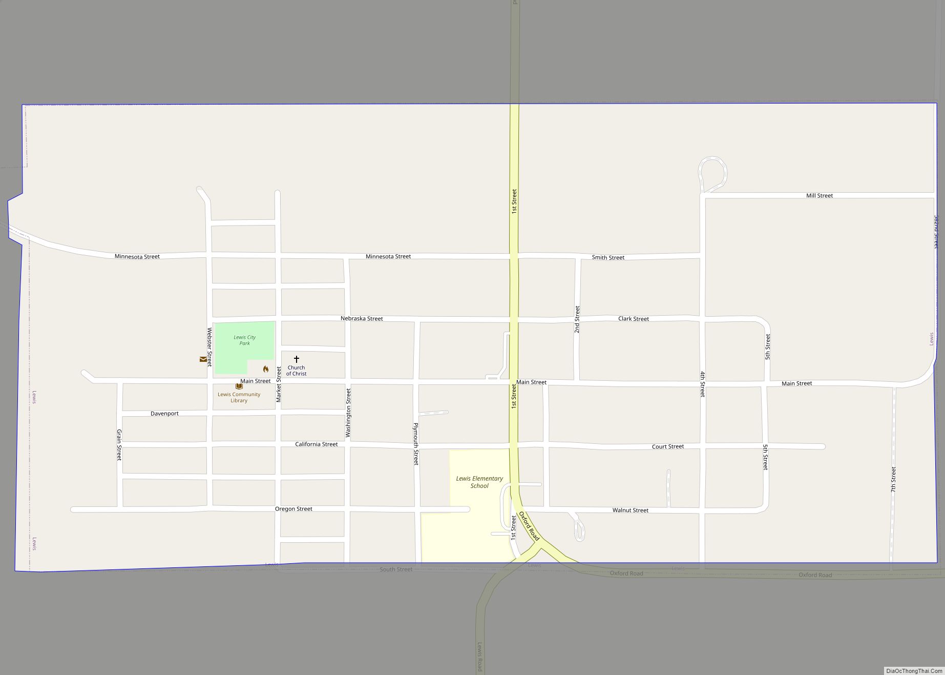
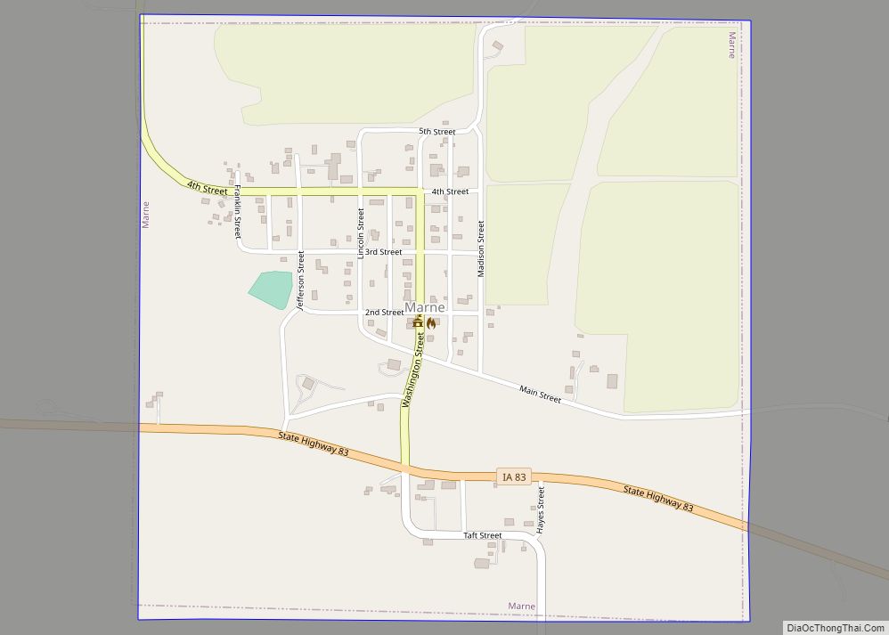
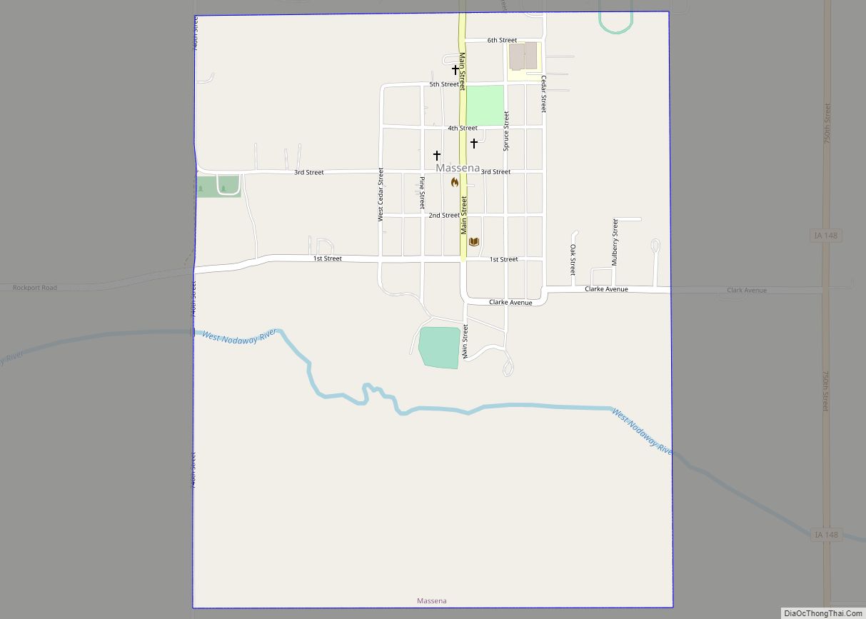
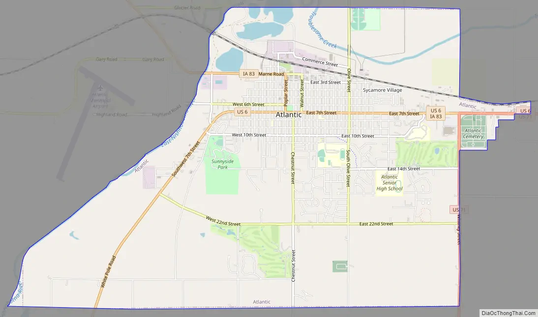
Online Interactive Map
Click on ![]() to view map in "full screen" mode.
to view map in "full screen" mode.
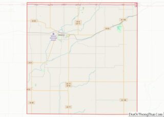
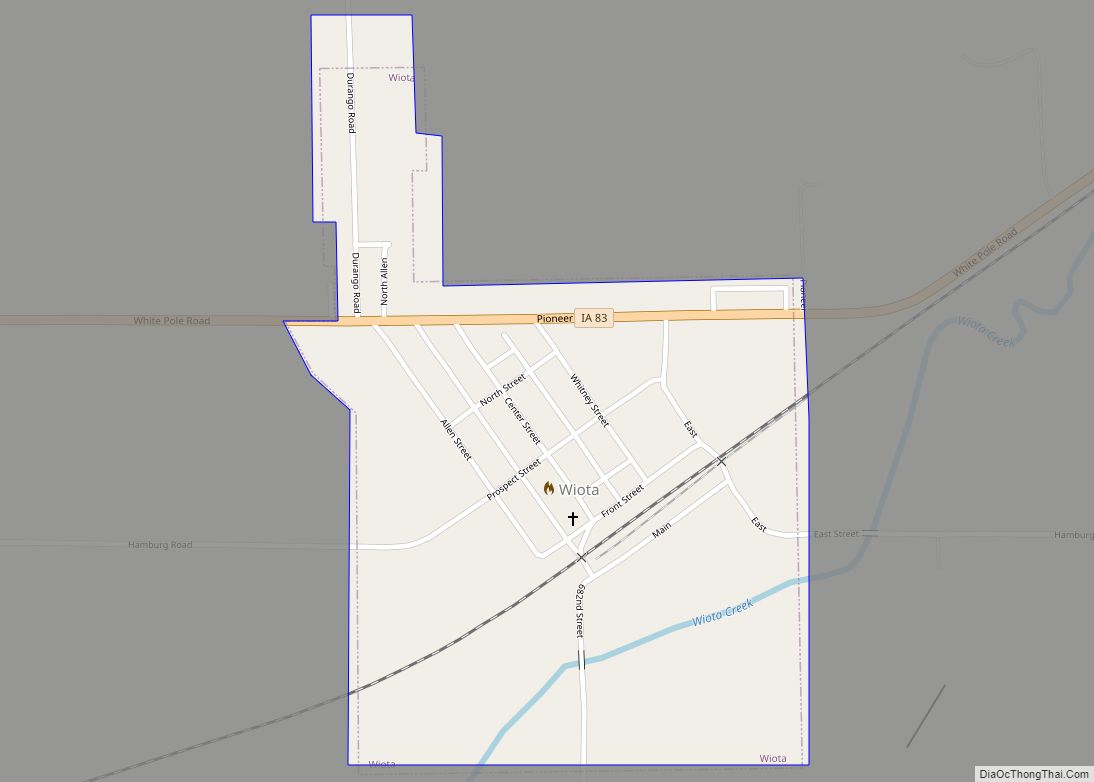
Atlantic location map. Where is Atlantic city?


History
Atlantic was founded in October 1868 by Franklin H. Whitney, B.F. Allen, John P. Cook, and others. While historians cannot agree on how Atlantic got its name, local legend tells that the founding fathers estimated that the town was about halfway between the Pacific Ocean and the Atlantic Ocean, so it led them to flip a coin and, clearly, Atlantic won. The nearby Rock Island Railroad was important in deciding the actual location of the town, and to this day, the old depot sits at the north end of Chestnut Street. Today, the depot serves as the offices of the Chamber of Commerce.
A log cabin stands in Atlantic City Park with a historical plaque bearing the following inscription:
Another story told about Atlantic is the way the main street was located. Someone asked Whitney where it should be placed. He marked the center at current day 6th and Chestnut and then plowed two furrows 100 feet (30 m) apart all the way up to the railroad, just north of Second Street.
Since 1929, Atlantic is noted for the Atlantic Coca-Cola Bottling Company, which bottles and distributes drinks from The Coca-Cola Company to Iowa and parts of Minnesota, Wisconsin, Illinois, and Missouri.
Atlantic has one high school, The Atlantic High School, home of the Atlantic Trojans.
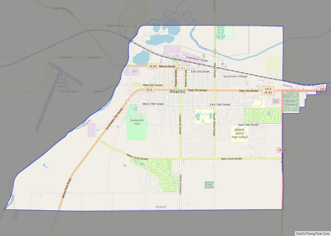
Atlantic Road Map
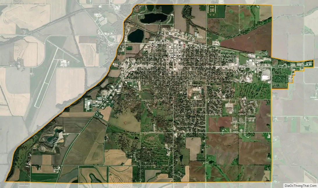
Atlantic city Satellite Map
Geography
Atlantic’s longitude and latitude coordinates in decimal form are 41.401404, -95.010867.
According to the United States Census Bureau, the city has a total area of 8.35 square miles (21.63 km), of which 8.32 square miles (21.55 km) is land and 0.03 square miles (0.08 km) is water.
See also
Map of Iowa State and its subdivision:- Adair
- Adams
- Allamakee
- Appanoose
- Audubon
- Benton
- Black Hawk
- Boone
- Bremer
- Buchanan
- Buena Vista
- Butler
- Calhoun
- Carroll
- Cass
- Cedar
- Cerro Gordo
- Cherokee
- Chickasaw
- Clarke
- Clay
- Clayton
- Clinton
- Crawford
- Dallas
- Davis
- Decatur
- Delaware
- Des Moines
- Dickinson
- Dubuque
- Emmet
- Fayette
- Floyd
- Franklin
- Fremont
- Greene
- Grundy
- Guthrie
- Hamilton
- Hancock
- Hardin
- Harrison
- Henry
- Howard
- Humboldt
- Ida
- Iowa
- Jackson
- Jasper
- Jefferson
- Johnson
- Jones
- Keokuk
- Kossuth
- Lee
- Linn
- Louisa
- Lucas
- Lyon
- Madison
- Mahaska
- Marion
- Marshall
- Mills
- Mitchell
- Monona
- Monroe
- Montgomery
- Muscatine
- O'Brien
- Osceola
- Page
- Palo Alto
- Plymouth
- Pocahontas
- Polk
- Pottawattamie
- Poweshiek
- Ringgold
- Sac
- Scott
- Shelby
- Sioux
- Story
- Tama
- Taylor
- Union
- Van Buren
- Wapello
- Warren
- Washington
- Wayne
- Webster
- Winnebago
- Winneshiek
- Woodbury
- Worth
- Wright
- Alabama
- Alaska
- Arizona
- Arkansas
- California
- Colorado
- Connecticut
- Delaware
- District of Columbia
- Florida
- Georgia
- Hawaii
- Idaho
- Illinois
- Indiana
- Iowa
- Kansas
- Kentucky
- Louisiana
- Maine
- Maryland
- Massachusetts
- Michigan
- Minnesota
- Mississippi
- Missouri
- Montana
- Nebraska
- Nevada
- New Hampshire
- New Jersey
- New Mexico
- New York
- North Carolina
- North Dakota
- Ohio
- Oklahoma
- Oregon
- Pennsylvania
- Rhode Island
- South Carolina
- South Dakota
- Tennessee
- Texas
- Utah
- Vermont
- Virginia
- Washington
- West Virginia
- Wisconsin
- Wyoming