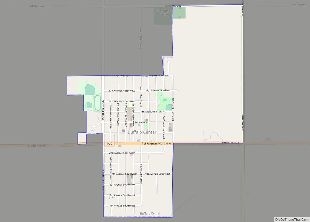
Buffalo Center is a city in Winnebago County, Iowa, United States. The population was 857 at the time of the 2020 census. Its ZIP code is 50424.
| Name: | Buffalo Center city |
|---|---|
| LSAD Code: | 25 |
| LSAD Description: | city (suffix) |
| State: | Iowa |
| County: | Winnebago County |
| Elevation: | 1,191 ft (363 m) |
| Total Area: | 1.07 sq mi (2.77 km²) |
| Land Area: | 1.07 sq mi (2.77 km²) |
| Water Area: | 0.00 sq mi (0.00 km²) |
| Total Population: | 857 |
| Population Density: | 800.19/sq mi (308.98/km²) |
| ZIP code: | 50424 |
| Area code: | 641 |
| FIPS code: | 1909280 |
| GNISfeature ID: | 0454952 |
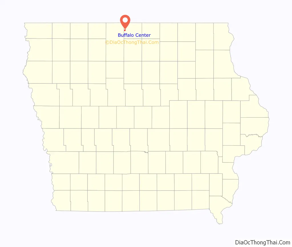
Online Interactive Map
Click on ![]() to view map in "full screen" mode.
to view map in "full screen" mode.
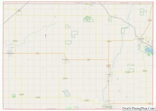
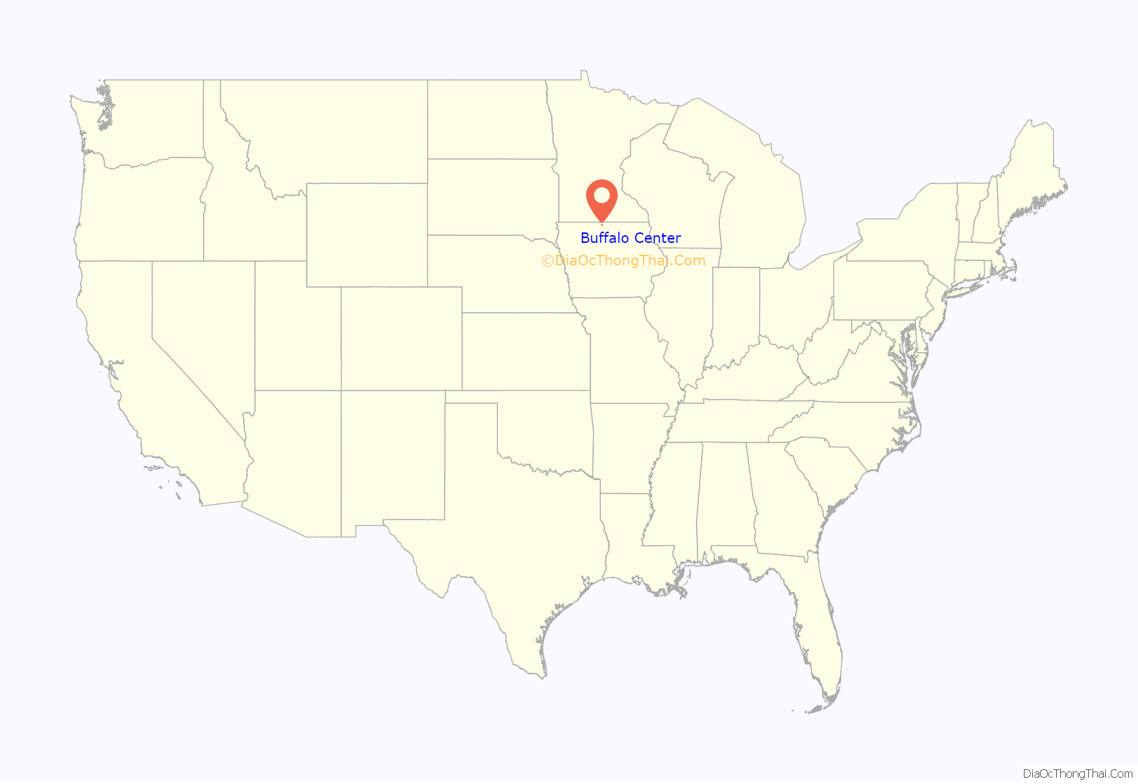
Buffalo Center location map. Where is Buffalo Center city?
History
Buffalo Center was platted in 1892, and was incorporated as a city later that same year. In 1996, Buffalo Center officially became the host community of the newly-formed North Iowa Community School.[4]
Located seven miles south of the Minnesota border, the town was named Buffalo Center because it was midway between the north and south forks of Buffalo Creek. The town was originally built south of the present site and moved north when the Chicago and Iowa Western Railroad set up lines in northern Iowa. It was settled in 1892 on mostly swampy ground, later dredged and tiled. One of the original settlers, Howard Pomeroy, took a mower and mowed through his wheat fields to show where the streets would be, and a hardware store and a blacksmith shop were the first business enterprises in the new town.
Buffalo Center has survived a number of devastating fires, which have ravaged Main Street businesses over and over, and the occasional tornado, as well as several winter storms and blizzards. One of the most severe was the historic Armistice Day blizzard of November 11, 1940, which killed 154 people throughout Iowa, Minnesota, Wisconsin, and Michigan.
On August 23, 1897, Buffalo Center became the first school system west of the Mississippi River to be consolidated, and it is believed to be the second one in the nation.
Today, Buffalo Center is a thriving town of about 1000 people. We have a large new community center, our first museum, several new businesses and a K-12 consolidated school that educates students from Buffalo Center, Rake, Lakota and Thompson.
Our 4th of July celebration is a well-known all-day holiday which features a 5K, a parade, music in the park, tournaments, games and contests for the kids, and a huge fireworks display. Other annual events include the Winter Gala, the summer Meat & Music Festival, Crazy Days, the Firemen’s Dance in July, and the Old-Fashioned Christmas Celebration in December.
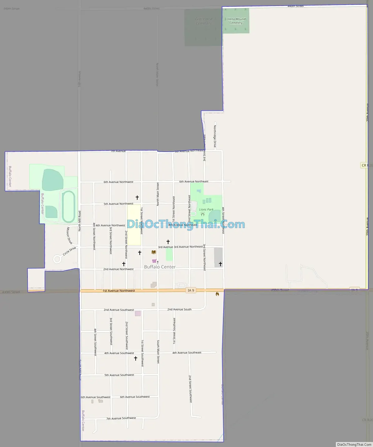
Buffalo Center Road Map
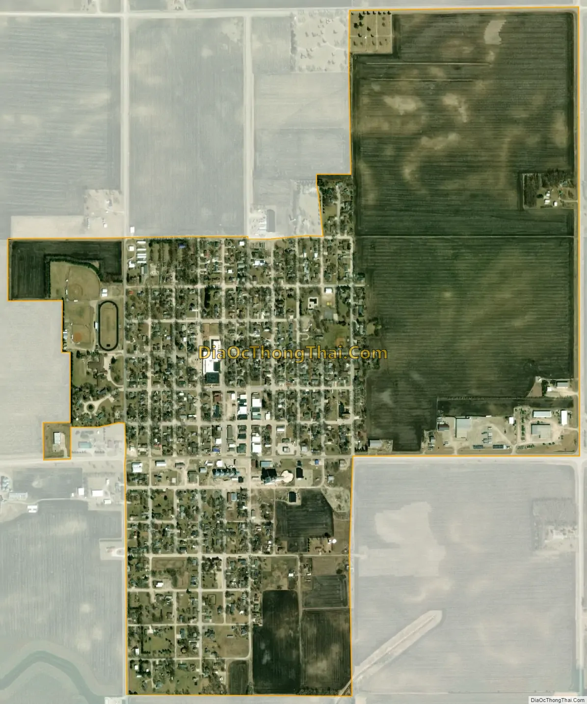
Buffalo Center city Satellite Map
Geography
Buffalo Center is located at 43°23′11″N 93°56′54″W / 43.38639°N 93.94833°W / 43.38639; -93.94833 (43.386497, -93.948241).
According to the United States Census Bureau, the city has a total area of 1.07 square miles (2.77 km), all land.
See also
Map of Iowa State and its subdivision:- Adair
- Adams
- Allamakee
- Appanoose
- Audubon
- Benton
- Black Hawk
- Boone
- Bremer
- Buchanan
- Buena Vista
- Butler
- Calhoun
- Carroll
- Cass
- Cedar
- Cerro Gordo
- Cherokee
- Chickasaw
- Clarke
- Clay
- Clayton
- Clinton
- Crawford
- Dallas
- Davis
- Decatur
- Delaware
- Des Moines
- Dickinson
- Dubuque
- Emmet
- Fayette
- Floyd
- Franklin
- Fremont
- Greene
- Grundy
- Guthrie
- Hamilton
- Hancock
- Hardin
- Harrison
- Henry
- Howard
- Humboldt
- Ida
- Iowa
- Jackson
- Jasper
- Jefferson
- Johnson
- Jones
- Keokuk
- Kossuth
- Lee
- Linn
- Louisa
- Lucas
- Lyon
- Madison
- Mahaska
- Marion
- Marshall
- Mills
- Mitchell
- Monona
- Monroe
- Montgomery
- Muscatine
- O'Brien
- Osceola
- Page
- Palo Alto
- Plymouth
- Pocahontas
- Polk
- Pottawattamie
- Poweshiek
- Ringgold
- Sac
- Scott
- Shelby
- Sioux
- Story
- Tama
- Taylor
- Union
- Van Buren
- Wapello
- Warren
- Washington
- Wayne
- Webster
- Winnebago
- Winneshiek
- Woodbury
- Worth
- Wright
- Alabama
- Alaska
- Arizona
- Arkansas
- California
- Colorado
- Connecticut
- Delaware
- District of Columbia
- Florida
- Georgia
- Hawaii
- Idaho
- Illinois
- Indiana
- Iowa
- Kansas
- Kentucky
- Louisiana
- Maine
- Maryland
- Massachusetts
- Michigan
- Minnesota
- Mississippi
- Missouri
- Montana
- Nebraska
- Nevada
- New Hampshire
- New Jersey
- New Mexico
- New York
- North Carolina
- North Dakota
- Ohio
- Oklahoma
- Oregon
- Pennsylvania
- Rhode Island
- South Carolina
- South Dakota
- Tennessee
- Texas
- Utah
- Vermont
- Virginia
- Washington
- West Virginia
- Wisconsin
- Wyoming