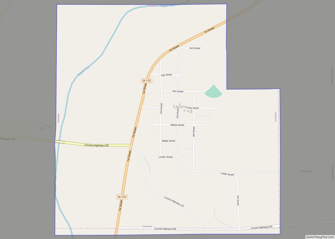
Castana is a city in Monona County, Iowa, United States. The population was 107 at the time of the 2020 census.
| Name: | Castana city |
|---|---|
| LSAD Code: | 25 |
| LSAD Description: | city (suffix) |
| State: | Iowa |
| County: | Monona County |
| Elevation: | 1,148 ft (350 m) |
| Total Area: | 0.91 sq mi (2.35 km²) |
| Land Area: | 0.91 sq mi (2.35 km²) |
| Water Area: | 0.00 sq mi (0.00 km²) |
| Total Population: | 107 |
| Population Density: | 117.97/sq mi (45.53/km²) |
| ZIP code: | 51010 |
| Area code: | 712 |
| FIPS code: | 1911530 |
| GNISfeature ID: | 0455207 |
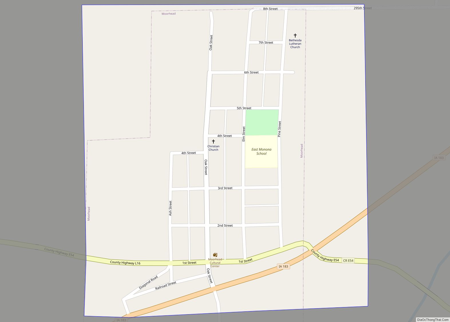
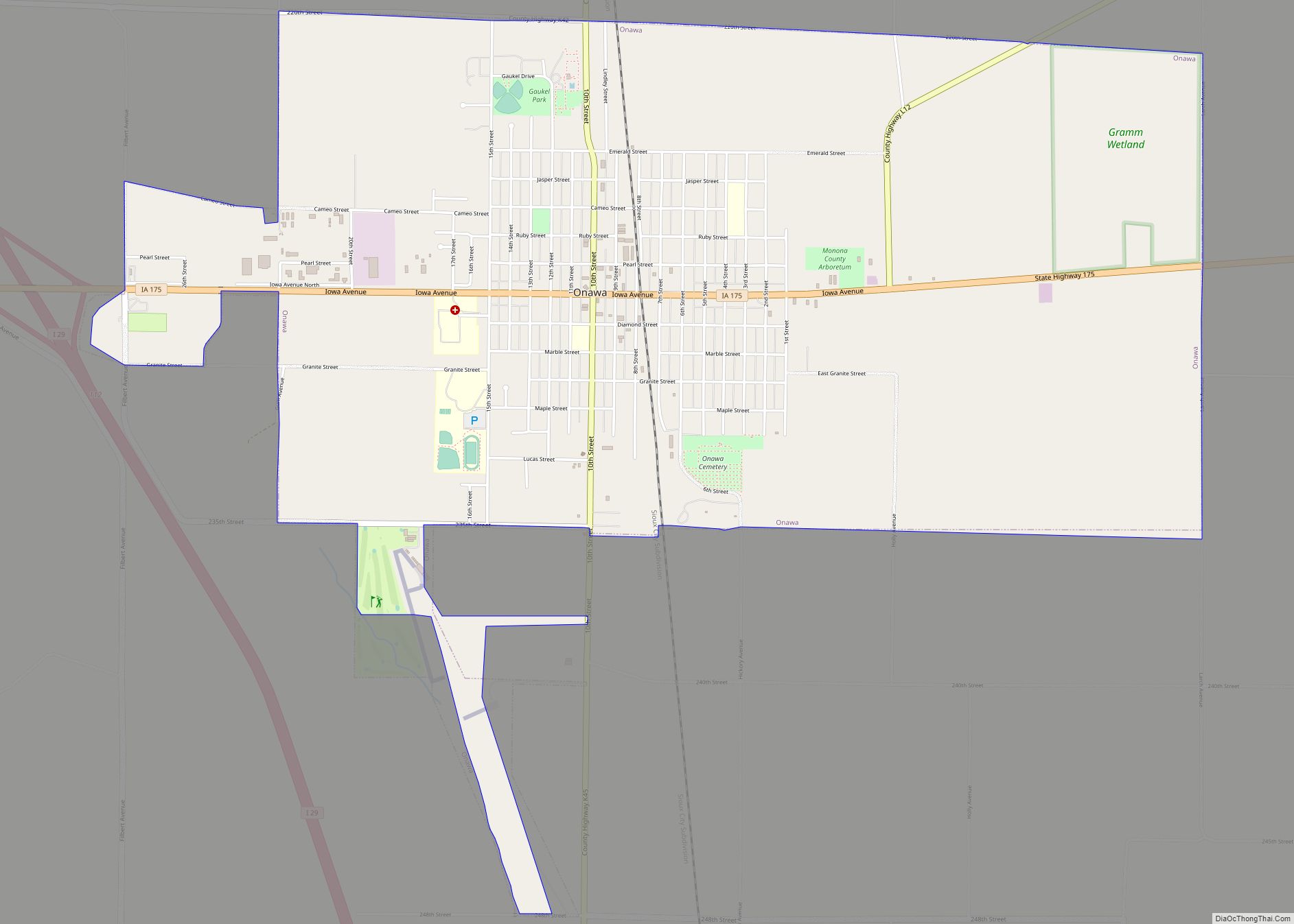
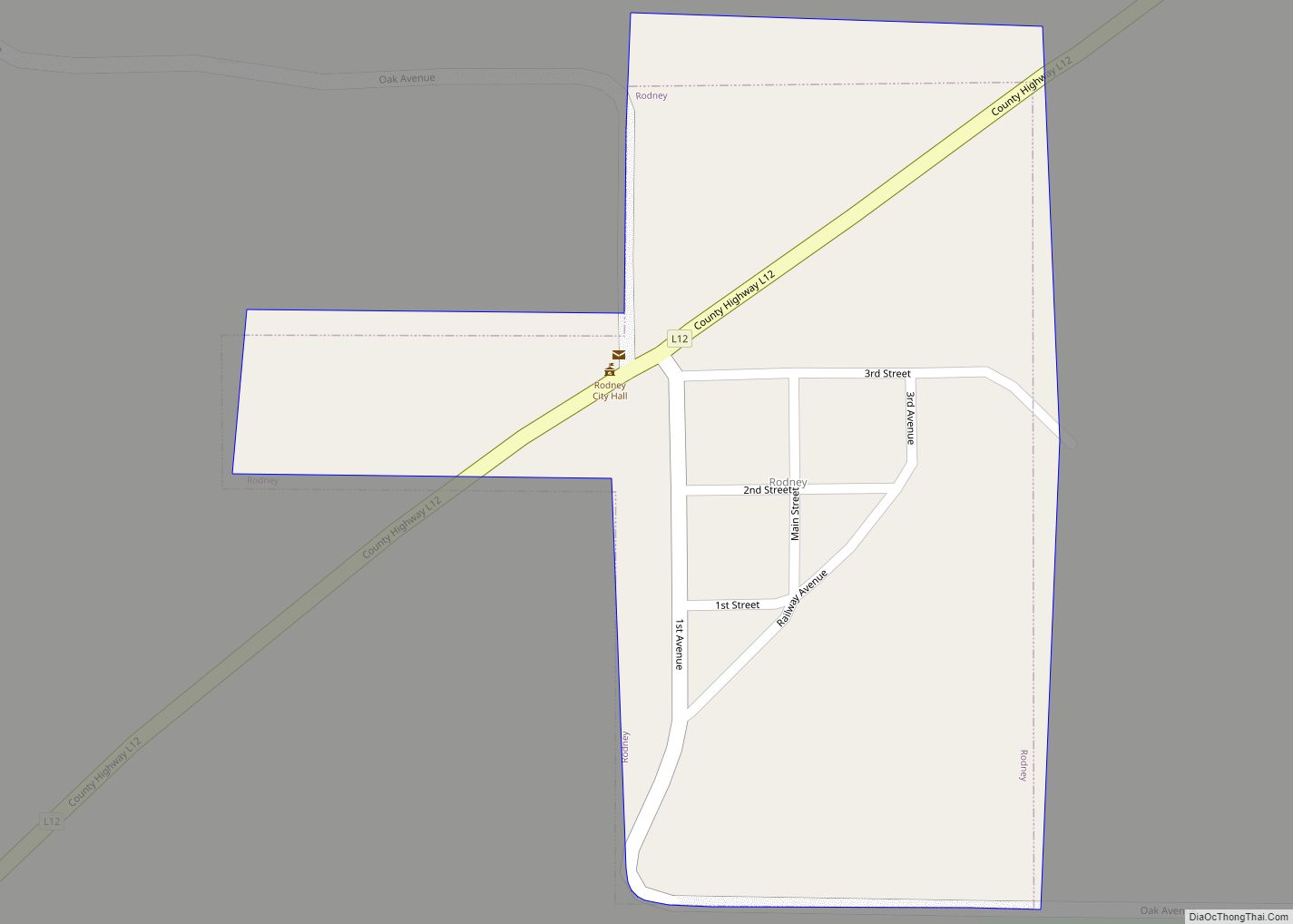
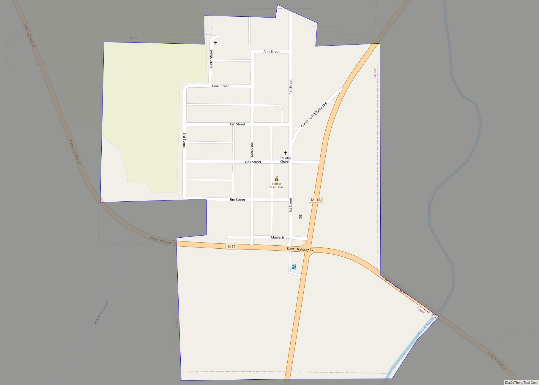
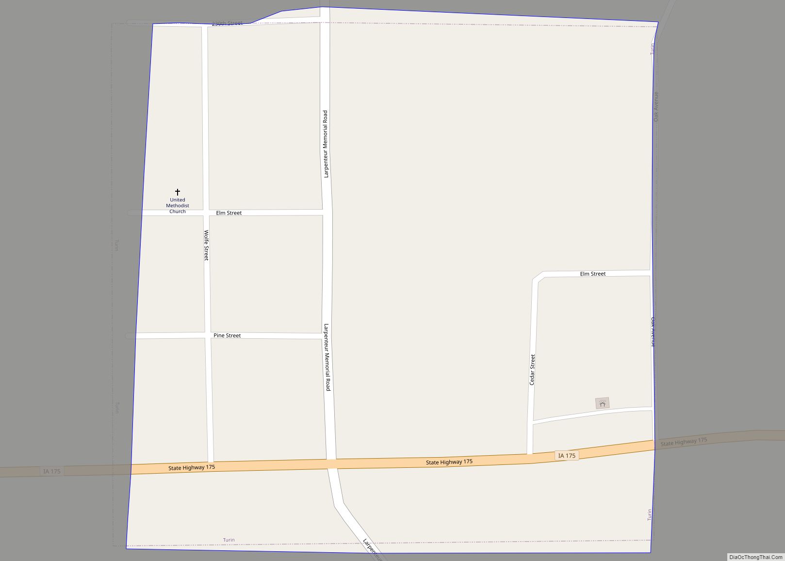
Online Interactive Map
Click on ![]() to view map in "full screen" mode.
to view map in "full screen" mode.
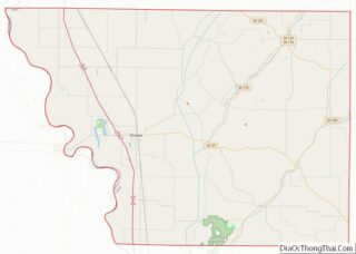
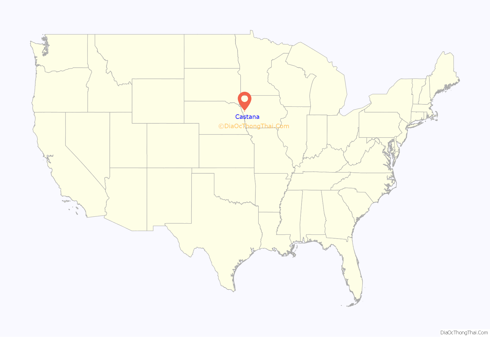
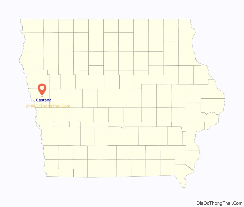
Castana location map. Where is Castana city?
History
A post office has been in operation at Castana since 1865. Castana was platted in 1886 by the railroad. The name Castana was selected by an early settler who believed it to be a Latin word meaning “chestnuts”.
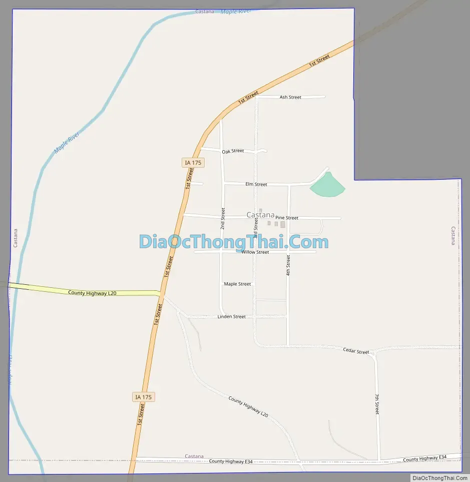
Castana Road Map
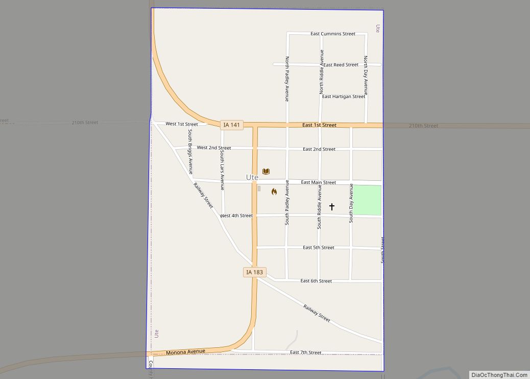
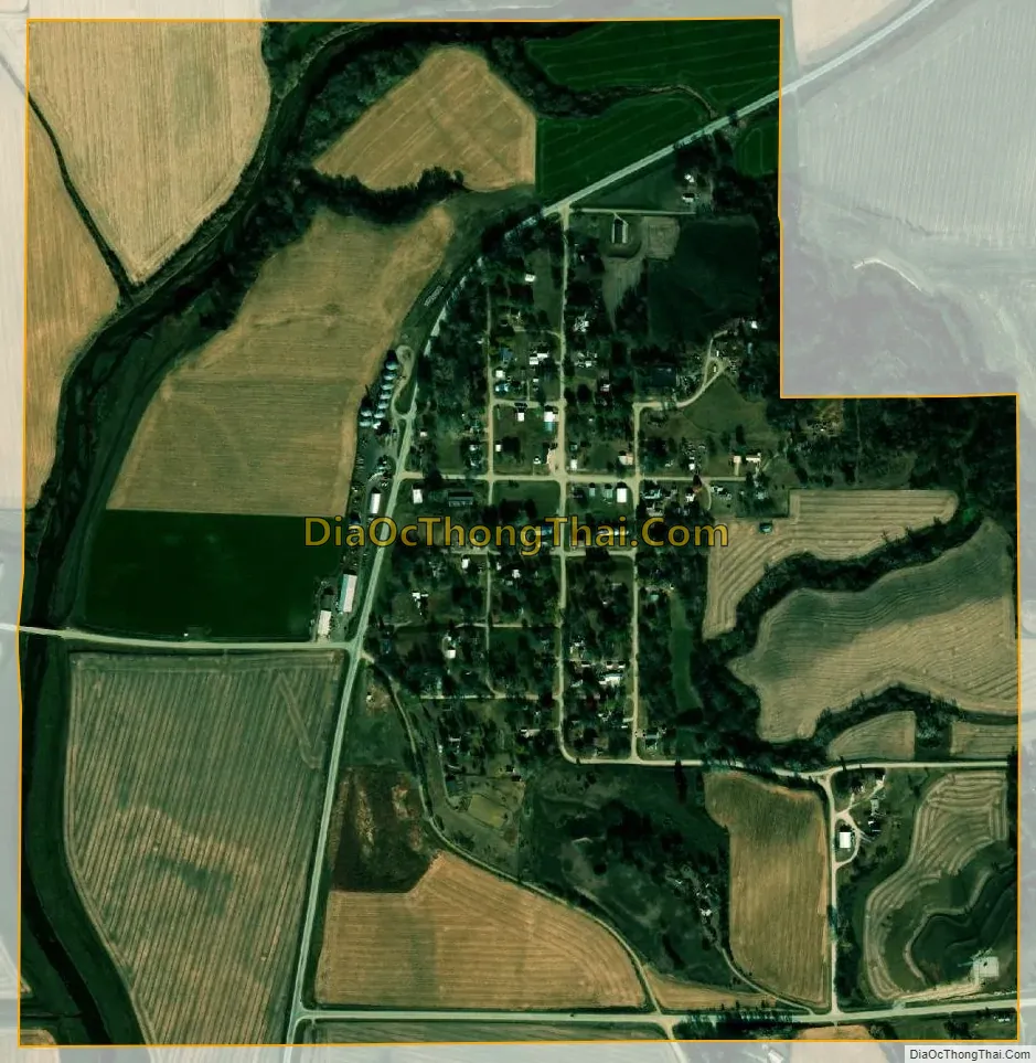
Castana city Satellite Map
Geography
Castana is located at 42°4′21″N 95°54′30″W / 42.07250°N 95.90833°W / 42.07250; -95.90833 (42.072518, -95.908266).
According to the United States Census Bureau, the city has a total area of 0.93 square miles (2.41 km), all land. The city is located 10 miles (16 km) from Onawa and 39 miles (63 km) from Sioux City.
See also
Map of Iowa State and its subdivision:- Adair
- Adams
- Allamakee
- Appanoose
- Audubon
- Benton
- Black Hawk
- Boone
- Bremer
- Buchanan
- Buena Vista
- Butler
- Calhoun
- Carroll
- Cass
- Cedar
- Cerro Gordo
- Cherokee
- Chickasaw
- Clarke
- Clay
- Clayton
- Clinton
- Crawford
- Dallas
- Davis
- Decatur
- Delaware
- Des Moines
- Dickinson
- Dubuque
- Emmet
- Fayette
- Floyd
- Franklin
- Fremont
- Greene
- Grundy
- Guthrie
- Hamilton
- Hancock
- Hardin
- Harrison
- Henry
- Howard
- Humboldt
- Ida
- Iowa
- Jackson
- Jasper
- Jefferson
- Johnson
- Jones
- Keokuk
- Kossuth
- Lee
- Linn
- Louisa
- Lucas
- Lyon
- Madison
- Mahaska
- Marion
- Marshall
- Mills
- Mitchell
- Monona
- Monroe
- Montgomery
- Muscatine
- O'Brien
- Osceola
- Page
- Palo Alto
- Plymouth
- Pocahontas
- Polk
- Pottawattamie
- Poweshiek
- Ringgold
- Sac
- Scott
- Shelby
- Sioux
- Story
- Tama
- Taylor
- Union
- Van Buren
- Wapello
- Warren
- Washington
- Wayne
- Webster
- Winnebago
- Winneshiek
- Woodbury
- Worth
- Wright
- Alabama
- Alaska
- Arizona
- Arkansas
- California
- Colorado
- Connecticut
- Delaware
- District of Columbia
- Florida
- Georgia
- Hawaii
- Idaho
- Illinois
- Indiana
- Iowa
- Kansas
- Kentucky
- Louisiana
- Maine
- Maryland
- Massachusetts
- Michigan
- Minnesota
- Mississippi
- Missouri
- Montana
- Nebraska
- Nevada
- New Hampshire
- New Jersey
- New Mexico
- New York
- North Carolina
- North Dakota
- Ohio
- Oklahoma
- Oregon
- Pennsylvania
- Rhode Island
- South Carolina
- South Dakota
- Tennessee
- Texas
- Utah
- Vermont
- Virginia
- Washington
- West Virginia
- Wisconsin
- Wyoming