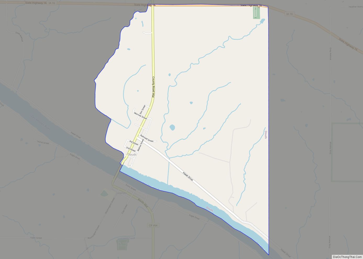
Douds is a census-designated place (CDP) in Van Buren County, Iowa, United States. The population was 165 at the 2000 census.
| Name: | Douds CDP |
|---|---|
| LSAD Code: | 57 |
| LSAD Description: | CDP (suffix) |
| State: | Iowa |
| County: | Van Buren County |
| Elevation: | 604 ft (184 m) |
| Total Area: | 2.31 sq mi (5.99 km²) |
| Land Area: | 2.21 sq mi (5.73 km²) |
| Water Area: | 0.10 sq mi (0.26 km²) |
| Total Population: | 156 |
| Population Density: | 70.52/sq mi (27.23/km²) |
| ZIP code: | 52551 |
| Area code: | 641 |
| FIPS code: | 1922035 |
| GNISfeature ID: | 0455960 |
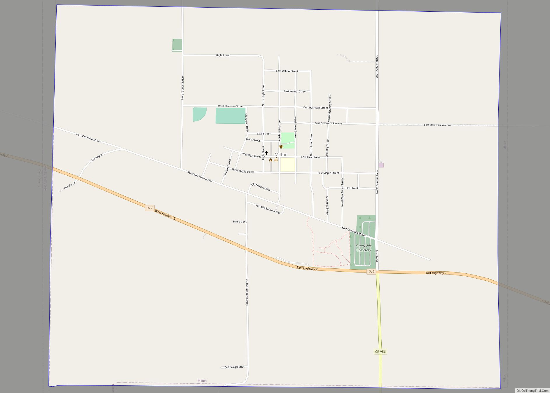
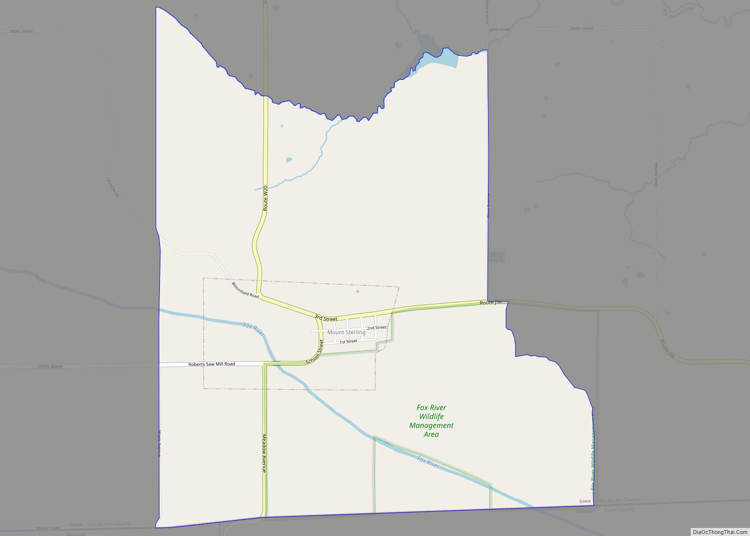
Online Interactive Map
Click on ![]() to view map in "full screen" mode.
to view map in "full screen" mode.
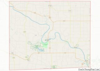
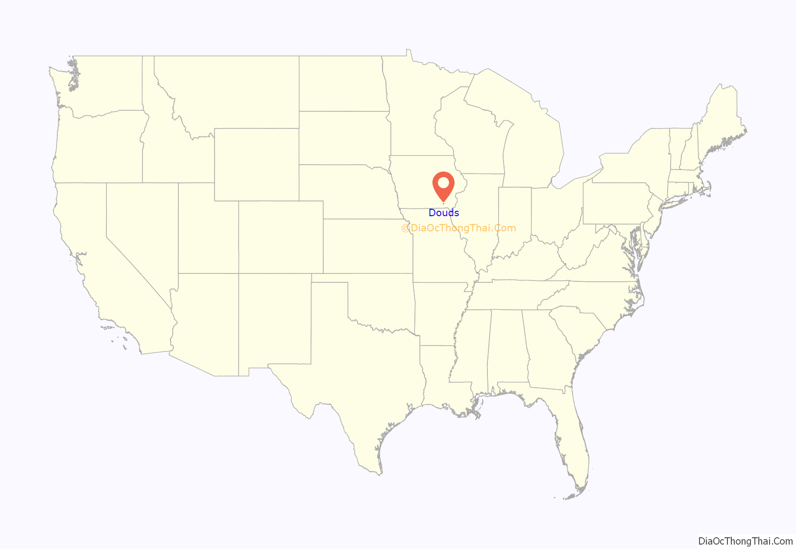
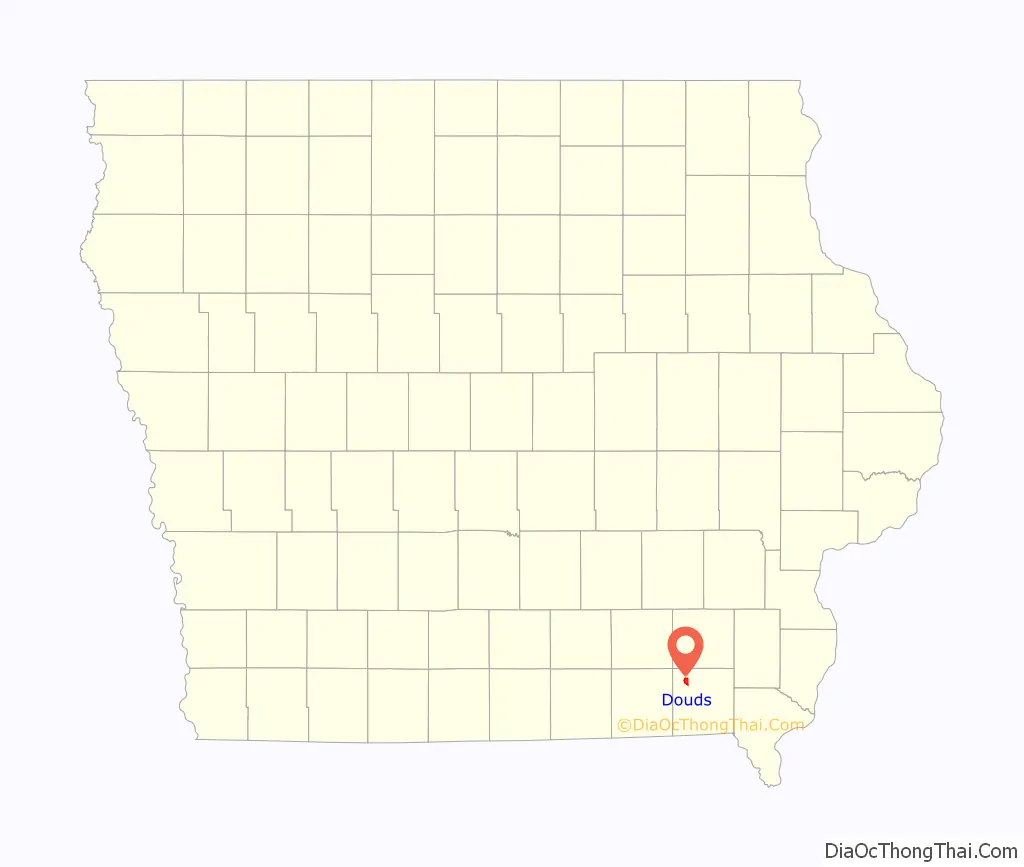
Douds location map. Where is Douds CDP?
History
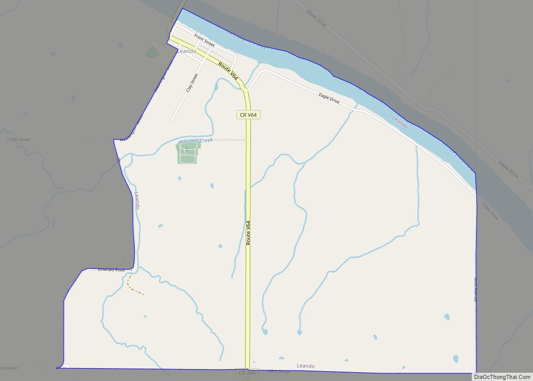
Douds was platted in 1866 by brothers Eliab and David Doud. It was originally called Doud’s Station. Douds was never officially incorporated as a town, but has a Post Office and its own zip code. On the southern bank of the Des Moines River lies Douds’ “Twin City”, Leando. Leando is the elder, but smaller of the two towns. Leando was settled in the 1830s and was originally called Portland. In the original deed it was stipulated by the Doud brothers that there was to be no buying or selling of intoxicating liquors in the town.
This was upheld until the 1990s when Rob Moore began selling alcohol in his grocery store. Until the construction of the first iron bridge (1898) the towns of Douds and Portland saw much rivalry. Douds is home to Douds Stone Inc. which operates from one of the largest underground limestone mines in the state of Iowa. Farmers and Traders Savings Bank (founded 1910) is located in Douds, and is one of the few banks to survive the Great Depression. Now considered one community, (Douds and Leando) Douds hosts its annual Field Day on the last full weekend in June.
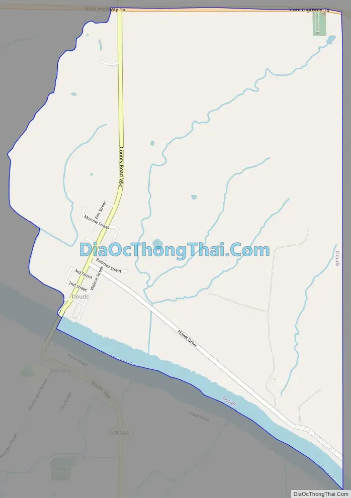
Douds Road Map
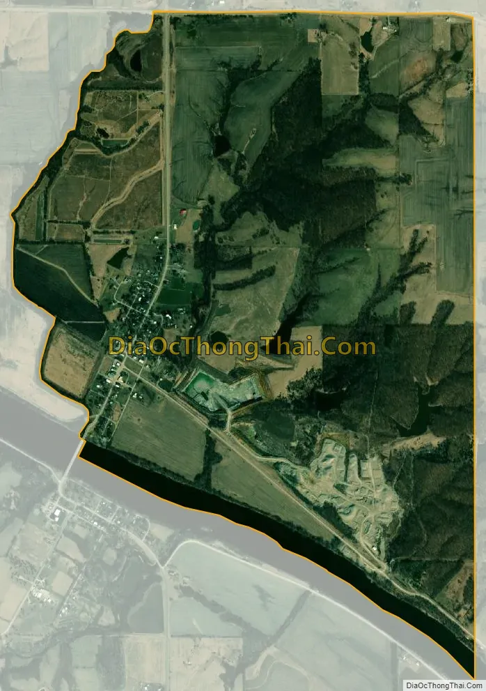
Douds city Satellite Map
Geography
Douds is located at 40°50′22″N 92°5′8″W / 40.83944°N 92.08556°W / 40.83944; -92.08556 (40.839571, -92.085476), in the Northwestern portion of Van Buren County.
According to the United States Census Bureau, the CDP has a total area of 2.3 square miles (6.0 km), of which 2.2 square miles (5.7 km) is land and 0.1 square miles (0.26 km) (3.91%) is water.
See also
Map of Iowa State and its subdivision:- Adair
- Adams
- Allamakee
- Appanoose
- Audubon
- Benton
- Black Hawk
- Boone
- Bremer
- Buchanan
- Buena Vista
- Butler
- Calhoun
- Carroll
- Cass
- Cedar
- Cerro Gordo
- Cherokee
- Chickasaw
- Clarke
- Clay
- Clayton
- Clinton
- Crawford
- Dallas
- Davis
- Decatur
- Delaware
- Des Moines
- Dickinson
- Dubuque
- Emmet
- Fayette
- Floyd
- Franklin
- Fremont
- Greene
- Grundy
- Guthrie
- Hamilton
- Hancock
- Hardin
- Harrison
- Henry
- Howard
- Humboldt
- Ida
- Iowa
- Jackson
- Jasper
- Jefferson
- Johnson
- Jones
- Keokuk
- Kossuth
- Lee
- Linn
- Louisa
- Lucas
- Lyon
- Madison
- Mahaska
- Marion
- Marshall
- Mills
- Mitchell
- Monona
- Monroe
- Montgomery
- Muscatine
- O'Brien
- Osceola
- Page
- Palo Alto
- Plymouth
- Pocahontas
- Polk
- Pottawattamie
- Poweshiek
- Ringgold
- Sac
- Scott
- Shelby
- Sioux
- Story
- Tama
- Taylor
- Union
- Van Buren
- Wapello
- Warren
- Washington
- Wayne
- Webster
- Winnebago
- Winneshiek
- Woodbury
- Worth
- Wright
- Alabama
- Alaska
- Arizona
- Arkansas
- California
- Colorado
- Connecticut
- Delaware
- District of Columbia
- Florida
- Georgia
- Hawaii
- Idaho
- Illinois
- Indiana
- Iowa
- Kansas
- Kentucky
- Louisiana
- Maine
- Maryland
- Massachusetts
- Michigan
- Minnesota
- Mississippi
- Missouri
- Montana
- Nebraska
- Nevada
- New Hampshire
- New Jersey
- New Mexico
- New York
- North Carolina
- North Dakota
- Ohio
- Oklahoma
- Oregon
- Pennsylvania
- Rhode Island
- South Carolina
- South Dakota
- Tennessee
- Texas
- Utah
- Vermont
- Virginia
- Washington
- West Virginia
- Wisconsin
- Wyoming