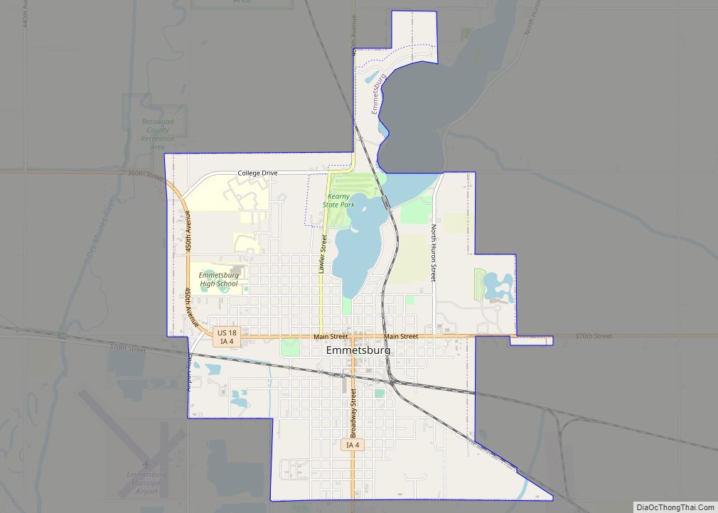
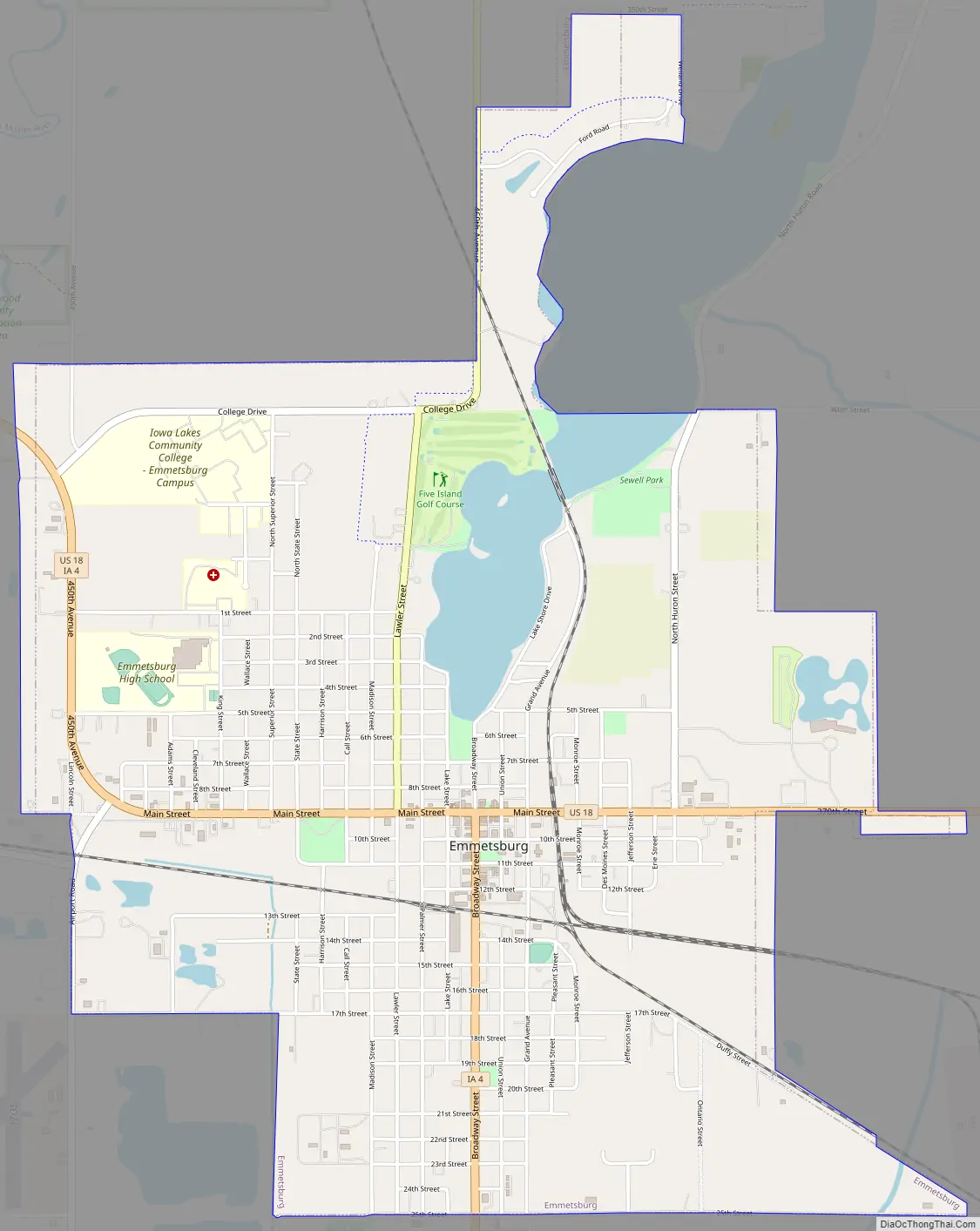
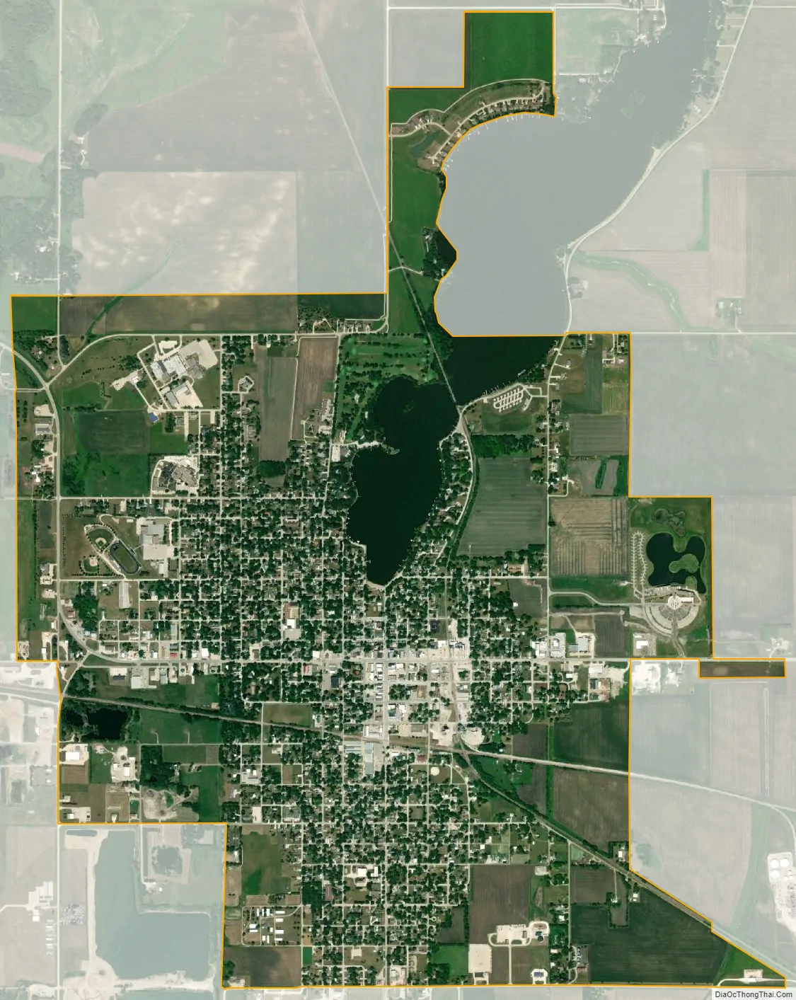
Emmetsburg is a city in Palo Alto County, Iowa, United States. The population was 3,706 at the time of the 2020 census. It is the county seat of Palo Alto County. Emmetsburg is located around the southern bay of Five Island Lake.
| Name: | Emmetsburg city |
|---|---|
| LSAD Code: | 25 |
| LSAD Description: | city (suffix) |
| State: | Iowa |
| County: | Palo Alto County |
| Elevation: | 1,237 ft (377 m) |
| Total Area: | 3.96 sq mi (10.25 km²) |
| Land Area: | 3.79 sq mi (9.82 km²) |
| Water Area: | 0.17 sq mi (0.43 km²) |
| Total Population: | 3,706 |
| Population Density: | 977.32/sq mi (377.30/km²) |
| ZIP code: | 50536 |
| Area code: | 712 |
| FIPS code: | 1925590 |
| GNISfeature ID: | 0456375 |
| Website: | www.emmetsburg.com |
Online Interactive Map
Click on ![]() to view map in "full screen" mode.
to view map in "full screen" mode.
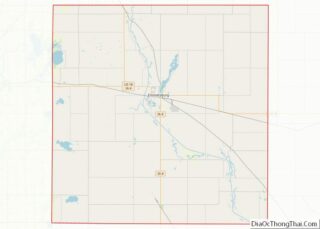
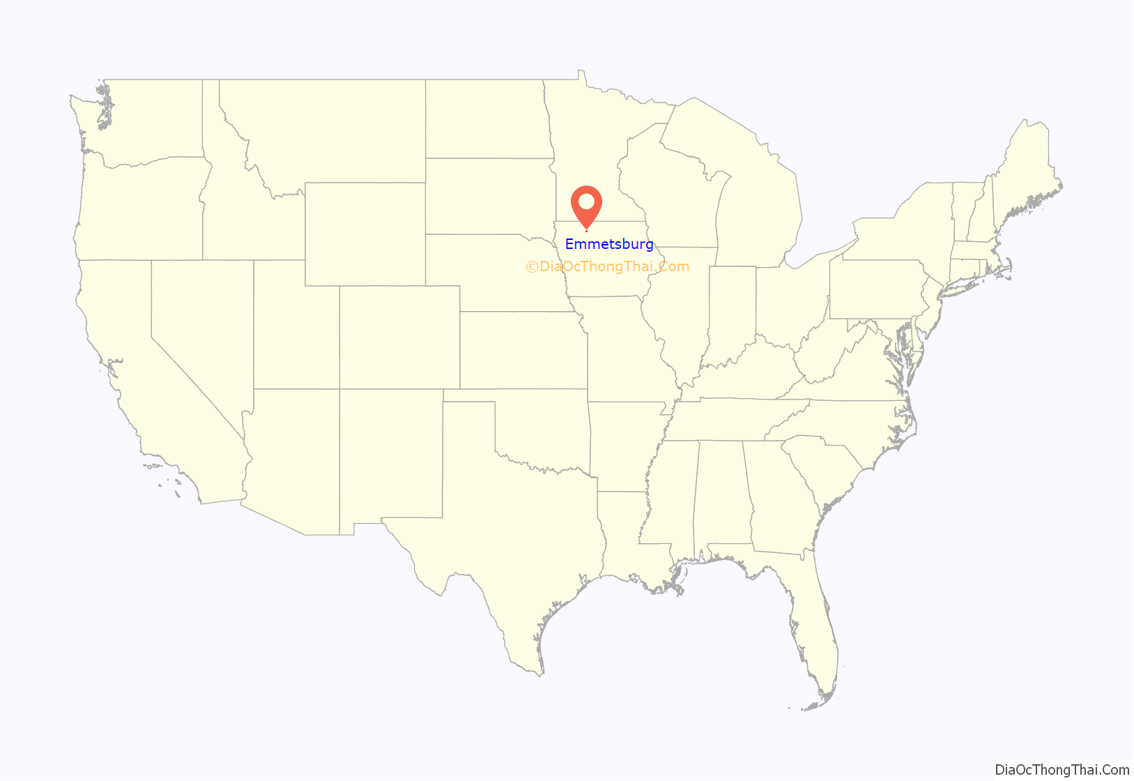
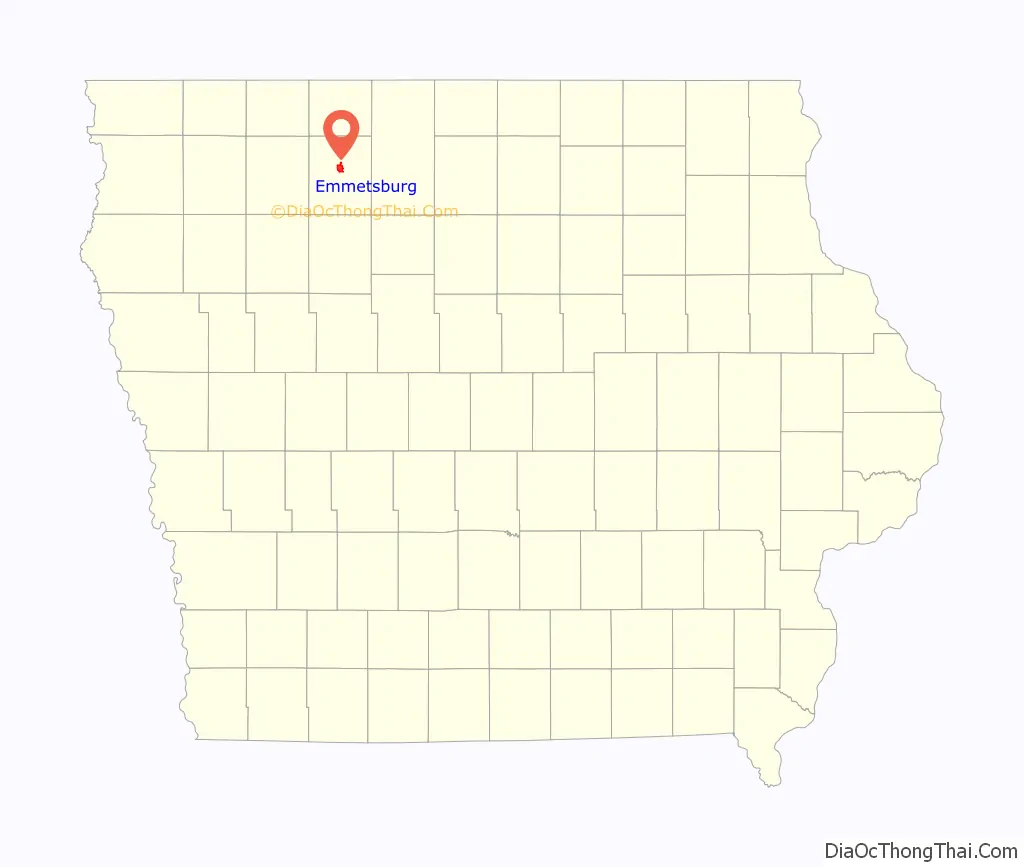
Emmetsburg location map. Where is Emmetsburg city?
History
The town was originally settled by immigrants during the Great Famine of Ireland between 1845 and 1852. Emmetsburg was named after the Dublin-born Irish nationalist Robert Emmet, who was executed at 25 for leading an 1803 rebellion against the British. The city was incorporated on November 17, 1877.
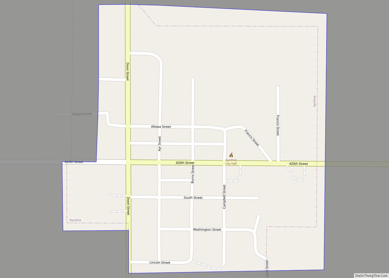
Emmetsburg Road Map
Emmetsburg city Satellite Map
Geography
The city lies just to the east of the Des Moines River.
According to the United States Census Bureau, the city has a total area of 3.97 square miles (10.28 km), of which 3.81 square miles (9.87 km) is land and 0.16 square miles (0.41 km) is water.
See also
Map of Iowa State and its subdivision:- Adair
- Adams
- Allamakee
- Appanoose
- Audubon
- Benton
- Black Hawk
- Boone
- Bremer
- Buchanan
- Buena Vista
- Butler
- Calhoun
- Carroll
- Cass
- Cedar
- Cerro Gordo
- Cherokee
- Chickasaw
- Clarke
- Clay
- Clayton
- Clinton
- Crawford
- Dallas
- Davis
- Decatur
- Delaware
- Des Moines
- Dickinson
- Dubuque
- Emmet
- Fayette
- Floyd
- Franklin
- Fremont
- Greene
- Grundy
- Guthrie
- Hamilton
- Hancock
- Hardin
- Harrison
- Henry
- Howard
- Humboldt
- Ida
- Iowa
- Jackson
- Jasper
- Jefferson
- Johnson
- Jones
- Keokuk
- Kossuth
- Lee
- Linn
- Louisa
- Lucas
- Lyon
- Madison
- Mahaska
- Marion
- Marshall
- Mills
- Mitchell
- Monona
- Monroe
- Montgomery
- Muscatine
- O'Brien
- Osceola
- Page
- Palo Alto
- Plymouth
- Pocahontas
- Polk
- Pottawattamie
- Poweshiek
- Ringgold
- Sac
- Scott
- Shelby
- Sioux
- Story
- Tama
- Taylor
- Union
- Van Buren
- Wapello
- Warren
- Washington
- Wayne
- Webster
- Winnebago
- Winneshiek
- Woodbury
- Worth
- Wright
- Alabama
- Alaska
- Arizona
- Arkansas
- California
- Colorado
- Connecticut
- Delaware
- District of Columbia
- Florida
- Georgia
- Hawaii
- Idaho
- Illinois
- Indiana
- Iowa
- Kansas
- Kentucky
- Louisiana
- Maine
- Maryland
- Massachusetts
- Michigan
- Minnesota
- Mississippi
- Missouri
- Montana
- Nebraska
- Nevada
- New Hampshire
- New Jersey
- New Mexico
- New York
- North Carolina
- North Dakota
- Ohio
- Oklahoma
- Oregon
- Pennsylvania
- Rhode Island
- South Carolina
- South Dakota
- Tennessee
- Texas
- Utah
- Vermont
- Virginia
- Washington
- West Virginia
- Wisconsin
- Wyoming