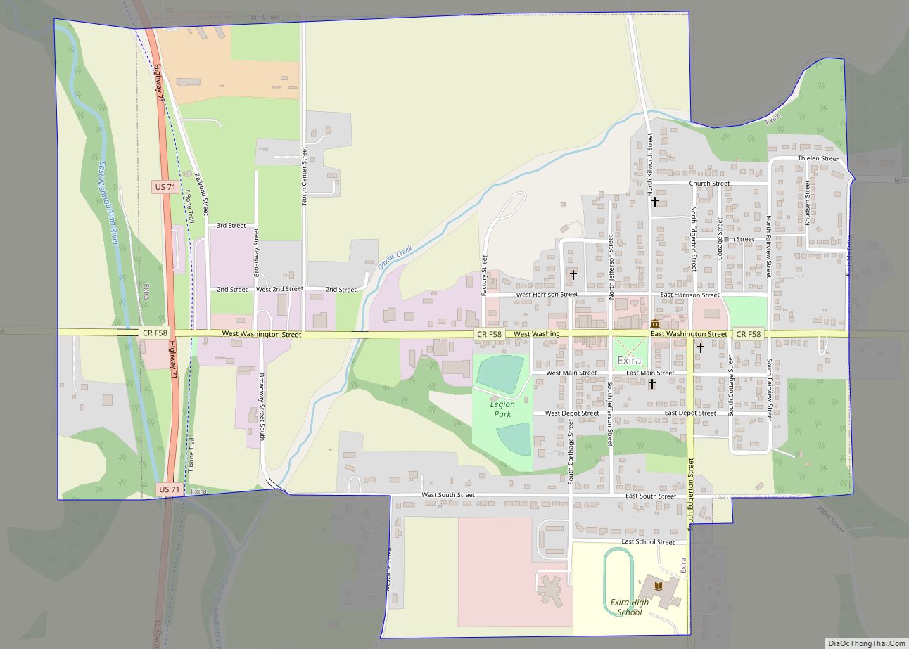
Exira is a city in Audubon County, Iowa, United States, along the East Nishnabotna River and U.S. Route 71. The population was 787 at the time of the 2020 census.
| Name: | Exira city |
|---|---|
| LSAD Code: | 25 |
| LSAD Description: | city (suffix) |
| State: | Iowa |
| County: | Audubon County |
| Elevation: | 1,263 ft (385 m) |
| Total Area: | 1.03 sq mi (2.67 km²) |
| Land Area: | 1.03 sq mi (2.67 km²) |
| Water Area: | 0.00 sq mi (0.00 km²) |
| Total Population: | 787 |
| Population Density: | 763.34/sq mi (294.62/km²) |
| ZIP code: | 50076 |
| Area code: | 712 |
| FIPS code: | 1926265 |
| GNISfeature ID: | 0456456 |
Online Interactive Map
Click on ![]() to view map in "full screen" mode.
to view map in "full screen" mode.
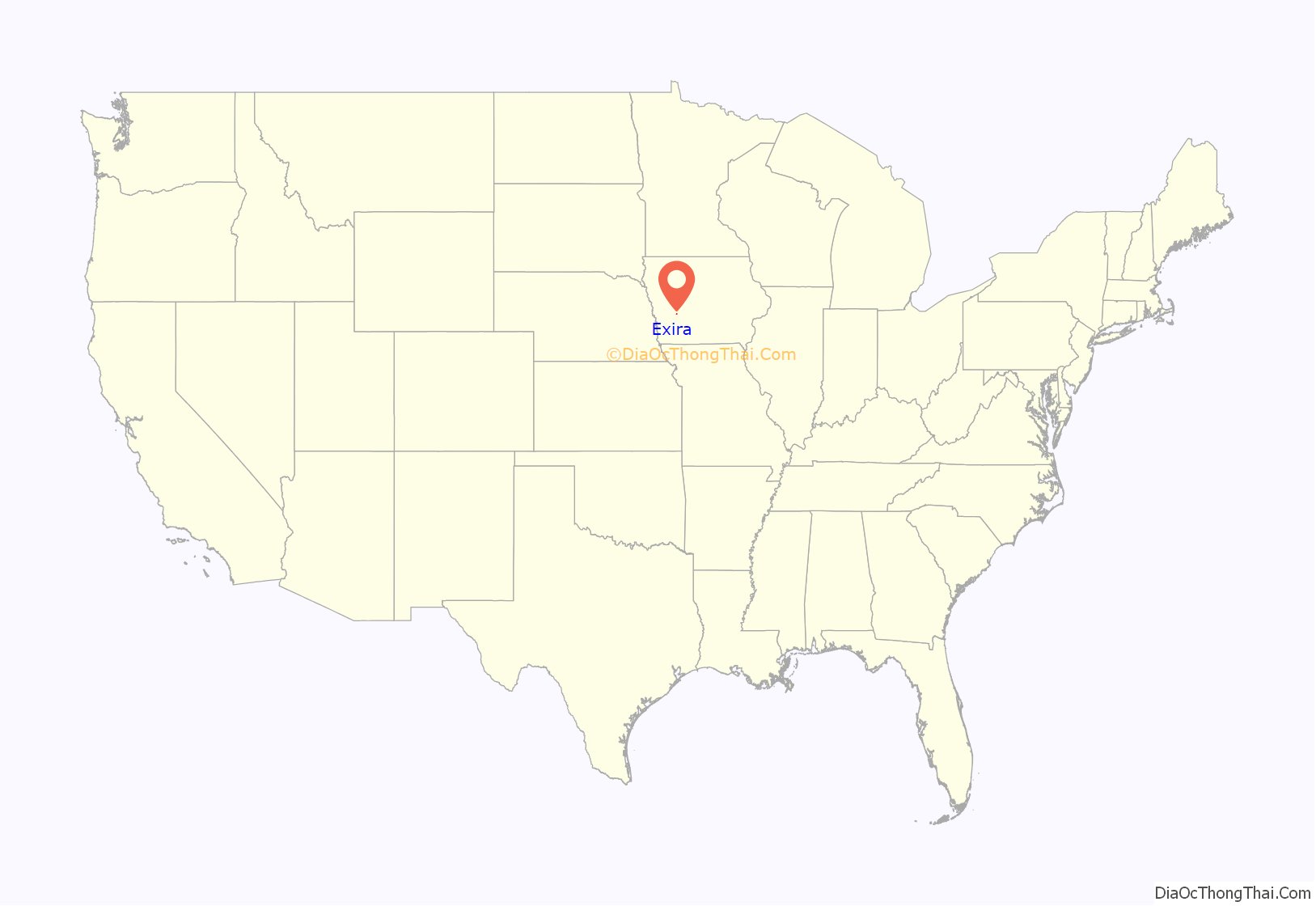
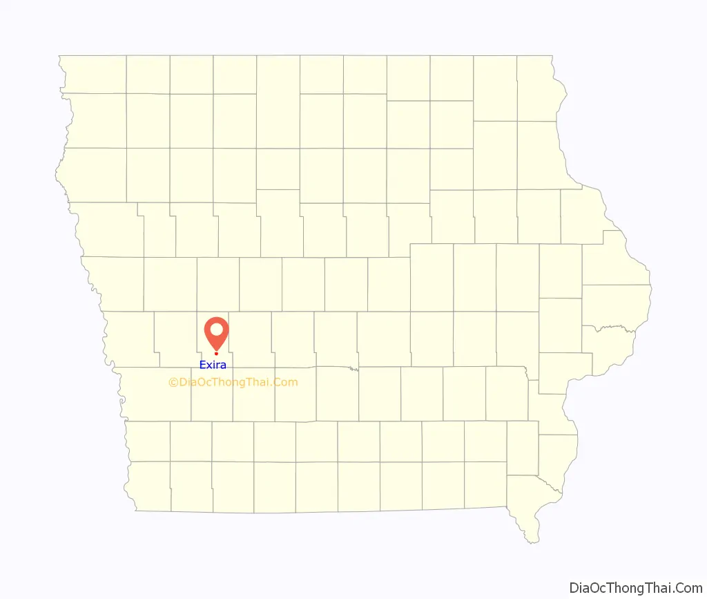
Exira location map. Where is Exira city?
History
The oldest town in Audubon County, Exira was founded in 1857. The town was named for Exira Eckman, daughter of Judge John Eckman from Ohio, who agreed to purchase a lot of property in the town if the town was named for his daughter.
The main industries in and around Exira are agriculture and agribusiness. Exira has a school, completed in 1959. There are four churches in the town.
On July 2, 1958, Exira was ravaged by the flooding of the East Nishnabotna River. Nineteen persons in the area lost their lives, 75 homes were destroyed and almost 20 businesses in the western part of Exira were damaged.
Exira is well known for its Fourth of July celebrations, which have been celebrated since 1861. The morning parade and the evening fireworks draw thousands of visitors to the town. Other attractions in the area include the Plow in the Oak Park, south of Exira on Highway 71, and Littlefield Recreation Area, 6 miles (9.7 km) southeast of Exira, which features a 70-acre (280,000 m) lake, prairie restoration area and a live bison pair.
Exira Road Map
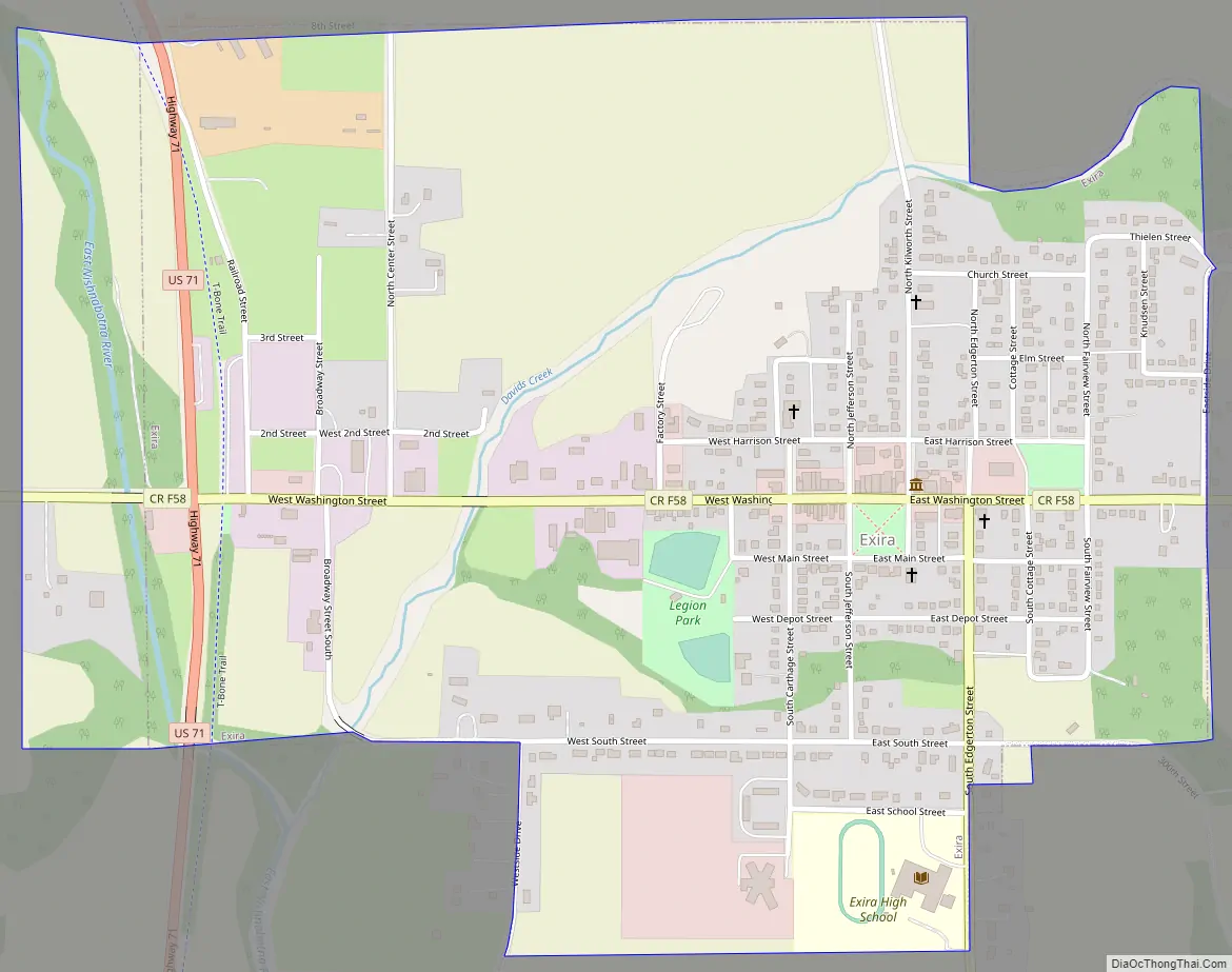
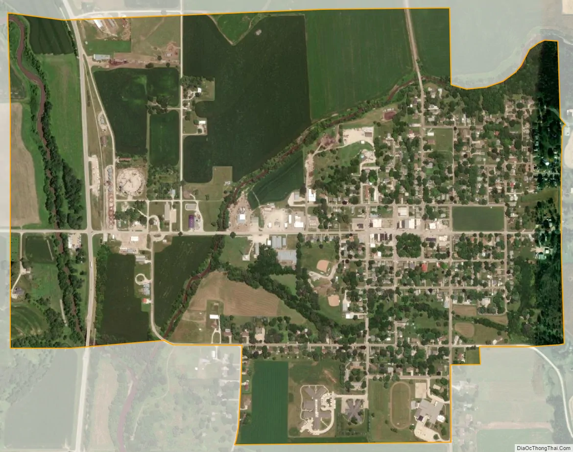
Exira city Satellite Map
Geography
Exira is located at 41°35′30″N 94°52′42″W / 41.59167°N 94.87833°W / 41.59167; -94.87833 (41.591617, -94.878247).
According to the United States Census Bureau, the city has a total area of 1.02 square miles (2.64 km), all land.
See also
Map of Iowa State and its subdivision:- Adair
- Adams
- Allamakee
- Appanoose
- Audubon
- Benton
- Black Hawk
- Boone
- Bremer
- Buchanan
- Buena Vista
- Butler
- Calhoun
- Carroll
- Cass
- Cedar
- Cerro Gordo
- Cherokee
- Chickasaw
- Clarke
- Clay
- Clayton
- Clinton
- Crawford
- Dallas
- Davis
- Decatur
- Delaware
- Des Moines
- Dickinson
- Dubuque
- Emmet
- Fayette
- Floyd
- Franklin
- Fremont
- Greene
- Grundy
- Guthrie
- Hamilton
- Hancock
- Hardin
- Harrison
- Henry
- Howard
- Humboldt
- Ida
- Iowa
- Jackson
- Jasper
- Jefferson
- Johnson
- Jones
- Keokuk
- Kossuth
- Lee
- Linn
- Louisa
- Lucas
- Lyon
- Madison
- Mahaska
- Marion
- Marshall
- Mills
- Mitchell
- Monona
- Monroe
- Montgomery
- Muscatine
- O'Brien
- Osceola
- Page
- Palo Alto
- Plymouth
- Pocahontas
- Polk
- Pottawattamie
- Poweshiek
- Ringgold
- Sac
- Scott
- Shelby
- Sioux
- Story
- Tama
- Taylor
- Union
- Van Buren
- Wapello
- Warren
- Washington
- Wayne
- Webster
- Winnebago
- Winneshiek
- Woodbury
- Worth
- Wright
- Alabama
- Alaska
- Arizona
- Arkansas
- California
- Colorado
- Connecticut
- Delaware
- District of Columbia
- Florida
- Georgia
- Hawaii
- Idaho
- Illinois
- Indiana
- Iowa
- Kansas
- Kentucky
- Louisiana
- Maine
- Maryland
- Massachusetts
- Michigan
- Minnesota
- Mississippi
- Missouri
- Montana
- Nebraska
- Nevada
- New Hampshire
- New Jersey
- New Mexico
- New York
- North Carolina
- North Dakota
- Ohio
- Oklahoma
- Oregon
- Pennsylvania
- Rhode Island
- South Carolina
- South Dakota
- Tennessee
- Texas
- Utah
- Vermont
- Virginia
- Washington
- West Virginia
- Wisconsin
- Wyoming