Kimballton is a city in Audubon County, Iowa, United States. The population was 291 at the time of the 2020 census.
| Name: | Kimballton city |
|---|---|
| LSAD Code: | 25 |
| LSAD Description: | city (suffix) |
| State: | Iowa |
| County: | Audubon County |
| Elevation: | 1,293 ft (394 m) |
| Total Area: | 0.76 sq mi (1.97 km²) |
| Land Area: | 0.76 sq mi (1.97 km²) |
| Water Area: | 0.00 sq mi (0.00 km²) |
| Total Population: | 291 |
| Population Density: | 381.89/sq mi (147.52/km²) |
| ZIP code: | 51543 |
| Area code: | 712 |
| FIPS code: | 1941295 |
| GNISfeature ID: | 0458078 |
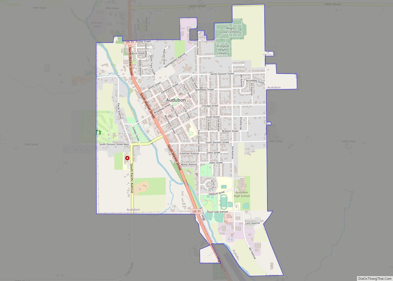
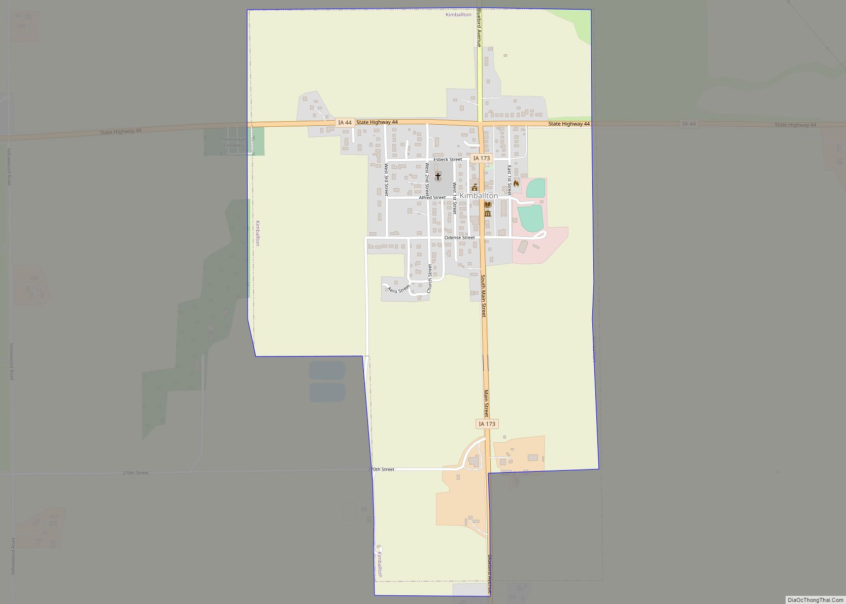
Online Interactive Map
Click on ![]() to view map in "full screen" mode.
to view map in "full screen" mode.
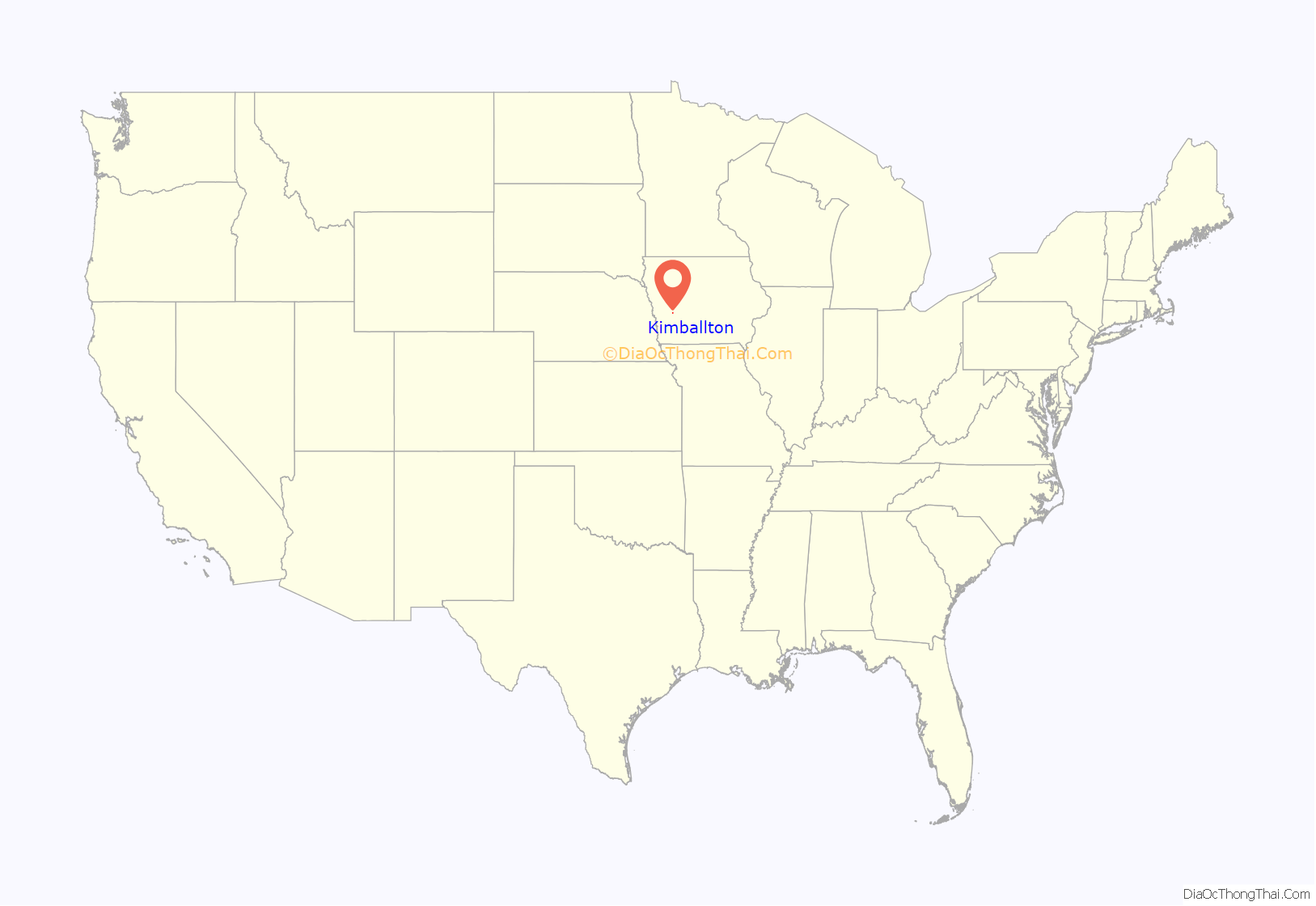
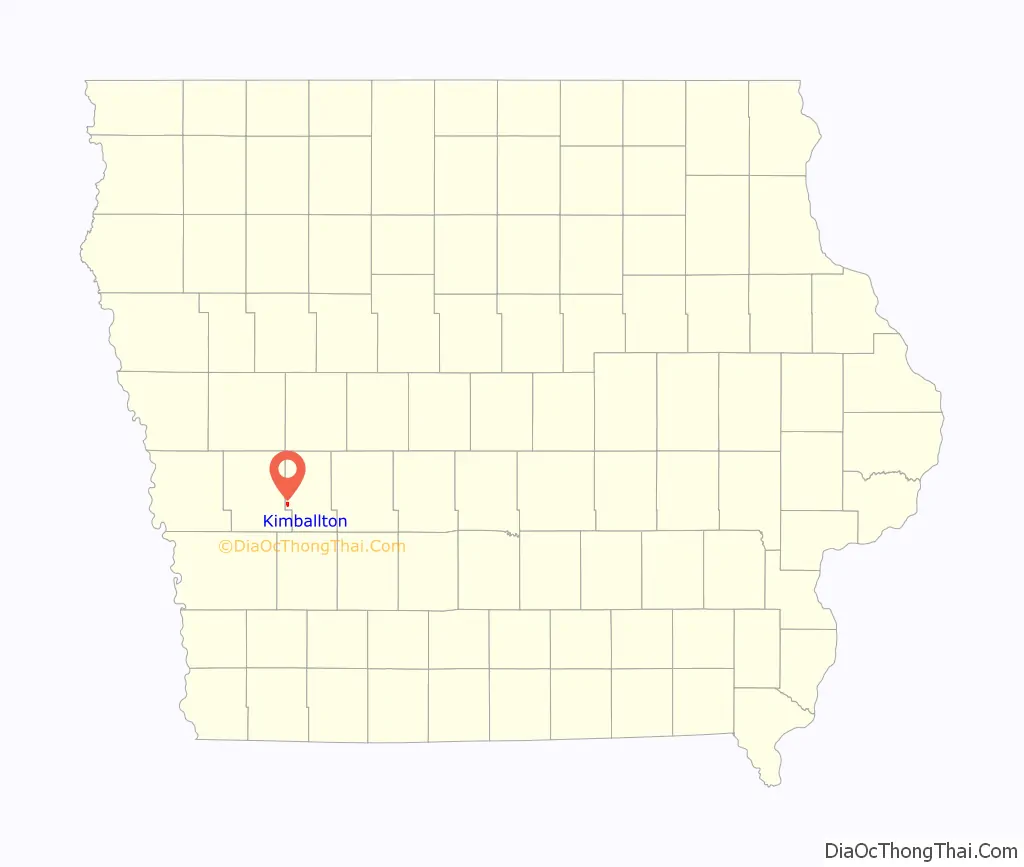
Kimballton location map. Where is Kimballton city?
History
Kimballton was founded in 1883 when Hans Jensen Jorgensen opened a post office at the site. The town was officially established in 1888, and incorporated in 1908. The town is named for a railroad employee, Edward Kimball.
There are eight sites in or near Kimballton listed on the National Register of Historic Places.
Kimballton Road Map

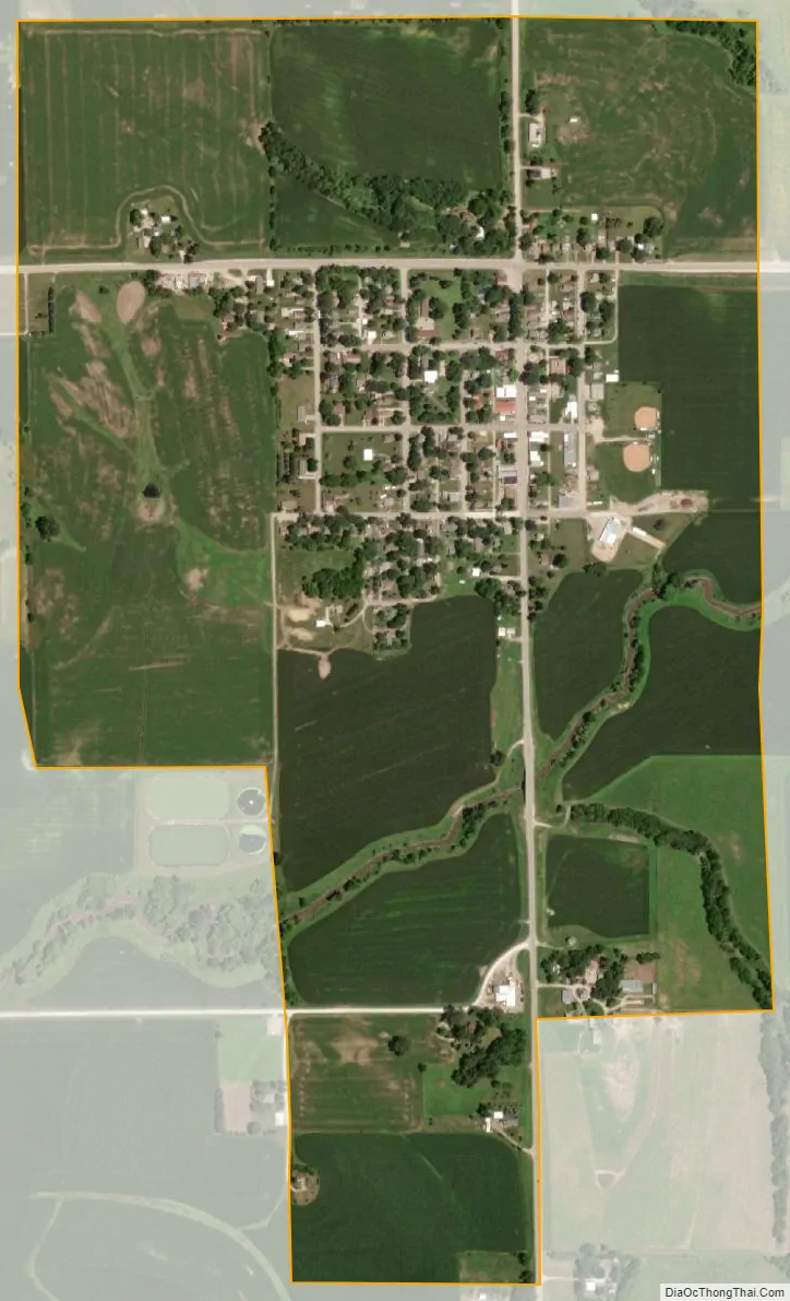
Kimballton city Satellite Map
Geography
Kimballton is located at 41°37′42″N 95°4′28″W / 41.62833°N 95.07444°W / 41.62833; -95.07444 (41.628280, -95.074492).
According to the United States Census Bureau, the city has a total area of 0.77 square miles (1.99 km), all of it land.
Kimballton lies 3 miles (4.8 km) north of Elk Horn, 13 miles (21 km) east of Harlan, and roughly 60 miles (roughly 95 km) east of Omaha.
See also
Map of Iowa State and its subdivision:- Adair
- Adams
- Allamakee
- Appanoose
- Audubon
- Benton
- Black Hawk
- Boone
- Bremer
- Buchanan
- Buena Vista
- Butler
- Calhoun
- Carroll
- Cass
- Cedar
- Cerro Gordo
- Cherokee
- Chickasaw
- Clarke
- Clay
- Clayton
- Clinton
- Crawford
- Dallas
- Davis
- Decatur
- Delaware
- Des Moines
- Dickinson
- Dubuque
- Emmet
- Fayette
- Floyd
- Franklin
- Fremont
- Greene
- Grundy
- Guthrie
- Hamilton
- Hancock
- Hardin
- Harrison
- Henry
- Howard
- Humboldt
- Ida
- Iowa
- Jackson
- Jasper
- Jefferson
- Johnson
- Jones
- Keokuk
- Kossuth
- Lee
- Linn
- Louisa
- Lucas
- Lyon
- Madison
- Mahaska
- Marion
- Marshall
- Mills
- Mitchell
- Monona
- Monroe
- Montgomery
- Muscatine
- O'Brien
- Osceola
- Page
- Palo Alto
- Plymouth
- Pocahontas
- Polk
- Pottawattamie
- Poweshiek
- Ringgold
- Sac
- Scott
- Shelby
- Sioux
- Story
- Tama
- Taylor
- Union
- Van Buren
- Wapello
- Warren
- Washington
- Wayne
- Webster
- Winnebago
- Winneshiek
- Woodbury
- Worth
- Wright
- Alabama
- Alaska
- Arizona
- Arkansas
- California
- Colorado
- Connecticut
- Delaware
- District of Columbia
- Florida
- Georgia
- Hawaii
- Idaho
- Illinois
- Indiana
- Iowa
- Kansas
- Kentucky
- Louisiana
- Maine
- Maryland
- Massachusetts
- Michigan
- Minnesota
- Mississippi
- Missouri
- Montana
- Nebraska
- Nevada
- New Hampshire
- New Jersey
- New Mexico
- New York
- North Carolina
- North Dakota
- Ohio
- Oklahoma
- Oregon
- Pennsylvania
- Rhode Island
- South Carolina
- South Dakota
- Tennessee
- Texas
- Utah
- Vermont
- Virginia
- Washington
- West Virginia
- Wisconsin
- Wyoming