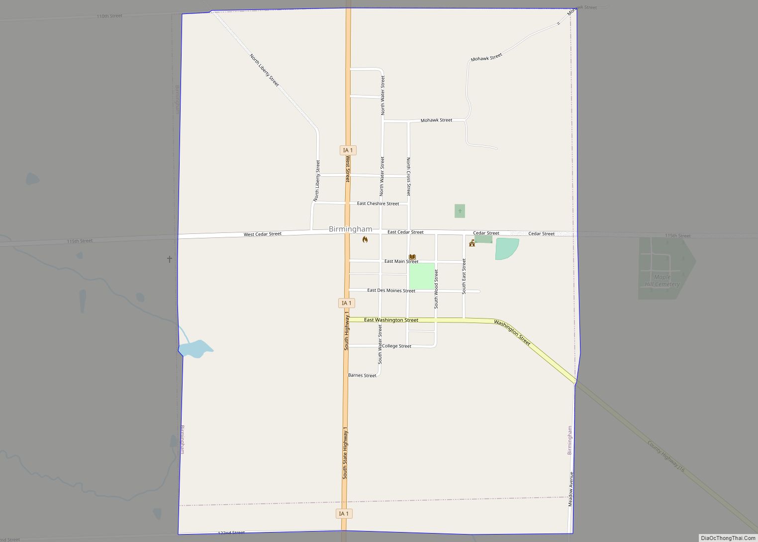
Farmington is a city in Van Buren County, Iowa, United States. The population was 579 at the time of the 2020 census.
| Name: | Farmington city |
|---|---|
| LSAD Code: | 25 |
| LSAD Description: | city (suffix) |
| State: | Iowa |
| County: | Van Buren County |
| Founded: | 1839 |
| Elevation: | 548 ft (167 m) |
| Total Area: | 0.46 sq mi (1.20 km²) |
| Land Area: | 0.46 sq mi (1.20 km²) |
| Water Area: | 0.00 sq mi (0.00 km²) |
| Total Population: | 579 |
| Population Density: | 1,253.25/sq mi (483.37/km²) |
| ZIP code: | 52626 |
| Area code: | 319 |
| FIPS code: | 1926895 |
| GNISfeature ID: | 0456553 |
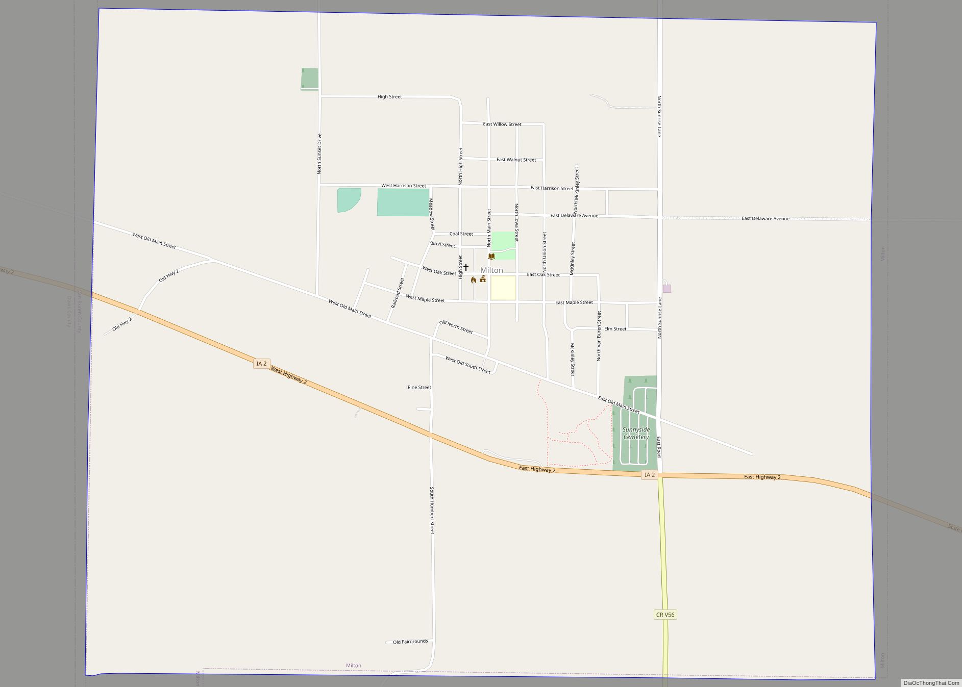
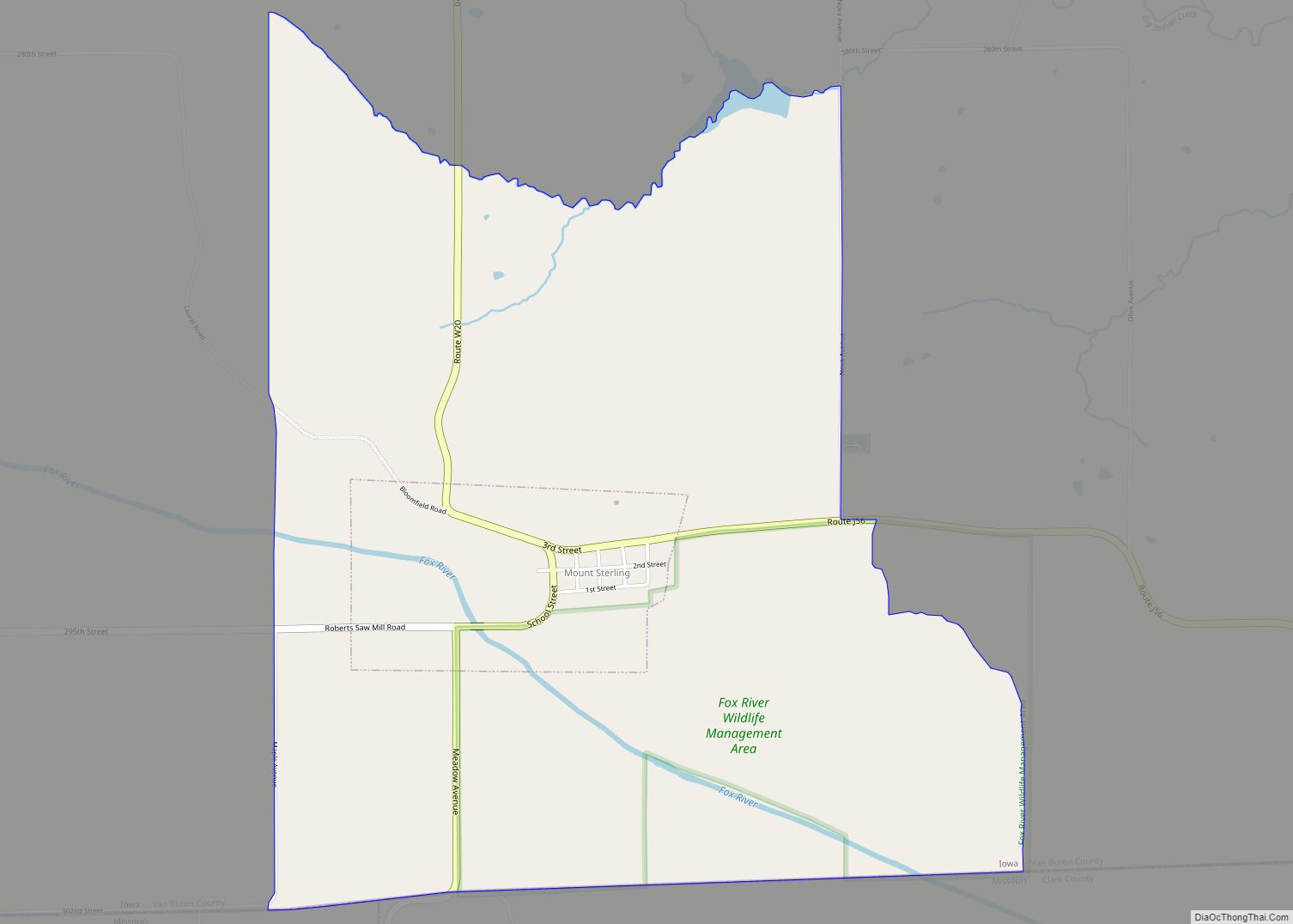
Online Interactive Map
Click on ![]() to view map in "full screen" mode.
to view map in "full screen" mode.
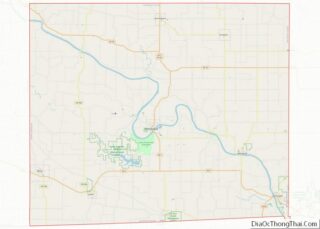
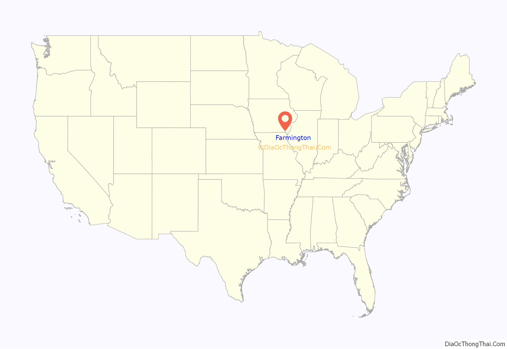
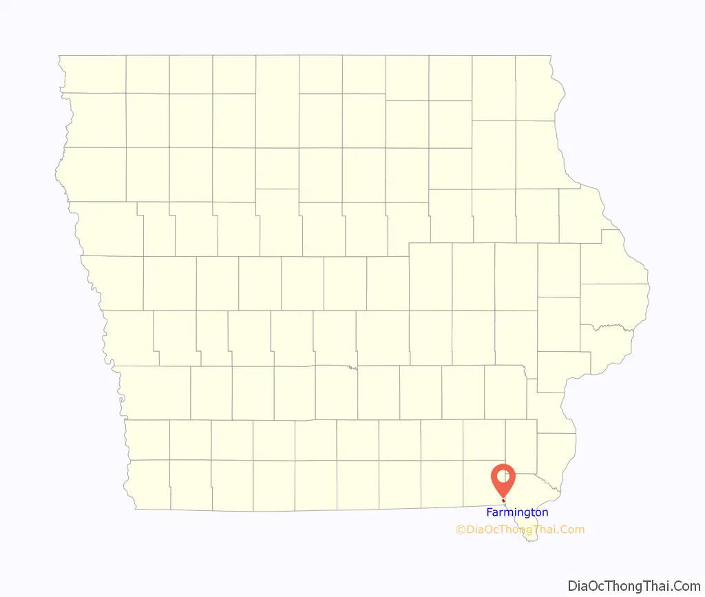
Farmington location map. Where is Farmington city?
History
Farmington was laid out in 1839. It was named after Farmington, Connecticut. The town was incorporated on January 11, 1841.
Farmington has suffered from several major floods of the Des Moines River, most notably in 1993, when a “500-year-flood” caused major damage to the buildings near the river, including a one-block area bordered by Walnut, Second, and Third Streets. The houses in this block were subsequently razed, and the property was purchased by the City of Farmington to create “Wild Rose City Park.”
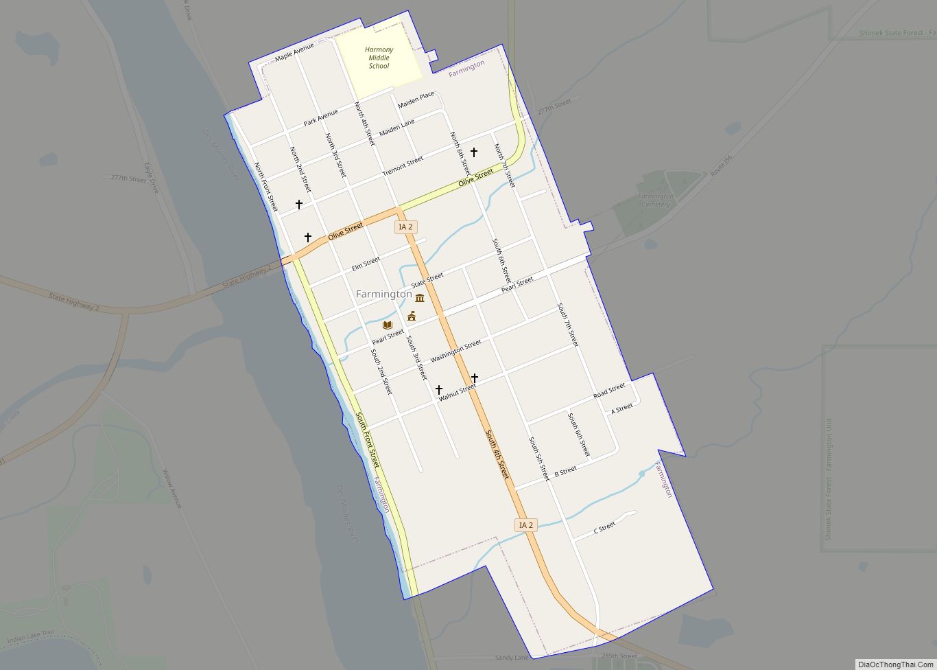
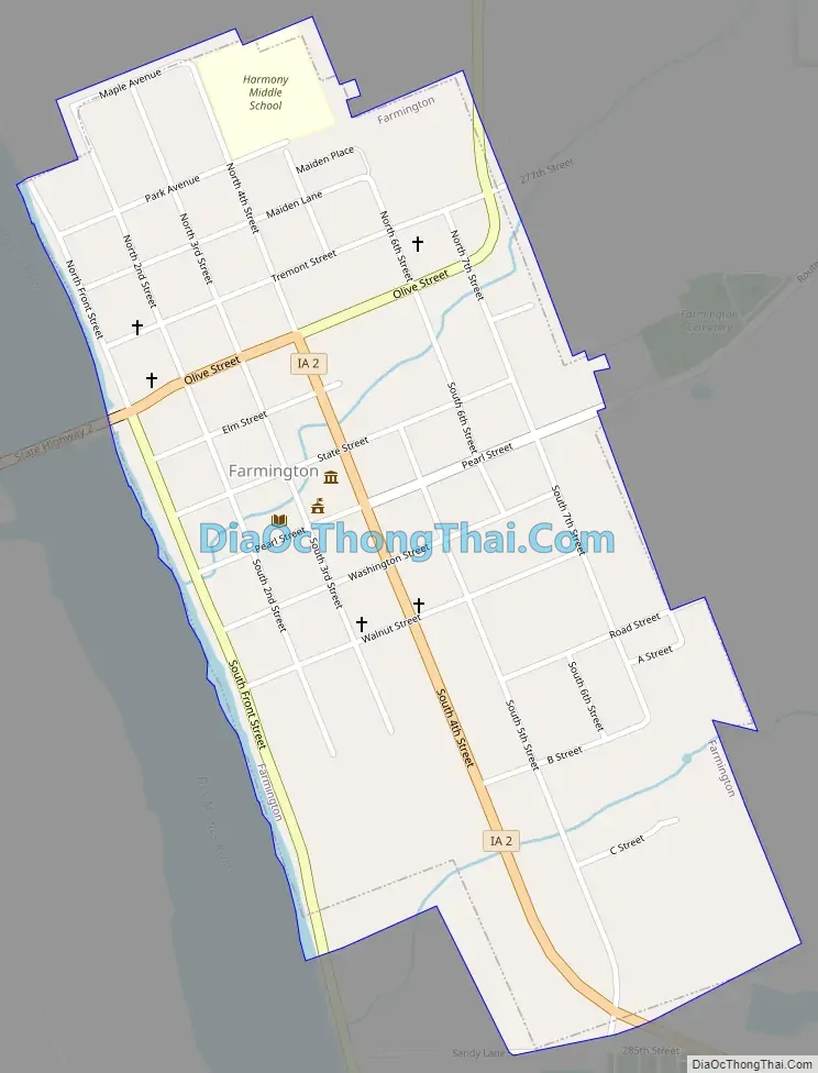
Farmington Road Map
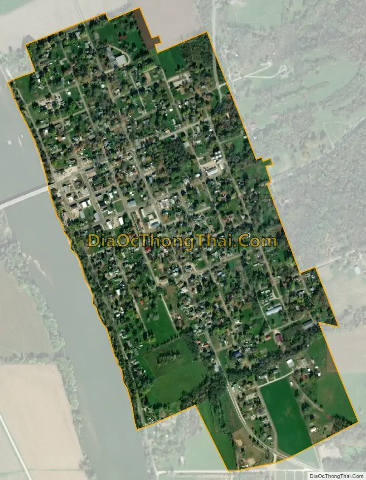
Farmington city Satellite Map
Geography
Farmington is located at 40°38′N 91°44′W / 40.633°N 91.733°W / 40.633; -91.733 (40.6397, -91.7394), on the left (east) bank of the Des Moines River.
According to the United States Census Bureau, the city has a total area of 0.47 square miles (1.22 km), all land.
See also
Map of Iowa State and its subdivision:- Adair
- Adams
- Allamakee
- Appanoose
- Audubon
- Benton
- Black Hawk
- Boone
- Bremer
- Buchanan
- Buena Vista
- Butler
- Calhoun
- Carroll
- Cass
- Cedar
- Cerro Gordo
- Cherokee
- Chickasaw
- Clarke
- Clay
- Clayton
- Clinton
- Crawford
- Dallas
- Davis
- Decatur
- Delaware
- Des Moines
- Dickinson
- Dubuque
- Emmet
- Fayette
- Floyd
- Franklin
- Fremont
- Greene
- Grundy
- Guthrie
- Hamilton
- Hancock
- Hardin
- Harrison
- Henry
- Howard
- Humboldt
- Ida
- Iowa
- Jackson
- Jasper
- Jefferson
- Johnson
- Jones
- Keokuk
- Kossuth
- Lee
- Linn
- Louisa
- Lucas
- Lyon
- Madison
- Mahaska
- Marion
- Marshall
- Mills
- Mitchell
- Monona
- Monroe
- Montgomery
- Muscatine
- O'Brien
- Osceola
- Page
- Palo Alto
- Plymouth
- Pocahontas
- Polk
- Pottawattamie
- Poweshiek
- Ringgold
- Sac
- Scott
- Shelby
- Sioux
- Story
- Tama
- Taylor
- Union
- Van Buren
- Wapello
- Warren
- Washington
- Wayne
- Webster
- Winnebago
- Winneshiek
- Woodbury
- Worth
- Wright
- Alabama
- Alaska
- Arizona
- Arkansas
- California
- Colorado
- Connecticut
- Delaware
- District of Columbia
- Florida
- Georgia
- Hawaii
- Idaho
- Illinois
- Indiana
- Iowa
- Kansas
- Kentucky
- Louisiana
- Maine
- Maryland
- Massachusetts
- Michigan
- Minnesota
- Mississippi
- Missouri
- Montana
- Nebraska
- Nevada
- New Hampshire
- New Jersey
- New Mexico
- New York
- North Carolina
- North Dakota
- Ohio
- Oklahoma
- Oregon
- Pennsylvania
- Rhode Island
- South Carolina
- South Dakota
- Tennessee
- Texas
- Utah
- Vermont
- Virginia
- Washington
- West Virginia
- Wisconsin
- Wyoming