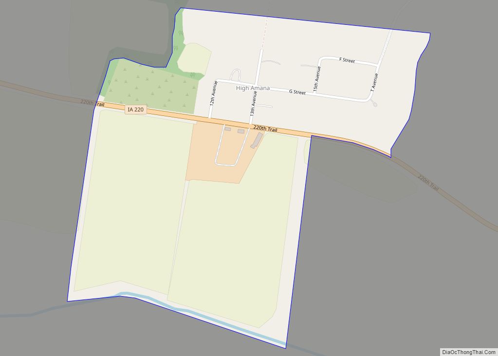
High Amana is an unincorporated community and census-designated place (CDP) in Iowa County, Iowa, United States, and is part of the “seven villages” of the Amana Colonies. As of the 2010 Census, the population of High Amana was 115.
| Name: | High Amana CDP |
|---|---|
| LSAD Code: | 57 |
| LSAD Description: | CDP (suffix) |
| State: | Iowa |
| County: | Iowa County |
| Elevation: | 755 ft (230 m) |
| Total Area: | 0.38 sq mi (0.99 km²) |
| Land Area: | 0.38 sq mi (0.99 km²) |
| Water Area: | 0.00 sq mi (0.00 km²) |
| Total Population: | 113 |
| Population Density: | 295.04/sq mi (113.94/km²) |
| Area code: | 319 |
| FIPS code: | 1936030 |
| GNISfeature ID: | 457445 |
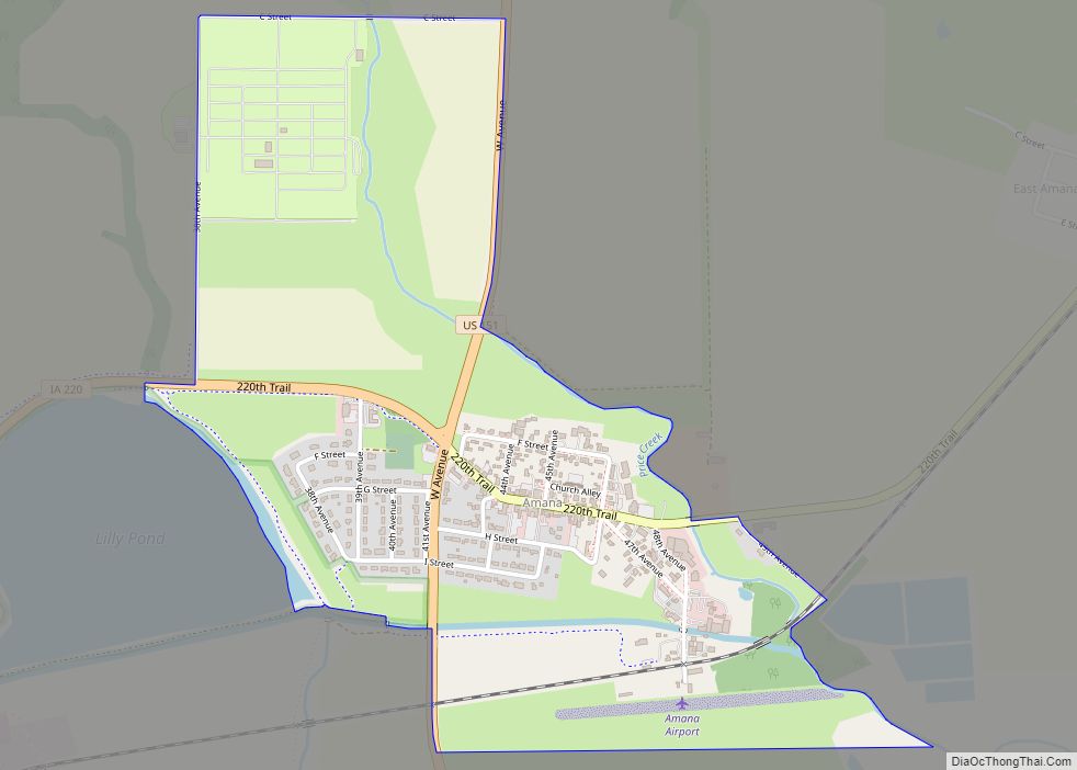
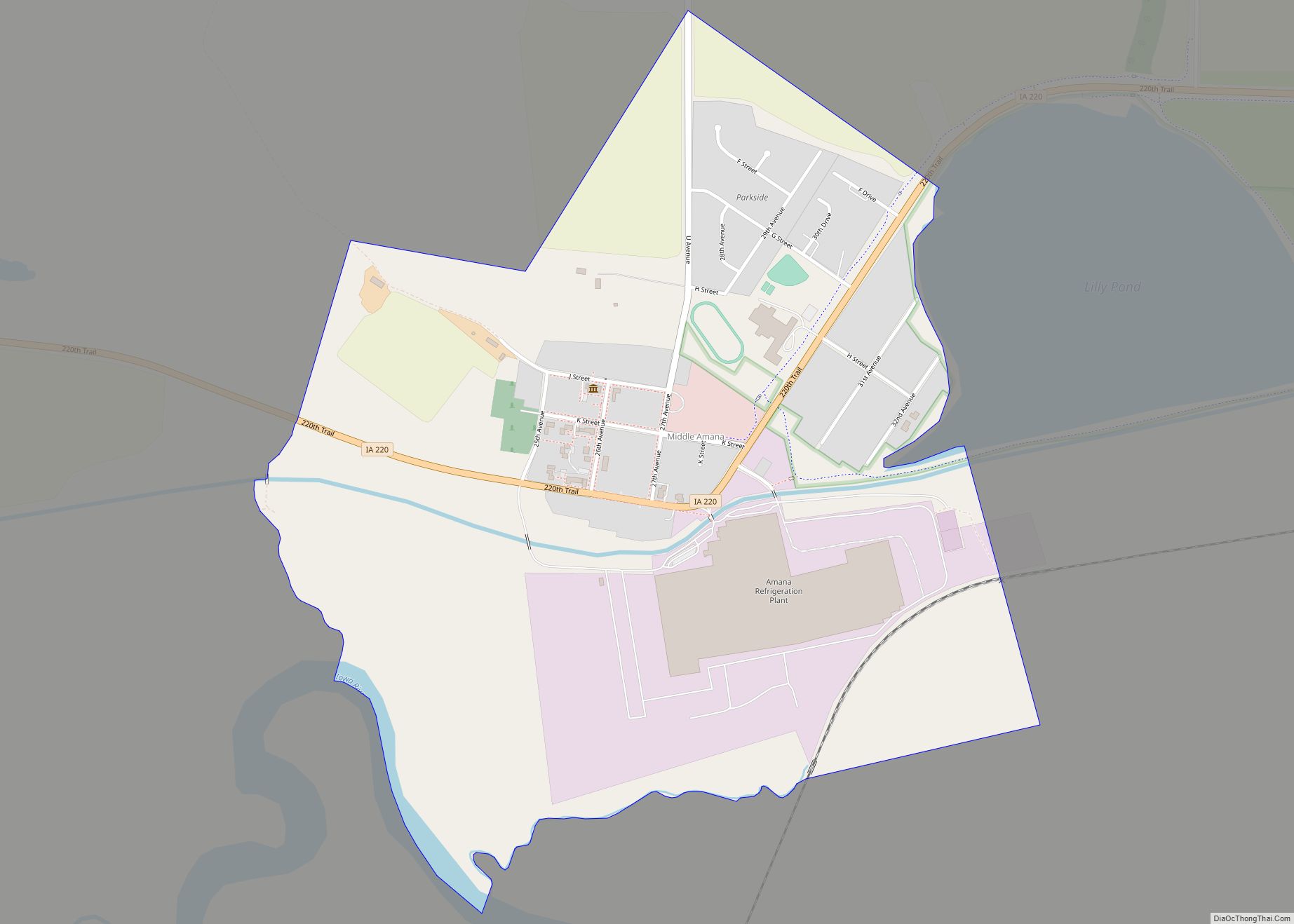
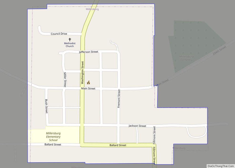
Online Interactive Map
Click on ![]() to view map in "full screen" mode.
to view map in "full screen" mode.
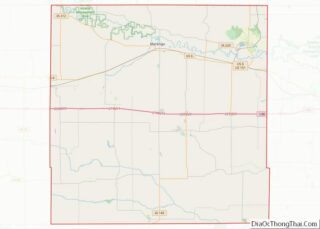
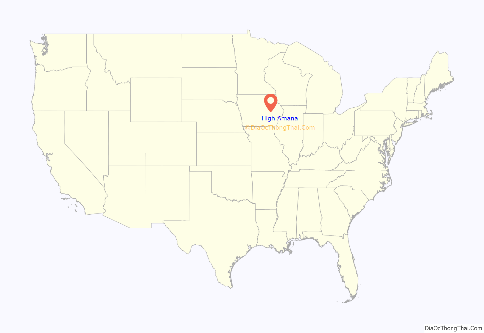
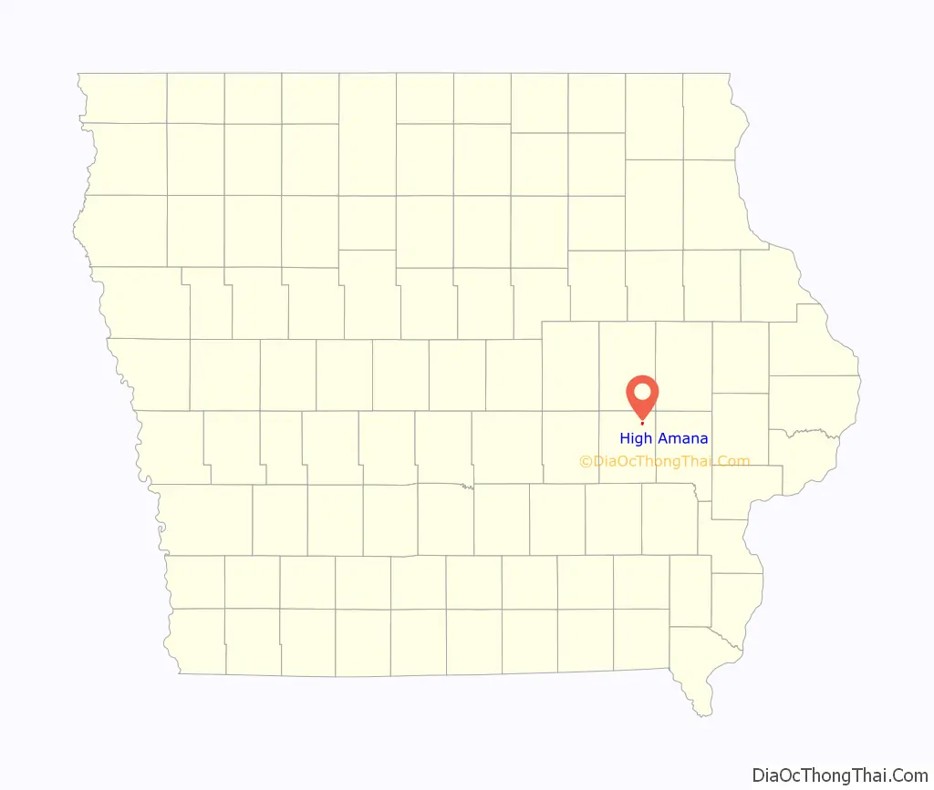
High Amana location map. Where is High Amana CDP?
History
This community was originally known as Hoch-Amana, German for “High Amana”, also inflected as Hohe-Amana. Its full name was Amana vor der Höhe, lit. ’Amana in front of the height/hill’.
In 1881, High Amana contained a general store, sawmill, machine shop, and a blacksmith shop.
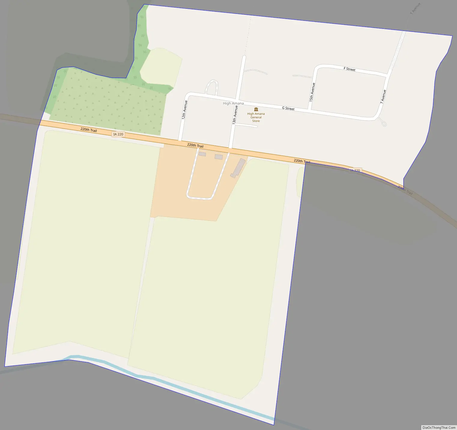
High Amana Road Map
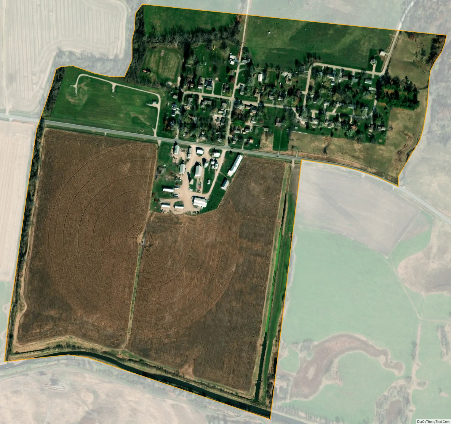
High Amana city Satellite Map
Geography
High Amana is in northeastern Iowa County, 2 miles (3 km) west of Middle Amana and 1.5 miles (2.4 km) east of West Amana. It sits at the northern edge of the valley of the Iowa River. According to the U.S. Census Bureau, the High Amana CDP has an area of 0.39 square miles (1.00 km), all land.
See also
Map of Iowa State and its subdivision:- Adair
- Adams
- Allamakee
- Appanoose
- Audubon
- Benton
- Black Hawk
- Boone
- Bremer
- Buchanan
- Buena Vista
- Butler
- Calhoun
- Carroll
- Cass
- Cedar
- Cerro Gordo
- Cherokee
- Chickasaw
- Clarke
- Clay
- Clayton
- Clinton
- Crawford
- Dallas
- Davis
- Decatur
- Delaware
- Des Moines
- Dickinson
- Dubuque
- Emmet
- Fayette
- Floyd
- Franklin
- Fremont
- Greene
- Grundy
- Guthrie
- Hamilton
- Hancock
- Hardin
- Harrison
- Henry
- Howard
- Humboldt
- Ida
- Iowa
- Jackson
- Jasper
- Jefferson
- Johnson
- Jones
- Keokuk
- Kossuth
- Lee
- Linn
- Louisa
- Lucas
- Lyon
- Madison
- Mahaska
- Marion
- Marshall
- Mills
- Mitchell
- Monona
- Monroe
- Montgomery
- Muscatine
- O'Brien
- Osceola
- Page
- Palo Alto
- Plymouth
- Pocahontas
- Polk
- Pottawattamie
- Poweshiek
- Ringgold
- Sac
- Scott
- Shelby
- Sioux
- Story
- Tama
- Taylor
- Union
- Van Buren
- Wapello
- Warren
- Washington
- Wayne
- Webster
- Winnebago
- Winneshiek
- Woodbury
- Worth
- Wright
- Alabama
- Alaska
- Arizona
- Arkansas
- California
- Colorado
- Connecticut
- Delaware
- District of Columbia
- Florida
- Georgia
- Hawaii
- Idaho
- Illinois
- Indiana
- Iowa
- Kansas
- Kentucky
- Louisiana
- Maine
- Maryland
- Massachusetts
- Michigan
- Minnesota
- Mississippi
- Missouri
- Montana
- Nebraska
- Nevada
- New Hampshire
- New Jersey
- New Mexico
- New York
- North Carolina
- North Dakota
- Ohio
- Oklahoma
- Oregon
- Pennsylvania
- Rhode Island
- South Carolina
- South Dakota
- Tennessee
- Texas
- Utah
- Vermont
- Virginia
- Washington
- West Virginia
- Wisconsin
- Wyoming