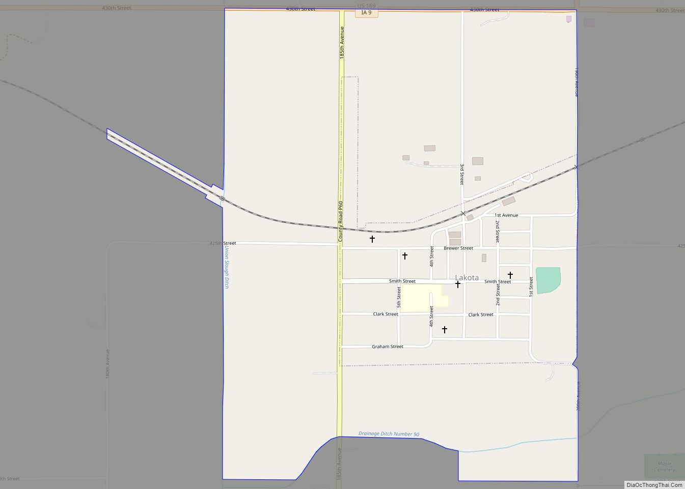
Lakota is a city in Kossuth County, Iowa, United States. The population was 267 at the time of the 2020 census. Prior to 1919, the town was known as Germania.
| Name: | Lakota city |
|---|---|
| LSAD Code: | 25 |
| LSAD Description: | city (suffix) |
| State: | Iowa |
| County: | Kossuth County |
| Elevation: | 1,142 ft (348 m) |
| Total Area: | 0.73 sq mi (1.89 km²) |
| Land Area: | 0.73 sq mi (1.89 km²) |
| Water Area: | 0.00 sq mi (0.00 km²) |
| Total Population: | 267 |
| Population Density: | 366.26/sq mi (141.47/km²) |
| ZIP code: | 50451 |
| Area code: | 515 |
| FIPS code: | 1942825 |
| GNISfeature ID: | 0458207 |
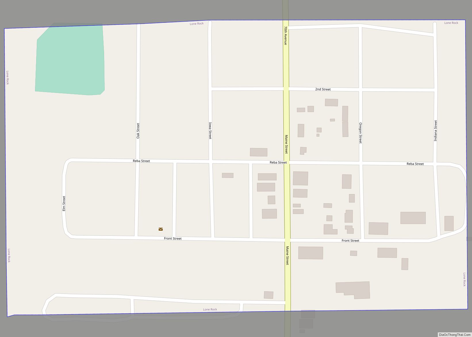
Online Interactive Map
Click on ![]() to view map in "full screen" mode.
to view map in "full screen" mode.
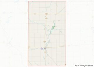
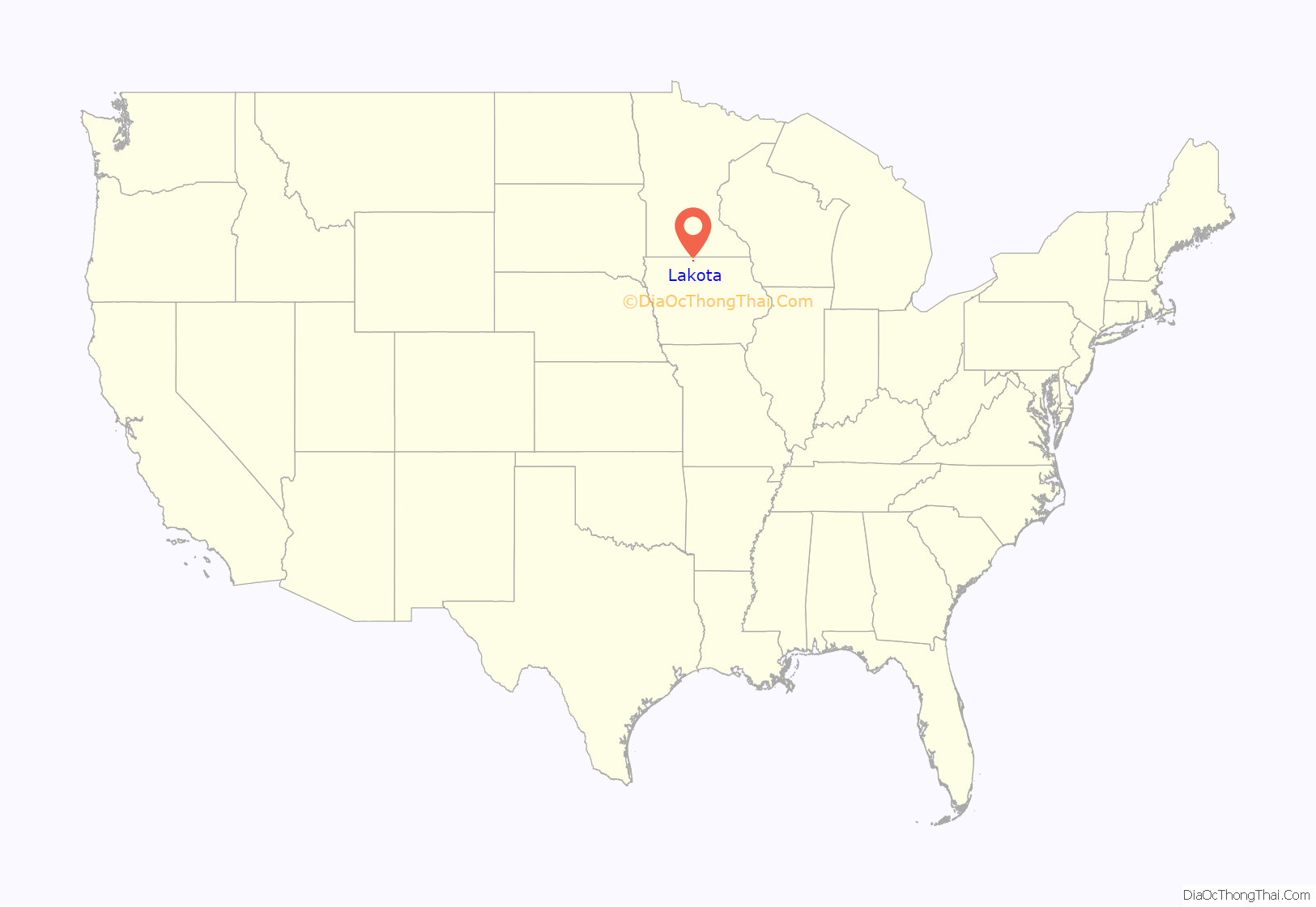
Lakota location map. Where is Lakota city?
History
The present town of Lakota was originally named Germania. The original town site of Germania was surveyed and filed for record by the Northern Iowa Land and Town Lot Company, August 26, 1892. The town received its name from the German heritage of many of the early settlers in the area. In 1918, the hysteria of World War I was sweeping the country. Residents couldn’t change their origin to protect themselves from the popular hatred of the time, but they could take the stigma of all things German from the town by wiping its name off the map, which they did. An election was held on October 1, 1918, to vote to change the name of Germania to Lakota. A canvas of the votes showed there were 48 yes and 32 no votes cast. Mayor J. Gus Thaves filed the certificate changing the name to Lakota at the Kossuth County Courthouse on October 16, 1918. However the name was not officially changed by the post office until August 5, 1919. The town was renamed Lakota, an Indian word with several different translations. Some say Lakota means “beautiful prairie” or as other translations say Lakota means “plenty”, others say it means “allies”.
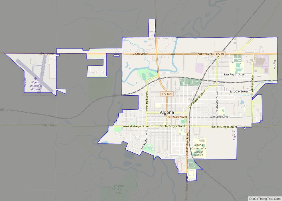
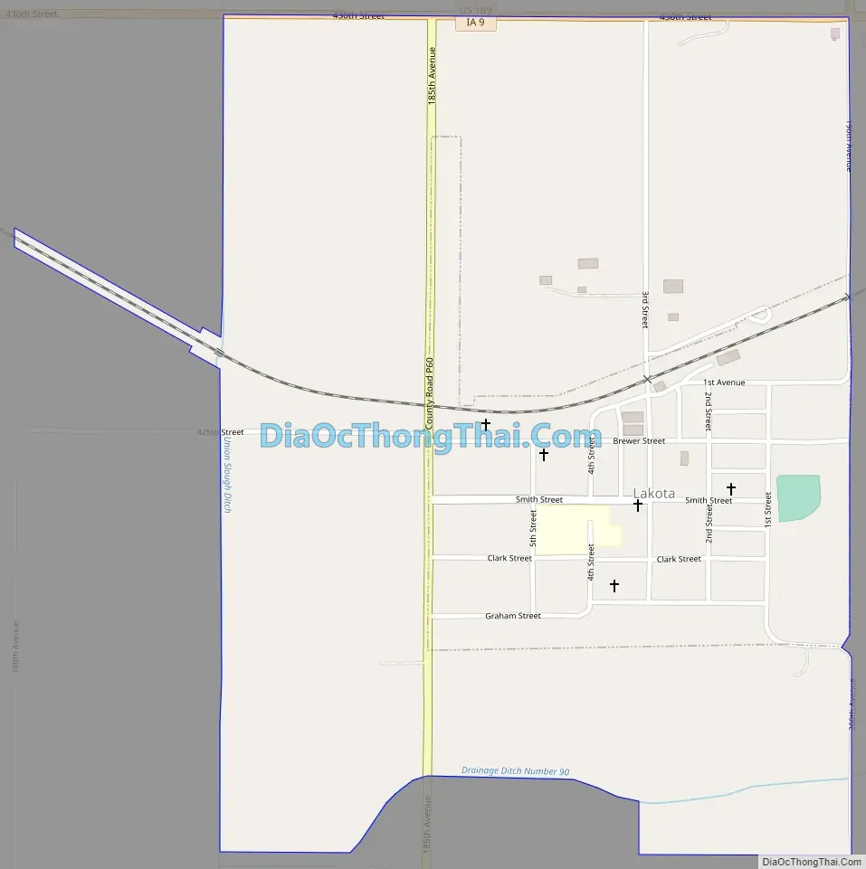
Lakota Road Map
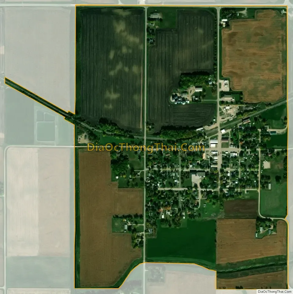
Lakota city Satellite Map
Geography
Lakota is located at 43°22′41″N 94°5′39″W / 43.37806°N 94.09417°W / 43.37806; -94.09417 (43.377953, -94.094274).
According to the United States Census Bureau, the city has a total area of 0.19 square miles (0.49 km), all land.
See also
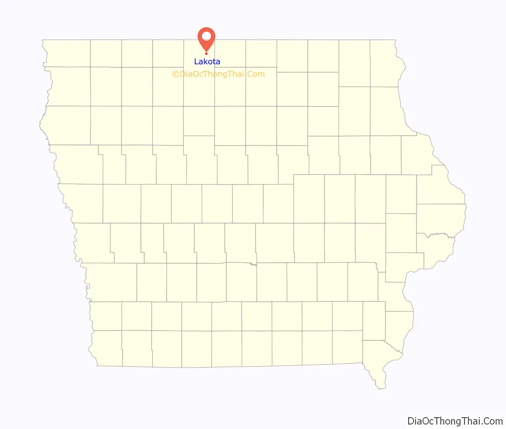
Map of Iowa State and its subdivision:- Adair
- Adams
- Allamakee
- Appanoose
- Audubon
- Benton
- Black Hawk
- Boone
- Bremer
- Buchanan
- Buena Vista
- Butler
- Calhoun
- Carroll
- Cass
- Cedar
- Cerro Gordo
- Cherokee
- Chickasaw
- Clarke
- Clay
- Clayton
- Clinton
- Crawford
- Dallas
- Davis
- Decatur
- Delaware
- Des Moines
- Dickinson
- Dubuque
- Emmet
- Fayette
- Floyd
- Franklin
- Fremont
- Greene
- Grundy
- Guthrie
- Hamilton
- Hancock
- Hardin
- Harrison
- Henry
- Howard
- Humboldt
- Ida
- Iowa
- Jackson
- Jasper
- Jefferson
- Johnson
- Jones
- Keokuk
- Kossuth
- Lee
- Linn
- Louisa
- Lucas
- Lyon
- Madison
- Mahaska
- Marion
- Marshall
- Mills
- Mitchell
- Monona
- Monroe
- Montgomery
- Muscatine
- O'Brien
- Osceola
- Page
- Palo Alto
- Plymouth
- Pocahontas
- Polk
- Pottawattamie
- Poweshiek
- Ringgold
- Sac
- Scott
- Shelby
- Sioux
- Story
- Tama
- Taylor
- Union
- Van Buren
- Wapello
- Warren
- Washington
- Wayne
- Webster
- Winnebago
- Winneshiek
- Woodbury
- Worth
- Wright
- Alabama
- Alaska
- Arizona
- Arkansas
- California
- Colorado
- Connecticut
- Delaware
- District of Columbia
- Florida
- Georgia
- Hawaii
- Idaho
- Illinois
- Indiana
- Iowa
- Kansas
- Kentucky
- Louisiana
- Maine
- Maryland
- Massachusetts
- Michigan
- Minnesota
- Mississippi
- Missouri
- Montana
- Nebraska
- Nevada
- New Hampshire
- New Jersey
- New Mexico
- New York
- North Carolina
- North Dakota
- Ohio
- Oklahoma
- Oregon
- Pennsylvania
- Rhode Island
- South Carolina
- South Dakota
- Tennessee
- Texas
- Utah
- Vermont
- Virginia
- Washington
- West Virginia
- Wisconsin
- Wyoming